- Officer, Victoria
-
Officer
Victoria
Aerial view from south west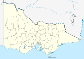
 Officer
Population: 1,417(2006)[1] Postcode: 3809 Elevation: 127 m (417 ft) Location: LGA: Shire of Cardinia State District: Gembrook, Bass Federal Division: La Trobe Suburbs around Officer: Guys Hill Beaconsfield Upper Beaconsfield Upper Beaconsfield Officer Pakenham Clyde Officer South Koo Wee Rup  Princes Highway, Officer
Officer is a suburb in Melbourne, Victoria, Australia, 49 km south-east from Melbourne's central business district. Its Local Government Area is the Shire of Cardinia. At the 2006 Census, Officer had a population of 1417.
Contents
History
The suburb is named after the Officer family, who were early settlers in the area. A timber industry was established, and by 1870 timber was being transported from the railways sidings named Officer's Wood Siding. This was shortened to Officer's and later, Officer.
A brickmaking industry began in the 1880s, but died away after the collapse of the land boom. The population was sufficient to justify a Post Office opening on 16 December 1885 (known as Officer's Siding until 1888, Officer Railway Station until 1913).[2]
The Town today
Three schools, Officer Primary School, Maranatha Christian School (Officer Campus)and Berwick Grammar School are situated here.
Officer is home to the Australian Rules ROC Football Club (Rythdale, Officer, Cardinia) competing in the Mornington Peninsula Nepean Football League. They last won the premiership in 2002.
Despite now being considered a suburb and having its own railway station, most of the land around Officer is undeveloped and used for farming. This is likely to change in the future, when construction of a 4,000 lot housing estate [1] begins at Officer.
Notable people of Officer
- AFL player Greg Tivendale (Number 32 for Richmond) grew up in Officer.
See also
References
- ^ Australian Bureau of Statistics (25 October 2007). "Officer (State Suburb)". 2006 Census QuickStats. http://www.censusdata.abs.gov.au/ABSNavigation/prenav/LocationSearch?collection=Census&period=2006&areacode=SSC21523&producttype=QuickStats&breadcrumb=PL&action=401. Retrieved 2007-09-15.
- ^ Premier Postal History. "Post Office List". https://www.premierpostal.com/cgi-bin/wsProd.sh/Viewpocdwrapper.p?SortBy=VIC&country=. Retrieved 2008-04-11
- ^ "Officer's conjoined lizards 'amazing'". Pakenham Cardinia Leader. 2011-01-09. http://pakenham-cardinia-leader.whereilive.com.au/news/story/officers-conjoined-lizards-amazing/.
Coordinates: 38°03′29″S 145°24′32″E / 38.058°S 145.409°E
Suburbs of the Shire of Cardinia Avonsleigh · Bayles · Beaconsfield · Beaconsfield Upper · Bunyip · Bunyip North · Caldermeade · Cardinia · Catani · Clematis · Cockatoo · Cora Lynn · Dalmore · Dewhurst · Emerald · Garfield · Garfield North · Gembrook · Guys Hill · Heath Hill · Iona · Koo Wee Rup · Koo Wee Rup North · Lang Lang · Lang Lang East · Maryknoll · Menzies Creek · Modella · Monomeith · Mount Burnett · Nangana · Nar Nar Goon · Nar Nar Goon North · Officer · Officer South · Pakenham · Pakenham South · Pakenham Upper · Rythdale · Tonimbuk · Tynong · Tynong North · Vervale · Yannathan
Categories:- Suburbs of Melbourne


Wikimedia Foundation. 2010.