| Crossing |
Carries |
Location |
Built |
Coordinates |
Connecticut
|
| Amtrak Old Saybrook – Old Lyme Bridge |
Amtrak Northeast Corridor |
Old Saybrook and Old Lyme |
|
41°18′39″N 72°20′57″W / 41.31083°N 72.34917°W / 41.31083; -72.34917 (Amtrak Old Saybrook – Old Lyme Bridge) |
| Raymond E. Baldwin Bridge |
 I-95 I-95
 US 1 US 1 |
1948
(rebuilt in 1993) |
41°19′09″N 72°20′51″W / 41.31917°N 72.3475°W / 41.31917; -72.3475 (Raymond E. Baldwin Bridge) |
| Chester–Hadlyme Ferry |
 Route 148 Route 148 |
Chester and Lyme |
1769 |
41°25′11″N 72°25′50″W / 41.41972°N 72.43056°W / 41.41972; -72.43056 (Chester–Hadlyme Ferry) |
| East Haddam Bridge |
 Route 82 Route 82 |
Haddam and East Haddam |
1913 |
41°27′05″N 72°27′52″W / 41.45139°N 72.46444°W / 41.45139; -72.46444 (East Haddam Bridge) |
| Providence and Worcester railroad bridge |
|
Middletown and Portland |
|
41°34′00″N 72°38′52″W / 41.5666667°N 72.64778°W / 41.5666667; -72.64778 (Providence and Worcester railroad bridge) |
| Arrigoni Bridge |
 Route 17 Route 17
 Route 66 Route 66 |
1938 |
41°34′09″N 72°38′55″W / 41.56917°N 72.64861°W / 41.56917; -72.64861 (Arrigoni Bridge) |
| Rocky Hill – Glastonbury Ferry |
 Route 160 Route 160 |
Rocky Hill and Glastonbury |
1655 |
41°39′57″N 72°37′40″W / 41.66583°N 72.62778°W / 41.66583; -72.62778 (Rocky Hill – Glastonbury Ferry) |
| William H. Putnam Memorial Bridge |
 Route 3 Route 3 |
Wethersfield and Glastonbury |
1959 |
41°42′51″N 72°38′27″W / 41.71417°N 72.64083°W / 41.71417; -72.64083 (William H. Putnam Memorial Bridge) |
| Charter Oak Bridge |
 US 5 US 5
 Route 15 Route 15 |
Hartford and East Hartford |
1991 |
41°45′11″N 72°39′18″W / 41.75306°N 72.655°W / 41.75306; -72.655 (Charter Oak Bridge) |
| Founders Bridge |
 Route 2 Route 2 |
1958 |
41°45′56″N 72°39′55″W / 41.76556°N 72.66528°W / 41.76556; -72.66528 (Founders Bridge) |
| Morgan G. Bulkeley Bridge |
 I-84 I-84
 US 6 US 6
 US 44 US 44 |
1906 |
41°46′09″N 72°39′54″W / 41.76917°N 72.665°W / 41.76917; -72.665 (Morgan G. Bulkeley Bridge) |
| Connecticut Southern railroad bridge |
|
|
41°46′35″N 72°39′27″W / 41.77639°N 72.6575°W / 41.77639; -72.6575 (Connecticut Southern railroad bridge) |
| Captain John Bissell Memorial Bridge |
 I-291 I-291 |
Windsor and South Windsor |
1958 |
41°48′47″N 72°38′40″W / 41.81306°N 72.64444°W / 41.81306; -72.64444 (Captain John Bissell Memorial Bridge) |
| Dexter Coffin Bridge |
 I-91 I-91 |
Windsor Locks and East Windsor |
1959 |
41°55′00″N 72°37′22″W / 41.9166667°N 72.62278°W / 41.9166667; -72.62278 (Dexter Coffin Bridge) |
| Bridge Street Bridge |
 Route 140 Route 140 |
rebuilt 1992 |
41°55′45″N 72°37′27″W / 41.92917°N 72.62417°W / 41.92917; -72.62417 (Bridge Street (Windsor Locks, CT)) |
| Amtrak/Springfield Terminal Railroad Bridge |
Amtrak New Haven – Springfield Line |
Suffield and Enfield |
|
41°56′36″N 72°36′50″W / 41.94333°N 72.61389°W / 41.94333; -72.61389 (Amtrak/Springfield Terminal Railroad Bridge) |
| Enfield–Suffield Covered Bridge (destroyed 1900) |
|
1832 |
41°58′30.34″N 72°36′22.31″W / 41.9750944°N 72.6061972°W / 41.9750944; -72.6061972 (Enfield–Suffield Covered Bridge) |
| Enfield–Suffield Veterans Bridge |
 Route 190 Route 190 |
1966 |
41°59′23″N 72°36′13″W / 41.98972°N 72.60361°W / 41.98972; -72.60361 (Enfield–Suffield Veterans Bridge) |
| Suffield and Thompsonville Bridge (demolished 1971) |
|
1893 |
41°59′57″N 72°36′25.56″W / 41.99917°N 72.6071°W / 41.99917; -72.6071 (Suffield and Thompsonville Bridge) |
Massachusetts
|
| Julia B. Buxton Bridge (South End Bridge) |
US 5 |
Agawam and Springfield |
1954 |
42°04′53″N 72°34′58″W / 42.08139°N 72.58278°W / 42.08139; -72.58278 (Springfield South End Bridge) |
| Memorial Bridge |
 Route 147 Route 147 |
West Springfield and Springfield |
1922 |
42°05′56″N 72°35′42″W / 42.09889°N 72.595°W / 42.09889; -72.595 (Springfield Memorial Bridge) |
| Old Toll Bridge (demolished) |
|
1816 |
42°5′59.68″N 72°35′46.47″W / 42.0999111°N 72.5962417°W / 42.0999111; -72.5962417 (Old Toll Bridge (removed)) |
| CSX Berkshire rail bridge |
CSX Berkshire Subdivision |
1873 |
42°06′05″N 72°35′57″W / 42.10139°N 72.59917°W / 42.10139; -72.59917 (CSX Berkshire rail bridge) |
| North End Bridge |
 US 20 US 20 |
1924 |
42°06′31″N 72°36′51″W / 42.10861°N 72.61417°W / 42.10861; -72.61417 (Springfield North End Bridge) |
| I-91 bridge |
I-91 |
West Springfield and Chicopee |
1966 |
42°08′07″N 72°36′55″W / 42.13528°N 72.61528°W / 42.13528; -72.61528 (Interstate 91 Bridge) |
| Chicopee – West Springfield Bridge (demolished 1987) |
|
|
42°8′38.39″N 72°37′7.11″W / 42.1439972°N 72.6186417°W / 42.1439972; -72.6186417 (Chicopee – West Springfield Bridge) |
| Massachusetts Turnpike bridge |
 I-90 I-90 |
1957 |
42°09′14″N 72°37′40″W / 42.15389°N 72.62778°W / 42.15389; -72.62778 (Interstate 90 (Massachusetts Turnpike) bridge) |
| I-391 bridge |
 I-391 I-391 |
Holyoke and Chicopee |
1979 |
42°11′24″N 72°36′36″W / 42.19°N 72.61°W / 42.19; -72.61 (Interstate 391 bridge) |
| Willimansett Bridge |
 Route 116 Route 116
 Route 141 Route 141 |
1891 |
42°11′42″N 72°36′05″W / 42.195°N 72.60139°W / 42.195; -72.60139 (Willimansett Bridge) |
| Springfield Terminal railroad bridge |
|
|
42°11′43″N 72°36′02″W / 42.19528°N 72.60056°W / 42.19528; -72.60056 (Springfield Terminal railroad bridge) |
| Vietnam Memorial Bridge |
Route 116 |
Holyoke and South Hadley |
1990 |
42°12′42″N 72°35′46″W / 42.21167°N 72.59611°W / 42.21167; -72.59611 (Vietnam Memorial Bridge) |
| Joseph E. Muller Bridge |
 US 202 US 202 |
1958 |
42°12′58″N 72°36′28″W / 42.21611°N 72.60778°W / 42.21611; -72.60778 (Joseph E. Muller Bridge) |
| Northampton Toll Bridge |
|
Northampton and Hadley |
1808 |
42°20′11″N 72°37′04″W / 42.33639°N 72.61778°W / 42.33639; -72.61778 (Northampton Toll Bridge) |
| Calvin Coolidge Bridge |
 Route 9 Route 9 |
1937 |
42°20′11″N 72°37′04″W / 42.33639°N 72.61778°W / 42.33639; -72.61778 (Calvin Coolidge Bridge) |
| Norwottuck Rail Trail Bridge |
Norwottuck Rail Trail |
1887 |
42°20′14″N 72°37′07″W / 42.33722°N 72.61861°W / 42.33722; -72.61861 (Norwottuck Rail Trail Bridge) |
| Hatfield Bridge (dismantled 1823) |
Toll Bridge passed by state legislature March 8, 1803 without funding. Town purchase it by lottery, was completed October 20, 1807 and dismantled on July 7, 1823. Bridge was located on Bridge Lane, Hatfield, MA |
Hatfield and Hadley |
1807 |
42°21′55.44″N 72°35′21.65″W / 42.3654°N 72.5893472°W / 42.3654; -72.5893472 (Hatfield Bridge, Bridge Lane, Hatfield, MA) |
| Sunderland Bridge |
Route 116 |
Deerfield and Sunderland |
1937 |
42°28′03″N 72°35′06″W / 42.4675°N 72.585°W / 42.4675; -72.585 (Sunderland Bridge) |
| Springfield Terminal railroad bridge |
|
Deerfield and Montague |
|
42°33′44″N 72°33′22″W / 42.56222°N 72.55611°W / 42.56222; -72.55611 (Springfield Terminal railroad bridge) |
| Canalside Rail Trail Bridge |
|
Deerfield and Montague |
c1880 |
42°34′45.30″N 72°34′29.53″W / 42.57925°N 72.5748694°W / 42.57925; -72.5748694 (Canalside Rail Trail Bridge) |
| Montague City Covered Bridge (destroyed 1936) |
|
Greenfield and Montague |
|
42°34′49.1″N 72°34′44.9″W / 42.580306°N 72.579139°W / 42.580306; -72.579139 (Montague City Covered Bridge) (approx.) |
| Montague trolley bridge (destroyed 1936) |
|
|
42°34′49.1″N 72°34′45.9″W / 42.580306°N 72.579417°W / 42.580306; -72.579417 (Montague trolley bridge) (approx.) |
| General Pierce Bridge |
|
1947 |
42°34′49″N 72°34′47″W / 42.58028°N 72.57972°W / 42.58028; -72.57972 (General Pierce Bridge) |
| Turners Falls Road Bridge |
|
1936 |
42°36′33″N 72°33′41″W / 42.60917°N 72.56139°W / 42.60917; -72.56139 (Turner Falls Road Bridge) |
| Gill–Montague Bridge |
|
Gill and Montague |
1937 |
42°36′40″N 72°33′11″W / 42.61111°N 72.55306°W / 42.61111; -72.55306 (Gill–Montague Bridge) |
| French King Bridge |
 Route 2 Route 2 |
Gill and Erving |
1931 |
42°35′52″N 72°29′48″W / 42.59778°N 72.49667°W / 42.59778; -72.49667 (French King Bridge) |
| Route 10 bridge |
 Route 10 Route 10 |
Northfield |
1969 |
42°41′00″N 72°28′18″W / 42.6833333°N 72.47167°W / 42.6833333; -72.47167 (Route 10 bridge) |
| Rail bridge |
New England Central Railroad and Amtrak |
1903 |
42°42′22.40″N 72°27′33″W / 42.706222°N 72.45917°W / 42.706222; -72.45917 (Rail bridge, Northfield, MA) |
| Schell Bridge (closed) |
|
1903 |
42°42′44″N 72°27′12″W / 42.71222°N 72.45333°W / 42.71222; -72.45333 (Schell Bridge (closed)) |
Vermont – New Hampshire
|
| Fort Hill Branch rail bridge |
|
Brattleboro and Hinsdale |
|
42°50′16.38″N 72°32′46.21″W / 42.8378833°N 72.5461694°W / 42.8378833; -72.5461694 (rail bridge) |
| VT/NH Route 119 bridge |
 VT 119 VT 119
 NH 119 NH 119 |
1920 |
42°51′05″N 72°33′10″W / 42.85139°N 72.55278°W / 42.85139; -72.55278 (Route 119 bridge) |
| United States Navy Seabees Bridge |
 VT 9 VT 9
 NH 9 NH 9 |
Brattleboro and Chesterfield |
rebuilt 2003 |
42°53′02″N 72°33′07″W / 42.88389°N 72.55194°W / 42.88389; -72.55194 (United States Navy Seabees Bridge) |
| Route 123 bridge |
 VT 123 VT 123
 NH 123 NH 123 |
Westminster and Walpole |
1910 |
43°05′04″N 72°26′00″W / 43.08444°N 72.4333333°W / 43.08444; -72.4333333 (Route 123 bridge) |
| Vilas Bridge |
|
Bellows Falls and North Walpole |
1930 |
43°08′07″N 72°26′25″W / 43.13528°N 72.44028°W / 43.13528; -72.44028 (Vilas Bridge) |
| Stone Arch Bridge |
Vermont Rail (Green Mountain) |
|
43°08′09″N 72°26′25″W / 43.13583°N 72.44028°W / 43.13583; -72.44028 (Stone Arch Bridge) |
| New England Central railroad bridge |
|
|
43°08′17″N 72°26′48″W / 43.13806°N 72.44667°W / 43.13806; -72.44667 (New England Central railroad bridge) |
| Arch Bridge |
|
1983 |
43°08′17″N 72°26′54″W / 43.13806°N 72.44833°W / 43.13806; -72.44833 (Arch Bridge) |
| Cheshire Bridge |
 VT 11 VT 11
 NH 11 NH 11 |
Springfield and Charlestown |
? |
43°15′37″N 72°25′38″W / 43.26028°N 72.42722°W / 43.26028; -72.42722 (Cheshire Bridge) |
| Route 12 bridge |
 VT 12 VT 12
 NH 12 NH 12 |
Ascutney and Claremont |
1969 |
43°24′11″N 72°24′01″W / 43.40306°N 72.40028°W / 43.40306; -72.40028 (Route 12 bridge) |
| New England Central railroad bridge |
|
Windsor and Cornish |
|
43°28′11″N 72°23′19″W / 43.46972°N 72.38861°W / 43.46972; -72.38861 (New England Central railroad bridge) |
| Cornish–Windsor Covered Bridge |
|
1866 |
43°28′25″N 72°23′01″W / 43.47361°N 72.38361°W / 43.47361; -72.38361 (Cornish–Windsor Covered Bridge) |
| I-89 bridge |
 I-89 I-89 |
Hartford and Lebanon |
1966 |
43°38′03″N 72°19′43″W / 43.63417°N 72.32861°W / 43.63417; -72.32861 (Interstate 89 bridge) |
| Railroad bridge |
|
White River Junction and West Lebanon |
|
43°38′49″N 72°18′48″W / 43.64694°N 72.31333°W / 43.64694; -72.31333 (rail bridge (abandoned)) |
| US-4 bridge |
 US 4 US 4 |
1936 |
43°39′02″N 72°18′51″W / 43.65056°N 72.31417°W / 43.65056; -72.31417 (US Route 4 bridge) |
| Ledyard Bridge |
 VT 10A VT 10A
 NH 10A NH 10A |
Norwich and Hanover |
1998 |
43°42′13″N 72°17′59″W / 43.70361°N 72.29972°W / 43.70361; -72.29972 (Ledyard Bridge) |
| Route 113 bridge |
 VT 113 VT 113
East Thetford Road |
East Thetford and Lyme |
1937 |
43°48′43″N 72°10′59″W / 43.81194°N 72.18306°W / 43.81194; -72.18306 (Route 113 bridge) |
| Morey Memorial Bridge |
 VT 25A VT 25A
 NH 25A NH 25A |
Fairlee and Orford |
1937 |
43°54′25″N 72°08′22″W / 43.90694°N 72.13944°W / 43.90694; -72.13944 (Morey Memorial Bridge) |
| Route 25 bridge |
 VT 25 VT 25
 NH 25 NH 25 |
Bradford and Piermont |
1929 |
43°58′40″N 72°06′43″W / 43.97778°N 72.11194°W / 43.97778; -72.11194 (Route 25 bridge) |
| Bedell Covered Bridge (destroyed by wind, 1979) |
|
South Newbury and Haverhill |
1805, 1823, 1862, 1866, 1979 |
44°02′43″N 72°04′27″W / 44.04528°N 72.07417°W / 44.04528; -72.07417 (Bedell Covered Bridge (missing)) |
| Newbury Crossing Road |
|
Newbury and Haverhill |
1970 |
44°03′58″N 72°03′05″W / 44.06611°N 72.05139°W / 44.06611; -72.05139 (Newbury Crossing Road bridge) |
| Ranger Bridge |
 US 302 US 302 |
Wells River and Woodsville |
1923 |
44°09′14″N 72°02′27″W / 44.15389°N 72.04083°W / 44.15389; -72.04083 (Ranger Bridge) |
| Wells River Bridge (closed) |
Boston and Maine Corporation (railroad) |
|
44°09′15″N 72°02′26″W / 44.15417°N 72.04056°W / 44.15417; -72.04056 (Wells River Bridge (closed)) |
| Frazier Road |
|
McIndoe Falls and Monroe |
1937 |
44°15′42″N 72°03′32″W / 44.26167°N 72.05889°W / 44.26167; -72.05889 (Frazier Road Bridge) |
| Barnet Road Bridge |
|
1930 |
44°17′13″N 72°03′25″W / 44.28694°N 72.05694°W / 44.28694; -72.05694 (Barnet Road Bridge) |
| I-93 bridge |
 I-93 I-93 |
Waterford and Littleton |
1976, 1981 |
44°20′34″N 71°53′27″W / 44.34278°N 71.89083°W / 44.34278; -71.89083 (Interstate 93 bridge) |
| Route 18 bridge |
 VT 18 VT 18
 NH 18 NH 18 |
1934 |
44°20′33″N 71°53′20″W / 44.3425°N 71.88889°W / 44.3425; -71.88889 (Route 18 bridge) |
| Gilman Road |
|
Gilman and Dalton |
reconstructed 1997 |
44°24′39″N 71°43′23″W / 44.41083°N 71.72306°W / 44.41083; -71.72306 (Gilman Road) |
| old Gilman Road |
|
pedestrian traffic only |
44°24′40.34″N 71°43′21.45″W / 44.4112056°N 71.722625°W / 44.4112056; -71.722625 (old Gilman Road) |
| Twin State railroad bridge |
|
South Lunenburg and Dalton |
|
44°25′38″N 71°40′35″W / 44.42722°N 71.67639°W / 44.42722; -71.67639 (Twin State railroad bridge) |
| Mount Orne Covered Bridge |
|
Lunenburg and South Lancaster |
1911 |
44°27′36″N 71°39′10″W / 44.46°N 71.65278°W / 44.46; -71.65278 (Mount Orne Covered Bridge) |
| Route 2 bridge |
 US 2 US 2 |
Guildhall and Lancaster |
1950 |
44°29′46″N 71°35′39″W / 44.49611°N 71.59417°W / 44.49611; -71.59417 (Route 2 bridge) |
| Guildhall Road |
|
Guildhall and Northumberland |
1984 |
44°33′51″N 71°33′31″W / 44.56417°N 71.55861°W / 44.56417; -71.55861 (Guildhall Road) |
| Janice Peaslee Bridge |
|
Stratford, New Hampshire to Maidstone, Vermont |
1893, 2005 |
44°39′6.69″N 71°33′45″W / 44.6518583°N 71.5625°W / 44.6518583; -71.5625 (Janice Peaslee Bridge) |
| St. Lawrence and Atlantic Railroad bridge |
|
Bloomfield and North Stratford |
|
44°45′08″N 71°37′52″W / 44.75222°N 71.63111°W / 44.75222; -71.63111 (St. Lawrence and Atlantic Railroad bridge) |
| Route 105 bridge |
 VT 105 VT 105 |
1947 |
44°45′09″N 71°37′50″W / 44.7525°N 71.63056°W / 44.7525; -71.63056 (Route 105 bridge) |
| Columbia Bridge |
|
Lemington and Columbia |
1912 |
44°51′11″N 71°33′05″W / 44.85306°N 71.55139°W / 44.85306; -71.55139 (Columbia Bridge) |
| Route 26 bridge |
 VT 26 VT 26
 NH 26 NH 26 |
Lemington and Colebrook |
1953 |
44°53′56″N 71°30′27″W / 44.89889°N 71.5075°W / 44.89889; -71.5075 (Route 26 bridge) |
| Route 114 bridge |
 VT 114 VT 114
Main Street |
Canaan and West Stewartstown |
1990 |
44°59′45″N 71°32′05″W / 44.99583°N 71.53472°W / 44.99583; -71.53472 (Route 114 bridge) |
| Canaan–Stewartstown Bridge |
|
Beecher Falls and Stewartstown |
1930 |
45°00′28″N 71°30′27″W / 45.00778°N 71.5075°W / 45.00778; -71.5075 (Canaan–Stewartstown Bridge) |
New Hampshire
|
| Route 3 bridge |
 US 3 US 3 |
Pittsburg and Clarksville |
1931 |
45°01′15″N 71°27′50″W / 45.02083°N 71.46389°W / 45.02083; -71.46389 (Route 3 bridge) |
| Pittsburg–Clarksville Covered Bridge (closed 1981) |
|
approximately 1876 |
45°03′16″N 71°24′25″W / 45.05444°N 71.40694°W / 45.05444; -71.40694 (Pittsburg–Clarksville Covered Bridge) |
| Route 145 bridge |
 NH 145 NH 145 |
1941 |
45°02′57″N 71°23′29″W / 45.04917°N 71.39139°W / 45.04917; -71.39139 (Route 145 bridge) |
| Murphy Dam Road |
|
|
45°02′44″N 71°22′54″W / 45.04556°N 71.38167°W / 45.04556; -71.38167 (Murphy Dam Road) |
| Forest Access Road |
logging traffic |
Pittsburg |
|
45°04′22″N 71°18′08″W / 45.07278°N 71.30222°W / 45.07278; -71.30222 (Pittsburg Forest Access Road) |
| Magalloway Road |
logging traffic |
|
45°07′05″N 71°12′31″W / 45.11806°N 71.20861°W / 45.11806; -71.20861 (Magalloway Road) |
| Scott Brook Road |
logging traffic |
|
45°10′54″N 71°10′38″W / 45.18167°N 71.17722°W / 45.18167; -71.17722 (Scott Brook Road) |
| Route 3 bridge |
US 3 |
1961 |
45°11′23″N 71°11′24″W / 45.18972°N 71.19°W / 45.18972; -71.19 (Route 3 bridge) |
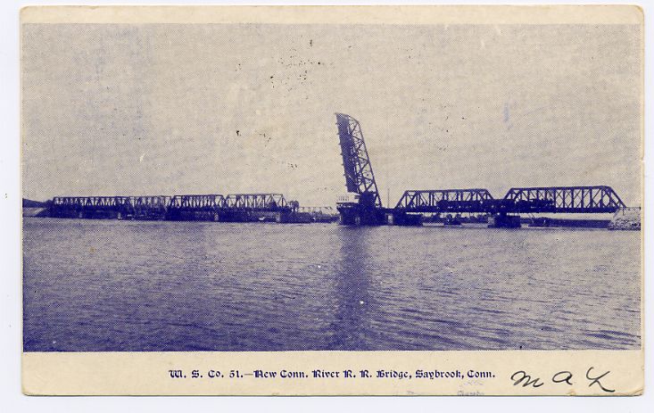
 Railroad bridge over the Connecticut, Old Saybrook, postcard mailed in 1908