- Maes Down
-
Maes Down Site of Special Scientific Interest 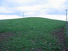
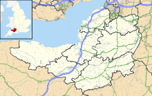
 Shown within Somerset
Area of Search Somerset Grid reference ST647406 Coordinates 51°09′49″N 2°30′22″W / 51.16355°N 2.50621°WCoordinates: 51°09′49″N 2°30′22″W / 51.16355°N 2.50621°W Interest Geological Area 0.2 hectares (0.0020 km2; 0.00077 sq mi) Notification 1985 Natural England website Maes Down (grid reference ST647406) is a 0.2 hectare geological Site of Special Scientific Interest between Shepton Mallet and Stoney Stratton in Somerset, notified in 1985. It is a Geological Conservation Review site.
The rocks seen at Maes Down were laid down about 190 million years ago, during the Upper Pliensbachian and Lower Toarcian Stages of the Jurassic Period of geological times, when this part of Britain lay beneath the sea.
References
- English Nature citation sheet for the site (accessed 10 August 2006)
External links
- English Nature website (SSSI information)
Summary SSSIs Ben Knowle · Blue Anchor to Lilstock Coast · Brean Down · Brimble Pit and Cross Swallet Basins · Bruton Railway Cutting · Cheddar Complex · Cloford Quarry · Cook's Wood Quarry · Crook Peak to Shute Shelve Hill · Doulting Railway Cutting · Emborough Quarries · Glenthorne · Godminster Lane Quarry and Railway Cutting · Greylake · Ham Hill · Hobbs Quarry · Holwell Quarries · Hurcott Farm · Hurcott Lane Cutting · Lamb Leer · Langport Railway Cutting · Laycock Railway Cutting · Leighton Road Cutting · Low Ham · Maes Down · Maesbury Railway Cutting · Miller's Hill, Milborne Wick · Moon's Hill Quarry · Priddy Caves · Priddy Pools · Rodney Stoke SSSI · Sandpit Hole and Bishop's Lot · Seavington St Mary · Shepton Montague Railway Cutting · Snowdon Hill Quarry · St. Dunstan's Well Catchment · Thrupe Lane Swallet · Vallis Vale · Viaduct Quarry · Windsor Hill Quarry · Wookey Hole · Wookey Station · Wurt Pit and Devil's Punchbowl
Neighbouring areas Avon · Devon · Dorset · Wiltshire
Categories:- Sites of Special Scientific Interest in Somerset
- Sites of Special Scientific Interest notified in 1985
- Geology of Somerset


Wikimedia Foundation. 2010.