- Doirani
-
Doirani
ΔοϊράνηLocation 
 Doirani
Coordinates 41°10′N 22°48′E / 41.167°N 22.8°ECoordinates: 41°10′N 22°48′E / 41.167°N 22.8°E Location within the peripheral unit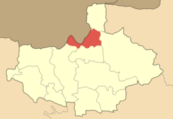
Government Country: Greece Region: Central Macedonia Regional unit: Kilkis Municipality: Kilkis Population statistics (as of 2001) Municipal unit - Population: 2,208 Other Time zone: EET/EEST (UTC+2/3) Auto: ΚΙ  Schengen entry stamp into Greece from Doirani.
Doirani (Greek: Δοϊράνη) is a former municipality in the Kilkis peripheral unit, Greece. Since the 2011 local government reform it is part of the municipality Kilkis, of which it is a municipal unit.[1] It is situated on the shores of Dojran Lake, which marks the border between Greece and the Republic of Macedonia. It had a population of 2,208 according to the 2001 census. It is the Greek part of the former municipality of Doyuran, which was divided in 1913 by the new borders created between Greece and what was then Serbia. The part at the other side of the border is called Dojran. The name comes from the ancient name Doviros.[citation needed]
Doirani was the site of much inter-ethnic fighting during the Macedonian Struggle in the early 20th century. Konstantinos Papagiannakis from Doirani was the most prominent Greek Macedonian Fighter in the area[2].
References
- ^ Kallikratis law Greece Ministry of Interior (Greek)
- ^ In Greek: Obscure Native Macedonian Fighters" Company of Macedonian Studies (CMS), University Studio Press, Thessaloniki, 2008]
Municipal unit of Cherso Municipal unit of Doirani Municipal unit of Gallikos Municipal unit of Kilkis Municipal unit of Kroussa Agios Markos · Anavryto · Antigoneia · Efkarpia · Elliniko · Eptalofos · Fyska · Gerakario · Isoma · Kato Theodoraki · Kentriko · Koiladi · Kokkinia · Koronouda · Pontokerasia · Terpyllos · Theodosia · Tripotamos · VathyMunicipal unit of Mouries Municipal unit of Pikrolimni Anthofyto · Mavroneri · Mikrokampos · Neo Agioneri · Neo Gynaikokastro · Palaio Agioneri · XylokeratiaCategories:- Populated places in Kilkis (peripheral unit)
- Greece–Republic of Macedonia border crossings
- Central Macedonia geography stubs


Wikimedia Foundation. 2010.