- Crowder's Mountain
-
Crowders Mountain 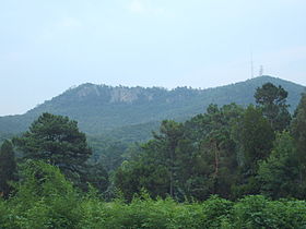
Crowders Mountain, July 2007Elevation 1,625 ft (495 m) Location Location Gaston County, North Carolina, USA Range None Coordinates 35°13′56″N 81°16′35″W / 35.232350°N 81.276439°WCoordinates: 35°13′56″N 81°16′35″W / 35.232350°N 81.276439°W Topo map USGS King's Mountain, NC Crowders Mountain is one of two main peaks within Crowders Mountain State Park, the other peak being King's Pinnacle. The park is located in the western Piedmont of North Carolina between the cities of King's Mountain and Gastonia or about 25 miles (40 km) west of Charlotte. Crowders Mountain abruptly rises nearly 800 feet (240 m) above the surrounding terrain, and has an elevation of 1,625 feet (495 m) above sea level.
Although stated as true on some sites, the mountain was not named after Ulrich Crowder [Krauter], a German merchant and farmer. In 1789, Ulrich purchased land much farther north of the mountain before moving west. The mountain is named for Crowders Creek, which originates near the base of the mountain. The original namesake of Crowders Creek is unknown, but mostly likely lived farther south along Crowders Creek. Crowders Mountain and The Pinnacle, located to the southwest, once served as markers to separate the hunting grounds of the Catawba and Cherokee Indians.
In the early 1970s plans were made to develop and excavate the mountain for kyanite, a mineral used to make porcelain. This led the city council of Gastonia, North Carolina and other concerned citizens to purchase the mountain from developers and give it to the state government.
In 1974 the State of North Carolina created Crowders Mountain State Park. The mountain presents sheer rock cliffs which are 100 - 150 feet (46 m) in height, and which are popular among rock climbers. Several hiking trails lead to the mountain's summit, from which it is possible to view the skyscrapers of nearby Charlotte, North Carolina on a clear day.
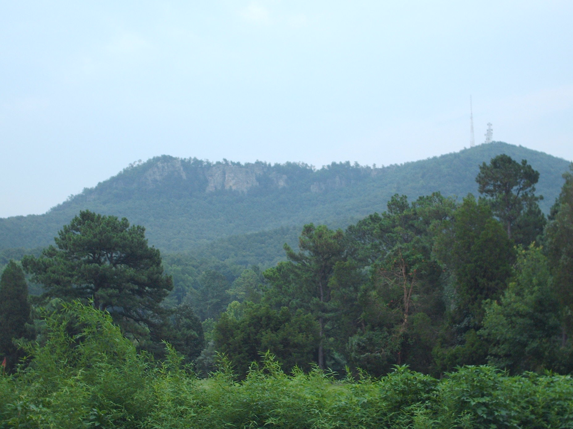
Communications center
One of the first FM radio stations in North Carolina, Gastonia's WGNC-FM, erected a transmission tower on Crowders Mountain in the late 1940s. Today three radio towers are located on the mountain. The transmitters are located within a 13,000-square-foot (1,200 m2) plot of land on the summit that remains privately owned. In addition to commercial radio, the towers relay signals for wireless phone companies, railroads and local emergency services.
On June 19, 2007, the Gastonia City Council denied a request to add 107 feet (33 m) to a 143-foot (44 m) communications tower on Crowders Mountain. Crown Castle International had requested the change to allow the signal of a Spanish-language radio station in Gaffney, South Carolina, to reach Charlotte.
The council cited concerns that the taller tower would damage views of the mountain and that construction equipment would harm the mountain's environment.
The tallest tower on the mountain is owned by CBS Communications and rises 268 feet (82 m).
References
- State Parks of North Carolina. Walter C Biggs and James F. Parnell, Authors. John F. Blair, Publisher. 1989
- George, Jefferson. (2007, June 18). Tower struggle: Antenna request latest battle for those fighting to minimize park intrusions. The Charlotte Observer
- George, Jefferson. (2007, June 20). Taller tower atop Crowders Mtn. axed: Council votes against extension, says it wants to protect state park. The Charlotte Observer
External links
Categories:- Protected areas of Gaston County, North Carolina
- Mountains of North Carolina
- Monadnocks
- North Carolina geography stubs
Wikimedia Foundation. 2010.