- Merzligen
-
Merzligen Country Switzerland Canton Bern District Seeland Coordinates 47°5′N 7°15′E / 47.083°N 7.25°ECoordinates: 47°5′N 7°15′E / 47.083°N 7.25°E Population 406 (Dec 2010)[1] - Density 177 /km2 (457 /sq mi) Area 2.3 km2 (0.89 sq mi) Elevation 509 m (1,670 ft) Postal code 3274 SFOS number 0741 Surrounded by Bellmund, Hermrigen, Jens, Kappelen Twin towns Jamné (Czech Republic) Website www.merzligen.ch
SFSO statistics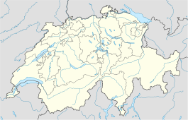
 Merzligen
View map of Merzligen Merzligen is a municipality in the Seeland administrative district in the canton of Bern in Switzerland.
Contents
History
Merzligen is first mentioned in 1278 as Merzelingen.[2]
Geography
Merzligen has an area, as of 2009[update], of 2.28 square kilometers (0.88 sq mi). Of this area, 1.63 km2 (0.63 sq mi) or 71.5% is used for agricultural purposes, while 0.38 km2 (0.15 sq mi) or 16.7% is forested. Of the rest of the land, 0.24 km2 (0.093 sq mi) or 10.5% is settled (buildings or roads) and 0.01 km2 (2.5 acres) or 0.4% is unproductive land.[3]
Of the built up area, housing and buildings made up 6.6% and transportation infrastructure made up 3.5%. Out of the forested land, all of the forested land area is covered with heavy forests. Of the agricultural land, 61.8% is used for growing crops and 5.7% is pastures, while 3.9% is used for orchards or vine crops.[3]
Merzligen is located on the heights between Lake Biel and the Bernese Seeland. It includes the village of Merzligen and part of the hamlet of St. Niklaus (the other part belongs to Bellmund).
Demographics
Merzligen has a population (as of 31 December 2010) of 406.[1] As of 2007[update], 2.7% of the population was made up of foreign nationals. Over the last 10 years the population has grown at a rate of 4.7%. Most of the population (as of 2000[update]) speaks German (91.5%), with French being second most common ( 6.1%) and Italian being third ( 0.5%).
In the 2007 election the most popular party was the SVP which received 31.6% of the vote. The next three most popular parties were the SPS (21.7%), the FDP (17.4%) and the Green Party (10.7%).
The age distribution of the population (as of 2000[update]) is children and teenagers (0–19 years old) make up 23.4% of the population, while adults (20–64 years old) make up 62.8% and seniors (over 64 years old) make up 13.9%. In Merzligen about 80.8% of the population (between age 25-64) have completed either non-mandatory upper secondary education or additional higher education (either university or a Fachhochschule).
Merzligen has an unemployment rate of 0.46%. As of 2005[update], there were 27 people employed in the primary economic sector and about 12 businesses involved in this sector. 5 people are employed in the secondary sector and there are 4 businesses in this sector. 16 people are employed in the tertiary sector, with 8 businesses in this sector.[4] The historical population is given in the following table:[2]
year population 1764 97 1850 198 1900 210 1950 230 2000 411 References
- ^ a b Swiss Federal Statistical Office - STAT-TAB, online database – Datenwürfel für Thema 01.2 - Bevölkerungsstand und -bewegung (German) accessed 29 September
- ^ a b Merzligen in German, French and Italian in the online Historical Dictionary of Switzerland.
- ^ a b Swiss Federal Statistical Office-Land Use Statistics 2009 data (German) accessed 25 March 2010
- ^ Swiss Federal Statistical Office accessed 09-Jul-2009
Municipalities in the Seeland administrative district, Switzerland Aarberg | Arch | Bangerten | Bargen | Brüttelen | Büetigen | Bühl | Büren an der Aare | Diessbach bei Büren | Dotzigen | Epsach | Erlach | Finsterhennen | Gals | Gampelen | Grossaffoltern | Hagneck | Hermrigen | Ins | Jens | Kallnach | Kappelen | Leuzigen | Lüscherz | Lyss | Meienried | Merzligen | Müntschemier | Niederried bei Kallnach | Oberwil bei Büren | Radelfingen | Rapperswil | Ruppoldsried | Rüti bei Büren | Schüpfen | Seedorf | Siselen | Studen (BE) | Täuffelen | Treiten | Tschugg | Vinelz | Walperswil | Wengi | Worben
Canton of Bern | Districts of Canton Bern | Municipalities of the canton of Bern
 Categories:
- Municipalities of Bern
- Municipalities of Switzerland

Wikimedia Foundation. 2010.