- Mazama, Washington
-
Mazama (population 230) is a small village nestled in the Methow Valley of the Methow River in the eastern part of Washington. It is 14 miles (22 km) northwest of Winthrop and about 28 miles (45 km) from the Canadian border.
Located on the eastern flank of the Cascade mountain range, forests of Douglas fir and Ponderosa pine cover Mazama and the surrounding area, which is home to one of the world's longest cross-country skiing trails, stretching for 120 miles (193 km) and running through the town itself.
Mazama's town center elevation is 2,178 feet (664 meters) and it is located 2.7 miles south, and 4,700 feet below Goat Peak.
Mazama and Winthrop recorded the coldest temperature ever measured in Washington state at −48 °F (-44.4 °C) on December 30, 1968.[1]
In the 19th century the town was called "Goat Creek". When a post office was secured in 1899 the settlers chose a name they thought was Greek for "mountain goat". They later discovered that they had looked in the wrong dictionary. Mazama means "mountain goat" in Spanish, not Greek.[2]
References
- ^ "United States Extreme Record Temperatures & Differences". http://ggweather.com/climate/extremes_us.htm. Retrieved 2008-11-22.
- ^ Meany, Edmond S. (1920). "Origin of Washington Geographic Names". The Washington Historical Quarterly (Washington University State Historical Society) XI: 133. http://books.google.com/?id=dbsUAAAAYAAJ. Retrieved 2009-06-11.
Municipalities and communities of Okanogan County, Washington Cities 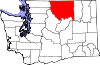
Towns Conconully | Coulee Dam ‡ | Elmer City | Nespelem | Riverside | Twisp | Winthrop
CDPs Unincorporated
communitiesIndian reservation Ghost towns Footnotes ‡This populated place also has portions in an adjacent county or counties
Coordinates: 48°35′37″N 120°24′26″W / 48.59368°N 120.40719°W
Categories:- Populated places in Okanogan County, Washington
- Unincorporated communities in Washington (state)

Wikimedia Foundation. 2010.