- Dulverton
-
Coordinates: 51°02′44″N 3°32′57″W / 51.0455°N 3.5491°W
Dulverton 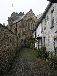
Church of All Saints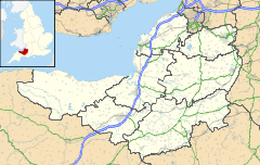
 Dulverton
Dulverton shown within SomersetPopulation 1,630 OS grid reference SS915285 District West Somerset Shire county Somerset Region South West Country England Sovereign state United Kingdom Post town DULVERTON Postcode district TA22 Dialling code 01398 Police Avon and Somerset Fire Devon and Somerset Ambulance South Western EU Parliament South West England UK Parliament Bridgwater and West Somerset List of places: UK • England • Somerset Dulverton is a town and civil parish in the heart of West Somerset, England, near the border with Devon. The town has a population of 1,630.[1] The parish includes the hamlets of Battleton and Ashwick which is located approximately 3.5 miles (5.6 km) north west of Dulverton. To the west of the hamlet lies Ashwich House, built in the Edwardian style in 1901.[2]
Dulverton is a popular tourist destination for exploring Exmoor, and is home to the Exmoor National Park Authority headquarters.
Contents
History
The name Dulverton was first recorded in 1084 as dieglaford-tun meaning "hidden ford"-tun.[3] The Domesday Book records it as Dolvertune and suggests it was a royal manor before the Norman Conquest.[4]
The town lies below the iron age hillforts of Oldberry Castle,[4] Mounsey Castle[3] and Brewer's Castle.[5]
The manor was granted to the Turbervilles by William I and in the late 12th century they gave the church and some land to Taunton Priory. The remainder of the manor passed to the Shete family.[4] The parish of Dulverton was part of the Williton and Freemanners Hundred.[6]
The Middle Ages saw continued growth and the establishment of fairs and markets, with several small industries based upon the traditions of upland farming and the wool trade.[3] These include related works such as laundries: originally used for the washing of sheep fleeces in the leats feeding the wide and fast-flowing River Barle, the surviving 19th-century industrial laundries[7] continue to provide a service to surrounding businesses. The market house in Fore Street, which is believed to date from 1760, was converted into the town hall in 1866,[3] with the porch and external double staircase being added in 1930 by Sir Albert Richardson.[8]
The manor was held by the Sydenhams, who had acquired it in 1568, until 1858 when it was sold to the Earl of Carnarvon.[3]
Exmoor House was built as the Dulverton Union Workhouse in 1855. It is now the headquarters of the Exmoor National Park Authority.[9][10]
Private housing stock generally ranges from medium-size to substantial Georgian to late Victorian family houses, with a small estate of post-war modern houses and bungalows towards the north of town.
Governance
The parish council has responsibility for local issues, including setting an annual precept (local rate) to cover the council’s operating costs and producing annual accounts for public scrutiny. The parish council evaluates local planning applications and works with the local police, district council officers, and neighbourhood watch groups on matters of crime, security, and traffic. The parish council's role also includes initiating projects for the maintenance and repair of parish facilities, as well as consulting with the district council on the maintenance, repair, and improvement of highways, drainage, footpaths, public transport, and street cleaning. Conservation matters (including trees and listed buildings) and environmental issues are also the responsibility of the council.
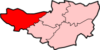
The town falls within the Non-metropolitan district of West Somerset, which was formed on April 1, 1974 under the Local Government Act 1972, having previously been part of Dulverton Rural District.[11] The district council is responsible for local planning and building control, local roads, council housing, environmental health, markets and fairs, refuse collection and recycling, cemeteries and crematoria, leisure services, parks, and tourism.
Somerset County Council is responsible for running the largest and most expensive local services such as education, social services, libraries, main roads, public transport, policing and fire services, trading standards, waste disposal and strategic planning.
As Dulverton falls within the Exmoor National Park some functions normally administered by district or county councils have, since 1997, fallen under the Exmoor National Park Authority, which is known as a ‘single purpose’ authority, which aims to "conserve and enhance the natural beauty, wildlife and cultural heritage of the National Parks" and "promote opportunities for the understanding and enjoyment of the special qualities of the Parks by the public",[12] including responsibility for the conservation of the historic environment.[13]
It is also part of the Bridgwater and West Somerset county constituency represented in the House of Commons of the Parliament of the United Kingdom. It elects one Member of Parliament (MP) by the first past the post system of election, and part of the South West England constituency of the European Parliament which elects six MEPs using the d'Hondt method of party-list proportional representation.
Geography
 Barle Bridge
The town lies in the deep, wooded valley of the River Barle, at an ancient route convergence and river crossing.[4] The river and the Barle Valley are both designated as biological Site of Special Scientific Interest. The river passes under the Tarr Steps a prehistoric clapper bridge possibly dating from 1000 BC. The stone slabs weigh up to 5 tons apiece. According to local legend, they were placed by the devil to win a bet. The bridge is 180 feet (55 m) long and has 17 spans.[14] It has been designated by English Heritage as a grade I listed building.[15] The other bridges over the Barle include the five span Barle Bridge which is medieval in origin. It has double rings on the downstream side and single rings on the upstream side.[16] It was repaired in 1624, and subsequently widened in 1819 by John Stone.[16] It was further repaired in 1866 and in 1952–1953 after flood damage.[17] The 18th century Marsh Bridge was altered in 1866 when the central pier was removed and an iron bridge inserted. The parapet was destroyed in 1952 and reconstructed in steel in 1979.[18] Towards Brushford the River Barle is crossed by the New Bridge dating from 1870, which led to Pixton Park,[19] which was the home of John Dyke Acland and his wife Harriet Acland and later the family of Evelyn Waugh and Auberon Waugh.
The other major river in the parish is the River Exe, which is on the parish boundary with Brompton Regis, which is crossed by the medieval Chilly Bridge[20] and Hele Bridge,[21] and the 18th century Weir Bridge.[22]
In between the town centre and the river is a large recreation meadow which recently underwent renovation by locals (including the pupils of Dulverton Middle School) supported by a Barclays Bank New Futures Scheme.
South of the town is Briggins Moor a biological Site of Special Scientific Interestwhich provides an example of unimproved mire of a type which is restricted to south-west England and Wales and which has been significantly reduced in extent in the recent past. Purple Moor-grass (Molinia caerulea) and Meadow Thistle (Cirsium dissectum) are abundant. There is a large colony of the Marsh Fritillary butterfly (Eurodryas aurinia).[23]
Transport
 Dulverton station just after the rails were lifted in October 1969
Two miles from Dulverton is the village of Brushford, where the Dulverton railway station on the Taunton to Barnstaple line used to be. It opened in 1873 and closed to passengers, who transferred to Dulverton by bus, in 1963. The station buildings are still visible and it is clear where the lines used to run as the railway embankment is still visible and worn in places although the rails have been lifted.
Religious sites
The parish Church of All Saints in Bank Square has a tower from the 15th century, which was extensively restored between 1853 and 1855 when the rest of church was rebuilt by Edward Ashworth. It has been designated as Grade II* listed building[24]
The Congregational Church in Chapel Street was built in the 19th century with adjoining schoolrooms.[25]
Cultural references
Two ships of the Royal Navy have been named HMS Dulverton after the town. The first Dulverton (L63), launched in 1941, was a type II Hunt-class destroyer. She served in World War II and was scuttled in 1943 after being severely damaged by German air attack. The second and current Dulverton (M35), launched in 1982, is a Hunt-class minesweeper.
Notable Dulvertonians
- Aubrey Herbert, diplomat, traveller and intelligence officer, was given Pixton Park by his mother
- Auberon Herbert (landowner) opened up Pixton Park to Eastern Europeans after World War II
- John Nelder, statistician
- Auberon Waugh, writer and journalist, born in 1939 at Pixton Park, Dulverton
- George Williams, founder of the YMCA, born in Dulverton in 1821
- The Wills family hold the title of Lord Dulverton
References
- ^ "Parish population estimates for 2002". Somerset County Council. http://www.webcitation.org/5lRyCc5hq. Retrieved 2009-03-18.
- ^ Jacobs, Brian, Ashwick House near Dulverton, Exmoor Encyclopedia
- ^ a b c d e Bush, Robin (1994). Somerset: The complete guide. Wimborne, Dorset: Dovecote Press. pp. 87–88. ISBN 1874336261.
- ^ a b c d Gathercole, Clare. "A brief history of Dulverton". Somerset Urban Archaeological Survey. Somerset County Council. http://www1.somerset.gov.uk/archives/hes/downloads/EUS_DulvertonText.pdf. Retrieved 2010-02-02.
- ^ "Archaeological Aerial Survey in the Northern Mendip Hills: A Highlight Report for the National Mapping Programme". Pastscape. http://www.pastscape.org.uk/hob.aspx?hob_id=35635. Retrieved 12 May 2011.
- ^ "Somerset Hundreds". GENUKI. http://www.genuki.org.uk/big/eng/SOM/Miscellaneous/. Retrieved 23 October 2011.
- ^ "Dulverton Laundry". Images of England. English Heritage. http://www.imagesofengland.org.uk/Details/Default.aspx?id=429315. Retrieved 2008-12-14.
- ^ "Market Hall". Images of England. English Heritage. http://www.imagesofengland.org.uk/Details/Default.aspx?id=429345. Retrieved 2008-12-14.
- ^ Dunning, Robert (2003). A History of Somerset. Somerset County Library. p. 109. ISBN 0861834763.
- ^ "Exmoor House". Images of England. English Heritage. http://www.imagesofengland.org.uk/Details/Default.aspx?id=429310. Retrieved 2008-12-14.
- ^ A Vision of Britain Through Time : Dulverton Rural District
- ^ "The Authority". Exmoor National Park. http://www.exmoor-nationalpark.gov.uk/index/living_in/the_authority.htm. Retrieved 2007-11-29.
- ^ "Exmoor National Park NMP". English Heritage. http://www.english-heritage.org.uk/server/show/nav.00100200300400200300l. Retrieved 2007-11-29.
- ^ Leete-Hodge, Lornie (1985). Curiosities of Somerset. Bodmin: Bossiney Books. pp. 63–64. ISBN 0906456983.
- ^ "Tarr Steps". Images of England. http://www.imagesofengland.org.uk/details/default.aspx?id=429207. Retrieved 2007-05-09.
- ^ a b Otter, R.A. (1994). Civil Engineering Heritage: Southern England. London: Thomas Telford Ltd. p. 91. ISBN 978-0727719713.
- ^ "Barle Bridge at NGR SS 9120 2782". Images of England. English Heritage. http://www.imagesofengland.org.uk/Details/Default.aspx?id=429309. Retrieved 2008-12-14.
- ^ "Marsh Bridge at NGR SS 9069 2895". Images of England. English Heritage. http://www.imagesofengland.org.uk/Details/Default.aspx?id=429205. Retrieved 2008-12-14.
- ^ "New Bridge". Images of England. English Heritage. http://www.imagesofengland.org.uk/Details/Default.aspx?id=429206. Retrieved 30 November 2008.
- ^ "Chilly Bridge". Images of England. English Heritage. http://www.imagesofengland.org.uk/Details/Default.aspx?id=265598. Retrieved 2008-11-29.
- ^ "Hele Bridge". Images of England. English Heritage. http://www.imagesofengland.org.uk/Details/Default.aspx?id=429171. Retrieved 2008-11-29.
- ^ "Weir Bridge". Images of England. English Heritage. http://www.imagesofengland.org.uk/Details/Default.aspx?id=429208. Retrieved 2008-11-29.
- ^ English Nature citation sheet for the site . Retrieved 9 August 2006.
- ^ "Church of All Saints". Images of England. English Heritage. http://www.imagesofengland.org.uk/Details/Default.aspx?id=429209. Retrieved 2008-12-14.
- ^ "Congregational Church and hall, dwarf wall, railings and gate". Images of England. English Heritage. http://www.imagesofengland.org.uk/Details/Default.aspx?id=429314. Retrieved 2008-12-14.
External links
- Dulverton at the Open Directory Project
Towns, villages and hamlets in the West Somerset district of Somerset, England  Allerford · Ashbeer · Bicknoller · Brandish Street · Brompton Ralph · Brompton Regis · Brushford · Carhampton · Clatworthy · Cockercombe · Crowcombe · Culbone · Cutcombe · Dulverton · Dunster · East Quantoxhead · Elworthy · Exford · Exton · Holford · Huish Champflower · Kilve · Lilstock · Luccombe · Luxborough · Minehead · Monksilver · Oare · Old Cleeve · Porlock · Roadwater · Sampford Brett · Selworthy · Simonsbath · Skilgate · Stogumber · Stogursey · Stringston · Timberscombe · Treborough · Upton · Washford · Watchet · West Quantoxhead · Williton · Winsford · Withycombe · Withypool · Wootton CourtenayCategories:
- Towns in Somerset
- West Somerset
- Civil parishes in Somerset


Wikimedia Foundation. 2010.