- Hudson River
-
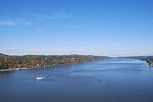
Hudson River 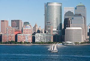 A sailboat on the Hudson River, with downtown Manhattan in the background
Country United States States New York, New Jersey Tributaries - left Opalescent River, Boreas River, Moses Kill River, Batten Kill, Hoosic River - right Goodnow River, Cedar River (New York), Indian River (New York), Sacandaga River, Snook Kill River, Mohawk River, Normans Kill, Vloman Kill, Coeymans Creek, Hannacroix Creek, Coxsackie Creek Cities Glens Falls, Mechanicville, Troy, Albany, Hudson, Kingston, Poughkeepsie, Newburgh, Beacon, Peekskill, Yonkers, New York City, Fort Lee, Hoboken, Jersey City city15 = Bayonne, New Jersey
Source Lake Tear of the Clouds - location Mount Marcy, New York, United States - elevation 4,293 ft (1,309 m) - coordinates 44°06′24″N 73°56′09″W / 44.10667°N 73.93583°W Mouth Upper New York Bay - elevation 0 ft (0 m) - coordinates 40°42′11″N 74°01′36″W / 40.70306°N 74.02667°W Length 315 mi (507 km) Basin 14,000 sq mi (36,260 km2) Discharge for Lower New York Bay, max and min at Green Island - average 21,400 cu ft/s (606 m3/s) - max 215,000 cu ft/s (6,088 m3/s) - min 882 cu ft/s (25 m3/s) Discharge elsewhere (average) - Troy 15,000 cu ft/s (425 m3/s)  Hudson and Mohawk watersheds
The Hudson is a 315-mile (507 km) river that flows from north to south through eastern New York. The highest official source is at Lake Tear of the Clouds, on the slopes of Mount Marcy in the Adirondack Mountains. The river itself officialy begins in Henderson Lake in Newcomb, New York. The river flows past Albany, and finally forms the border between New York City and New Jersey at its mouth before emptying into Upper New York Bay. Its lower half is a tidal estuary,[1] which occupies the Hudson Fjord. This was created during the most recent North American glaciation over the latter part of the Wisconsin Stage of the Last Glacial Maximum, 26,000 to 13,300 years ago.[2] Tidal waters influence the Hudson's flow as far north as Troy.
The river is named after Henry Hudson, an Englishman sailing for the Dutch East India Company, who explored it in 1609. It had previously been observed by Italian explorer Giovanni da Verrazano sailing for King Francis I of France in 1524, as he became the first European known to have entered the Upper Bay, but he considered the river to be an estuary. The Dutch called the river the "North River" – with the Delaware River called the "South River" – and it formed the spine of the Dutch colony of New Netherland. Settlement of the colony clustered around the Hudson, and its strategic importance as the gateway to the American interior led to years of competition between the English and the Dutch over control of the river and colony.
In the Eighteenth Century, the river valley and its inhabitants were the subject and inspiration of Washington Irving, the first internationally acclaimed American author. In the Nineteenth Century the area inspired the Hudson River School of painting, an American pastoral style, as well as the idea of "wilderness" and "conservation."
Contents
Names
The river was called Muh-he-kun-ne-tuk, the Great Mohegan, by the Iroquois,[3][4][5] and it was known as Muhheakantuck ("river that flows two ways") by the Lenape tribe who inhabited both banks of the lower portion of the river - all of present day New Jersey and the island of Manhattan. The Hudson was named the "North River" by the Dutch, who called the Delaware River the "South River." The name "North River" was used in the New York City area up until the early 1900s, with limited use continuing into the modern day.[6] The term persists in radio communication among commercial shipping traffic, especially below Tappan Zee.[7]
Geography
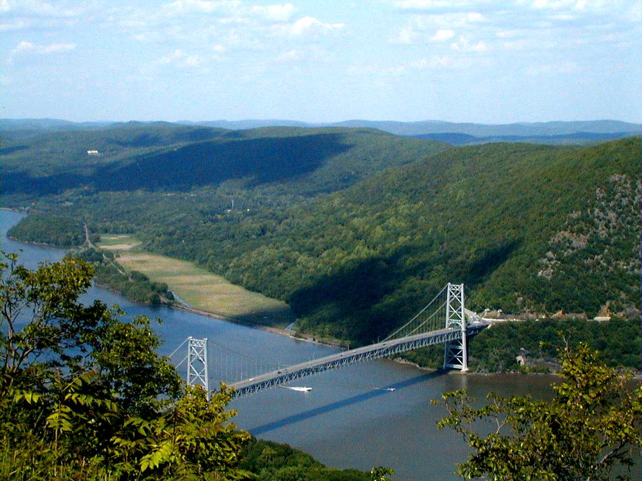
The official source of the Hudson is Lake Tear of the Clouds in the Adirondack Mountains. However, the waterway from the lake is known as Feldspar Brook and the Opalescent River, feeding into the Hudson at Tahawus. The actual Hudson River begins several miles north of Tahawus at Henderson Lake. The Hudson is joined at Waterford (north of Albany) by the Mohawk River, its major tributary, just south of which the Federal Dam separates the Upper Hudson River Valley from the Lower Hudson River Valley or simply the Hudson River Valley. The Hudson river then flows south, passing between the Catskill Mountains and the Taconic Mountains, widening significantly at the Tappan Zee, finally flowing between Manhattan Island and the New Jersey Palisades and into the Atlantic Ocean at New York Bay, an arm of the ocean, where it forms New York Harbor.
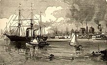 View of the Hudson in the 1880s showing Jersey City
The lower Hudson is actually a tidal estuary, with tidal influence extending as far as the Federal Dam at Troy.[1] Strong tides make parts of New York Harbor difficult and dangerous to navigate. During the winter, ice floes drift south or north, depending upon the tides. The Mahican name of the river reflects its partially estuarine nature: muh-he-kun-ne-tuk means "the river that flows both ways."[8] The Hudson is often mistaken for one of the largest rivers in the United States, but it is an estuary throughout most of its length below Troy and thus only a small fraction of fresh water, about 15,000 cubic feet (425 m³) per second, is present. The mean fresh water discharge at the river's mouth in New York is approximately 21,400 cubic feet (606 m³) per second. The Hudson and its tributaries, notably the Mohawk River, drain a large area. Parts of the Hudson River form coves, such as Weehawken Cove in Hoboken and Weehawken.
The Hudson is sometimes called, in geological terms, a "drowned" river. The rising sea levels after the retreat of the Wisconsin glaciation, the most recent ice age, have resulted in a marine incursion that drowned the coastal plain and brought salt water well above the mouth of the river. The deeply eroded old riverbed beyond the current shoreline, Hudson Canyon, is a rich fishing area. The former riverbed is clearly delineated beneath the waters of the Atlantic Ocean, extending to the edge of the continental shelf.
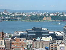 Hudson from Midtown Manhattan with Javits Convention Center in foreground. The New Jersey Palisades is visible across the river.
The Delaware and Hudson Canal ended at the Hudson at Kingston, running southwest to the coal fields of northeastern Pennsylvania.
Notable landmarks on the Hudson include West Point, Home of Franklin D. Roosevelt National Historic Site, Bard College, the Culinary Institute of America, Marist College, the Thayer Hotel at West Point, Bannerman's Castle, Metro-North Railroad's Hudson Line (formerly part of the New York Central Railroad system), the Tappan Zee, the New Jersey Palisades, Hudson River Islands State Park, Hudson Highlands State Park,Walkway over the Hudson, Sing Sing Correctional Facility, New York Military Academy, Fort Tryon Park with The Cloisters, Liberty State Park, and Stevens Institute of Technology. Cities and towns on the New Jersey side include Tenafly, Fort Lee, Edgewater, West New York, Weehawken, Hoboken, and Jersey City. Cities in New York State include Troy, Albany, Kingston, Poughkeepsie, Glens Falls, Yonkers, Newburgh Beacon and New York City.
The natural beauty of the Hudson Valley earned the Hudson River the nickname "America's Rhine", being compared to that of the famous 40 mile (65 km) stretch of Germany's Rhine River valley between the cities of Bingen and Koblenz. A similar 30-mile (48 km) stretch on the east bank of the Hudson has been designated the Hudson River Historic District, a National Historic Landmark. The Hudson was designated as one of the American Heritage Rivers in 1997.
The Narrows
The Narrows, a tidal stream between the New York City boroughs of Staten Island and Brooklyn, connects the upper and lower sections of New York Bay. It has long been considered the maritime "gateway" to New York City and historically has been the most important entrance into the harbor.
The Narrows were most likely formed about 6,000 years ago at the end of the last ice age. Previously, Staten Island and Long Island were connected, preventing the Hudson River from terminating via The Narrows. At that time, the Hudson River emptied into the Atlantic Ocean through a more westerly course through parts of present day northern New Jersey, along the eastern side of the Watchung Mountains to Bound Brook, New Jersey and then on into the Atlantic Ocean via Raritan Bay. A build up of water in the Upper Bay eventually allowed the Hudson River to break through previous land mass that was connecting Staten Island and Brooklyn to form The Narrows as it exists today. This allowed the Hudson River to find a shorter route to the Atlantic Ocean via its present course between New Jersey and New York City (Waldman, 2000).
North River
Main article: North River (Hudson River)
North River is an alternate name for the southernmost portion of the Hudson, usually referring to all or part of the waterway located between Manhattan and Hudson County.[9][10][11][12][13] The colonial name given by the Dutch to the entire river in the early seventeenth century, the term fell out of popular use for most of it some time in the early 1900s,[14] but continues in use locally by mariners and others[15][16][17] as well as on some nautical charts[18] and maps. The term also lives on in the names of a variety of facilities such as the North River piers, North River Tunnels, and the North River Wastewater Treatment Plant, and has strong historical ties with New York Harbor.
Haverstraw Bay
Haverstraw Bay, just north of the Tappan Zee (the widest part of the river), is located between Croton Point in the Southeast and the town of Haverstraw in the Northwest. Haverstraw Bay is a popular destination for recreational boaters and is home to many yacht clubs and marinas, including Croton Yacht Club, Croton Sailing School, Half Moon Bay Marina (Croton), Pennybridge Marina, Minisceongo Yacht Club, Stony Point Bay Marina, and Haverstraw Marina, and is traversed by NY Waterway's Haverstraw–Ossining Ferry.
Transportation
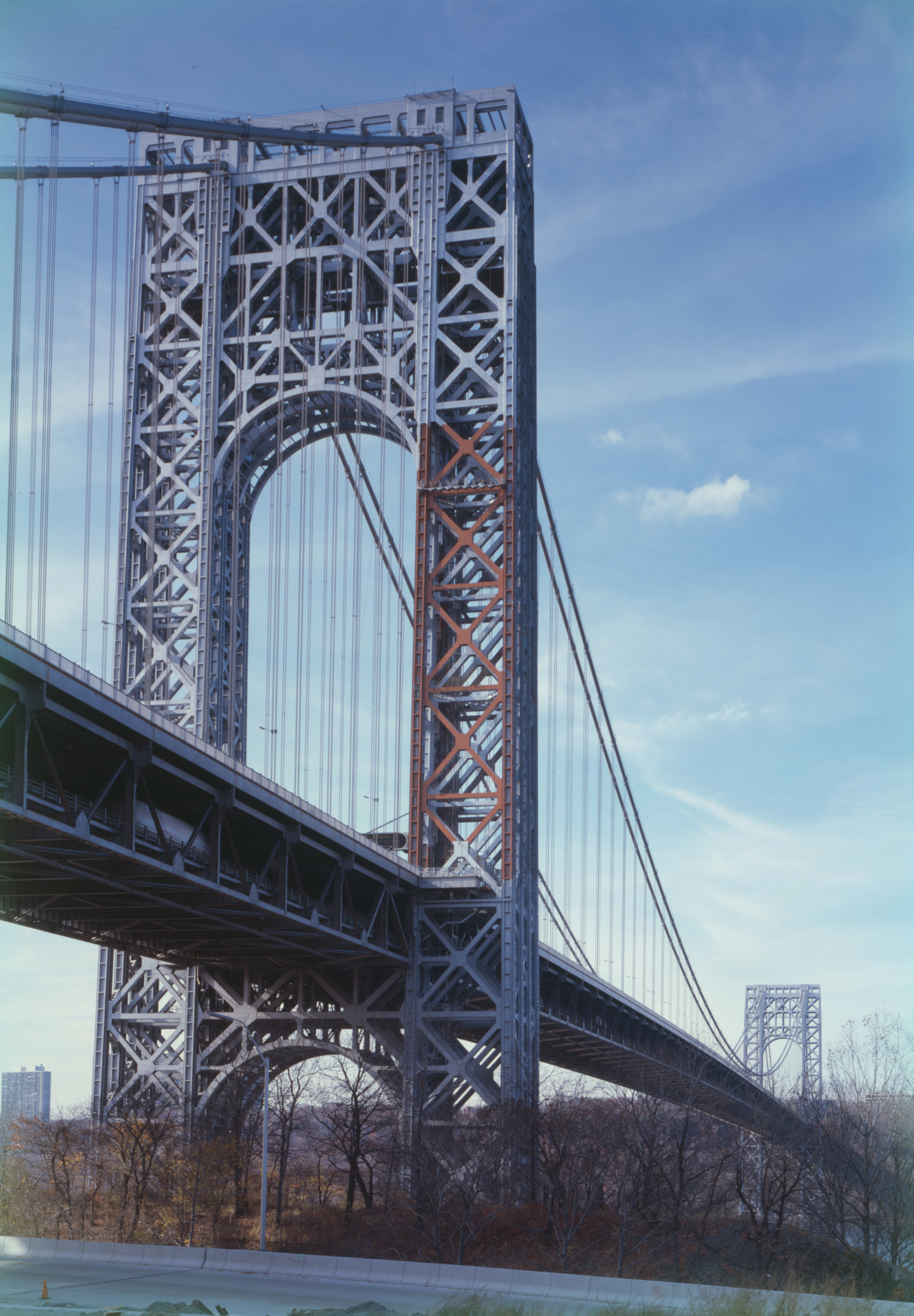
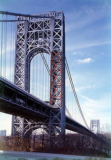 The George Washington Bridge, connecting Fort Lee, New Jersey across the Hudson River to New York City, is the world's busiest motor vehicle bridge.[19]
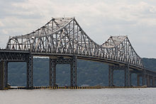
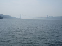 Looking downriver from the Circle Line Sightseeing Cruises boat. George Washington Bridge can be seen in the background.
The Hudson River is navigable for a great distance above mile 0 (at 40°42.1'N., 74°01.5'W.) off The Battery. The original Erie Canal, opened in 1825 to connect the Hudson with Lake Erie, emptied into the Hudson at the Albany Basin, just three miles (5 km) south of the Federal Dam in Troy (at mile 134). The canal enabled shipping between cities on the Great Lakes and Europe via the Atlantic Ocean. The New York State Canal System, the successor to the Erie Canal, runs into the Hudson River north of Troy and uses the Federal Dam as the Lock 1 and natural waterways whenever possible. The first railroad in New York, the Mohawk and Hudson Railroad, opened in 1831 between Albany and Schenectady on the Mohawk River, enabling passengers to bypass the slowest part of the Erie Canal.
In northern Troy, the Champlain Canal split from the Erie Canal and continued north along the west side of the Hudson to Thomson, where it crossed to the east side. At Fort Edward the canal left the Hudson, heading northeast to Lake Champlain. A barge canal now splits from the Hudson at that point, taking roughly the same route (also parallel to the Delaware and Hudson Railway's Saratoga and Whitehall Railroad) to Lake Champlain at Whitehall. From Lake Champlain, boats can continue north into Canada to the Saint Lawrence Seaway.
The Hudson Valley also proved attractive for railroads, once technology progressed to the point where it was feasible to construct the required bridges over tributaries. The Troy and Greenbush Railroad was chartered in 1845 and opened that same year, running a short distance on the east side between Troy and Greenbush (east of Albany). The Hudson River Railroad was chartered the next year as a continuation of the Troy and Greenbush south to New York City, and was completed in 1851. In 1866 the Hudson River Bridge opened over the river between Greenbush and Albany, enabling through traffic between the Hudson River Railroad and the New York Central Railroad west to Buffalo. When the Poughkeepsie Rail Bridge opened in 1879, it became the longest single span bridge in the world. On October 3, 2009, it re-opened as a pedestrian walkway over the Hudson, as part of the Hudson River Quadricentennial Celebrations and connects over 25 miles of existing pedestrian trails.[20][21]
The New York, West Shore and Buffalo Railway began at Weehawken Terminal and ran up the west shore of the Hudson as a competitor to the merged New York Central and Hudson River Railroad. Construction was slow, and was finally completed in 1884; the New York Central purchased the line the next year.

The Hudson is crossed at numerous points by bridges, tunnels, and ferries. The width of the Lower Hudson River required major feats of engineering to cross, the results today visible in the Verrazano-Narrows Bridge, the George Washington Bridge, and the Tappan Zee Bridge, as well as the Lincoln and Holland Tunnels and the PATH and Pennsylvania Railroad tubes. The George Washington Bridge (signed as I-95/US 1-9/US 46), connecting Fort Lee, New Jersey to the Washington Heights neighborhood of Upper Manhattan in New York City, is the world's busiest motor vehicle bridge.[22] The Troy-Waterford Bridge at Waterford was the first bridge over the Hudson, opened in 1809. The Rensselaer and Saratoga Railroad was chartered in 1832 and opened in 1835, including the Green Island Bridge, the first bridge over the Hudson south of the Federal Dam.[23]
The Upper Hudson River Valley was also useful for railroads. Sections of the Rensselaer and Saratoga Railroad, Troy and Boston Railroad and Albany Northern Railroad ran next to the Hudson between Troy and Mechanicville. North of Mechanicville the shore was bare until Glens Falls, where the short Glens Falls Railroad ran along the east shore. At Glens Falls the Hudson turns west to Corinth before continuing north; at Corinth the Adirondack Railway begins to run along the Hudson's west bank. The original Adirondack Railway opened by 1871, ending at North Creek along the river. In World War II an extension opened to Tahawus, the site of valuable iron and titanium mines. The extension continued along the Hudson River into Hamilton County, and then continued north where the Hudson makes a turn to the west, crossing the Hudson and running along the west shore of the Boreas River. South of Tahawus the route returned to the east shore of the Hudson the rest of the way to its terminus.
 NASA image of the lower Hudson
Political boundaries
The Hudson River serves as a political boundary between the states of New Jersey and New York, and further north between New York counties. The northernmost place with this convention is in southwestern Essex County.
Hamilton Essex Warren river runs along
municipal boundariesSaratoga Warren Saratoga Washington Saratoga Rensselaer Albany Rensselaer Greene Columbia Ulster Columbia Ulster Dutchess Orange Dutchess Orange Putnam Rockland Westchester Bergen (NJ) Westchester Bergen (NJ) Bronx Bergen (NJ) New York Hudson (NJ) New York Tributaries
- See Rivers of the Hudson River Basin for an alphabetical listing including tributaries of tributaries.
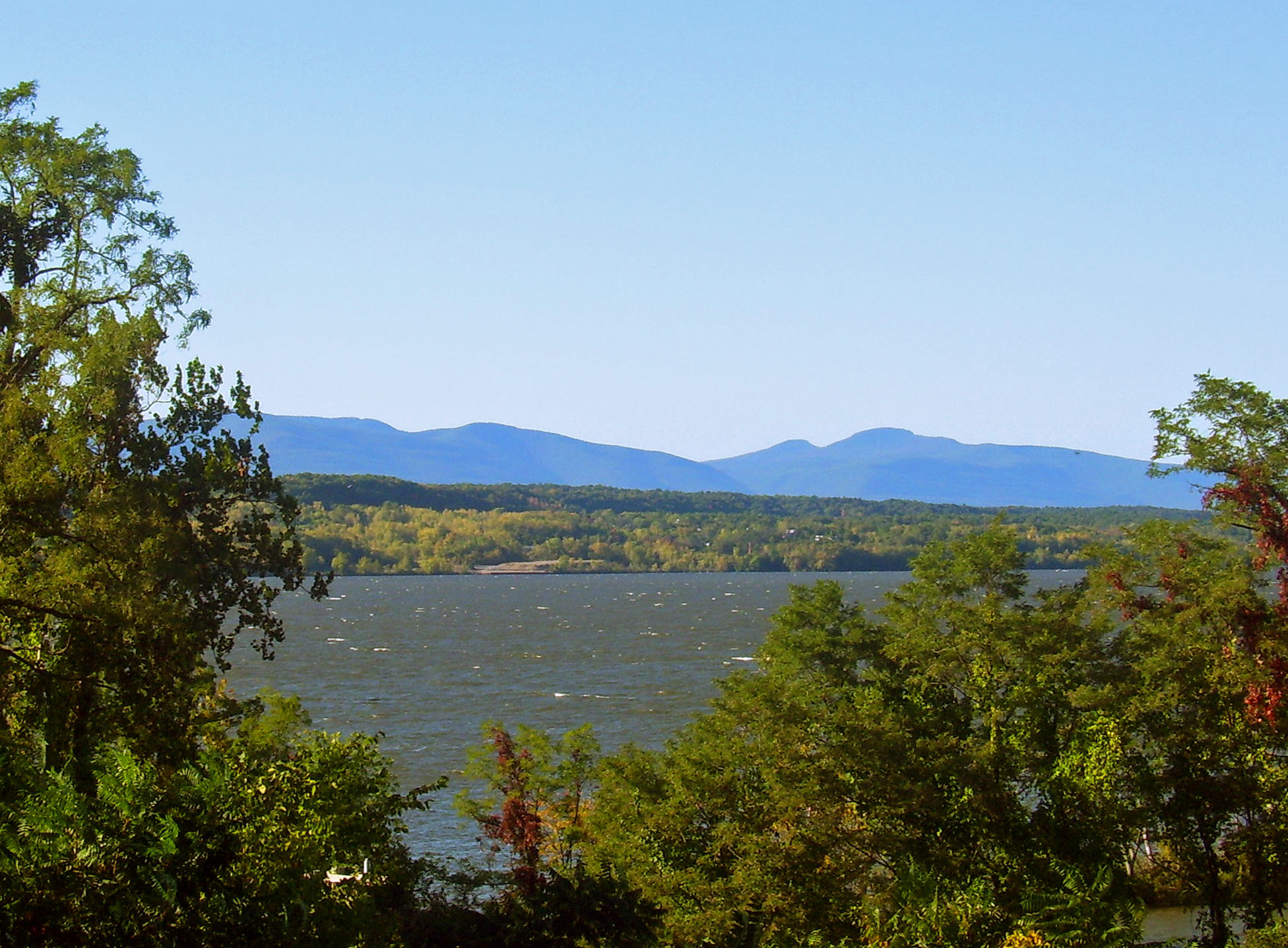
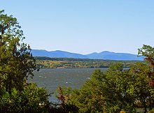 View of the Catskills from Rhinecliff
 The Hudson near Newcomb, New York, a dozen miles south of its source.
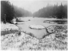 Lake Tear of the Clouds, by Seneca Ray Stoddard (late 19th century)
From north to south, moving downriver
- Opalescent Brook
- Cedar River
- Indian River
- Boreas River[24]
- Schroon River
- Sacandaga River
- Mill Creek
- Batten Kill
- Hoosic River
- Mohawk River
- Poesten Kill[25]
- Patroon Creek
- Normans Kill[26]
- Moordener Kill
- Coeymans Creek
- Catskill Creek[27] whose name was applied to the Catskill Mountains
- Roeliff-Jansen Kill[28]
- Esopus Creek
- Rondout Creek
- Crum Elbow Creek[29]
- Wappinger Creek
- Casperkill
- Quassaick Creek
- Fishkill Creek
- Moodna Creek
- Croton River
- Sing Sing Kill
- Pocantico River[30] which flows through Rockefeller State Park Preserve
- Sparkill Creek[31]
- Wicker's Creek
- Saw Mill River
Note kill as used above is the Dutch word for creek. This can obviously cause confusion since kill is an English word with a totally different meaning. Sometimes the original Dutch colonial name is retained, as in Poestin Kill. Sometimes the Dutch name is redundantly combined with the English word, as in Fishkill Creek (Fish Creek Creek, not a creek named after the killing of fish).
Theodore Roosevelt's historic route
On September 14, 1901, then-Vice President Theodore Roosevelt was at Lake Tear of the Clouds after returning from a hike to the Mount Marcy summit when he received a message informing him that President William McKinley, who had been shot two weeks earlier but was expected to survive, had taken a turn for the worse.
Roosevelt hiked down 10 miles (16 km) on the southwest side of the mountain to the closest stage station at Long Lake, New York. He then took a 40-mile (64-km) midnight stage coach ride through the twisting Adirondack Roads to the Adirondack Railway station at North Creek, where he discovered that McKinley had died. Roosevelt took the train to Buffalo, where he was officially sworn in as President.
The 40 mile (64 km) route is now designated the Roosevelt-Marcy Trail.
Pollution and other environmental impacts
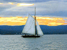 The sloop Clearwater on the Hudson River
PCB contamination
PCBs were widely used as dielectric and coolant fluids, for example in transformers, capacitors, and electric motors.[32]General Electric manufacturing facilities at Hudson Falls and Fort Edward discharged between 209,000–1,300,000 lb (95–590 metric tons) of polychlorinated biphenyl (PCBs) into the river from 1947 to 1977. The PCBs caused extensive contamination of fish in the river and apparently triggered a rapid evolutionary change in the Atlantic tomcod, which after about 50 years of exposure evolved a two amino acid change in its AHR2 receptor gene, causing the receptor to bind more weakly with PCBs than normal.[33] The mutation does not prevent the tomcods from accumulating PCBs in their bodies and passing them on to striped bass and whatever else eats them.[33] This system of passing contamination on to larger organisms is also known as biomagnification. The toxic chemicals also accumulated in sediments that settled to the river bottom.[34] The highest concentration of PCBs comes from the Thompson Island Pool. [35]
In 1966, Pete Seeger and Toshi Seeger founded Hudson River Sloop Clearwater, an environmental education organization and an actual boat (a sloop), that promotes awareness of the river and its history. Clearwater has gained national recognition for its activism starting in the 1970s to force a clean-up of PCB contamination of the Hudson caused by GE and other companies.[36]
There are many economic effects caused by the PCB Contamination. The water cannot be used for agriculture use, money is lost from the fishing industry because of the ban on recreational fishing, medical expenses for people who have side-effects from the water, and the cost of clean-up efforts.
In 1976 the New York State Department of Environmental Conservation banned all fishing in the Upper Hudson due to health concerns with PCBs.[37][38] PCBs are thought to be responsible for health issues that include Neurological Disorders, lower IQ and poor short-term memory (active memory), hormonal disruption, suppressed immune system, cancer, skin Irritations, Parkinson’s Disease, ADHD, heart disease, and diabetes. PCB contamination in humans come from drinking the contaminated water, absorption through the skin, eating contaminated aquatic life, and inhaling volatilized PCBs. PCB contamination is especially dangerous for pregnant and nursing women. The contamination can reach the fetus and potentially cause birth defects. Contamination through breast milk can also have harmful effects on the child indirectly.
In 1977, PCBS were banned in the United States.[39] In 1983, the United States Environmental Protection Agency (EPA) declared a 200-mile (322-km) stretch of the river, from Hudson Falls to New York City, to be a Superfund site requiring cleanup.This superfund site is considered to be one of the largest in the nation. In 2001, after a ten year study of PCB contamination in the Hudson River, the EPA proposed a plan to clean up the river by dredging more than 100,000 pounds of PCBs. The worst PCB hotspots are targeted for remediation by removing and disposing of more than 2.6 million cubic yards of contaminated sediment.[40] The dredging project is the most aggressive environmental effort ever proposed to clean up a river, and will cost GE about $460,000,000. GE began sediment dredging operations to clean up the PCBs on May 15, 2009.[41] This stage (Phase One) of the cleanup was completed in October 2009, and was responsible for the removal of approximately 300,000 cubic yards of contaminated sediment, which was more than the targeted amount. Over 620 barges filled with sediment were transported to the processing facility on the Champlain Canal, and over 80 rail cars transported the dredged sediment to a waste facility in Andrews, Texas. [42]The true scope of Phase One was about 100,000 cubic yards more than planned, and Phase Two will be expanded as a consequence. Before Phase two of the cleanup, GE was given the opportunity to opt out of the clean up efforts, but they chose to complete the project. Phase two of the cleanup project, led by GE and monitored by the EPA, began in June 2011. This phase targets approximately 2.4 million cubic yards of PCB-contaminated sediment from a forty mile section of the Upper Hudson River. Phase Two of the clean up will take approximately 5 to 7 years to complete.[43]
Other pollutants
 Bird's-eye view of the Hudson from the Walkway Over the Hudson
Other ongoing pollution issues affecting the river include: accidental sewage discharges, urban runoff, heavy metals, furans, dioxin, pesticides, and polycyclic aromatic hydrocarbons (PAHs).[44]
A study reported in the August 2008 issue of the journal Environmental Toxicology and Chemistry suggests that mercury in common Hudson River fish, including striped bass, yellow perch, largemouth bass, smallmouth bass and carp, has declined strongly over the past three decades. The conclusions were extracted from a large database of mercury analyses of fish fillets accumulated by NYSDEC and collected over much of the length of the Hudson from New York City waters to the Adirondack watershed. The research indicates that the trends are in line with the recovery that the Hudson River has experienced over the past few decades, now that activist groups, government officials and industry are beginning to cooperate to help clean up the river system.[45]
NYSDEC has listed various portions of the Hudson as having impaired water quality due to PCBs, cadmium, and other toxic compounds. Hudson River tributaries with impaired water quality (not necessarily the same pollutants as the Hudson main stem) are Mohawk River, Dwaas Kill, Schuyler Creek, Saw Mill River, Esopus Creek, Hoosic River, Quaker Creek, and Batten Kill. Many lakes in the Hudson drainage basin are also listed.[46]
Other environmental impacts
Proposed hydroelectric facility
In 1980, Consolidated Edison (Con Ed) agreed to drop its 17-year fight to build a pumped-storage hydroelectricity facility on Storm King Mountain.[47] The actions of local citizen organizations that led to the Con Ed decision spurred the creation of Riverkeeper, a non-profit environmental organization that grew into a global umbrella organization, the Waterkeeper Alliance.[48]
Cooling water withdrawals
In 2010 NYSDEC charged that the Indian Point Energy Center, a nuclear power plant in Buchanan, is violating the Clean Water Act due to its large withdrawals of water from the Hudson, which kills millions of fish and other aquatic organisms each year. The state is demanding that Entergy, the plant operator, construct cooling towers to mitigate the environmental impacts.[49]
The Hudson River estuary system is part of The National Estuarine Research Reserve System.[50]
See also
- Hudson River Chain
- Hudson River Region AVA
- List of Hudson River Islands
- List of fixed crossings of the Hudson River
- List of ferries across the Hudson River in New York City
- List of New Jersey rivers
- List of New York rivers
- Upper Hudson River Valley
- Hudson Canyon - A submarine canyon extending hundreds of miles into the Atlantic Ocean that connects Hudson River to the deep ocean basin.
- Hudson River Waterfront Walkway
- Poughkeepsie Yacht Club
- US Airways Flight 1549, which had a forced landing in the Hudson in January 2009
- Geography of New York-New Jersey Harbor Estuary
References
- Notes
- ^ a b "The Hudson River Estuary - The Basics". Life.bio.sunysb.edu. http://life.bio.sunysb.edu/marinebio/fc.1.estuaries.html. Retrieved 2011-04-26.
- ^ The Hudson as Fjord New York State Department of Environmental Conservation
- ^ Hoffman, Charles Fenno (1839). Wild scenes in the forest and prairie (Chapter II: Ko nea rau neh neh or The Flying Head). Original from Oxford University. p. 31. http://books.google.com/books?id=JHoEAAAAQAAJ&pg=RA1-PA48&dq=%22The+Flying+Head%22&as_brr=1&ie=ISO-8859-1#PRA1-PA31,M1.
- ^ Abbatt, William (1906). The Magazine of History with Notes and Queries (INDIAN LEGENDS VIII: THE FLYING HEAD A LEGEND OF SACONDAGA LAKE). Original from Harvard University. p. 282. http://books.google.com/books?id=x_AOAAAAYAAJ&pg=PA282&dq=%22The+Flying+Head%22&as_brr=1&ie=ISO-8859-1.
- ^ Coppée, Henry (edited by) (1900). The Classic and the Beautiful from the Literature of Three Thousand Years (THE FLYING HEAD A LEGEND OF SACONDAGA LAKE). Original from the New York Public Library: Carson & Simpson. p. 220. http://books.google.com/books?id=fL8CAAAAYAAJ&pg=PA224&dq=%22The+Flying+Head%22&as_brr=1&ie=ISO-8859-1#PPA220,M1.
- ^ Steinhauer, Jennifer. "F.Y.I", The New York Times, May 15, 1994. Accessed January 17, 2008. "The North River was the colonial name for the entire Hudson River, just as the Delaware was known as the South River. These names went out of use sometime early in the century, said Norman Brouwer, a historian at the South Street Seaport Museum."
- ^ Stanne, Stephen P.; Roger G. Panetta, Brian E. Forist (1996). The Hudson, An Illustrated Guide to the Living River. New Brunswick, NJ: Rutgers University Press. ISBN 0-8135-2270-6.
- ^ Rittner 2002, p. 18.
- ^ The Random House Dictionary (2009)("Part of the Hudson River between NE New Jersey and SE New York.")
- ^ The American Heritage Dictionary of the English Language,'Fourth Edition (2006) ("An estuary of the Hudson River between New Jersey and New York City flowing into Upper New York Bay.")
- ^ Webster's New World College Dictionary (2005) ("The lower course of the Hudson River, between New York City & NE N.J.")
- ^ The Merriam-Webster Online Dictionary (2009) ("An estuary of Hudson River between SE New York & NE New Jersey" )
- ^ Joint Report With Comprehensive Plan and Recommendations New York, New Jersey Port and Harbor Development Commission (1926)
- ^ Steinhauer, Jennifer."F.Y.I",The New York Times, May 15, 1994. Accessed January 17, 2008. "The North River was the colonial name for the entire Hudson River, just as the Delaware was known as the South River. These names went out of use sometime early in the century, said Norman Brouwer, a historian at the South Street Seaport Museum."
- ^ "North River Historic Ship Society". Nrhss.org. http://www.nrhss.org/historicvessels.htm. Retrieved 2011-04-26.
- ^ The Great North River Tugboat Race and Competition
- ^ "North River Power Squadron". Northriversquadron.org. http://www.northriversquadron.org/. Retrieved 2011-04-26.
- ^ "Sea Paddle Nyc". Surfline.com. 2008-08-20. http://www.surfline.com/surf-news/lopez-doerner-malloy-and-friends-brave-the-hudson-to-raise-autism-awareness-sea-paddle-nyc_17842//. Retrieved 2011-04-26.
- ^ "Port Authority of New York and New Jersey - George Washington Bridge". http://www.panynj.gov/bridges-tunnels/george-washington-bridge.html. Retrieved 2010-11-11.
- ^ http://img35.imageshack.us/img35/2940/cimg0281s.jpg
- ^ "Walkway over the Hudson". Walkway.org. http://walkway.org/. Retrieved 2011-04-26.
- ^ "Port Authority of New York and New Jersey - George Washington Bridge". http://www.panynj.gov/bridges-tunnels/george-washington-bridge.html. Retrieved 2010-10-02.
- ^ "NEB&W Self-Guided Tour of Troy & Green Island". Railroad.union.rpi.edu. 2007-12-13. http://railroad.union.rpi.edu/images/Open-house/Self-guided-tour-of-Troy.asp. Retrieved 2011-04-26.
- ^ "Riverfacts.com—Boreas River". Riverfacts.com. http://www.riverfacts.com/rivers/12033.html. Retrieved 2011-04-26.
- ^ "RiverFacts.com—Poesten Kill". Riverfacts.com. http://www.riverfacts.com/rivers/12199.html. Retrieved 2011-04-26.
- ^ "RiverFacts.com—Normans Kill". Riverfacts.com. http://www.riverfacts.com/rivers/12175.html. Retrieved 2011-04-26.
- ^ "Riverfacts.com—Catskill Creek". Riverfacts.com. http://www.riverfacts.com/rivers/12050.html. Retrieved 2011-04-26.
- ^ "Riverfacts.com—Roeliff Jansen Kill". Riverfacts.com. http://www.riverfacts.com/rivers/12217.html. Retrieved 2011-04-26.
- ^ "Crum Elbow Creek". Hhr.highlands.com. http://www.hhr.highlands.com/crumelbowcreek.htm. Retrieved 2011-04-26.
- ^ Pocantico River photograph
- ^ "Sparkill Creek". Sparkill Creek. http://www.sparkillcreek.com/. Retrieved 2011-04-26.
- ^ "Polychlorinated biphenyl". http://en.wikipedia.org/wiki/Polychlorinated_biphenyl. Retrieved 2011-10-18.
- ^ a b "Pollution Triggers Genetic Resistance Mechanism in a Coastal Fish". Science Daily. http://www.sciencedaily.com/releases/2011/02/110217141513.htm. Retrieved 2011-02-18.
- ^ "Frequently Asked Questions". Hudson River PCBs. New York, NY: U.S. Environmental Protection Agency. http://www.epa.gov/hudson/faqs.htm. Retrieved 2010-10-05.
- ^ Clean Up GE. [1] Accessed 2011-11-9.
- ^ Hudson River Sloop Clearwater, Beacon, NY. "History." Accessed 2010-10-05.
- ^ EPA. "Hudson River PCBs." February 5, 2009.
- ^ "National Priorities List Fact Sheets: Hudson River PCBs". EPA. http://www.epa.gov/Region2/superfund/npl/0202229c.pdf. Retrieved 2007-12-31.
- ^ "NRDC: Historic Hudson River Cleanup". http://www.nrdc.org/water/pollution/hhudson.asp. Retrieved 2011-10-24.
- ^ "EPA Region 2". http://www.epa.gov/region02/superfund/npl/0202229c.pdf. Retrieved 2011-10-24.
- ^ "The Hudson River Dredging Project". General Electric. http://www.hudsondredging.com/. Retrieved 2009-10-22.
- ^ Greenversations. [2] Accessed 2011-11-9.
- ^ "Hudson Dredging Data". General Electric. http://hudsondredgingdata.com/. Retrieved 2011-10-18.
- ^ New York State Department of Environmental Conservation (NYSDEC). Albany, NY. (2007). "Hudson River Estuary Program: Cleaning the river: Improving water quality". p. 24. Archived from the original on 2008-02-27. http://web.archive.org/web/20080227042436/http://www.dec.ny.gov/docs/remediation_hudson_pdf/hrepc.pdf. Retrieved 2007-12-31.
- ^ Levinton, J.S.; Ochron, S.T.P. (2008). "Temporal and geographic trends in mercury concentrations in muscle tissue in five species of hudson river, USA, fish". Environmental Toxicology and Chemistry 27 (8): 1691–1697. doi:10.1897/07-438.1.
- ^ NYSDEC. "Final New York State 2008 Section 303(d) List of Impaired Waters Requiring a TMDL/Other Strategy."[dead link] May 26, 2008.
- ^ Marist College, Poughkeepsie, NY. "The Scenic Hudson Decision." Marist Environmental History Project. Accessed 2010-10-05.
- ^ Cronin, John; Kennedy, Robert; Gore, Al (1999). The Riverkeepers: Two Activists Fight to Reclaim Our Environment as a Basic Human Right. Simon and Schuster. ISBN 9780684846255.
- ^ Wald, Matthew L. (2010-08-23). "Nuclear Plant’s Use of River Water Prompts $1.1 Billion Debate With State". New York Times. http://www.nytimes.com/2010/08/23/science/earth/23cooling.html.
- ^ "Network of 27 Protected Areas". NOAA. http://nerrs.noaa.gov/Reserves.html. Retrieved 2007-01-27.[dead link]
- Bibliography
- Rittner, Don (2002). Troy, NY: A Collar City History. Charleston, SC: Arcadia Publishing. ISBN 0738523682. http://books.google.com/books?id=36IWs6w6tZMC.
External links
- Historic Hudson River Towns, Inc. - Official site
- Hudson Riverkeeper
- Hudson River Sloop Clearwater
- Scenic Hudson
- Hudson River Foundation
- The River Project
- HudsonWatch.net - dealing with General Electric Company's Hudson River/PCB Cleanup and related matters
- Hudson River Watertrail Association
- The Hudson River Environmental Society
- Hudson River Maritime Museum
- Hudson River History
- Groundwork Hudson Valley & Saw Mill River Coalition
- Chronology - Hudson River
- Beczak Environmental Education Center
Articles and topics related to Hudson River Capital District of New York Central communities Albany (History · City Hall · Coat of Arms) · Schenectady (City Hall) · Troy (History) · List of all incorporated places
Largest communities
(over 20,000 in 2000)Medium-sized communities
(10,000 to 20,000 in 2000)City of Amsterdam · Brunswick · Cohoes · East Greenbush · Glens Falls · Gloversville · Halfmoon · Malta · North Greenbush · Schodack · Watervliet · WiltonSmall communities
(5,000 to 10,000 in 2000)Town of Amsterdam · Ballston Spa · Cobleskill · Village of Colonie · Duanesburg · City of Johnstown · Town of Johnstown · Kinderhook · Mechanicville · New Scotland · Rensselaer · Sand Lake · Scotia · Town of Stillwater · WaterfordCounties Albany · Columbia · Fulton · Greene · Montgomery · Rensselaer · Saratoga · Schenectady · Schoharie · Warren · WashingtonHistory Mohawks · Mahicans · Fort Orange · Rensselaerswyck · Beverwyck · Albany Plan of Union · Timeline of town creation · Toponymies of places · Tech ValleyGeography Hudson River (Valley) · Mohawk River · Erie Canal · Lake Albany · Lake George · Albany Pine Bush (Rensselaer Lake · Woodlawn Preserve) · Adirondack Mountains · Catskill Mountains · Rensselaer PlateauReligion and culture Culture in New York's Capital District · Sports in New York's Capital District · Episcopal Diocese of Albany · Roman Catholic Diocese of AlbanyEducation Public school districtsList of school districts in New York's Capital DistrictHigher educationNewspapers TV/Radio Broadcast television in the Capital District Local stations WRGB (6.1 CBS, 6.2 This TV) • WTEN (10.1 ABC, 10.2 Weather, 10.3 RTV) • WNYT (13.1 NBC, 13.2 Weather, 13.3 Weather Radar) • WMHT (17.1 PBS, 17.2 ThinkBright, 17.3 HD) • WXXA (23.1 Fox, 23.2 The Cool TV) • WNGN-LP 35 / WNGX-LP 42 (FN) • WCWN (45.1 The CW, 45.2 Uni Sp) • WNYA / WNYA-CD (51.1 MNTV, 51.2 Antenna TV) • W52DF 52 (silent)
Outlying area stations WVBK-CA 2 (RSN' Manchester, VT) • W04AJ 4 (PBS; Glens Falls) • W04BD 4 (PBS; Schoharie) •
WNCE-CA 8 (A1; Glens Falls) • WYBN-CA 14 (RSN; Cobleskill) • WCDC (19.1 ABC; Adams, MA) • WVBG-LP 25 (RSN; Greenwich) • W36AX 36 (PBS / VPT; Manchester, VT) • W47CM 47 (silent; Glens Falls) • WYPX (55.1 Ion, 55.2 qubo, 55.3 Life; Amsterdam) • W53AS 53 (PBS / VPT; Bennington, VT)Adjacent locals Cable-only stations YNN Capital Region • TW3 • YES • SNY • MSG Network
Defunct stations New York State television: Albany/Schenectady • Binghamton • Buffalo • Burlington/Plattsburgh • Elmira • New York City • Rochester • Syracuse • Utica • Watertown
Vermont Broadcast television: Albany/Schenectady • Boston, MA • Burlington/Plattsburgh
Massachusetts television: Albany • Boston • Providence • Springfield
Radio stations in the Albany / Schenectady / Troy market by FM frequency 88.3 · 89.1² · 89.7 · 89.9 · 90.3/93.1² · 90.7/94.9 · 90.7 · 90.7 · 90.9 · 91.1 · 91.5 · 92.3 · 92.9 · 93.5 · 93.7 · 94.5 · 94.7 · 95.5 · 95.9 · 96.3 · 96.7 · 97.3 · 97.5 · 97.7 · 97.9 · 98.3² · 98.5 · 98.5 · 99.1 · 99.5² · 100.3 · 100.9 · 101.3 · 101.7 · 101.9 · 102.3² · 102.7 · 103.1² · 103.5 · 103.9 · 104.5 · 104.9 · 105.7² · 106.1 · 106.5² · 107.1 · 107.7²by AM frequency NOAA Weather Radio frequency 162.550by callsign W226AC · W235AY · W256BU · W291BY · WABY · WAJZ · WAMC (AM) · WAMC-FM² · WBAR · WBPM · WCDB · WCKL · WCKM · WCQL · WCSS · WCTW · WDCD · WDCD-FM · WDDY² · WENT · WEQX · WEXT · WFFG · WFLY · WFNY · WGDJ · WGNA² · WGXC · WGY¹² · WGY-FM² · WHAZ · WHAZ-FM · WHUC · WHVP · WIZR · WJIV · WKBE · WKKF² · WKLI · WLJH · WMHT² · WMYY · WNYQ · WOFX² · WOPG · WPGL · WPYX² · WQAR · WQBJ · WQBK · WQSH² · WRIP · WROW · WRPI · WRUC · WRVE² · WSDE · WTMM · WTRY² · WUAM · WVCR · WVKZ · WVTL · WXL34 · WYAI · WYJB · WYKV · WZCR · WZMRDefunct stations New York Radio Markets: Albany-Schenectady-Troy • Binghamton • Buffalo-Niagara Falls • Elmira-Corning • Hamptons-Riverhead • Ithaca • Nassau-Suffolk (Long Island) • New York City • Newburgh-Middletown (Mid Hudson Valley) • Olean • Plattsburgh • Poughkeepsie • Rochester • Syracuse • Utica-Rome • Watertown
Other New York Radio Regions: Jamestown-Dunkirk • North Country • Saratoga
See also: List of radio stations in New YorkAmerican Heritage Rivers 
Rivers Blackstone & Woonasquatucket • Connecticut • Cuyahoga • Detroit • Hanalei • Hudson • Lower Mississippi • Potomac • New • Rio Grande • St. Johns • Upper Mississippi • Upper Susquehanna & Lackawanna • Willamette
Basins Hudson River · Roeliff Jansen Kill · Wappinger Creek · Fishkill Creek · Ten Mile River · Croton River Categories:
- Hudson River
- American Heritage Rivers
- Borders of New Jersey
- Borders of New York
- Geography of Hudson County, New Jersey
- Rivers of New Jersey
- Rivers of New York
- Rivers on the Appalachian Trail


Wikimedia Foundation. 2010.