- Agnanta
-
Agnanta
ΆγνανταLocation 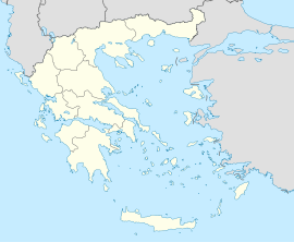
 Agnanta
Coordinates 39°28′N 21°5′E / 39.467°N 21.083°ECoordinates: 39°28′N 21°5′E / 39.467°N 21.083°E Location within the peripheral unit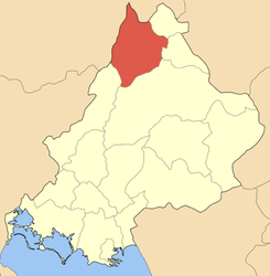
Government Country: Greece Region: Epirus Regional unit: Arta Municipality: Central Tzoumerka Population statistics (as of 2001) Municipal unit - Population: 4,022 Other Time zone: EET/EEST (UTC+2/3) Auto: ΑΤ Agnanta (Greek: Άγναντα) is a village and a former municipality in the Arta peripheral unit, Epirus, Greece. Since the 2011 local government reform it is part of the municipality Central Tzoumerka, of which it is a municipal unit.[1] Agnanta is one of the largest villages of the Tzoumerka region. The population of the municipal unit is 4,022 (2001). It is located at a distance of 55 km north of the city of Arta and east of the city of Ioannina. The geographical center of the village has an altitude of 650–700 m, while some of its highest districts approach an altitude of 1000 m. The name Agnanta has its origin in the Greek adverb agnantia, which means across (agnantevo means look across, watch/look from far).
Contents
History
There are no documents or written evidence to certify exactly when Agnanta first appeared as an organized community. The first preserved written evidence is a TAPU (Turkish title deed) from 1729, which refers to properties and forest regions of Agnanta. It is likely that an organized village existed there much earlier and probably since the early decades of the 17th century, when populations moved from other areas towards Tzoumerka due to indictments and diseases in other areas.
Natural characteristics
Agnanta is a picturesque village of unique and pure natural beauty. Some of its key characteristics are its abundant vegetation and its natural springs. In its dense forests, a wide variety of trees can be found, among which firs, maple and pine trees dominate. Agnanta's vegetation composes an uninhibited natural landscape of a rich variety of colors, lighting and glint, which transform fully with the seasons.
Entertainment
Popular entertainment and dining options include variety of traditional restaurants (taverns), cafe-bars and nightclubs. There are also hotels located in the center of the village and a hotel located in the region of Plaka, approximately 15 km away from the village. A variety of outdoor activities is offered by the hotel owners and other companies are rafting, canoeing and hiking.
References
- ^ Kallikratis law Greece Ministry of Interior (Greek)
Categories:- Populated places in Arta (peripheral unit)


Wikimedia Foundation. 2010.