- North Haven, Connecticut
-
North Haven, Connecticut — Town — 
SealLocation in New Haven County, Connecticut
Coordinates: 41°22′54″N 72°51′30″W / 41.38167°N 72.85833°WCoordinates: 41°22′54″N 72°51′30″W / 41.38167°N 72.85833°W Country United States State Connecticut NECTA New Haven Region South Central Region Incorporated 1786 Government – Type Selectman-town meeting – First Selectman Michael Freda (R) Area – Total 21.1 sq mi (54.6 km2) – Land 20.8 sq mi (53.8 km2) – Water 0.3 sq mi (0.8 km2) Elevation 66 ft (20 m) Population (2005)[1] – Total 23,908 – Density 1,149/sq mi (444/km2) Time zone Eastern (UTC-5) – Summer (DST) Eastern (UTC-4) ZIP code 06473 Area code(s) 203 FIPS code 09-54870 GNIS feature ID 0213479 Website http://www.town.north-haven.ct.us/ North Haven is a suburban town in New Haven County, Connecticut on the outskirts of New Haven, Connecticut. North Haven is less than 10 minutes from downtown New Haven and Yale University. It is also near Quinnipiac University and Sleeping Giant State Park. It has easy access to I-91 and Route 15. The population was estimated at 23,908 in 2005.[1]
In July 2007, Money Magazine ranked North Haven as the eighty-sixth "best place to live" in the United States.[2]
Contents
Geography
According to the United States Census Bureau, the town has a total area of 21.1 square miles (54.6 km²), of which, 20.8 square miles (53.8 km²) of it is land and 0.3 square miles (0.8 km²) of it (1.52%) is water. North Haven is located less than ten miles (16 km) from Long Island Sound.
North Haven is 27 miles (43 km) from Hartford, 76 miles (122 km) from New York City, 80 miles (130 km) from Providence and 115 miles (185 km) from Boston. The center of town in generally considered to be an area stretching along Route 5, from approximately its interchange with I-91 in the north to Bailey Road in the south.
Principal communities
- North Haven center
- Clintonville
- Montowese
- Green Acres
- Ridge Road
- Quinnipiac (extends into Wallingford )
Voter Registration and Party Enrollment as of 2010[3] Party Active Voters Inactive Voters Total Voters Percentage Republican 3,802 85 3,887 24.09% Democratic 3,836 129 3,965 24.57% Unaffiliated 7,922 342 8,264 51.21% Minor Parties 19 1 20 0.001% Total 15,579 557 16,136 100% History
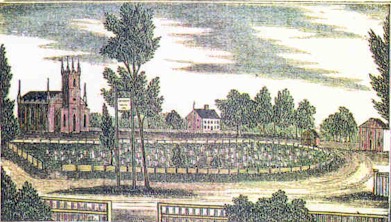
 John Warner Barber's 1835 engraving, showing St. John's Episcopal Church, the Trumbull House and the North Haven Congregational Church on the town Green
In his will of 1714, the Reverend James Pierpont (1659–1714) of New Haven gave 8 acres (32,000 m2) to his neighbors in the Northeast Parish, as North Haven was called "provided those neighbors will set their meeting house there and make their training and burying there."
The first meeting house, completed in 1722, stood on the Green, west of what is now known as the Old Center Cemetery. About half of the original Pierpont gift remains today as the North Haven Green.
Ezra Stiles enumerated about forty families living in North Haven in the early part of the eighteenth century. All of these people were multipurpose farmers, producing what they needed for themselves and their families. In 1786, the General Assembly permitted North Haven to incorporate as a town, separate from New Haven. New roads were built to facilitate communication, namely the Hartford Turnpike in 1798 and the Middletown Turnpike in 1813.
The first United States census counted 1236 people in the agricultural community of North Haven in 1790. However, the 1789 Grand List had found 1620 sheep in North Haven with the sheep outnumbering the residents.
By the middle of the nineteenth century, signs of the Industrial Revolution were apparent. In 1838, the New Haven and Hartford Railroad had laid its tracks along the level sand plains by the Quinnipiac River. In addition, small industries such as the manufacture of agricultural implements in Clintonville began in 1830. On the 1850 census, 62% of the population were listed as farmers. One third of the residents worked in various nonagricultural occupations such as mechanics, brickmakers, and shoemakers.
After the American Civil War, the expanding production of bricks, especially by the I.L.Stiles Co. brought immigrants to North Haven from Ireland, Germany, Italy, and Poland. By 1880, 11 out of 100 people had been born outside of the United States.
In the 1880s, Solomon Linsley, a North Haven architect, built both the Memorial Town Hall and the new District 4 School. Linsley designed and built thirty-two Victorian style houses and public buildings in North Haven.
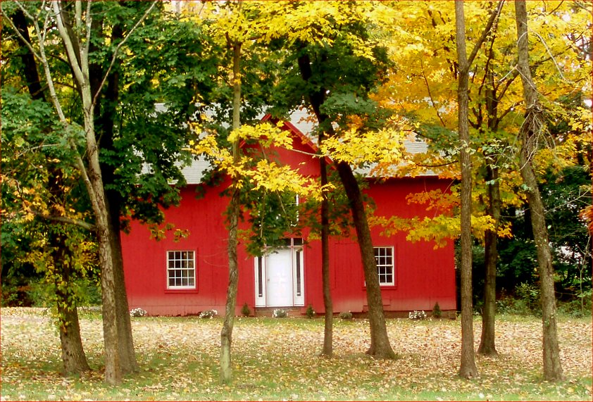
 Storage barn on Dixwell Avenue, near the Hamden border.
By 1900, public transportation was important to North Haven residents. Eighteen passenger trains stopped at the Broadway station every day. The Airline Railroad ran through Montowese and Clintonville to Middletown. Trolleys ran from Montowese to New Haven. After 1900, the line was extended north to Wallingford, Connecticut.
After World War I, the automobile changed life in this country town. The brickyards along the river were the major industry. However, those residents who owned a car could live in North Haven and commute to New Haven for their jobs. Small real estate development began to grow up along the southern edge of town.
Significant population growth occurred at the end of World War II. North Haven's population increased rapidly, quadrupling between 1945 and 1970. The establishment of two factories: Pratt & Whitney and Marlin Firearms spurred the subsequent population increase. This population shift necessitated the building of a new police station, firehouse, library, and five schools in the 1950s and 1960s to accommodate the needs of the growing community. The town continues to grow and expand until this day.
In spite of its rapid growth throughout the past few decades, however, this New England town still retains its town meeting form of government.
For those interested in an indepth look at the history of North Haven, you should refer to Amidst Cultivated and Pleasant Fields: A Bicentennial History of North Haven, Connecticut by Lucy McTeer Brusic. Several copies are available to borrow at the North Haven Memorial Library.
Demographics
As of the census[4] of 2000, there were 23,035 people, 8,597 households, and 6,490 families residing in the town. The population density was 1,108.9 people per square mile (428.2/km²). There were 8,773 housing units at an average density of 422.3 per square mile (163.1/km²). The racial makeup of the town was 92.98% White, 2.22% Black or African American, 0.09% Native American, 3.36% Asian, 0.01% Pacific Islander, 0.52% from other races, and 0.82% from two or more races. Hispanic or Latino of any race were 1.88% of the population.
There were 8,597 households out of which 31.0% had children under the age of 18 living with them, 64.2% were married couples living together, 8.1% had a female householder with no husband present, and 24.5% were non-families. 21.0% of all households were made up of individuals and 10.9% had someone living alone who was 65 years of age or older. The average household size was 2.65 and the average family size was 3.10.
In the town the population was spread out with 22.6% under the age of 18, 5.6% from 18 to 24, 27.2% from 25 to 44, 26.1% from 45 to 64, and 18.6% who were 65 years of age or older. The median age was 42 years. For every 100 females there were 93.6 males. For every 100 females age 18 and over, there were 89.7 males.
The median income for a household in the town was $65,703, and the median income for a family was $73,041 (these figures had risen to $80,450 and $90,190 respectively as of a 2007 estimate)[5] Males had a median income of $50,843 versus $36,063 for females. The per capita income for the town was $31,870. About 2.3% of families and 3.5% of the population were below the poverty line, including 1.6% of those under age 18 and 6.4% of those age 65 or over.
Economy
North Haven has a growing commercial, retailing and manufacturing base which employs approximately 12,640 people. There are more than 75 manufacturing and commercial firms in North Haven, 40 of which are assessed at over $1,000,000 [1]. North Haven has five industrial parks containing 490 acres (2.0 km2), and hosts such corporate tenants as Quebecor/Northeast Graphics and Marlin Firearms. North Haven is also a division headquarters for surgical device-maker Covidien. The town has a relatively large parks system. Housing stock is diversified.
Education
There are 4 public elementary schools in North Haven.
- Clintonville
- Green Acres
- Montowese
- Ridge Road
There is also one public middle school.
- North Haven Middle School
There is also a public high school.
- North Haven High School
Gateway Community Technical College also has a North Haven campus located on Bassett Road. The school was originally named Orchard Hill Junior High School and was part of the North Haven Public Schools system until its sale to the college.
Quinnipiac University opened a 100-acre (0.40 km2) graduate education in part of the former Blue Cross/Blue Shield campus in 2009. [2]
North Haven High School
A new building for the high school started construction in early 2004, and finished construction by the beginning of the 2005-2006 school year. The school building features suitable classrooms with interactive and advanced technology as well as updated computer systems.
Notable residents
- Dan Fegan, NBA agent, graduated from North Haven High School and Yale law school.
- Kevin Gilbride, offensive coordinator, New York Giants.
- Paul Marcarelli, actor and screenwriter whom graduated from North Haven High School.
- John Aristotle Phillips, entrepreneur
- Ezra Stiles, president of Yale
- David Vanacore, composer, is a native of North Haven.
- Tiffany Weimer, American professional soccer player(Vancouver Whitecaps)
Notable sites
- Evangelical Baptist Church (North Haven, Connecticut)
- Peter's Rock
- Quinnipiac River State Park
- Wharton Brook State Park
- Hansen Park
- Lancraft Fife and Drum Corps
References
- ^ a b U.S. Census Bureau Population Estimates
- ^ Kate Ashford, Andrea Bartz, Jeff Cox, Asa Fitch, Stephen Gandel, Josh Hyatt, Rob Kelley, Kathleen Knight, Joe Light, Ismat Sarah Mangla, Sarah Max, Jennifer Merritt, Brad Nelson, Donna Rosato, Ingrid Tharasook. "Best Places to Live: Top 100". CNNMoney.com. http://money.cnn.com/galleries/2007/moneymag/0707/gallery.BPTL_top_100.moneymag/86.html. Retrieved 2007-08-19.
- ^ "Registration and Party Enrollment Statistics as of October 26, 2010" (PDF). Connecticut Secretary of State. http://www.sots.ct.gov/sots/lib/sots/electionservices/registration_and_enrollment_stats/2010_registration_and_enrollment_statistics.pdf. Retrieved 2011-01-21.
- ^ "American FactFinder". United States Census Bureau. http://factfinder.census.gov. Retrieved 2008-01-31.
- ^ http://factfinder.census.gov/servlet/ACSSAFFFacts?_event=ChangeGeoContext&geo_id=06000US0900954870&_geoContext=01000US%7C04000US06%7C16000US0652582&_street=&_county=north+haven&_cityTown=north+haven&_state=04000US09&_zip=&_lang=en&_sse=on&ActiveGeoDiv=geoSelect&_useEV=&pctxt=fph&pgsl=010&_submenuId=factsheet_1&ds_name=ACS_2007_3YR_SAFF&_ci_nbr=null&qr_name=null®=null%3Anull&_keyword=&_industry=
Colleges and universities
- Gateway Community College - North Haven Campus
- Quinnipiac University
External links
 State of Connecticut
Topics - Index
- Culture
- Constitution
- Delegations
- Elections
- Geography
- Government
- History
- Images
- People
- Visitor Attractions
Regions Counties Cities Places Municipalities and communities of New Haven County, Connecticut Cities 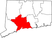
Towns Beacon Falls | Bethany | Branford | Cheshire | East Haven | Guilford | Hamden | Madison | Middlebury | Naugatuck* | North Branford | North Haven | Orange | Oxford | Prospect | Seymour | Southbury | Wallingford | Wolcott | Woodbridge
*Consolidated borough and town
Borough Unincorporated
communitiesDevon | Fair Haven | Heritage Village | Northford | Quaker Farms | Short Beach | South Britain | Stony Creek | Waterville | Westville | Yalesville
Categories:- North Haven, Connecticut
- Towns in New Haven County, Connecticut


Wikimedia Foundation. 2010.