- Sheet Harbour, Nova Scotia
Infobox Settlement
official_name = Sheet Harbour
other_name =
native_name =
nickname =
settlement_type =
motto =
imagesize =
image_caption =
flag_size =
image_
seal_size =
image_shield =
shield_size =
city_logo =
citylogo_size =
mapsize =
map_caption =
mapsize1 =
map_caption1 =
settlement_type = Community
motto =
imagesize =
image_caption =
flag_size =
image_
seal_size =
image_shield =
shield_size =
city_logo =
citylogo_size =
mapsize =
map_caption =
mapsize1 =
map_caption1 =
image_dot_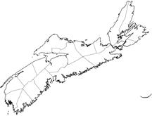
dot_mapsize = 250px
dot_map_caption =Location of Pagename
dot_x =140 |dot_y =108
pushpin_
pushpin_label_position =
pushpin_map_caption =
pushpin_mapsize =
subdivision_type = Country
subdivision_name = CAN
subdivision_type1 = Province
subdivision_name1 = NS
subdivision_type2 = Municipality
subdivision_name2 = HRM
subdivision_type4 = District
subdivision_name4 = 1
government_footnotes =
government_type = Regional Council
leader_title = Governing Council
leader_name =Halifax Regional Council
leader_title1 = Community Council
leader_name1 = [http://www.halifax.ca/commcoun/mdvccc/mdvccc.html Marine Drive Valley & Canal]
leader_title2 =
leader_name2 =
leader_title3 =
leader_name3 =
leader_title4 =
leader_name4 =
established_title = Foundedestablished_date = 1784
established_title2 =
established_date2 =
established_title3 =
established_date3 =
area_magnitude =
unit_pref =
area_footnotes =
area_total_km2 = 188.38
area_land_km2 =
area_water_km2 =
area_total_sq_mi =
area_land_sq_mi =
area_water_sq_mi =
area_water_percent =
area_urban_km2 =
area_urban_sq_mi =
area_metro_km2 =
area_metro_sq_mi =
population_as_of = 2001
population_footnotes =
population_note =
population_total = 820population_density_km2 =
population_density_sq_mi =
population_metro =
population_density_metro_km2 =
population_density_metro_sq_mi =
population_urban =
population_density_urban_km2 =
population_density_urban_sq_mi =
population_blank1_title =
population_blank1 =
population_density_blank1_km2 =
population_density_blank1_sq_mi =
timezone = AST
utc_offset = -4
timezone_DST = ADT
utc_offset_DST = -3
latd= 44|latm= 45|lats=0 |latNS= N
longd= 62|longm= 32|longs= 0|longEW= W
elevation_footnotes =
elevation_m = 0-114
elevation_ft =
postal_code_type = Canadian Postal code
postal_code = B0J 3B0
area_code =
blank_name = Telephone Exchange
blank_info = 902 885
blank1_name = GNBC Code
blank1_info = CBIKA
|footnotes =Part of a series about Places in Nova Scotia Sheet Harbour is a small community on the eastern shore of the
Halifax Regional Municipality , inNova Scotia ,Canada in the Musquodoboit/Sheet Harbour region of the Marine Drive on Trunk 7 , 87.44kilometers from Halifax.History
The settlement began in 1784 by
Loyalist refugees and British veterans of theAmerican Revolution and became a prosperous centre for thelumber industry.Sheet Harbour was named "Port North" on the Royal Navy Chart that was published in 1778. It was decided that "Port North" was not descriptive enough so it's name was changed to Sheet Harbour because of a white, flat rock that looks like a sheet (named Sheet Rock). Sheet rock can be found at the entrance of the harbour. Sheet Harbour for about 2 decades was known as Cambell Town, this name fell into disuse and became known as Sheet Harbour. [Found in "Sheet Harbour: A Local History" by James E. Rutledge written in 1954, page 9-10]
Industry
The economy of Sheet Harbour is based on the
tourism ,fishery and forestry but since the 1990s, there is anindustrial park to service theSable Offshore Energy Project For Tourism Sheet Harbour has the
MacPhee House .Communications
*
Postal Code B0J 3B0*
Telephone exchange 902 885Aliant *
Television
**CBHT Channel 11 - 18 kW
**CJCH Channel 2Sheet Harbour has a C@p Site for public use. It has a fax machine and is able to send emails.
Activities
*Seaside Festival: August 6-17 * [http://www.sheetharbour.ca/seaside2008.pdf Seaside Festival schedule 2008] * [http://www.seasidefestival.ca/contact.asp about]
*Winter Parade
*Sheet Harbour has many ATV trails to be explored.
*Sheet Harbour's Rockets Field which is one of the two
Baseball fields in Sheet Harbour
*Taylor Head Beach Programs for Kids
The 2610 Royal Canadian Army Cadet Corps is in Sheet Harbour. This Corps has put Sheet Harbour on the map in Cadet circles for its ability to produce the best young Air Riffle shooters in
Canada . For a good article about this excellent program see the following website: [http://www.forces.gc.ca/site/Community/MapleLeaf/article_e.asp?id=2465 "The Face Behind Corps #2610" by Capt Rick Eng]Demographics
*Total Population - 820
*Total Dwellings - 426
*Total Land Area - 188.384 km²Transportation
The community is at the junction of three Highways Trunk 7, Route 224,and Route 374. The community also has a small harbour authority and a commercial port.
chools
*
Duncan MacMillan High School (grades 7 to 12) [http://www.dmhs.ednet.ns.ca/ DMHS Website]
*Sheet Harbour Consolidated School (Primary to grade 6), [http://sheetharbour.ednet.ns.ca/ SHCS website]Hotels, Motels and Bed and Breakfasts in the Sheet Harbour area
*Fairwinds Motel & Restaurant Sheet Harbour
*Back in Thyme Bed & Breakfast
*The Sheet Harbour Hotel
*Marquis Of Dufferin Seaside Inn Hotel (Port Dufferin)References
External links
* [http://www.sheetharbour.ca Official website]
* [http://www.rootsweb.ancestry.com/~nscsheet/index.html Sheet Harbour Ancestry website]
* [http://highway7.com/t_places/place_0006_a2zmarine2.html Tourist attractions]
Wikimedia Foundation. 2010.