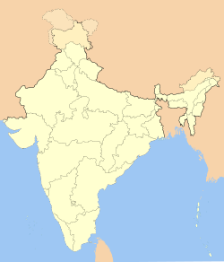
Mamit

Mamit
Mamit
—  city  —
Mamit
Location of Mamit
in Mizoram
Coordinates 23°56′N 92°29′E / 23.93°N 92.48°E / 23.93; 92.48Coordinates: 23°56′N 92°29′E / 23.93°N 92.48°E / 23.93; 92.48
Country India
State Mizoram
District(s) Mamit
Population 5,261 (2001)
Time zone IST (UTC+05:30)
Area

Elevation


718 metres (2,356 ft)

Mamit is a census town in Mamit district in the Indian state of Mizoram.

Geography

Mamit is located at 23°56′N 92°29′E / 23.93°N 92.48°E / 23.93; 92.48.[1] It has an average elevation of 718 metres (2355 feet).

Demographics

As of 2001 India census,[2] Mamit had a population of 5261. Males constitute 54% of the population and females 46%. Mamit has an average literacy rate of 82%, higher than the national average of 59.5%: male literacy is 81%, and female literacy is 83%. In Mamit, 15% of the population is under 6 years of age.

References

  1. ^ Falling Rain Genomics, Inc - Mamit
  2. ^ "Census of India 2001: Data from the 2001 Census, including cities, villages and towns (Provisional)". Census Commission of India. Archived from the original on 2004-06-16. http://web.archive.org/web/20040616075334/http://www.censusindia.net/results/town.php?stad=A&state5=999. Retrieved 2008-11-01. 


Wikimedia Foundation. 2010.

Игры ⚽ Поможем написать реферат

Look at other dictionaries:

  • Mamit — Original name in latin Mamit Name in other language Mamit State code IN Continent/City Asia/Kolkata longitude 23.92703 latitude 92.48968 altitude 870 Population 6104 Date 2012 10 06 …   Cities with a population over 1000 database

  • Mamit — Admin ASC 2 Code Orig. name Mamit Country and Admin Code IN.31.7909838 IN …   World countries Adminstrative division ASC I-II

  • Mamit district — This article is about the district. For its eponymous headquarters, see Mamit. Mamit district Location of Mamit district in Mizoram State …   Wikipedia

  • Mamit — Yon bwat long an metal e won avèk kouvèti solid kole nan de pwent li …   Definisyon 2500 mo Kreyòl

  • mamıt — mahmut …   Beypazari ağzindan sözcükler

  • Kannistè — Mamit. Non moun nan nò peyi Ayiti bay yon bwat an metal ki tou won avèk de kouvèti, yonn nan shak pwent li …   Definisyon 2500 mo Kreyòl

  • Lunglei district — This article is about the district. For its eponymous headquarters, see Lunglei. Lunglei district Location of Lunglei district in Mizoram State …   Wikipedia

  • Kolasib district — This article is about the district. For its eponymous headquarters, see Kolasib. Kolasib district Location of Kolasib district in Mizoram State …   Wikipedia

  • Innu — Heutige Innu Gemeinden in Québec und Neufundland und Labrador sowie die zwei Naskapi Gemeinden (Kawawachikamach und Natuashish) Die Innu (Nehilaw und Ilniw ‘Volk’) oder Montagnais (sprich: Moon tahn YAY, franz. ‘Bergbewohner’) sind eine Gruppe… …   Deutsch Wikipedia

  • Liste der First Nations — Die Liste der First Nations beinhaltet alle vom Department of Indian Affairs and Northern Development aufgeführten First Nations in Kanada. Zur Unterscheidung wurde seinerzeit ein Nummernsystem eingeführt, Nummern, die hier mit angegeben sind.… …   Deutsch Wikipedia

Share the article and excerpts

Direct link
Do a right-click on the link above
and select “Copy Link”