- Norwood Avenue (BMT Jamaica Line)
-
Norwood Avenue


New York City Subway rapid transit station 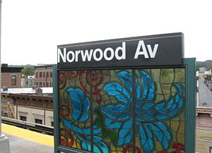
Station statistics Address Norwood Avenue & Fulton Street
Brooklyn, NY 11208Borough Brooklyn Locale Cypress Hills Coordinates 40°40′54″N 73°52′45″W / 40.681582°N 73.879151°WCoordinates: 40°40′54″N 73°52′45″W / 40.681582°N 73.879151°W Division B (BMT) Line BMT Jamaica Line Services J  (all except rush hours, peak direction)
Z (rush hours, peak direction)
Structure Elevated Platforms 1 island platform Tracks 2 Other information Opened May 30, 1893[1] Traffic Passengers (2010) 1,056,263[2]  1.4%
1.4%Rank 346 out of 422 Station succession Next north Crescent Street: J Z Next south Cleveland Street: J
(Z skips to Van Siclen Avenue)Station service legend Symbol Description 
Stops in station at all times 
Stops all times except late nights 
Stops late nights only 
Stops late nights and weekends only 
Stops weekdays only 
Stops all times except rush hours in the peak direction Stops all times except weekdays 
Stops rush hours only 
Stops rush hours in the peak direction only 
Station is closed (Details about time periods) Norwood Avenue is a skip-stop station on the BMT Jamaica Line of the New York City Subway. Located at the intersection of Norwood Avenue and Fulton Street in Cypress Hills, Brooklyn, it is served by the Z train during rush hours in peak direction and the J at all other times.
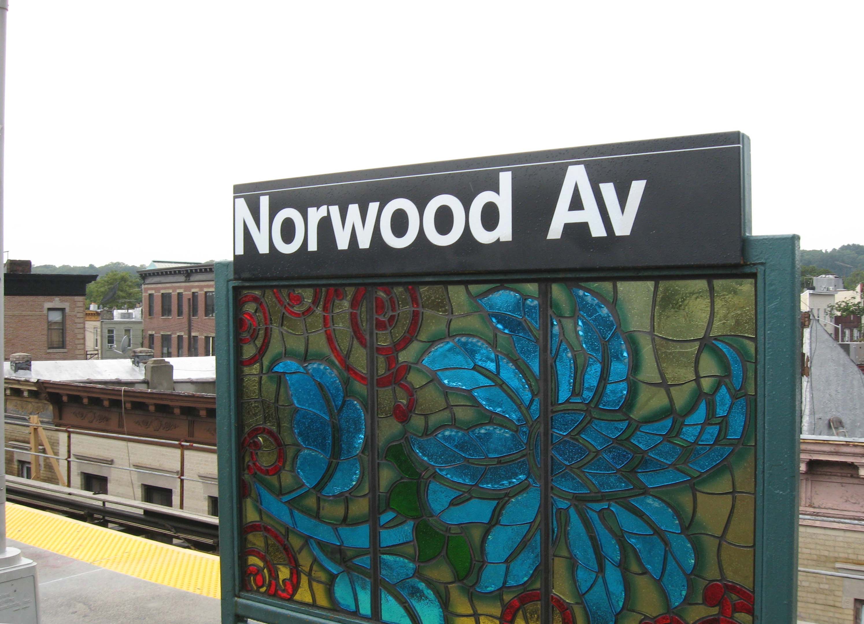
This elevated station, opened on May 30, 1893 and rehabilitated in 2007, has two tracks and one island platform. The platform has a short red canopy with green frames and support columns at the east (railroad north) end and silver lampposts and black station sign structures for the rest of the length.
The station's only entrance/exit is a station house connected to the platform at the extreme east end. It has a bank of three turnstiles, token booth, and one staircase going down to an elevated passageway beneath the tracks, where two staircases go down to either eastern corners of Norwood Avenue and Fulton Street.
The 2007 artwork here is called "Culture SwirlM" by Marget Lazetta, It consists of stained glass artwork of various images on the platform sign structures.
Between here and Crescent Street, the remains of a former connection to the Long Island Rail Road's Atlantic Avenue Branch one block to the south of the BMT Jamaica Line can be seen at Chestnut Street. In the 1890s, the railroad wanted access to Manhattan while the Brooklyn Rapid Transit company wanted access to The Rockaways. Due to the close proximity of the two lines, the companies cooperated on a connection beginning in 1898. The LIRR ran service to Broadway Ferry while BRT ran service to the Rockaways via Woodhaven Junction. When the Williamsburg Bridge opened, LIRR service was extended to Essex Street and later Chambers Street. This was the LIRR's first direct access to Manhattan.
In 1917, the United States Railroad Administration ruled that a commuter railroad line cannot operate on the same tracks with a subway or elevated line, requiring this connection to be severed. Most of the junction's structure remained until the 1940s when it was dismantled so the steel could be used in World War II and the Atlantic Avenue Branch was moved underground.
References
- ^ "Trains Running This Morning". Brooklyn Daily Eagle: p. 10. May 30, 1893. http://eagle.brooklynpubliclibrary.org/Default/Scripting/ArchiveView.asp?BaseHref=BEG/1893/05/30&Page=10&skin=BE.
- ^ "Facts and Figures: 2010 Annual Subway Ridership". New York City Metropolitan Transportation Authority. http://mta.info/nyct/facts/ridership/ridership_sub_annual.htm. Retrieved 2011-05-18.
External links
- nycsubway.org — BMT Jamaica Line: Norwood Avenue
- Station Reporter — J Train
- The Subway Nut — Norwood Avenue Pictures
- MTA's Arts For Transit — Norwood Avenue (BMT Jamaica Line)
- Norwood Avenue entrance from Google Maps Street View
Categories:- BMT Jamaica Line stations
- New York City Subway stations in Brooklyn
- Railway stations opened in 1893
Wikimedia Foundation. 2010.