- Kolachal
-
Colachel — city — Coordinates 8°10′N 77°14′E / 8.17°N 77.24°ECoordinates: 8°10′N 77°14′E / 8.17°N 77.24°E Country India State Tamil Nadu District(s) Kanniyakumari Population 23,787 (2011[update]) Time zone IST (UTC+05:30) Colachal (Tamil: குளச்சல்) is located within the administrative jurisdiction of Kanyakumari District. Colachel is a second grade Municipal town situated on the west coast of Kanyakumari District. It is a port on the Malabar coast, 20 km north-west of Kanya Kumari (Cape Comorin), the southernmost tip of peninsular India.
History
It is an ancient port town, Vasco-Da-gama called it ‘Colachi’. Before the State re-organization in 1956, it was part of the Travancore State. It was a Dutch colony which came under Travancore. After the defeat of the Dutch by King Marthandavarma in 1751, a victory pillar had been erected near the beach in commemoration of the victory. The town is bounded on the south by Arabian Sea. It has Pampoori Vaikal in its Western side. Nagercoil the headquarters of Kanyakumari District is 20 km away from this town in the North East Direction.
Battle of Colachel
Main article: Battle of ColachelA dramatic and virtually unknown past, in an area of bucolic calm surrounded by spectacular hills: that is Colachel, a name that should be better known to us. For this is where, in 1741, an extraordinary event took place the Battle of Colachel. For the first, and perhaps the only time in Indian history, an Indian kingdom defeated a European naval force.
The ruler of Travancore, Marthanda Varma, routed an invading Dutch fleet; the Dutch commander, Delannoy, joined the Travancore army and served for decades; the Dutch never recovered from this debacle and were never again a colonial threat to India. It was a remarkable achievement for a small princely state.
This place was the scene of the battle between the Travancore (Anglicised form of Thiruvithaamkoor) forces led by King Marthanda Varma (1729–1758) and the Dutch East India Company forces led by Admiral Eustachius De Lannoy on August 10, 1741. It was the first time in Indian history that an Indian kingdom defeated a European naval force.[1]
The Dutch marines landed in Colachel with artillery and captured the land up to Padmanabhapuram, the then capital of Travancore. The arrival of Marthanda Varma's Nairs (the warriors) from the north forced the Dutch to take up defensive positions in Colachel, where they were attacked and defeated by the Travancore forces. Twenty-eight high level Dutch officers, including Admiral D'lennoy, were captured. The defeat of the Dutch in Colachael was the turning point of the Travancore-Dutch War. D'lennoy went on to serve Marthanda Varma for the next two decades and was promoted to the post of the Valiya kappithan (Senior Admiral) of the Travancore forces same status like a Nair lord. He modernised the Travancore army, and built the Nedumkotta, a line of fortifications in the north of the kingdom, which held up the army of Tipu Sultan in 1791, during his ill-fated invasion of Travancore. D'lennoy is buried in the Udayagiri Fort, also known as Dillanai kotta (D'lennoy's fort) which is located 7 kilometres north of Padmanabhapuram (about 14 kilometres from Nagercoil).
The Indian government has built a pillar of victory in Colachel to commemorate the event. Colachel is currently in the Kanya Kumari District of the Tamil Nadu State of India, and is an important port on the west coast of that state.
Roads
The town is well connected to all parts of the state through road. Nagercoil, the district headquarters of Kanyakumari is situated 20 km from Colachel in the northeast direction. Frequent bus services from Colachel are available to the various places of the district.
Railways
The broad gauge rail link between Thiruvananthapuram and Kanyakumari passes at a distance of 8 km from Colachel town. The nearest Railway station is at Eraniel Code (ERL) (Monday Market).
Airways
The nearest Air Terminal to the town is Thiruvananthapuram which is located 65 km away in the south east direction.
Geography
The town is located on the western coastal side of Kanyakumari District and falls in the coordinates of 8°09′N 77°08′E / 8.15°N 77.14°E.[2]The average elevation of the town is 25 meters (82 ft) above Mean Sea Level (MSL). Town is mostly characterized by a flat terrain with a few areas in the northwest region having elevation difference with other parts of the town. Generally the town is sloped gently from North to south direction and also sloping in a radial direction towards centre portion of the town from east and west directions.
Climate
Temperature
The town has a pleasant Climate favorable and creating a pleasing living atmosphere. The maximum and minimum temperature is 33°C and 22°C in this region.
Rainfall
The town receives maximum rainfall during North east Monsoon and southwest monsoon is scanty. The average annual rainfall is 1,000 mm. The maximum rainfall in a year occurs during the months from October to December.
Soil Type
The soil is generally red gravel but sandy loam soil also exists in some places. Rubber is the principal crop; Coconut, Cashew nut and Tamarind are the predominant trees found in this region.
Population Distribution
As of 2011[update] India census Colachal had a population of 23,787. Males constitute 51% of the population and females 49%. Kolachal has an average literacy rate of 76%, higher than the national average of 59.5%: male literacy is 78%, and female literacy is 75%. In Colachal, 11% of the population is under 6 years of age. Majority of the population belong to the Roman Catholic Mukkuvar community. Other major communities are Muslims, Christian, Hindu Nadars, Nairs, Chettys, etc.
Places of interest
This small coastal town is near to the route from Thiruvananthapuram to Kanyakumari on National Highway 47 in present day state of Tamil Nadu's Kanyakumari district in India. It is situated very close to Mahendragiri, where the Indian Space Research Organisation's rocket testing facility is located. Efforts are being made by the port advisory committee for the construction of a ship yard and for the development of a natural harbor at Colachel. Colachel beach is a local tourist attraction. People often visit to see the St.Mary's Church and prayer hall at Colachel. In and around Colachel, there are many Catholic churches. St. Joseph's church, Kalimar St.Antony's church are among them. Other places of attraction near colachel include Padmanabhapuram palace and Pechupparai dam. There is a very ancient church, locally known as Thomayar koil at Thiruvithamcode on the way to Azhakiyamandapam claiming its ancestry to 63 AD and believed to be consecrated by none other than St.Thomas[citation needed], the apostle of Jesus. This was recently declared as an International Pilgrim Centre(Arappally) of the Syrian Christians of Kerala, the neighboring State. The life-like image of Devi with a smiling face is a combination of innocence, purity and beauty. Smeared with sandal paste, decked with different varieties of valuable ornaments and decorated with beautiful garlands of flowers. She creates a sense of devotion and "peace that pass the understanding" in the mind of every worshiper. There is one version that Adi Sankara composed Soundaryalahari after seeing the sunrise, sunset and moon rise on the full moon day of the Tamil month of Chithrai at Kanyakumari praising the virgin Goddess[citation needed]. The beauty of Devi Kanyakumari reflects in the opening lines of his divine work. On the golden sands of Kanyakumari stand the shrines of Adi Sankara with his disciples, Swami Vivekananda in meditative mood and Gandhi Smarak Mandir in Oryan style. The reputed Vivekananda Rock Memorial on the sea-girl rock is a "visible symbol of invisible strength, invisible faith and burning devotion that Swami Vivekananda personified". Near Gandhi Smarak Mandir stands a memorial to our beloved leader Karmaveerar Kamaraj. The off shore 133 feet tall statue of Thiruvalluvar at Kanyakumari is a notable landmark of Tamil Nadu tourism.
Colachel Municipality
Colachel was formed as Grade III Municipality in the year 1920. It is one of the oldest municipalities formulated in the state. The Municipality consists, Colachel as its only revenue village within its jurisdiction and in its LPA. The Municipality of Colachel consists of 24 wards and the elected representatives from each ward constitute the council. Colachel Municipality consists of five functional departments. Each department consists of Head who reports to the Municipal Commissioner and functions as per the responsibilities prescribed in the Act and as delegated by the Commissioner. In the recently held local body elections,the independent candidate Mr.Jessiah was elected as Chairman. He was working as Chairman previously also. Names of some of the previous chairmans are Mr.M.A.James, Mr.Ismail, Mr.Nasir,Mr.Neelaraj etc.[3] The chronological order of the activities in formulation of the urban local body and its up gradation are listed below:
-
- Constituted as Grade III Municipality in 1920
- Colachel Local Planning Area was declared in G.O Ms. No. 654 RD & LA dated 16.03.1974 which contains Colachel Municipal limits only. Colachel Local Authority was declared as Colachel Local Planning Authority (LPA) in G.O. Ms. No. 650 RDLA dated 08.04.1975
- Colachel Town was declared as a ‘heritage town’ as per G.O. Ms. No. 191 MA&WS department dated 18.07.1994.
- Upgraded as Second Grade Municipality with effect from 1998 vide the MAWS Department Government Order No.85 dated 22-08-1998.
Traffic and Transportation
The Traffic flow is found to be in high West coast road (Colachel - Nagercoil road) when compared with other roads. This road is the major spine, from which the other roads start. All the major roads meet in this junction causes heavy traffic congestion during the peak hours.
Bus Stand
The Town has one Bus stand under C category. More than 120 buses daily pass through the town. It is located along the Colachel – Nagercoil State Highway. The total extent of the bus stand is 3282 sq.
Colachel Harbor
There are many rumors surrounding the would-be Colachel Harbor. Some believe that the project is moved over to some other harbor in Kerala. A part of the people is satisfied with a fishing harbor; and the rest still fight for a harbor. In every election, be it Legislative Assembly or Parliament, this is sure to catch both the voters' and candidates' attention. But in due course forgotten. Even there is no official version as to what happened to Colachel Harbor.
Local Economy
The people of Colachel do a variety of jobs based on their backgrounds. This includes fishing with catamarans, deep see fishing with mechanized boats, exporting fish, coconut fibre production, fibre works, coir making, palm fibre works, selling general merchandise, agriculture, etc. There used to be a factory for manufacturing fibre based products (Thumbaabees) but is closed now. Also there is a nearby natural mineral extraction factory called Indian Rare Earths Limited(IRE). But the local people say that they do not get much employment with this company though the company used to mine for minerals in their localities.[4]
Education
Most of the people are educated. There are two higher secondary schools (St.Mary's and V.K.P. higher secondary schools), one high school (Govt. High School), a pimary scool(St. Mary's Primary Scool in Colachel beach)and many primary, (Government Middle School colachel) middle schools in this town. There are many matriculation schools also in Colachel. From that St. Mary's Mariculation school in Simon colony, St. Joseph's Marticulation school in Velliakulam, Orient Matriculation scool in Kamarajar salai and St. Anne's Matriculation School, which is run by the St. Anne's Education and Charitable Trust.There are some nursery scools which were managed and run by the state government of Tamil nadu is situated in maramdi street. For higher education few engineering, arts and science colleges are also available in its proximity.
Temples/Masjid/Church
Temples
Maha Vishnu Temple Kalimar
Ayya Narayanaswamy Temple, Sasthan karai
Theripura Sundari Amman Koil
Ayya Narayanaswamy Temple, Mathanavilali
Vinayagar Temple, colachel
Velliyakulam Sri Murugan Temple
Isaki Amman Temple, Kallathivilai
Pilankarai siva Temple
Patharai Shivan kovil
Sampa Siva Puram Murugan TempleMasjid
Juma Masjid
Mohideen Mosque
Ribai Mosque
JAQH Masjid
Meeran Mohideen Mosque
Akkarai palli - TharhaChurchs
CSI Church
St.Mary's Church
Maramadi St. Antony's Church2004 Tsunami
The December 2004 Tsunami of the Indian Ocean caused huge devastation and damages. In Colachel, it caused the death of around 500 people. As the land near the coastline is flat and at sea level with no seawall, water traveled inland carving out new streams and estuaries. The waves were reported to be around 5m high and a run up height of 2.6m. Maximum number of casualties happened near the A.V.M. Canal as well as around the open trenches being used by the local coconut fibre industry.[5]
The government and several non-governmental agencies have been providing relief works for those affected by the tsunami.
Folk Arts
Though the natives of Colachel do not earn a living by performing folk arts, several folk arts are being practiced in temples and churches during the annual festivals. Ayya Narayana swamy Temples in Thiru Aadu Vassipu (Aakilathirattu Ammanai reading), Villupattu, Kaniankoothu, Thiruvathirai Kali, Kalial and Ottam Thullal are some of the folk arts performed during temple festivals. Most usually, rural artists and natives perform Kadhaprasangam, Natagam (drama), rural dances, etc. during the annual festivals of churches and temples.
Politics
Colachel assembly constituency is part of Kanyakumari (Lok Sabha constituency).[6]
References
- ^ The Hindu — A different battle at Colachal
- ^ TIDCO — Tamilnadu Infrastructure
- ^ Colachel Municipality
- ^ Indian Rare Earths Mining Areas
- ^ Effect of 2004 Tsunami pages S446-S447
- ^ "List of Parliamentary and Assembly Constituencies". Tamil Nadu. Election Commission of India. http://archive.eci.gov.in/se2001/background/S22/TN_ACPC.pdf. Retrieved 2008-10-13.
External links
- Global Security.org — Madras Regiment
- Tribune India — A historic battle
- [1] - 2011 Census
District of Kanyakumari History 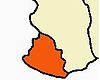
Taluks Agastheeswaram · Kallkkulam · Thovalai · Vilavancode
Blocks Agastheeswaram · Killiyoor · Kurunthancode · Melpuram · Munchirai · Rajakkamangalam · Thiruvattar · Thovalai · Thuckalay
Municipalities Colachel · Kuzhithurai · Nagercoil · Padmanabhapuram
Town panchayats Agastheeswaram · Aloor · Anjugramam · Aralvaimozhi · Arumanai · Asaripallam · Attoor · Azhagappapuram · Azhagiapandiapuram · Boothapandi · Edaikodu · Eraniel · Ezhudesam · Ganapathipuram · Kadayal · Kaliyakkavilai · Kallukuttam · Kanyakumari · Kappiyarai · Karungal · Keezhkulam · Killiyoor · Kodimunai · Kollancode · Kothanalloor · Kottaram · Kulasekaram · Kumarapuram · Manavalakurichy · Mandaikadu · Marthandam · Marungoor · Mulagumoodu · Mylaudy · Nalloor · Neyyoor · Pacode · Palapallam · Pazhugal · Ponmanai · Puthalam · Pudukadai · Reethapuram · South Thamaraikulam · Suchindram · Thazhakudi · Thengamputhoor · Theroor · Thingalnagar · Thirpparappu · Thiruvattar · Thiruvithancode · Unnamalaikadai · Valvaithankoshtam · Vavathurai · Vellimalai · Verkilambi · Vilavoor · Villukuri
Religious sites Devi Kanya Kumari Temple · Kumara coil · Marunthuvazh Malai · Mondaicaud Bhagavathi Temple · Nagaraja Temple · Our Lady of Ransom Church, Kanyakumari · St. Arockiya Nathar Church, Vavathurai · Pancha pathi · Peer Mohammed Dargah · Sivalayams · Sri Adikesavaperumal Temple · St. Xavier's Church · Swamithope pathi · Thanumalayan Temple · Thirunadhikkara · Thiruppathisaram · Thirucharanathumalai
Tourism Kanyakumari · Kalikesam · Mathur Aqueduct · Mukkadal · Muttom · Olakaruvi · Padmanabhapuram Palace · Pechiparai Reservoir · Sothavilai Beach · Thiruparrapu · Udayagiri · Vattakottai Fort · Vattakottai · Vattaparai Falls · Vavathurai
Major festivals Education Bishop Agniswamy College of Education · Malankara Catholic College · Nesamony Memorial Christian College · Noorul Islam College of Engineering · Ponjesly College of Engineering · Scott Christian College · South Travancore Hindu College · St. Xavier's College of Engineering ·
Sun College of EngineeringRailway Station Nagercoil Junction · Kanyakuamri · Nagercoil Town · Kuzhitthurai · Eraniel · Palliyadi · Kuzhitthurai West · Thovalai · Veerani Aloor
Municipalities of Tamil Nadu Municipal
CorporationsChennai · Coimbatore · Erode · Madurai · Salem · Tiruchirappalli · Tirunelveli · Tirupur · Tuticorin · Vellore
Municipalities Alandur · Ambasamudram · Ambattur · Ambur · Anaiyur · Anakaputhur · Arakkonam · Arani · Aranthangi · Arcot · Ariyalur · Aruppukkottai · Attur · Avadi · Avaniyapuram · Bhavani · Bodinayakanur · Chengalpattu · Chidambaram · Chinnamanur · Colachel · Coonoor · Cuddalore · Cumbum · Devakottai · Dharapadavedu · Dharapuram · Dharmapuri · Dindigul · Edappadi · Gobichettipalayam · Goundampalayam · Gudalur: (Coimbatore district), (Nilgiris district), (Theni district) · Gudiyatham · Hosur · Inam Karur · Jayankondam · Jolarpet · Kadayanallur · Kallakurichi · Kancheepuram · Karaikudi · Karur · Kasipalayam (E) · Kattivakkam · Kayalpattinam · Keelakarai · Kodaikanal · Komarapalayam · Koothanallur · Kovilpatti · Krishnagiri · Kulithalai · Kumbakonam · Kuniyamuthur · Kurichi · Kuzhithurai · Madhavaram · Maduranthakam · Maduravoyal · Manali · Manapparai · Mannargudi · Maraimalainagar · Mayiladuthurai · Melur · Mettupalayam · Mettur · Nagapattinam · Nagercoil · Nallur: (Kanniyakumari district), (Tirunelveli district) · Namakkal · Narasingapuram · Nellikuppam · Nelliyalam · Padmanabhapuram · Palani · Palladam · Pallavapuram · Pallipalayam · Pammal · Panruti · Paramakudi · Pattukkottai · Perambalur · Periyakulam · Periyasemur · Pernampattu · Pollachi · Poonamallee · Pudukkottai · Puliyankudi · Punjaipuliampatti · Puzhuthivakkam · Rajapalayam · Ramanathapuram · Rameswaram · Ranipet · Rasipuram · Sankarankoil · Sathuvachari · Sathyamangalam · Sattur · Sengottai · Sirkazhi · Sivagangai · Sivakasi · Srivilliputhur · Surampatti · Tambaram · Tenkasi · Thanjavur · Thanthoni · Theni Allinagaram · Tirumangalam · Thiruparankundram · Thiruthangal · Thiruthani · Thiruthuraipoondi · Thiruvannamalai · Thiruvathipuram · Thiruverkadu · Thuraiyur · Thuvakudi · Tindivanam · Tiruchengode · Tiruppattur · Tiruvallur · Tiruvarur · Tiruvottiyur · Udhagamandalam · Udumalaipettai · Usilampatti · Valasaravakkam · Valparai · Vandavasi · Vaniyambadi · Vedaranyam · Veerappanchatram · Velampalayam · Vellakoil · Vikramasingapuram · Villupuram · Virudhachalam · Virudhunagar · Walajapet
Nagar
PanchayatsCategories:- Cities and towns in Kanyakumari district
-


Wikimedia Foundation. 2010.