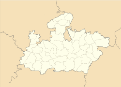
- Gormi
-
Gormi — city — Coordinates 26°36′N 78°31′E / 26.6°N 78.52°ECoordinates: 26°36′N 78°31′E / 26.6°N 78.52°E Country India State Madhya Pradesh District(s) Bhind Population 17,255 (2001[update]) Time zone IST (UTC+05:30) Area
• 147 metres (482 ft)
Gormi is a town and a nagar panchayat in Bhind district in the Indian state of Madhya Pradesh.
Geography
Gormi is located at 26°36′N 78°31′E / 26.6°N 78.52°E.[1] It has an average elevation of 147 metres (482 feet There is famous temple of Rishi Gautam. it is said that gautam used to do meditation in gormi.
Gormi located at Bhind Morena Road. it is 70 km from gwalior. and 60 km from morena. Train goes up to Soni station which is 9 km from Gormi.
Kwari river is 10 km towards Gormi porsa road.
Demographics
As of 2001[update] India census,[2] Gormi had a population of 17,255. Males constitute 54% of the population and females 46%. Gormi has an average literacy rate of 62%, higher than the national average of 59.5%: male literacy is 72%, and female literacy is 50%. In Gormi, 17% of the population is under 6 years of age.
References
- ^ Falling Rain Genomics, Inc - Gormi
- ^ "Census of India 2001: Data from the 2001 Census, including cities, villages and towns (Provisional)". Census Commission of India. Archived from the original on 2004-06-16. http://web.archive.org/web/20040616075334/http://www.censusindia.net/results/town.php?stad=A&state5=999. Retrieved 2008-11-01.
Cities and towns in Chambal Division Bhind district Morena district Sheopur district Related topics Cities and towns
in other DivisionsCategories:- Cities and towns in Bhind district
- Madhya Pradesh geography stubs
Wikimedia Foundation. 2010.


