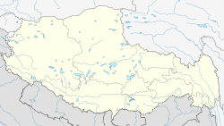
- Nagchu Town
-
Nagchu Railway station Coordinates: 31°29′N 92°03′E / 31.483°N 92.05°E Country China Province Tibet Autonomous Region Prefecture Nagchu Prefecture County Nagchu County Time zone CST (UTC+8) Nagchukha, or Chinese transliteration: Naqu (simplified Chinese: 那曲镇; pinyin: Nàqū), is a small town in northern Tibet, seat of the Nagqu Prefecture approximately 250 kilometers north-east of the capital Lhasa, in the People's Republic of China.
At the time of the visit in 1950 of Thubten Jigme Norbu, the elder brother of Tenzin Gyatso, the 14th Dalai Lama, Nagchukha was a small town with only a few clay huts but was also the headquarters of the District Officer, the Dzongpön. it was on the main caravan route coming from Amdo to Central Tibet.[1]
It is along the newly opened Qingzang railway at 14,850 feet (4,526 meters).
China is planning to build the highest airport in the world at an altitude of 4,436 metres (14,500 ft). The construction is planned to start in 2011 and take three years to complete. When completed, it will overtake the current the highest, Qamdo Bangda Airport, with an elevation of 4,334 metres (14,219 ft).[2]
Climate data for Nagchu, Elevation = 4505m Month Jan Feb Mar Apr May Jun Jul Aug Sep Oct Nov Dec Year Average high °C (°F) −2
(28)−1
(30)2
(36)6
(43)10
(50)14
(57)15
(59)14
(57)12
(54)7
(45)1
(34)−2
(28)6 Average low °C (°F) −22
(−8)−19
(−2)−14
(7)−9
(16)−3
(27)0
(32)3
(37)2
(36)0
(32)−6
(21)−15
(5)−21
(−6)−8 Precipitation mm (inches) 2
(0.08)2
(0.08)3
(0.12)10
(0.39)26
(1.02)82
(3.23)106
(4.17)94
(3.7)69
(2.72)20
(0.79)3
(0.12)3
(0.12)419
(16.5)Source: weatherbase.com[3] Footnotes
- ^ Tibet is My Country: Autobiography of Thubten Jigme Norbu, Brother of the Dalai Lama as told to Heinrich Harrer, p. 160. First published in German in 1960. English translation by Edward Fitzgerald, published 1960. Reprint, with updated new chapter, (1986): Wisdom Publications, London. ISBN 0-86171-045-2.
- ^ "Tibet to be location of highest airport in the world." 12 Jan. 2010 [1]
- ^ "Nagchu Climate Guide" - weatherbase.com
Categories:- Tibet geography stubs
- Populated places in Tibet
Wikimedia Foundation. 2010.


