- Ivano-Frankivsk Oblast
Infobox Ukrainian oblast
Name = Ivano-Frankivsk Oblast
UkrainianName = Івано-Франківська область
TransliteratedName = Ivano-Frankivs’ka oblast’

Nickname = Івано-Франківщинаspaces|2(Ukrainian) "Ivano-Frankivshchyna"spaces|2(transliteration )
Ukraine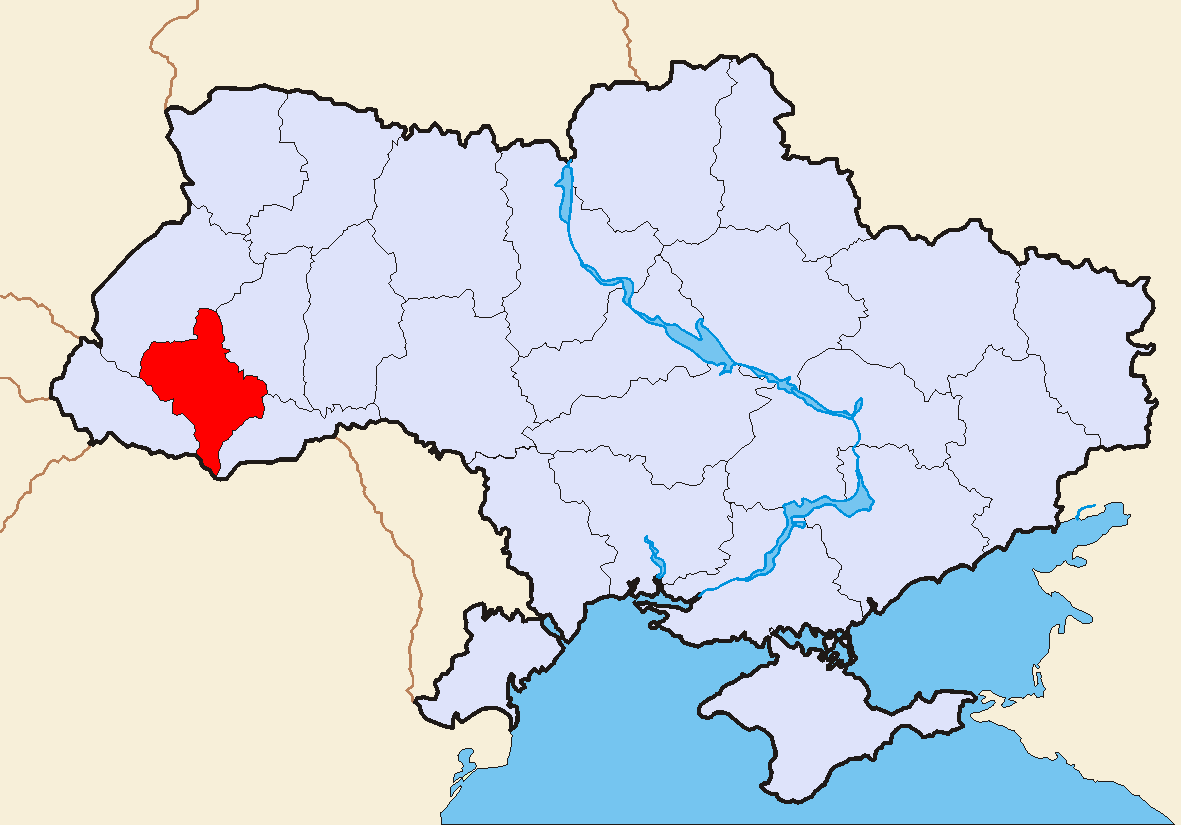
OfficialLang = Ukrainian
Administrative_center =Ivano-Frankivsk
Largest_cities =Ivano-Frankivsk ,Kalush ,Kolomyia
GovernorName = Roman Tkach
GovernorParty = OU [http://www.if.gov.ua/modules.php?name=Content&pa=showpage&pid=381]
ChairmanName = Ihor Myroslavovych Oliinyk
ChairmanParty = ?
CouncilSeats = ?
DateEstablished =December 4 ,1939
Raions = 14
CityRaions = 5
Cities = 15
CMTs = 24
Villages = 765
AreaRank = 22nd
TotalArea = 13,900
LandArea = ?
WaterArea = ?
PercentWater = ?
PopulationYear = 2006
Population_rank = 13th
Population = 1,388,000
Density = 101
Population_Growth = ?
SalaryYear = 2006
Salary_rank = 14th
Salary = 889
Salary_Growth = ?
PostalAbbreviation = 88-90xxx
PostalCodePrefix =List of postal codes#U-Z
ISOCode =
FIPSRegionCode =
PhoneCode = +380-34
LicencePlateNumber = РЕ, АО
Website = www.if.gov.ua
VRSite = [http://gska2.rada.gov.ua:7777/pls/z7502/A005?rdat1=04.06.2007&rf7571=13163 www.rada.gov.ua]
Footnotes =Ivano-Frankivsk Oblast ( _uk. Івано-Франківська область, translit. "Ivano-Frankivs’ka oblast’"; also referred to as Ivano-Frankivshchyna) is an oblast (province) in western
Ukraine . Its administrative center isIvano-Frankivsk .In the past the area was known as
Stanisławów Voivodship (1918-1939) andStanislav Oblast (1939-1962).The area of the region is 14,000 km², its population (as of
2004 -05-01 ) is 1.4 million.Some of the main cities of the oblast are
Bolekhiv ,Burshtyn ,Dolyna ,Halych ,Horodenka ,Ivano-Frankivsk , Kalush,Kolomyia ,Kosiv ,Nadvirna ,Rohatyn ,Sniatyn ,Tlumach , andTysmenytsia .The
Carpathian Mountains rise in the southern and western parts of the oblast.The Dniester River flows through Ivano-Frankivsk Oblast.
Historical and Cultural Sites
* The most recent monument of the cultural heritage was erected in the city of
Kolomyia in Pokuttia. The museum "Pysanka" was built in 2000 and is the unique one in the world.
* Another interesting historical site is the cavern complex in theDovbush Rock . The site is commemorated to the legendary freedom fighter Olexa Dovbush who in the legend fights against the Polishszlachta . The rock complex is located about 7 miles south west fromBolekhiv near village ofBubnysche .
* One more cultural site is located in the north of the Oblast in the small city ofRohatyn . Here is located an old church, the Church of the Holy Spirit, built back in 1598.ubdivisions
The Ivano-Frankivsk Oblast is administratively subdivided into 14
raions (district s) as well as 5 cities (municipalities) which are directly subordinate to the oblast government:Bolekhiv , Kalush,Kolomyia ,Yaremcha , and the administrative center of the oblast,Ivano-Frankivsk .ee also
*Poland’s
Stanisławów Voivodeship (1921-1939)External links
* [http://www.if.gov.ua/ Ivano-Frankivsk Oblast official site]
Wikimedia Foundation. 2010.