- Mühlheim an der Donau
-
Mühlheim an der Donau 

 Mühlheim an der DonauLocation of the town of Mühlheim an der Donau within Tuttlingen district
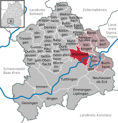

Coordinates 48°01′50″N 8°53′9″E / 48.03056°N 8.88583°ECoordinates: 48°01′50″N 8°53′9″E / 48.03056°N 8.88583°E Administration Country Germany State Baden-Württemberg Admin. region Freiburg District Tuttlingen Mayor Jörg Kaltenbach Basic statistics Area 21.73 km2 (8.39 sq mi) Elevation 664 m (2179 ft) Population 3,480 (31 December 2010)[1] - Density 160 /km2 (415 /sq mi) Other information Time zone CET/CEST (UTC+1/+2) Licence plate TUT Postal code 78570 Area code 07463 Website www.muehlheim-donau.de  Mühlheim
Mühlheim an der Donau (or alternatively in English Mühlheim on the Danube) is a town in the district Tuttlingen in Baden-Württemberg, Germany. It is situated on the Danube, 7 km northeast of Tuttlingen.
Contents
History
While today the largest part of the city is on the right bank of the Danube, the city Mühlheim was founded on the left bank, where the old part of town is still to be found. There a spring provides enough water year-round to drive millwheels. There is evidence that watermills were built here as early as the Roman imperium. The place takes its name from this, Mühlheim being equivalent to the English cognates: Mill-Home. An old trade route from the Bodensee crossed the river here, and from the ford at Mühlheim continued into the Albvorland after Rottweil.
The first documentary mention of the city dates from the year 843.Attractions
The timber framed Gothic city hall has been a listed historical monument since 1928. The earliest known written record dates to 1512, but a Romanesque capital is believed to date from around 1200.
The castle was first built around 1200 and was reconstructed in its present form in the mid 18th century.
The Galluschurch is Mühlheim's cemetery church. Parts of the building are Romanesque and date from the 10th and 11th centuries. The interior has frescos from the 14th and 15th centuries.
The yellow rock offers a fantastic view on the meandering Danube valley.
References
- ^ "Bevölkerung und Erwerbstätigkeit" (in German). Statistisches Landesamt Baden-Württemberg. 31 December 2009. http://www.statistik-bw.de/Veroeffentl/Statistische_Berichte/3126_10001.pdf.
External links
- (German) virtual travel through the town
Aldingen | Balgheim | Bärenthal | Böttingen | Bubsheim | Buchheim | Deilingen | Denkingen | Dürbheim | Durchhausen | Egesheim | Emmingen-Liptingen | Fridingen | Frittlingen | Geisingen | Gosheim | Gunningen | Hausen ob Verena | Immendingen | Irndorf | Kolbingen | Königsheim | Mahlstetten | Mühlheim | Neuhausen ob Eck | Reichenbach | Renquishausen | Rietheim-Weilheim | Seitingen-Oberflacht | Spaichingen | Talheim | Trossingen | Tuttlingen | Wehingen | Wurmlingen Categories:
- Towns in Baden-Württemberg
- Tuttlingen district


Wikimedia Foundation. 2010.