- Oak Ridges Moraine
-
The Oak Ridges Moraine is an ecologically important geological landform in the Mixedwood Plains of south-central Ontario, Canada. The moraine covers a geographic area of 1,900 square kilometres (730 sq mi) between Caledon and Rice Lake, near Peterborough. One of the most significant landforms in southern Ontario, the moraine gets its name from the rolling hills and river valleys extending 160 km (99 mi) from the Niagara Escarpment east to Rice Lake. It was formed 12,000 years ago by advancing and retreating glaciers (see geological origins, below). The moraine is currently a contested site in Ontario, since it stands in the path of major urban development (see political action).
 The Oak Ridges Moraine.
Contents
Physiography
The Oak Ridges Moraine is a pair of large ridges composed of four elevated wedges. It is bounded to the west by the Niagara Escarpment, a cuesta which was critical to the formation of the moraine, and to the east by the Trent River and Rice Lake. The four wedges (Albion, Uxbridge, Pontypool and Rice Lake from west to east) formed in stages, though some synchronous formation also occurred at an early period of formation. The moraine peaks at the Uxbridge wedge, generally rising from east to west, a result of the moraine's west-to-east formation. That is, the western portion of the moraine received earlier and more frequent sedimentary deposition than the eastern portion, as the ice lobes which controlled the moraine's eastern formation slowly retreated. The Rice Lake wedge is separated from the other wedges where the Oak Ridges Moraine intersects Rice Lake.
To the north are drumlinized uplands, referred to as the Peterborough drumlin field.
 Looking southwest at The Oak Ridges Moraine from the North Monaghan Parkway in Peterborough. Highway 115 is visible in the centre of the picture as it ascends the Moraine.
Geological origins
Main article: Origin of the Oak Ridges MoraineThe Oak Ridges Moraine probably formed in the Late Wisconsonian glacial period. Ice melt from the Niagara Escarpment flowed into the western boundaries of the moraine, wherein conduits beneath the ice expanded to form a west-to-east passage between the main Laurentide ice sheet and a mass of ice in the Lake Ontario basin.
Stratified sediment was deposited rapidly on the high-relief erosional surface. Up to 150 m (500 ft) in some areas, the deposits occurred on surfaces defined by highly eroded channels and drumlin uplands. The channel tunnels were primarily created by the erosion from glacial rivers, a typical process before moraine formation.
Characteristic of this moraine is the transition of deposition layers from glaciofluvial to glaciolacustrine. Sedimentary glaciofluvial areas form the core of the Oak Ridges Moraine, though restricted to subglacial cavity fills of confined subaqueous fans. Overlaying this core is a glaciolacustrine sedimentary layer that is younger and topographically lower, principally in the delta and basin areas of the moraine.
In the late stages of its development, random unstratified accumulation (known as diamicton) occurred along the ice margins. Whereas the glacial river deposits were more substantial by volume, the diamicton deposits represent a greater portion of the moraine's exposed surface. Research suggests that sedimentation occurred in a west to east sequence along the four main sedimentary wedges: Albion, Uxbridge, Pontytool and Rice Lake. The wedges may have formed in a relatively short period of time, perhaps no more than a few hundred years, as indicated by the annual deposition cycles in glacial lakes (known as varves) within the moraine sediments. However, the lowest beds in the moraine may have experienced synchronous sedimentation.
Hydrology
Main article: Hydrography of the Oak Ridges MoraineA number of features comprise the hydrological system of the Oak Ridges Moraine:[1]
- permanent and ephemeral streams,
- wetlands,
- kettle lakes and ponds, and their catchment areas,
- seepage areas and springs, and
- aquifers and other recharge areas.
This hydrological system is inter-twined with a regional flow systems not bound by the morphological limits of the moraine.[2] For this reason, environmentalists and researchers promote an aggressive protection strategy extending beyond the moraine, thus ensuring a contiguously protected hydrological system.
The preservation of aquifers is especially important, since they are used as a primary water source by some municipalities located on or near the moraine. These aquifers also discharge into tributaries that are the headwaters of creeks and rivers which eventually flow into Lake Simcoe, Lake Scugog and Lake Ontario.
The Oak Ridges Moraine Conservation Act stipulates that any development which targets the moraine or nearby areas must satisfy several conditions, most prominently that each development leave a buffer zone of 30 metres (98 ft) between it and any hydrological feature; for a kettle lake, this measure is from the edge of the lake's catchment area.
The Oak Ridges Moraine's hydrological system is a major constituent of the Humber Watershed, so that any factors affecting the moraine may have an impact on the connected systems. A specific concern is urbanization, which affects water quality by increasing its load of metals and organic contaminants.[3] A study by Cook et al. (1985) found an increase in mean annual runoff, instantaneous discharge, and hydrograph peak flow as a result of urbanization: "...changes in land use coincided with changes in volumetric and time distribution aspects of hydrologic response".
Ecology
 The Hooded Warbler is a threatened species in Canada. Happy Valley Forests is one of the few remaining Canadian habitats for this species.Main article: Ecology of the Oak Ridges Moraine
The ecologically diverse moraine is the water source for many headwaters streams flowing south into rivers that drain into Lake Ontario and north into rivers that drain into Lake Scugog and Lake Simcoe. Varied landforms on the moraine, such as woodlands, wetlands, watercourses, kettle lakes and bogs, have provided an environment suitable for significant flora and fauna communities to develop and thrive. The moraine contains one of the last large contiguous forested spans in southern Ontario.
Some of the wide variety of plant and animal species found in the moraine are species at risk in Canada and Ontario, including the West Virginia White Butterfly, Jefferson Salamander, Red-shouldered Hawk, and American Ginseng. Unique ecosystems in the moraine include wetlands similar to those of boreal forests in Northern Ontario, and remnants of tallgrass prairie and oak-pine savanna that are globally threatened ecosystems. A representative portion of the moraine may be found in the Happy Valley Forests, in York Region, north of Toronto.
Research on the moraine
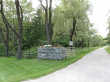 Entrance to the Koffler Scientific Reserve.
In 1829, John Bigsby conducted the first investigation of the moraine.[4] He noted the elevation, and styled the area Oak Ridge, identifying the portion of moraine north of Toronto. The moraine's extent was not established until 1863 when William Logan conducted the Geological Survey of Canada.
Taylor formally defined the landform as the Oak Ridges Moraine in 1913. He described its extent to be from King and Maple in the west to the Trent River in the east. He also proposed that its origin was overlapping, interlobate glaciation retreat, between the Lake Ontario Lobe and the older Lake Simcoe Lobe. This has become the accepted explanation for the moraine's development, though research in the 1970s suggested the moraine may not be interlobate.
Research conducted in the 1990s revealed that the moraine has multiple origins: its eastern area has subglacial depositions (Gorrell and McCrae, 1993); early parts of the moraine were deposited in an esker (Brennand and Shaw, 1994); and that the moraine is not continuous, but is composed of multiple depositional environments: subglacial, ice-marginal and proglacial lacustrine (Barnett et al., 1998).
Current research efforts on the moraine are quite extensive. Because of the political implications of development on the moraine, and because its aquifers are a source of potable water for numerous communities, both federal and provincial governments have invested resources towards research on the moraine. The Geological Survey of Canada and Ontario Geological Survey both investigate hydrostratigraphy and hydrology throughout the moraine.
Palaeo-Indian hunter-gatherers were in this area between 10,000 - 7000 BC. The oldest artifact found in what is now Richmond Hill, Ontario, from these people, was a stone scraper about 40 mm long, at the Mortson Site, near Leslie Street and 19th Avenue. Other artifacts were found in a settlement site on the eastern shore of Lake Wilcox.
Archaic Iroqouis artifacts c. 1800 BC have also been found at the Silver Stream site, near the headwaters of the Rouge River on Leslie Street just north of Major Mackenzie Drive, and at the Esox site, on the eastern shore of Lake Wilcox.
Political action
Main article: Politics of the Oak Ridges MoraineAlthough preservation of the moraine was first suggested in the 1940s, it was not until 1991 that the issue achieved prominence in political discourse.[5] Part of the reason for its entry into political discourse, was due to the formation, in 1989, of the Save the Oak Ridges Moraine (STORM) Coalition.[6]
The Government of Ontario created the Oak Ridges Moraine Technical Working Committee in June 1991, with the aim of creating a regional planning strategy for the moraine. The plan was completed in 1994, but was subsequently dismissed in favour of local government administration of the affected lands. This led to intense development on some portions of the moraine.
In early 1999, developers targeted Richmond Hill for large subdivisions on the moraine which would house over 100,000 people. On July 20, 1999, Minister of Municipal Affairs and Housing Steve Gilchrist announced, on "Rouge Park Day", that he would be implementing a ban on all development on the Oak Ridges Moraine. This announcement sparked considerable opposition by the development industry which, in turn, attracted considerable media attention and public interest. A media campaign by environmental groups built on the public opposition of the developments, and the issue was transferred to the Ontario Municipal Board (OMB) in 2000.
By May 2001, with the issue still unresolved, the provincial Conservative government announced a six-month moratorium on moraine development. A panel was formed to create a land-use plan consistent with the current "smart growth" policy. The plan was released in October 2001, and became the basis for the Oak Ridges Moraine Conservation Act, 2002, which divided the moraine into four zones with increasingly stringent controls on development in each. The Act prevented development of over 92% of the land mass of the moraine and only those development projects which had already received zoning and planning approval were allowed to be completed.
During the provincial election of 2003, the Liberal Party of Ontario promised to terminate development on the moraine as part of their election campaign. The government, in its attempt to halt developments, proposed the North Pickering Land Exchange.[7] This involved exchanging government-owned public lands in North Pickering (the Seaton lands) for privately-owned lands on the Oak Ridges Moraine in Richmond Hill and Uxbridge. The exchange settled outstanding disputes being considered by the OMB involving moraine lands in Richmond Hill and Uxbridge.
Despite all these efforts, including the government's creation of a permanently protected Greenbelt, the political struggle regarding the moraine continues.
Unless approved prior to the Oak Ridges Moraine Conservation Act coming into force in 2001 or through orders of the Ontario Municipal Board to the contrary, development on the Oak Ridges Moraine is restricted to the Settlement Area. Smaller-scale development which improves the ecological integrity of the moraine is permitted in other areas (i.e., tree farm), but is otherwise restricted. Given that the land-subdivision process is lengthy and that the Region of York is experiencing a shortage in servicing capacity, what often appears as "new" development in York Region on the moraine is in the majority of cases development which has had approval for many years.
Development pressures
The greatest threat to the function of the moraine is land development on and below its surface, particularly in the headwaters. The estimated current population on the moraine land itself is roughly 200,000 but this number continues to grow at a frantic pace, with large urban developments occurring in Stouffville, Vaughan, Richmond Hill, Oak Ridges and Aurora. This rapid development is especially apparent in Oak Ridges, where land previously set aside for conservation has, as recently as 2009, been opened up by the Richmond Hill Town Council for development. Another five million people live in close proximity. Use of the moraine is currently under dispute; environmental groups such as the Sierra Club maintain the area's delicate ecosystems are threatened by development pressures. Attractive forests and hilly relief typical of the moraine are a magnet for developers looking for building opportunities in the densely populated Greater Toronto Area. However, many planners and residents see a need to preserve the moraine from the negative aspects of urban sprawl.
Moreover, because it is a rich resource for sand and gravel, it has become a significant source of materials for the aggregate industry of the Greater Toronto Area.[8]
Conservation
Local concerns for preserving wildlife habitat on the moraine have increased in recent years. In April 2000, the Oak Ridges Moraine Land Trust was formed. The ORMLT is a non-profit organization that raises funds to protect areas on the moraine through conservation easements and outright purchases. They have protected 6 square kilometres (1,500 acres). The Nature Conservancy of Canada is also active and are raising funds to protect a 5.4 km2 (1,300 acres) property called Happy Valley Forest.
See also
References and notes
- ^ Bradford, Andrea; Stephen Maude. "Achieving Ecological Integrity on the Oak Ridges Moraine: Towards Ecologically Relevant Water Management" (PDF). University of Guelph. http://www.soe.uoguelph.ca/webfiles/abradfor/Assets/Text/ORM%20Paper.pdf. Retrieved 2006-06-16.
- ^ Gerber, Richard E.; Ken Howard (September 2002). "Hydrogeology of the Oak Ridges Moraine aquifer system: implications for protection and management from the Duffins Creek watershed". Canadian Journal of Earth Sciences 39 (9): 1333–1348. doi:10.1139/e02-058. ISSN 1480-3313. http://pubs.nrc-cnrc.gc.ca/cgi-bin/rp/rp2_abst_e?cjes_e02-058_39_ns_nf_cjes. Retrieved 2006-06-16.
- ^ "Issues in Stormwater Quality and Quantity in the Humber:Background". University of Toronto. http://www.unc.edu/~davidten/wisqqih/context/. Retrieved 2006-06-16.
- ^ Barnett, P.J.; Sharpe, D.R., Russell, H.A.J., Brennand, T.A., Gorrell, G., Kenny, F.M., and Pugin, A. (October 1998). "On the Origin of the Oak Ridges Moraine" (PDF). Canadian Journal of Earth Sciences 35 (10): 1152. doi:10.1139/cjes-35-10-1152. ISSN 1480-3313. Archived from the original on 2007-08-24. http://web.archive.org/web/20070824085653/http://www.sfu.ca/personal/tabrenna/pubs_files/Barnettetal98_ORM_CJES.pdf. Retrieved 2006-06-16.
- ^ "Case Study: The Oak Ridges Moraine". Linking Science and Policy for Urban Nonpoint Pollution in the Great Lakes Region. International Association for Great Lakes Research. November 2002. http://www.iaglr.org/scipolicy/nps/oakridges.php. Retrieved 2006-06-16.
- ^ STORM Coalition. "Save the Oak Ridges Moraine". http://www.stormcoalition.org/. Retrieved 2007-07-27
- ^ "North Pickering Land Exchange". Ministry of Municipal Affairs and Housing. http://www.mah.gov.on.ca/Page326.aspx. Retrieved 2006-06-16.
- ^ "More facts about the Oak Ridges Moraine". Ministry of Municipal Affairs and Housing. http://www.mah.gov.on.ca/userfiles/HTML/nts_1_3631_1.html. Retrieved 2006-06-16.
External links
- Government of Ontario - Ministry of Municipal Affairs and Housing: The Oak Ridges Moraine
- Natural Resources Canada - Earth Sciences Sector: Oak Ridges Moraine Groundwater Research
- Natural Resources Canada: Oak Ridges Moraine - A Ridge of Resources
- Nature Conservancy Canada: The Oak Ridges Moraine
- Oak Ridges Moraine Land Trust
Categories:


Wikimedia Foundation. 2010.