- Belt Parkway
-
Belt Parkway
Route information Length: 25.29 mi[1] (40.70 km) Major junctions West end:  I-278 in Brooklyn
 I-678 in Queens
 NY 878 in Queens
East end: 
 Cross Island Parkway / Southern State Parkway in Queens
Location Counties: Kings, Queens Highway system Numbered highways in New York
Interstate • U.S. • N.Y. (former) • Reference • CountyThe Belt System is a series of connected limited-access highways that form a belt-like circle around the New York City boroughs of Brooklyn and Queens. The system comprises four officially separate parkways; however, three of the four are signed as the Belt Parkway. The three parkways that make up the signed Belt Parkway—the Shore Parkway, the Southern Parkway (not to be confused with the Southern State Parkway), and the Laurelton Parkway—are a combined 25.29 miles (40.70 km) in length.
Contents
Route description
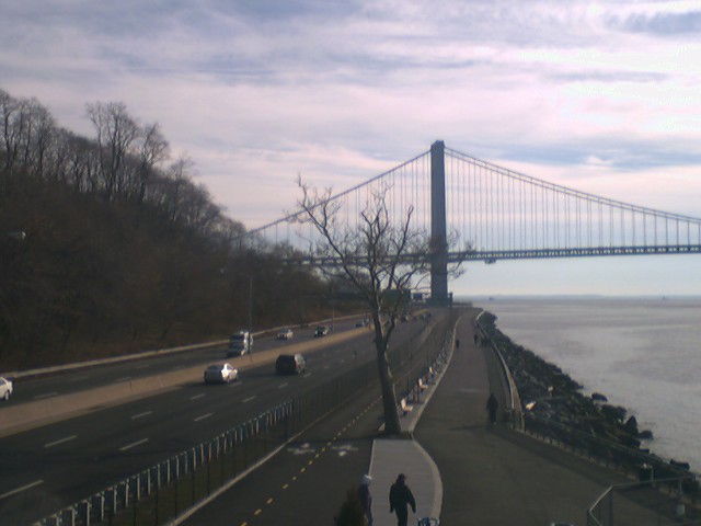
 Entering the Belt Parkway eastward from Verrazano Narrows Bridge
The Shore Parkway, Southern Parkway, Laurelton Parkway, and Cross Island Parkway are collectively known as the "Belt System".[2] The four components of the Belt System are designated as NY 907C, NY 907D, NY 907B, and NY 907A, respectively, by the New York State Department of Transportation. All four numbers are reference route designations and are not signed.[3] Excluding the Cross Island Parkway, the other three segments are now known collectively as the official "Belt Parkway". It is designated an east–west route, and its exit numbering system begins, in standard fashion, at the western terminus of the Shore Parkway, the westernmost parkway in the system. The numbering increases as the parkway proceeds eastward, and continues onto the Cross Island at the eastern terminus of the Belt Parkway. The north–south parkway retains the numbering scheme to its northern terminus.
 Northwestward from Verrazano Bridge
Shore Parkway
The Shore Parkway begins at the Gowanus Expressway near the east end of the Verrazano Narrows Bridge and proceeds eastward through Brooklyn. The Shore, the part of the system many think of when they mention "Belt Parkway," makes a large arc to the south, passing under the Verrazano Narrows Bridge and turning southeast. Entering the Coney Island area, the parkway turns east, roughly following the former path of Coney Island Creek before turning northeast to skip across former islands in Jamaica Bay and reach the Southern Parkway. The Shore Parkway Greenway lies between the Parkway and the shore, connecting Owl's Head Park to Coney Island, and Brigham Street in Sheephead Bay to Howard Beach.
 Belt Parkway with Verrazano Bridge in the background
Shore Road Drive parallels the first stretch of the Shore Parkway. Exit 1 is for the Shore Road Drive (unsigned). The road makes a curve to the south after exit 1 and heads towards the Verrazano Bridge. The Shore Parkway goes through Shore Road Park until exit 2, which is for Shore Road (unsigned) and 4th Avenue. Exit 3 is on the westbound side only, while going eastbound the next exit is number 4. Exit 3 is for the Verrazano Narrows Bridge towards Staten Island. In Dyker Beach Park, exit 4 interchanges for Bay 8th Street. Exit 5 is next, for the Bay Parkway, which heads northward towards the neighborhood of Midwood.
Exit 6 going westbound is for Cropsey Avenue, which heads towards Coney Island. Exit 6 in the westbound direction is split into exits 6S and 6N. Exit 6N has access to Stillwell Avenue. Exit 7 going eastbound is for Ocean Parkway while westbound it is for Shell Road and is numbered 7A. Exit 7B going westbound is for Ocean Parkway. Exit 8 going westbound is the first signed exit for Coney Island. The exit is also for East 14th Street (unsigned) and Sheepshead Bay Road (unsigned). Exits 9A and 9B going eastbound are for Knapp Street and Sheepshead Bay. Exits 11S and 11N make a full cloverleaf interchange for Flatbush Avenue.
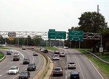
 Westbound from Flatbush Avenue
Exit 13 is next for Rockaway Parkway, which begins at a traffic circle. Exit 14 comes next for Pennsylvania Avenue. As the Shore Parkway gets closer to Jamaica, exit 15 comes for Erskine Street. After exits 17S and 17N for State Route 27 and Cross Bay Boulevard, the road becomes known as the Southern Parkway.
Southern Parkway
The Southern Parkway, distinct from the Southern State Parkway in Nassau and Suffolk counties, is located entirely within the median of Conduit Boulevard, NY 27. between Cross Bay Boulevard and Brookville Boulevard. It passes by JFK International Airport. After Exits 17N/17S, the Belt Parkway interchanges with NY 878 (the Nassau Expressway), I-678 (the Van Wyck Expressway), and going eastbound, also the JFK Expressway as well as Lefferts Boulevard, at Exit 19 (Westbound Lefferts Boulevard is Exit 18B, the Nassau Expressway and the Van Wyck is Exit 19, and the JFK Expressway is Exit 20). The next exit is for 150 Street and Rockaway Boulevard, which is Exit 20 eastbound and Exit 21A westbound. Exit 21B is Farmers Boulevard and Guy R. Brewer Boulevard. After that comes Springfield Boulevard at Exit 22. The parkway now turns to the northeast. North and South Conduit Avenues take NY 27 to Long Island. there is an eastbound exit to South Conduit Avenue which is Exit 23B. Going westbound, just before the curve, there is access to North Conduit Avenue at Exit 23A. Past the curve the Laurelton Parkway begins.
Laurelton Parkway
The Laurelton Parkway is a short connector between the Southern Parkway and the Cross Island Parkway. There is a one-way service road on the west side going westbound, and on the east side, the two-way Brookville Boulevard acts as a service road. Going eastbound, Exit 24A is for Francis Lewis Boulevard and Merrick Boulevard. Going westbound, Exit 24B is a separate exit for Merrick Boulevard. It also serves 130 Avenue. There is also a westbound-only exit, Exit 23A, which goes to North Conduit Avenue. Just before the end of the parkway, Exit 25B serves Elmont Road and Linden Boulevard going eastbound, and Exit 25A goes to the Southern State Parkway. The Belt (Laurelton) Parkway now becomes the Cross Island Parkway.
Cross Island Parkway
Main article: Cross Island ParkwayThe Cross Island Parkway continues north from the interchange with the Southern State Parkway near the border of Nassau County, then west to the Bronx-Whitestone Bridge, where it terminates at the Whitestone Expressway. For more information see the Cross Island Parkway main page.
History
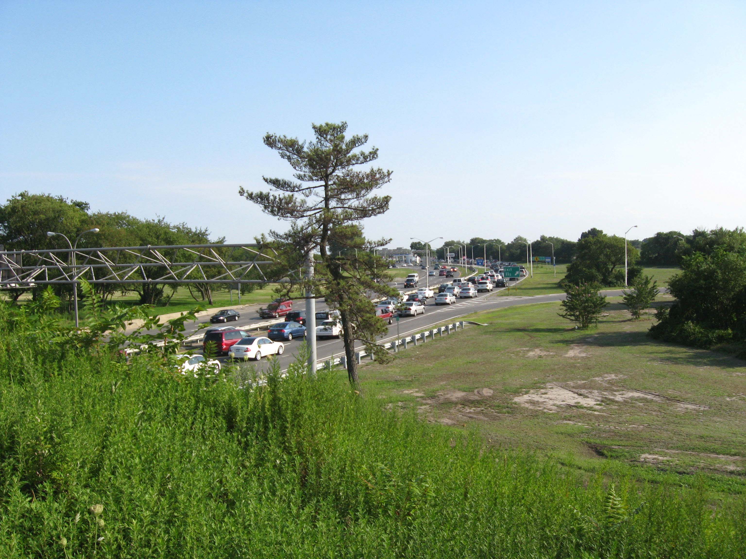
 Exit 25A as seen from the southbound Cross Island Parkway
The Belt Parkway was proposed by builder and highway advocate Robert Moses in 1930 to provide modern highway access to Manhattan and to connect to, and use similar design principles to, parkways already constructed on Long Island and Westchester County, New York. Construction began in 1934. The full loop was completed when the Brooklyn-Queens Expressway (also known as the "BQE") was finished in 1960.
The Belt System
Though some signage bears the name "Belt Parkway," the original plan never called for a highway of that name, rather a system of different named parkways called the "Belt System." The Belt System is made up of a series of interconnecting highways, none of which are actually named the Belt Parkway. Originally, the highways were the Gowanus Parkway from the Brooklyn-Battery Tunnel to the Shore Parkway; the entirety of the Shore, Southern, Laurelton, and Cross Island Parkways; the Whitestone Parkway from the Cross Island to the Grand Central Parkway; and the Grand Central from the Whitestone to the Triborough Bridge.
All the original parkways, except the Gowanus, were built on grassy rights-of-way with trees, in a more pleasant surrounding than most highways of their time. The Gowanus Parkway was built as an elevated structure over Third and Hamilton Avenues in order to avoid the active docks and industrial areas including Sunset Park, Brooklyn.
Conversion and completion
Like most parkways in New York State, the parkways comprising the Belt System were closed to commercial traffic, including any vehicle with a non-passenger registration and all commercial trucking of any size. Originally even station wagons, which had "suburban" registrations, were excluded but they were later allowed, along with passenger-registered SUVs and vans.
The system was not completed as a parkway, and some portions of the original system were converted to expressways, which allows commercial traffic to use them. These expressway portions included the Gowanus Expressway, replacing Gowanus Parkway as a connector between Manhattan and the Verrazano-Narrows Bridge to Staten Island and New Jersey (now signed as part of Interstate 278); Whitestone Expressway, which converted Whitestone Parkway into a truck route to connect the Van Wyck Expressway to the Bronx-Whitestone Bridge (now signed as part of Interstate 678); and the Brooklyn-Queens Expressway, built as an expressway to connect the Gowanus Parkway/Expressway to the Triborough Bridge and Grand Central Parkway to complete the system (now signed as part of Interstate 278).
Exit list
County Location Mile[1] Exit Destinations Notes Kings Bay Ridge 0.00 I-278 east – Queens, BronxWestbound exit and eastbound entrance 1 65th-67th Streets Fort Hamilton 3.38 2 4th Avenue / Fort Hamilton Parkway – Verrazano-Narrows Bridge 3 I-278 west (Verrazano-Narrows Bridge) – Staten Island, New JerseyWestbound exit and eastbound entrance Bath Beach 4.47 4 Bay 8th Street/14th Avenue 5.63 5 Bay Parkway Gravesend 6.73 6 Cropsey Avenue / Stillwell Avenue – Coney Island Signed as exits 6S (south) and 6N (north) westbound 7.81 7A Shell Road – Coney Island Westbound exit and eastbound entrance; formerly part of exit 7S 7B Ocean Parkway – Coney Island, Brighton Beach Signed as exit 7 eastbound; formerly split into exits 7S and 7N Sheepshead Bay 7.89 8 Coney Island Avenue – Brighton Beach 9.69 9 Knapp Street – Sheepshead Bay Two exits - 9A and 9B - eastbound; both lead to Knapp Street Floyd Bennett Field 11.09 11 Flatbush Avenue – Rockaways, Marine Park, Kings Plaza Signed as exits 11S (south) and 11N (north) Bergen Beach Jamaica Bay Riding Academy Eastbound exit and entrance Canarsie 14.38 13 Rockaway Parkway Starrett City 15.42 14 Pennsylvania Avenue 15 Erskine Street Queens Howard Beach 17.91 17 Cross Bay Boulevard / Cohancy Street – Woodhaven, Rockaways Signed as exits 17S (south) and 17N (north) westbound 17W North Conduit Avenue (NY 27 west) Westbound exit and eastbound entrance South Ozone Park 18.30 18B Lefferts Boulevard – Aqueduct Racetrack Eastbound exit is part of exit 19 19 NY 878 east (Nassau Expressway) / I-678 (Van Wyck Expressway) – Kennedy Airport, Whitestone BridgeWestbound exit only connects to I-678 north; access to Kennedy Airport is via exit 20 20 JFK Expressway – Kennedy Airport Westbound exit and eastbound entrance Springfield Gardens 20.45 21A 150th Street, Rockaway Boulevard Signed as exit 20 eastbound 22.29 21B Farmers Boulevard, Guy R. Brewer Boulevard 22 Springfield Boulevard Laurelton 23.67 23A North Conduit Avenue (NY 27 west), 225th Street Westbound exit only 23.67 23B  NY 27 east (Sunrise Highway)
Eastbound exit and westbound entrance 24A Francis Lewis Boulevard No westbound entrance 24.26 24B Merrick Boulevard Eastbound exit is via exit 24A 24B 130th Avenue Eastbound exit, eastbound and westbound entrance 25.29 25A Southern State Parkway – Eastern Long IslandEastbound exit and westbound entrance 25.29 Cross Island Parkway – Whitestone BridgeEastbound exit and westbound entrance 1.000 mi = 1.609 km; 1.000 km = 0.621 mi The exit numbering system uses sequential, not mile-based, numbers. Also, "directional" letters (e.g. N-S; E-W) are found here.
References
- ^ a b "2008 Traffic Volume Report for New York State" (PDF). New York State Department of Transportation. June 16, 2009. p. 253. https://www.nysdot.gov/divisions/engineering/technical-services/hds-respository/NYSDOT%20TVR%202008%20by%20Route.pdf. Retrieved April 1, 2010.
- ^ "Bridge Inventory Manual – Appendix G: State Touring Route Numbers for Named Roads" (PDF). New York State Department of Transportation. April 2005. https://www.nysdot.gov/divisions/engineering/structures/repository/manuals/inventory/appendix_g_named_roads_april05.pdf. Retrieved April 1, 2010.
- ^ New York State Department of Transportation (January 2009) (PDF). Official Description of Highway Touring Routes, Bicycling Touring Routes, Scenic Byways, & Commemorative/Memorial Designations in New York State. https://www.nysdot.gov/divisions/operating/oom/transportation-systems/repository/2009%20tour-bk.pdf. Retrieved April 1, 2010.
External links
- Belt Parkway Historic Overview at Steve Anderson's nycroads.com
- Belt Parkway (Greater New York Roads)
Parkways in New York City Manhattan The Bronx Brooklyn-Queens Belt Parkway system: Cross Island - Laurelton - Shore - Southern
Others: Grand Central - Jackie Robinson (Interborough)
Former: Gowanus - Whitestone - Long Island Motor ParkwayStaten Island Korean War Veterans (Richmond)
Former: Willowbrook - Proposed: Wolfe's PondCategories:- Parkways in New York City
- Transportation in Brooklyn
- Transportation in Queens
- Robert Moses projects


Wikimedia Foundation. 2010.