- Nurlat
-
Nurlat (English)
Нурлат (Russian)
Норлат (Tatar)- Town[citation needed] - 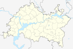
 Nurlat
Coordinates: 54°26′N 50°48′E / 54.433°N 50.8°ECoordinates: 54°26′N 50°48′E / 54.433°N 50.8°E 
Flag Administrative status Country Russia Federal subject Republic of Tatarstan Municipal status Municipal district Nurlatsky Municipal District[citation needed] Urban settlement Nurlat Urban Settlement[citation needed] Statistics Area 16 km2 (6.2 sq mi)[citation needed] Population (2010 Census,
preliminary)32,600 inhabitants[1] Population (2002 Census) 32,527 inhabitants[2] Density 2,038 /km2 (5,280 /sq mi)[3] Time zone MSD (UTC+04:00)[4] Founded 1905[citation needed] Dialing code(s) +7 884345[citation needed] Nurlat (Tatar and Russian: Нурла́т) is a town in the Republic of Tatarstan, Russia, located on the Kondurcha River, 268 kilometers (167 mi) southeast of Kazan. It serves as the administrative center of Nurlatsky District, although it is not administratively a part of it. Population: 32,600 (2010 Census preliminary results);[1] 32,527 (2002 Census);[2] 23,507 (1989 Census).[5]
Nurlat was formerly known as Nurlat-Oktyabrsky.
It was founded in 1905 as a settlement around a railway station. Town status was granted to it in 1961.
There is an airport in Nurlat.
References
- ^ a b Федеральная служба государственной статистики (Federal State Statistics Service) (2011). "Предварительные итоги Всероссийской переписи населения 2010 года (Preliminary results of the 2010 All-Russian Population Census)" (in Russian). Всероссийская перепись населения 2010 года (All-Russia Population Census of 2010). Federal State Statistics Service. http://www.perepis-2010.ru/results_of_the_census/results-inform.php. Retrieved 2011-04-25.
- ^ a b Федеральная служба государственной статистики (Federal State Statistics Service) (2004-05-21). "Численность населения России, субъектов Российской Федерации в составе федеральных округов, районов, городских поселений, сельских населённых пунктов – районных центров и сельских населённых пунктов с населением 3 тысячи и более человек (Population of Russia, its federal districts, federal subjects, districts, urban localities, rural localities—administrative centers, and rural localities with population of over 3,000)" (in Russian). Всероссийская перепись населения 2002 года (All-Russia Population Census of 2002). Federal State Statistics Service. http://www.perepis2002.ru/ct/doc/1_TOM_01_04.xls. Retrieved 2010-03-23.
- ^ The value of density was calculated automatically by dividing the 2010 Census population by the area specified in the infobox. Please note that this value may not be accurate as the area specified in the infobox does not necessarily correspond to the area of the entity proper or is reported for the same year as the population.
- ^ Правительство Российской Федерации. Постановление №725 от 31 августа 2011 г. «О составе территорий, образующих каждую часовую зону, и порядке исчисления времени в часовых зонах, а также о признании утратившими силу отдельных Постановлений Правительства Российской Федерации». Вступил в силу по истечении 7 дней после дня официального опубликования. Опубликован: "Российская Газета", №197, 6 сентября 2011 г. (Government of the Russian Federation. Resolution #725 of August 31, 2011 On the Composition of the Territories Included into Each Time Zone and on the Procedures of Timekeeping in the Time Zones, as Well as on Abrogation of Several Resolutions of the Government of the Russian Federation. Effective as of after 7 days following the day of the official publication).
- ^ "Всесоюзная перепись населения 1989 г. Численность наличного населения союзных и автономных республик, автономных областей и округов, краёв, областей, районов, городских поселений и сёл-райцентров. (All Union Population Census of 1989. Present population of union and autonomous republics, autonomous oblasts and okrugs, krais, oblasts, districts, urban settlements, and villages serving as district administrative centers.)" (in Russian). Всесоюзная перепись населения 1989 года (All-Union Population Census of 1989). Demoscope Weekly (website of the Institute of Demographics of the State University—Higher School of Economics. 1989. http://demoscope.ru/weekly/ssp/rus89_reg.php. Retrieved 2010-03-23.
Administrative divisions of the Republic of Tatarstan Capital: Kazan 
Cities and towns Agryz · Almetyevsk · Arsk · Aznakayevo · Bavly · Bolgar · Bugulma · Buinsk · Chistopol · Laishevo · Leninogorsk · Mamadysh · Mendeleyevsk · Menzelinsk · Naberezhnye Chelny · Nizhnekamsk · Nurlat · Tetyushi · Yelabuga · Zainsk · Zelenodolsk
Administrative districts Agryzsky · Aksubayevsky · Aktanyshsky · Alexeyevsky · Alkeyevsky · Almetyevsky · Apastovsky · Arsky · Atninsky · Aznakayevsky · Baltasinsky · Bavlinsky · Bugulminsky · Buinsky · Cheremshansky · Chistopolsky · Drozhzhanovsky · Kamsko-Ustyinsky · Kaybitsky · Kukmorsky · Laishevsky · Leninogorsky · Mamadyshsky · Mendeleyevsky · Menzelinsky · Muslyumovsky · Nizhnekamsky · Novosheshminsky · Nurlatsky · Pestrechinsky · Rybno-Slobodsky · Sabinsky · Sarmanovsky · Spassky · Tetyushsky · Tukayevsky · Tyulyachinsky · Verkhneuslonsky · Vysokogorsky · Yelabuzhsky · Yutazinsky · Zainsky · ZelenodolskyCategories:- Cities and towns in Tatarstan


Wikimedia Foundation. 2010.