- Coquet Island, England
-
Coordinates: 55°21′N 1°30′W / 55.35°N 1.5°W
Coquet Island, England 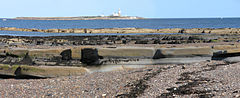
Coquet Island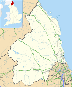
 Coquet Island, England
 Coquet Island, England shown within Northumberland
OS grid reference NU317063 List of places: UK • England • Northumberland Coquet Island
 /ˈkoʊkət/ is a small island of about 6 hectares (15 acres), situated 1.2 kilometres (0.75 mi) off Amble on the Northumberland coast, northeast England.
The Island is owned by the Duke of Northumberland. The Royal Society for the Protection of Birds manage the island as a bird reserve, for its important seabird colonies.
The most numerous species is the Puffin, with over 18,000 pairs nesting in 2002, but the island is most important for the largest colony of the endangered Roseate Tern in Britain, which, thanks to conservation measures including the provision of nestboxes to protect the nests from gulls and bad weather, has risen to 92 pairs in 2005. Other nesting birds include Sandwich Tern, Common Tern, Arctic Tern, Black-legged Kittiwake, Fulmar, three gull species, and Eider Duck.
Coquet Island also holds the remaining structure of a medieval monastery, which was largely incorporated into the 19th-century lighthouse and lighthouse keepers' cottages. The lighthouse, operated by Trinity House, is now automatic with no resident keeper, so the island is uninhabited in winter, but seasonal wardens are present throughout the summer to protect the nesting birds.
Landing on Coquet Island for the general public is prohibited, but local boating companies from Amble sail close up to the island in good weather throughout the summer, allowing visitors to get good views of the Puffins and Roseate Terns.
See also
- The Farne Islands; another important bird reserve about 30 km to the north.
- Henry of Coquet (12th century) - Danish hermit and miracleworking saint who lived on this island.
External links
- Tide times for Coquet Island from the BBC and Easytide.
- History of Coquet Island. (Modified from "A History of Northumberland", volume V, by John Crawford Hodgson. Published 1899).
Categories:- Islands of Northumberland
- Royal Society for the Protection of Birds reserves in England
- Sites of Special Scientific Interest in Northumberland
- Uninhabited islands of Northumberland


Wikimedia Foundation. 2010.