- Cumnor Hill
-
Cumnor Hill is a hill in the civil parish of Cumnor, to the west of the city of Oxford in the English county of Oxfordshire. In 1974 it was transferred from Berkshire. It is also the name of the ribbon development between the original Cumnor village and Botley outside the ring road on the outskirts of Oxford.
The road up Cumnor Hill was the original route of the A420 between Oxford and Swindon, until the Cumnor Hill by-pass was built in the 1970s. The road is now unclassified.
At the top of Cumnor Hill is the hamlet of Chawley, where the Kimmeridge Clay is close to the surface. There were brickworks there until 1937[1].
Position: (grid reference SP476050)
References
Towns 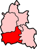
Large Villages Blewbury • Cumnor (Chilswell, Cumnor Hill, Dean Court, Farmoor, Swinford) • Drayton • East Challow • East Hendred • Grove • Harwell • Kennington • Kingston Bagpuize with Southmoor (Kingston Bagpuize, Southmoor) • Marcham (Cothill) • Milton • North Hinksey (Botley, Harcourt Hill) • Radley • St. Helen Without (Dry Sandford, Shippon) • Shrivenham • Stanford in the Vale (Bow) • Steventon • Sunningwell (Bayworth, Boars Hill, Foxcombe Hill) • Sutton Courtenay • Watchfield • Wootton (Boars Hill, Henwood, Lamborough Hill)Other Civil
Parishes
(Component
Villages
and Hamlets)Appleford-on-Thames • Appleton-with-Eaton (Appleton, Eaton) • Ardington (Ardington Wick, West Ginge) • Ashbury (Idstone, Kingstone Winslow) • Baulking • Besselsleigh • Bourton • Buckland (Gainfield) • Buscot • Charney Bassett • Childrey • Chilton • Coleshill • Compton Beauchamp (Knighton) • Denchworth • East Hanney • Eaton Hastings • Fernham • Frilford • Fyfield and Tubney (Fyfield, Tubney, Netherton) • Garford • Goosey • Great Coxwell • Hatford (Little Hatford) • Hinton Waldrist (Duxford) • Kingston Lisle • Letcombe Bassett • Letcombe Regis • Little Coxwell • Littleworth • Lockinge (East Lockinge, West Lockinge) • Longcot • Longworth • Lyford • Pusey • Shellingford • South Hinksey (Hinksey Hill)• Sparsholt • Uffington • Upton • West Challow • West Hanney • West Hendred (East Ginge) • Woolstone • Wytham (Seacourt)Former Districts
and BoroughsMunicipal Borough of Abingdon • Abingdon Rural District • Faringdon Rural District • Wantage Urban District • Wantage Rural DistrictFormer
ConstituenciesCoordinates: 51°44′30″N 1°18′43″W / 51.74169°N 1.31201°W
Categories:- Districts of Oxford
- Hills of Oxfordshire
- Oxfordshire geography stubs

Wikimedia Foundation. 2010.