- Mare Island
-
For other uses, see Mare Island (disambiguation).
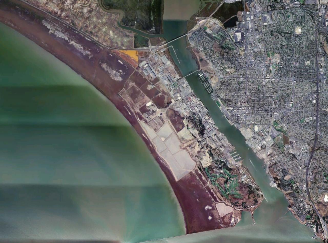
 Aerial photo of the southern part of Mare Island
Mare Island is a peninsula in the United States alongside the city of Vallejo, California, about 23 miles (37 km) northeast of San Francisco. The Napa River forms its eastern side as it enters the Carquinez Strait juncture with the east side of San Pablo Bay. Mare Island is considered a peninsula because no full body of water separates this or several other named "islands" from the mainland.[citation needed] Instead, a series of small sloughs cause seasonal water-flows among the so-called islands. Mare Island is the largest of these at about 3.5 miles (5.6 km) long and a mile wide.
The Napa River widens and forms a harbor between Mare Island and the mainland.
Contents
History
In 1775, a Spanish explorer, Perez Ayala became the first European to land on what would become Mare Island. This area was part of Rancho Suscol, deeded to General Mariano Guadalupe Vallejo in 1844. Originally named Isla de la Plana by Ayala, the island became a waypoint for early settlers. In 1835, whilst traversing the Carquinez Strait, a crude ferry transporting men and livestock capsized in a squall, among the livestock feared lost in the wreckage was General Mariano Guadalupe Vallejo's, Mexican Commandante for Northern California, prized white mare. Several days later, General Vallejo's mare was found on the island, having swum ashore. The island was renamed by Vallejo to Isla de la Yegua, Spanish for Mare Island in her honor.
Shipyard
Main article: Mare Island Naval ShipyardIn 1850, Commodore John Drake Sloat was ordered to lead a survey party in quest of a logical site for the nation's first Pacific naval installation. Sloat recommended the island across the Napa River from the settlement of Vallejo; it being "free from ocean gales and from floods and freshets."
On November 6, 1850, two months after California was admitted to statehood, President Fillmore reserved Mare Island for government use. The U.S. Navy Department acted favorably on Commodore Sloat's recommendations and Mare Island was purchased in July, 1852, for the sum of $83,410 for the use as a naval shipyard. Two years later, on September 16, 1854, Mare Island became the first permanent U.S. naval installation on the west coast, with Commodore David G. Farragut, as Mare Island's first base commander.
For more than a century, Mare Island was the United States Navy's Mare Island Naval Shipyard. The growing size and number of the country's naval fleet was making older facilities obsolete and led to increased building and refitting of shipyards nationally. A 508-foot (155 m) drydock was built by the Public Works Department on an excellent rock foundation of cut granite blocks. The work took nineteen years and was completed in 1891. During the Spanish-American War, a concrete drydock on wooden piles, 740 feet (230 m) long, was completed after eleven years of work, in 1910. By 1941, a third drydock had been completed and the drydock number four was under construction. The ammunition depot and submarine repair base were modern, fireproof buildings. A million dollar, three-way vehicle causeway to Vallejo replaced a ferry service.[1]
Before World War II, Mare Island had been in a continual state of upbuilding. By 1941, new projects included improvements to the central power plant, a new pattern storage building, a large foundry, machine shop, magazine building, paint shop, new administration building, and a huge storehouse. The yard was expected to be able to repair and paint six to eight large naval vessels at a time. Several finger piers had recently[when?] been built, as well as a new shipbuilding wharf, adding one 500-foot (150 m) and a 750-foot (230 m) berth. It employed 5593 workers at the beginning of 1939, and rapidly increased to 18,500 busily engaged by May 1941, with a monthly payroll of $3,500,000. Then came Pearl Harbor. In 1941, the drafting department had expanded to three buildings accommodating over 400 Naval architects, engineers and draftsmen. The hospital carried 584 bed patients.[2]
In 1969, the US Navy transferred its (Vietnam War) Brown Water Navy Riverine Training Forces from Coronado, California, to Mare Island. Swift Boats (Patrol Craft Fast-PCF), and PBRs (Patrol Boat River), among other types of riverine craft, conducted boat operations throughout the currently named Napa-Sonoma Marshes State Wildlife Area, which are located on the north and west portions of Mare Island. Mare Island Naval Base was deactivated during the 1995 cycle of US base closures, but the US Navy Reserves still have access to the water portions of the State Wildlife Area for any riverine warfare training being conducted from their new base in Sacramento, California.
Restoration and reuse
In 1993, Congress approved the findings of the Base Realignment and Closure report, leading to the closure of Mare Island Naval Shipyard.[3] The shipyard had long been the economic engine of the city of Vallejo, having reached an employment peak of 40,000 workers during World War II, and even employing 10,000 workers after scaling back in 1988. When Congress ordered the base closure, the shipyard employed 5,800 workers.[4]
The vision of rebuilding Mare Island as a vital place where people lived and worked was a key goal in the base conversion planning process undertaken by the city of Vallejo in the early 1990s.
Preservation of many of Mare Island’s 661 structures and other cultural resources was an additional factor in the planning process. As the oldest shipyard and naval facility on the West Coast, the shipyard earned a National Historic Landmark designation by the federal government in 1975. In 1979, California listed the entire naval base as a State Historical Landmark. In 1999, the city of Vallejo added Mare Island to the National Register of Historic Districts with 42 individual city landmarks.
Finally, as with any restoration of an industrial, brownfield landscape, both city and government agencies required environmental review, toxics removal, and soil mediation before any new development and reuse.
In 1998, the city of Vallejo contracted with Lennar Mare Island LLC to redevelop the island’s 5,657 acres (22.89 km2) into a multi-use community. Lennar Corporation contracted the Sausalito-based SWA Group, to provide a Master Development Plan for Vallejo, additional historical research and landscape architectural services.
The final land-use plan SWA submitted to the city of Vallejo in 2005 divided Mare Island into 13 specific zones, including a university district, and industrial zone, historic core, and residential neighborhoods. In addition, 78% of the entire island was set aside for wildlife habitat and wetlands, parkland and open space, and dredge ponds.[5]
SWA’s site plan began with the island’s grid of small, tree-lined streets and extended them so that they terminate in dramatic views of the bay and river and a new public waterfront. The historic core was repurposed as a new town center with retail, entertainment attractions, and additional, higher-density housing. Other improvements included a new grove of Canary Island Palm trees and London Plane trees along the G Street corridor, one of two entry points on the island. This feature enhances a visitor’s sense of arrival and frames the long view of Mt. Tamalpais across the San Pablo Bay.
In 2007, Lennar Corp finished construction on three new residential neighborhoods. Farragut Village, with 277 new homes in a site layout and landscape pattern designed by SWA Group, was the first completed neighborhood. Additional neighborhoods include Coral Sea and Kirkland Isle II. When all construction is complete, Mare Island will have 1,400 homes and condos, plus 7,000,000 square feet (650,000 m2) of commercial, retail, entertainment, and industrial space.[6]
Mare Island’s new residents petitioned Lennar Corp. and the city of Vallejo to drop the dredge ponds, whose role had been to collect silt, drainage, and storm water from both the Napa River and the Bay and instead restore that acreage to wetlands. Both city officials and the developer agreed and in January 2006, the land use plan was amended to add the Mare Island Shoreline Heritage Preserve. An advisory board was appointed by the city to restore the 215-acre (0.87 km2) site into publicly accessible parkland.[7]
Overall, the conversion and reuse of Mare Island will result in the 3,075 acres (12.44 km2) of protected tidal and nontidal wetlands providing wintering habitat for thousands of shorebirds and waterfowl. For example, during the migrating season in February 2008, thousands of people attended the three-day San Francisco Bay Flyway Festival on Mare Island, cosponsored by Lennar Mare Island LLC. The event, which included an art show, exhibitors, and music, marked the annual return of more than a million shorebirds, ducks, geese, and hawks to the Bay Area.[8]
Access
Mare Island can be accessed by State Route 37 on its north side, as well as by Interstate 80 via the Mare Island Causeway and Tennessee Street, a designated route.
Mare Island is also the location of Touro University California, the US Forest Service Pacific Southwest Regional Office, and the new administrative offices of the Vallejo City Unified School District.
For information on visiting Mare Island, see:
For information on the Historic Nature of Vallejo, see:
Notes
- ^ Lott, A Long Line of Ships, pp. 117–206.
- ^ Lott, A Long Line of Ships, pp. 209–237.
- ^ title = City of Vallejo: Mare Island Base Closure FAQS | url = http://www.ci.vallejo.ca.us/GovSite/default.asp?serviceID1=163&Frame=L1
- ^ title = The History of Base Realignments and Closures | url = www.senate.state.tx.us/75r/senate/ commit/c650/downloads/Robles_brachistory.ppt
- ^ title = Mare Island Regional Park Task Force | url = www.mareisland.org/anniversary/mareislandnarrative.pdf
- ^ title = Lennar Mare Island - History | url = www.lennarmareisland.com/history.htm
- ^ Title = New Vision Sought for Mare Island | url = http://www.sfbayjv.org/news_summaries/2006/march/New_vision_sought_for_Mare_Island.html
- ^ title = San Francisco Bay Flyway Festival | url = www.sfbayflywayfestival.com/mareisland.htm
Lott's Book may be purchased at the Mare Island Museum, 8th and Railroad.
References
- Blackman, Raymond V.B. Jane's Fighting Ships 1970-71. London: Jane's Yearbooks.
- Lott, Arnold S., Lt. Comdr., U.S.N. A Long Line of Ships: Mare Island's Century of Naval Activity in California. Annapolis: United States Naval Institute, 1954.
- Silverstone, Paul H., U.S. Warships of World War II. New York: Doubleday & Company, 1968.
- Steffes, James, ENC Retired: Swift Boat Down- The Real Story of the Sinking of PCF-19. (2006) ISBN 1-59926-612-1.
- Tillman, Barrett Clash of the Carriers. New York: New American Library, 2005. ISBN 978-0-451-21965-5
- 1941 Society of Naval Architects Bulletin, Harold W. Linnehan, writing as a visitor from Design section, Mare Island, California.
Further reading
- Holzer, T.L. et al. (2002). Comments on potential geologic and seismic hazards affecting Mare Island, Solano County, California [U.S. Geological Survey Open-File Report 02-425]. Menlo Park, CA: U.S. Department of the Interior, U.S. Geological Survey.
External links
38°05′43″N 122°16′41″W / 38.095254°N 122.278004°WCoordinates: 38°05′43″N 122°16′41″W / 38.095254°N 122.278004°W
Categories:- Islands of the San Francisco Bay Area
- Places in the San Francisco Bay Area
- Landforms of Solano County, California
- Vallejo, California
- United States Navy bases
- American Civil War army posts
Wikimedia Foundation. 2010.