- Dover
-
This article is about the English town. For the larger local government district, see Dover (district). For other uses, see Dover (disambiguation).
Coordinates: 51°07′46″N 1°18′32″E / 51.1295°N 1.3089°E
Dover 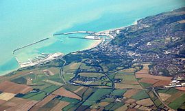
Aerial view of Dover Harbour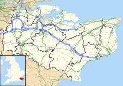
 Dover
Dover
Dover shown within KentPopulation 28,156 (2001 Census) Urban area 39,078 OS grid reference TR315415 - London 77.8mi District Dover Shire county Kent Region South East Country England Sovereign state United Kingdom Post town DOVER Postcode district CT16, CT17 Dialling code +44 (0)1304 Police Kent Fire Kent Ambulance South East Coast EU Parliament South East England UK Parliament Dover List of places: UK • England • Kent Dover (
 /ˈdoʊvər/) is a town and major ferry port in the home county of Kent, in South East England. It faces France across the narrowest part of the English Channel, and lies south-east of Canterbury; east of Kent's administrative capital Maidstone; and north-east along the coastline from Dungeness and Hastings. The town is the administrative centre of the Dover District and home of the Dover Calais ferry through the Port of Dover. The surrounding chalk cliffs have become known as the White cliffs of Dover, and the narrow sea passage nearby – the Strait of Dover.[1] Its strategic position has been evident throughout its history: archaeological finds have revealed that the area has always been a focus for peoples entering and leaving Britain. The name of the town derives from the name of the river that flows through River Dour. The town has been inhabited since the Stone Age according to archeological finds, and Dover is one of only a few places in Britain – London and Cornwall being other examples – to have a corresponding name in the French language, Douvres.[2]
Services related to the Port of Dover provide a great deal of the town’s employment, as does tourism, although many of the former ferry services have declined. There was a military barracks in Dover, which was closed in 2007.
Contents
History
Main article: History of Dover Dover Castle seen from Castle Street.
Dover’s name originated with its river – the River Dour, deriving from the Brythonic Dubrās ("the waters"), via its Latinized form of Dubris. The cliffs also gave Britain its ancient name of Albion ("white"). The Romans called it ’’Porte Dubris’’; the modern name was in use at least by the time Shakespeare wrote King Lear (between 1603 and 1606), in which the town and its cliffs play a prominent role.
Dover’s history, because of its proximity to France, has always been of great strategic importance to Britain. Archaeological finds have shown that there were Stone Age people in the area; and that by the Bronze Age the maritime influence was already strong. Some Iron Age finds exist also, but the coming of the Romans made Dover part of their communications network. Like Lemanis (Lympne) and Rutupiae (Richborough) Dover was connected by road to Canterbury and Watling Street; and it became Portus Dubris, a fortified port. Forts were built above the port; lighthouses were constructed to guide passing ships; and one of the best-preserved Roman villas in Britain is here.
Dover figured largely in the Domesday Book as an important borough. It also served as a bastion against various attackers: notably the French during the Napoleonic Wars; and against Germany during World War II.
Geography
 1945 Ordnance Survey map of Dover, showing the harbour
Dover is near the extreme south-east corner of Britain. At South Foreland, the nearest point to the continent, Cap Gris Nez near Calais is 34 kilometres (21 mi) away, across the Strait of Dover.[3]
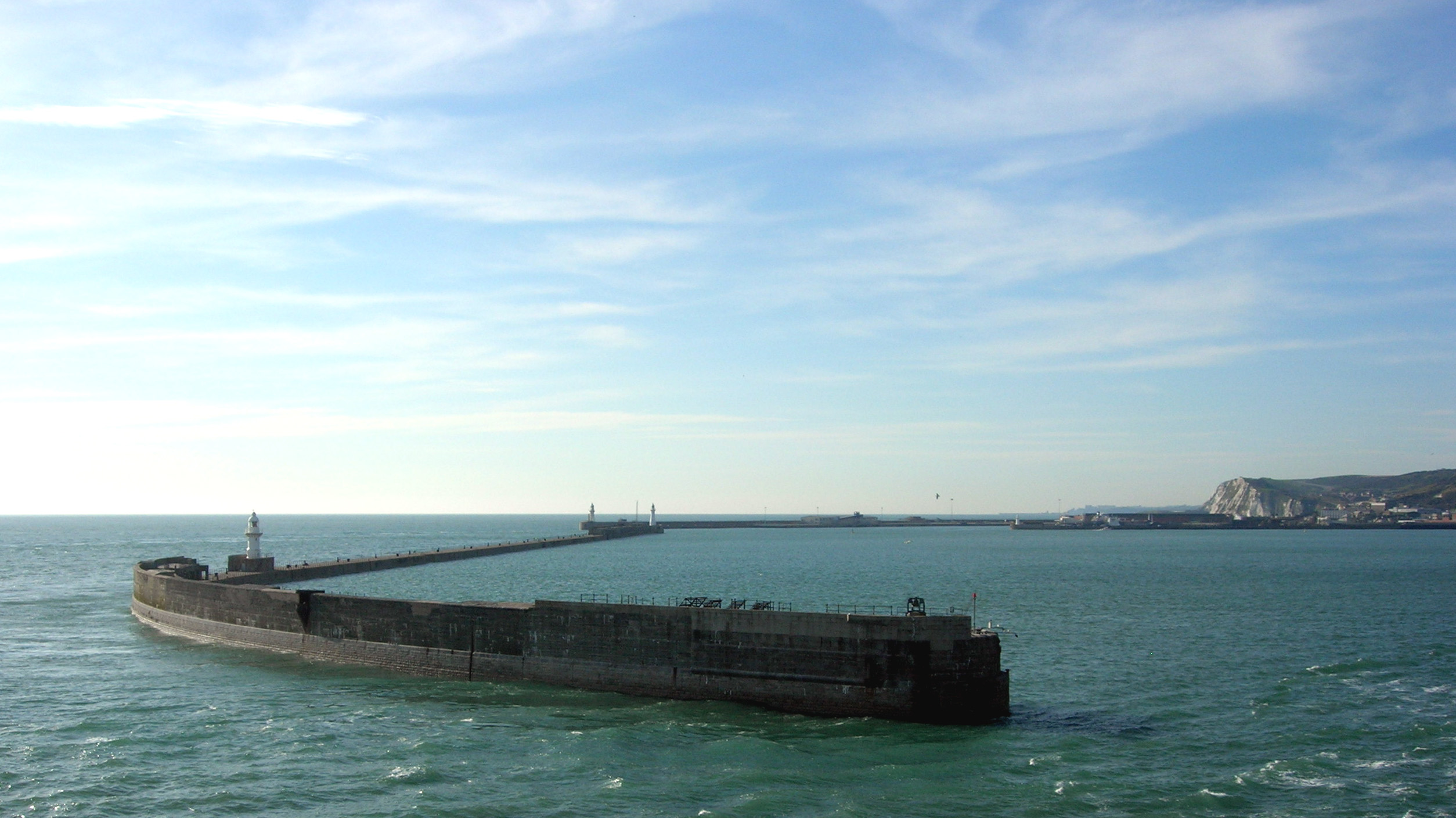
The site of its original settlement lies in the valley of the River Dour, making it an ideal place for a port, sheltered from the prevailing south-westerly winds. This led to the silting up of the river mouth by the action of longshore drift; the town was then forced into making artificial breakwaters to keep the port in being. These breakwaters have been extended and adapted so that the port lies almost entirely on reclaimed land.
The higher land on either side of the valley – the Western Heights and the eastern high point on which Dover Castle stands – has been adapted to perform the function of protection against invaders. The town has gradually extended up the river valley, encompassing several villages in doing so. Little growth is possible along the coast, since the cliffs are on the sea’s edge. The railway, being tunnelled and embanked, skirts the foot of the cliffs.
Climate
Dover has an oceanic climate (Koppen classification Cfb) similar to the rest of England and the United Kingdom with moderate temperatures year-round and light precipitation each month.
Climate data for Dover Month Jan Feb Mar Apr May Jun Jul Aug Sep Oct Nov Dec Year Average high °C (°F) 6
(43)7
(44)9
(48)11
(52)15
(59)18
(65)21
(70)21
(69)18
(65)14
(58)10
(50)7
(45){{{year high C}}}
(56)Average low °C (°F) 1
(34)1
(34)2
(36)4
(40)7
(45)11
(51)14
(57)13
(56)11
(52)8
(47)4
(40)2
(36){{{year low C}}}
(44)Precipitation mm (inches) 46
(1.8)33
(1.3)41
(1.6)43
(1.7)38
(1.5)48
(1.9)46
(1.8)46
(1.8)56
(2.2)61
(2.4)66
(2.6)21.7
(1.9/2.22)572
(22.5)Source: [4] Demography
In 1800 Edward Hasted (1732–1812) reported that the town had a population of almost 10,000 people.[5]
At the 2001 census, the town of Dover had 28,156 inhabitants, while the population of the whole urban area of Dover, as calculated by the Office for National Statistics, was 39,078 inhabitants.[6]
With the expansion of Dover, many of the outlying ancient villages have been incorporated into the town. Originally the parishes of Dover St. Mary's and Dover St. James, since 1836 Buckland and Charlton have become part Dover, and Maxton (a hamlet to the west), River, Kearsney, Temple Ewell, and Whitfield, all to the north of the town centre, are within its conurbation.
Economy
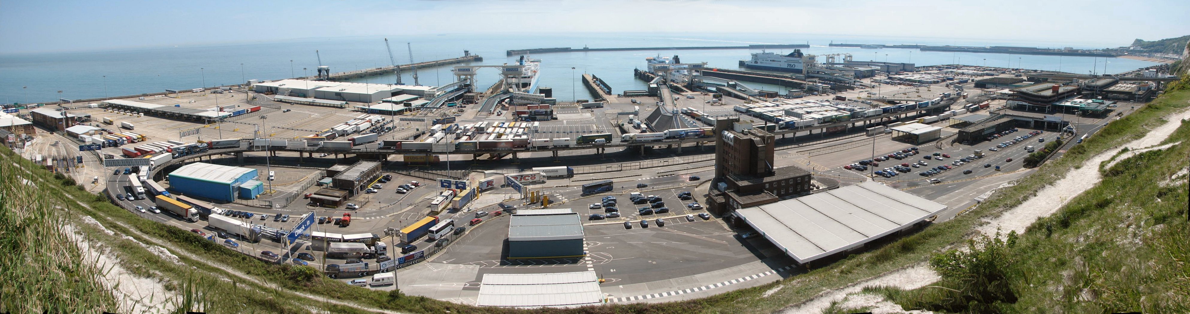
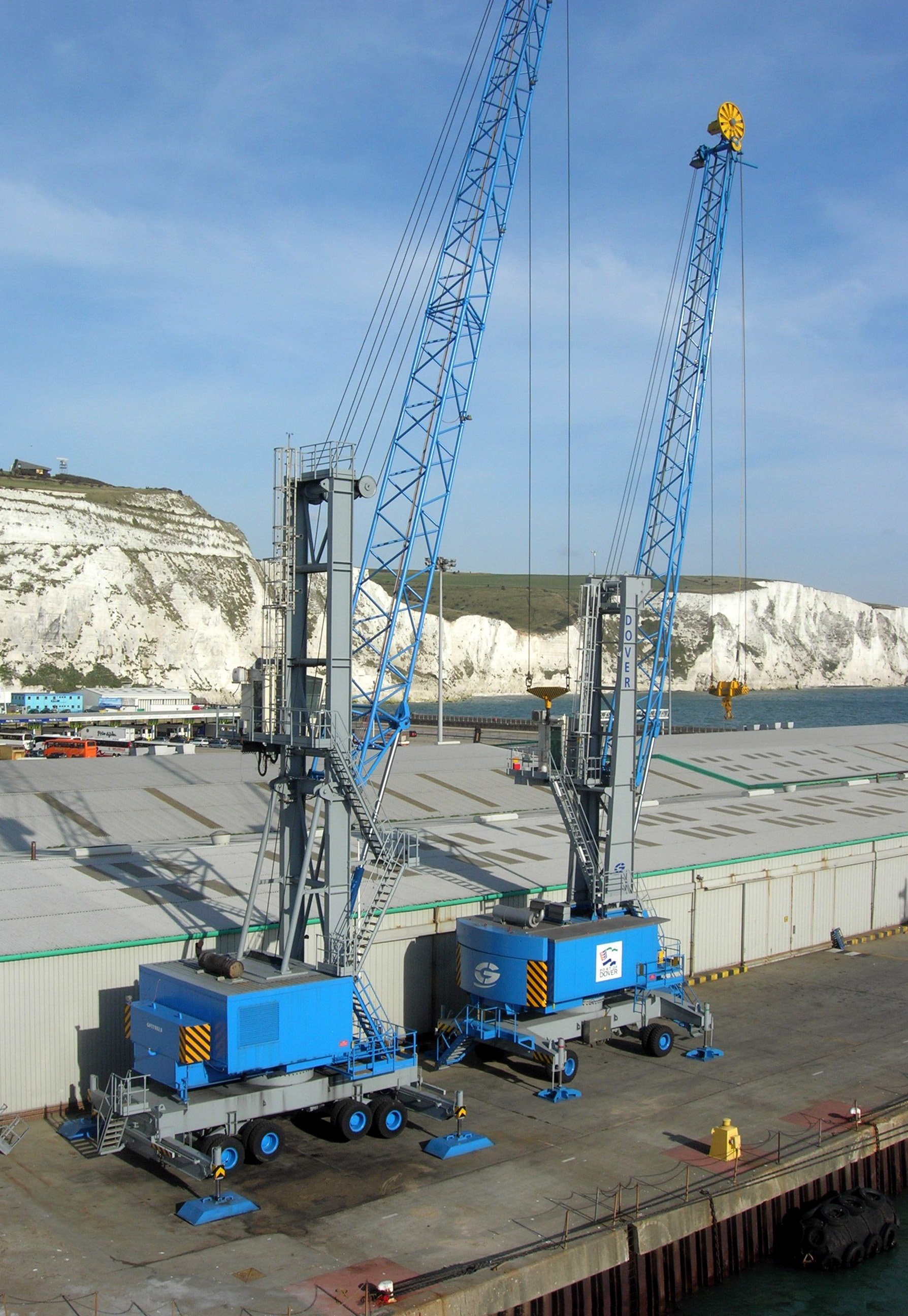
Shipping
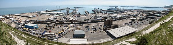
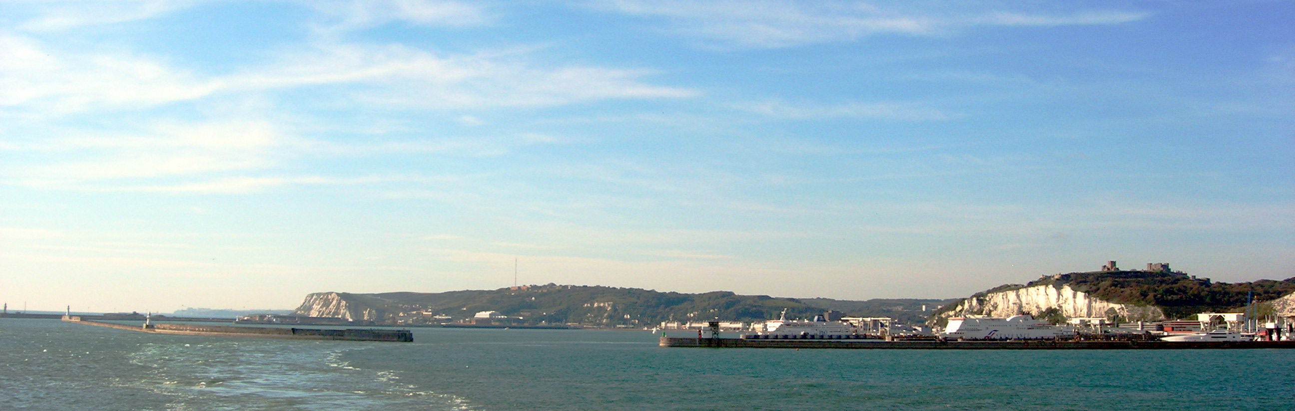
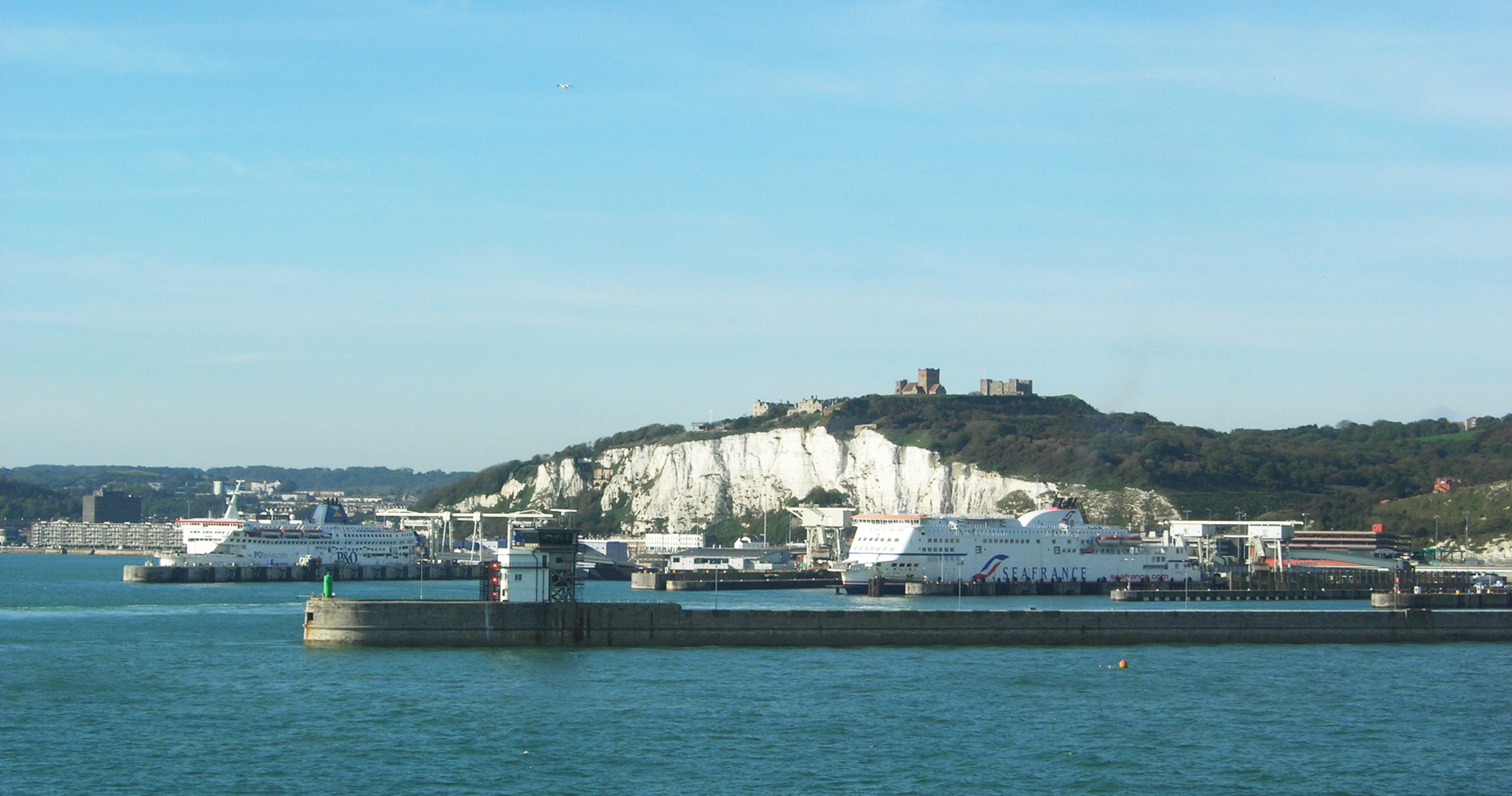
 The Port of Dover and the white cliffs of Dover
The Dover Harbour Board[7] is the responsible authority for the running of the Port of Dover. The English Channel, here at its narrowest point in the Straits of Dover, is the busiest shipping lane in the world. Ferries crossing between here and the Continent have to negotiate their way through the constant stream of shipping crossing their path. The Dover Strait Traffic Separation Scheme allots ships separate lanes when passing through the Strait. The Scheme is controlled by the Channel Navigation Information Service based at Maritime Rescue Co-ordination Centre Dover. MRCC Dover is also charged with co-ordination of civil maritime search and rescue within these waters.[8]
The Port of Dover is also used by cruise ship passengers, and the old Dover Marine railway station building, together with a newly built one[clarification needed], cater for those passengers.[9]
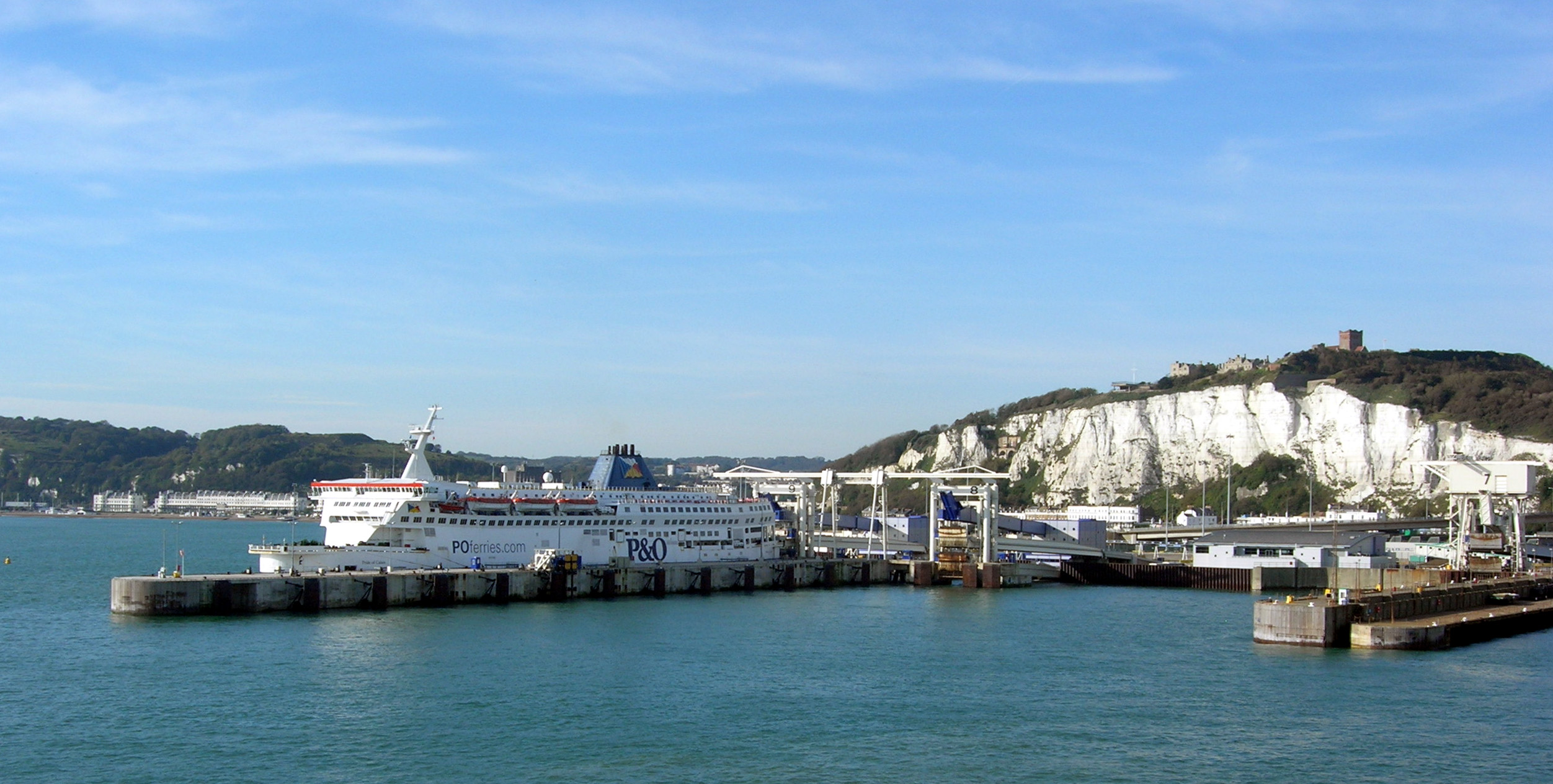
The ferry lines using the port are (number of daily sailings in parentheses):
- to Calais: P&O Ferries (25) and Sea France (20);
- to Dunkerque: DFDS Seaways (previously Norfolkline) (11).
These services have been cut in recent years:
- P&O Ferries sailings to Boulogne (5 daily) were withdrawn in 1993 and Zeebrugge (4 daily) in 2002.
- SNCF withdrew their three train ferry sailings on the opening of the Channel Tunnel.
- Regie voor Maritiem Transport[10][11] moved their Ostend service of three sailings daily to Ramsgate in 1994; the route now operates as TransEuropa Ferries
- Stena Line merged their 20 Calais sailings into the current P&O operation in 1998.
- Hoverspeed ceased operations in 2005 and withdrew their 8 daily sailings.
- SpeedFerries ceased operations in 2008 and withdrew their 5 daily sailings.
- LD Lines ceased the Dover-Dieppe service on 29 June 2009 and Dover-Boulogne 5 September 2010.
The Dover lifeboat is a Severn class lifeboat based in the Western Docks.[12]
Transport
Dover’s main communications artery, the A2 road replicates two former routes, connecting the town with Canterbury. The Roman road was followed for centuries until, in the late 18th century, it became a toll road. Stagecoaches were operating: one description stated that the journey took all day to reach London, from 4am to being “in time for supper”.[13]
The other main roads, travelling west and east, are the A20 to Folkestone and thence to London and the A258 through Deal to Sandwich.
The railway reached Dover from two directions: the South Eastern Railway's main line connected with Folkestone in 1844, and the London, Chatham and Dover Railway opened its line from Canterbury in 1861. A tram system operated in the town from 1897 to 1936.
Dover has two long distance footpaths: the Saxon Shore Way and the North Downs Way. Two National Cycle Network routes begin their journey at the town.
Also, the ferry to Calais is a popular transport. From Dover to Calais it usually take one and a half hours to cross the Strait of Dover. The Strait of Dover is the stretch of water between Dover and Calais, and also the stretch of water the Dover-Calais and Calais-Dover ferries cross.
RNLI
Dover Lifeboat station is based at crosswall quay in Dover Habour. There is a Severn class lifeboat, which is the biggest in the fleet. It belongs to the RNLI which covers all of Great Britain. The lifeboat number is 17-09 and has a lot of emergencies in the Channel. The Severn class is designed to lay afloat. Built from fibre reinforced composite (FRC) the boat is lightweight yet very strong and is designed to right itself in the event of a capsize. There is also a coastguard station in Dover. Based on the top of the white cliffs it has a great over view.
Education
Further information: List of schools in KentThere are nine secondary level schools, 16 primary schools and two schools for special education.
Several of the state secondary schools now specialise: Astor College for the Arts; Dover Grammar School for Girls is a specialist Humanities College; Dover Grammar School for Boys, a Business and Enterprise College; St Edmund's Catholic College for the Performing Arts; and Dover Christ Church Academy, a specialist Maths, ICT and Music Academy.
The Duke of York's Royal Military School, England's only military boarding school for children of service personnel (co-ed ages 11–18), is also located in Dover, next to the military base.
Dover College, a public school was founded in 1871 by a group of local business men.[14]
Public services
Dover has one hospital, Buckland Hospital[15] located in a former Victorian workhouse on Coombe Valley Road. The town once had four hospitals, Buckland, Royal Victoria, Isolation and the Eye Hospitals located at various points across the town. Buckland Hospital is currently (2008) threatened with closure and various local organisations are trying to stop the cuts facing the hospital.[16]
Local media
Television
Dover was the home to television studios and production offices of Southern Television Ltd, the company which operated the ITV franchise for South and South East England from 1958-1981. The studios were located on Russell Street and were home to programmes like 'Scene South East', 'Scene Midweek', 'Southern News', 'Farm Progress' and the nightly epilogue, 'Guideline'. The studios were operated by TVS in 1982 and home to 'Coast to Coast', however they closed a year later when the company moved their operations to the newly complete Television Centre in Maidstone.
Newspapers
Dover has two paid for newspapers, the Dover Express (published by Kent Regional News and Media) and the Dover Mercury (published by the KM Group). Free newspapers for the town include the Dover and Deal Extra, part of the KM Group; and yourdover, part of KOS Media.
Radio
Dover has one local commercial radio station, KMFM Shepway and White Cliffs Country, broadcasting to Dover on 106.8FM. The station was founded in Dover as Neptune Radio in September 1997 but moved to Folkestone in 2003 and was consequently rebranded after a takeover by the KM Group. Dover is also served by the county-wide stations Heart, Gold and BBC Radio Kent.
The Gateway Hospital Broadcasting Service, in Buckland Hospital radio, closed at the end of 2006. It was the oldest hospital radio station in East Kent being founded in 1968.[17]
Dover Community Radio (DCR) currently offer podcasts on local events and organisations on their website. They are also launching an online community radio station via their website for the town and district on March 28, 2011.[18]
Culture
There are three museums: the main Dover Museum,[19] the Dover Transport Museum,[20] and the Roman Painted House.[21]
Dover has three twin towns:
 Calais, France
 Huber Heights, Ohio, USA
 Split, Croatia
Sports
The Vista Leisure Centre,[22] catering for a wide range of sports and activities, is on Townwall Street. There are sports clubs catering for the usual range of sports, among them football (Dover Athletic F.C.); rugby; rowing; swimming; water polo and netball (Dover and District Netball League).[23]
One event which gets media attention is that of swimming the English Channel.[24]
Sea fishing, from the beach, pier or out at sea, is carried out here.[25] The so-called Dover sole (solea solea) is found all over European waters.
Places of interest
- Blériot memorial: the outline of Blériot's aircraft marked with granite setts at the exact spot where Blériot landed after the first cross-Channel flight, 1909[26]
- Connaught Park
- Cowgate Nature Reserve
- Dover Castle
- Dover Museum
- Kearsney Abbey
- Russell Gardens
- Samphire Hoe Country Park
- Seafront promenade
- South Foreland Lighthouse
- St Edmund's Chapel
- Dover Transport Museum
- Roman Painted House Museum
Notable people
Further information: List of people from DoverGallery
 Dover Harbour, from the cliffs above.
References
http://en.wikipedia.org/wiki/Strait_of_Dover
Notes
- ^ The French name for the Strait is La Manche
- ^ "Liste des noms français de toponymes britanniques - Wikipédia" (in (French)). Fr.wikipedia.org. 2010-04-03. http://fr.wikipedia.org/wiki/Liste_des_noms_fran%C3%A7ais_de_toponymes_britanniques. Retrieved 2010-04-18.
- ^ "Eosnap.com". Eosnap.com. http://www.eosnap.com/?tag=strait-of-dover. Retrieved 2011-08-26.
- ^ "Dover monthly weather". http://www.weather.com/weather/climatology/monthly/UKXX0042?x=0&y=0.
- ^ "Hasted description of Dover". British-history.ac.uk. 1998-01-29. http://www.british-history.ac.uk/report.aspx?compid=63592. Retrieved 2011-08-26.
- ^ "KS01 Usual resident population: Census 2001, Key Statistics for urban areas". National Statistics. http://www.statistics.gov.uk/statbase/ssdataset.asp?vlnk=8271&More=Y. Retrieved 2007-06-08.
- ^ "Dover Harbour Board". Doverport.co.uk. http://www.doverport.co.uk. Retrieved 2011-08-26.
- ^ "The Dover Strait Traffic Navigation Scheme and rules relating thereto". Mcga.gov.uk. http://www.mcga.gov.uk/c4mca/mcga-hmcg_rescue/channel_navigation_information_service__cnis_/dops_-_all-sar_cnis_unorthodox_crossings.htm. Retrieved 2011-08-26.
- ^ "Dover Cruise ship terminal". Europeforvisitors.com. http://europeforvisitors.com/cruises/reviews/port-of-dover.htm. Retrieved 2011-08-26.
- ^ Ostende ferry[dead link]
- ^ "Telenet.be". Users.telenet.be. 1996-09-19. http://users.telenet.be/eddy.lannoo/intro_rmt.htm. Retrieved 2011-08-26.
- ^ "The Dover lifeboat". The Dover lifeboat. 2011-08-07. http://www.dover-lifeboat.org.uk. Retrieved 2011-08-26.
- ^ "From ''The Life of Thomas Telford''". Worldwideschool.org. http://www.worldwideschool.org/library/books/hst/biography/TheLifeofThomasTelford/chap5.html. Retrieved 2011-08-26.
- ^ "Dover College". Dover College. http://dovercollege.org.uk. Retrieved 2011-08-26.
- ^ Buckland Hospital
- ^ "Stopping the hospital cuts". BBC News. 2007-05-18. http://news.bbc.co.uk/1/hi/england/kent/6670107.stm. Retrieved 2011-08-26.
- ^ GHBS closure
- ^ "Dover Community Radio Website". Dovercommunityradio.co.uk. 2011-07-31. http://www.dovercommunityradio.co.uk. Retrieved 2011-08-26.
- ^ "Dover Museum website". Dover.gov.uk. http://www.dover.gov.uk/museum/. Retrieved 2011-08-26.
- ^ "Dover Transport Museum". Dovertransportmuseum.homestead.com. http://dovertransportmuseum.homestead.com/. Retrieved 2011-08-26.
- ^ "The Roman Painted House, Dover- Homepage". Theromanpaintedhouse.co.uk. http://www.theromanpaintedhouse.co.uk/. Retrieved 2011-08-26.
- ^ "Vista Leisure Centre". Vistaleisure.com. http://www.vistaleisure.com/dover-home.aspx. Retrieved 2011-08-26.
- ^ "Netaball league". Doveranddistrictnetballleague.co.uk. http://doveranddistrictnetballleague.co.uk. Retrieved 2011-08-26.
- ^ Whyte Studio. "Channel Swimming". Dover.uk.com. http://www.dover.uk.com/channelswimming. Retrieved 2011-08-26.
- ^ "Sea Fishing". Doverpages.co.uk. http://www.doverpages.co.uk/sea_fishing_dover/sea_fishing_dover.htm. Retrieved 2011-08-26.
- ^ "Dover Aeroplane". Hows.org.uk. http://www.hows.org.uk/personal/hillfigs/dover/dover.htm. Retrieved 2010-04-18.
Bibliography
- Statham, S.P.H. (1899). The history of the castle, town, and port of Dover. London: Longmans Green & Co.. pp. 462 p..
- Foot, William (2006). Beaches, fields, streets, and hills ...: the anti-invasion landscapes of England, 1940. CBA research report 144. York: Council for British Archaeology. ISBN 1-902771-53-2.
External links
- Official site
- Dover Latest News
- Dover Street Map
- The Dover War Memorial Project
- Dover Locals
- Dover Soul Local Community Website
- Western Heights Preservation Society
- Friends of Dover Castle A scheme for the local people of Dover to contribute and benefit from their Castle.
- Dover Community Radio Dover District's podcasting service, an online radio service for the town and surrounding area.
Categories:- Cinque ports
- Populated coastal places in Kent
- Dover (district)
- Dover, Kent
- Towns in Kent
- France–United Kingdom border crossings


Wikimedia Foundation. 2010.