- Copeland (borough)
-
For the constituency of the same name, see Copeland (UK Parliament constituency).
Coordinates: 54°25′52″N 3°23′20″W / 54.431°N 3.389°W
Borough of Copeland — Borough — 
Arms of Copeland Borough CouncilShown within Cumbria
Sovereign state United Kingdom Constituent country England Region North West England Ceremonial county Cumbria Founded Admin. HQ Whitehaven Government – Type Copeland Borough Council – Leadership: Leader & Cabinet – Executive: Labour – MPs: Jamie Reed Area – Total 282.5 sq mi (731.7 km2) Area rank 50th Population (2010 est.) – Total 69,500 – Rank Ranked 301st – Density 246/sq mi (95/km2) Time zone Greenwich Mean Time (UTC+0) – Summer (DST) British Summer Time (UTC+1) Postcode ISO 3166-2 ONS code 16UE OS grid reference NUTS 3 Ethnicity 99.3% White Website copeland.gov.uk Copeland is a local government district and borough in western Cumbria, England. Its council is based in Whitehaven. It was formed on 1 April 1974 by the merger of the borough of Whitehaven, Ennerdale Rural District and Millom Rural District.
The name is derived from an alternate name for the Cumberland ward of Allerdale above Derwent, which covered roughly the same area.
Different explanations exist for the name. According to a document issued at the time of the borough's grant of arms, the name Copeland is derived from kaupland or bought land, the area of the Forest having been bought from the estate of St Bees Priory.[1]
Angus Winchester (1985) upholds that the name kaupland derives from the Irish-Norse invasion of the area in the tenth century (Wainwright 1975). According to this explanation, the area was purchased from the Kingdom of Strathclyde, possibly with loot from Ireland. Geoffrey Hodgson (2008) argues that this Viking invasion accounts for the high frequency of the Hodgson surname in the area.
Governance
See also: Copeland local electionsElections to the borough council are held every four years, with currently 51 councillors being elected at each election. Since the first election in 1973 the council has been under Labour control, apart from between 1976 and 1979 when it was under no overall control. As of the 2011 election the council is composed of the following councillors:-[2]
Party Councillors Labour Party 34 Conservative Party 15 Independent 2 References
- ^ Arms of Copeland Borough Council, document issued at time of grant of arms
- ^ "England council elections". BBC News Online. http://www.bbc.co.uk/news/special/election2011/council/html/16ue.stm. Retrieved 25 July 2011.
- Hodgson, Geoffrey M. (2008) Hodgson Saga, second edition (Standon, Hertfordshire: Martlet Books).
- Wainwright, F. T. (1975) Scandinavian England: Collected Papers (Chichester: Phillimore).
- Winchester, Angus J. L. (1985) 'The Multiple Estate: A Framework for the Evolution of Settlement in Anglo-Saxon and Scandinavian Cumbria', in Baldwin, John R. and Whyte, Ian D. (eds) (1985) The Scandinavians in Cumbria (Edinburgh: The Scottish Society for Northern Studies), pp. 89–101.
 Districts of North West England
Cheshire 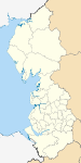
Cumbria Allerdale • Barrow-in-Furness • Carlisle • Copeland • Eden • South Lakeland
Greater Manchester Lancashire Blackburn with Darwen • Blackpool • Burnley • Chorley • Fylde • Hyndburn • Lancaster • Pendle • Preston • Ribble Valley • Rossendale • South Ribble • West Lancashire • Wyre
Merseyside Ceremonial county of Cumbria Boroughs or districts - City of Carlisle
- Borough of Allerdale
- Borough of Barrow-in-Furness
- Borough of Copeland
- District of Eden
- District of South Lakeland
Major settlements - Alston
- Ambleside
- Appleby-in-Westmorland
- Aspatria
- Barrow-in-Furness
- Bowness-on-Windermere
- Brampton
- Broughton-in-Furness
- Carlisle
- Cleator Moor
- Cockermouth
- Dalton-in-Furness
- Egremont
- Grange-over-Sands
- Harrington
- Kendal
- Keswick
- Kirkby Lonsdale
- Kirkby Stephen
- Longtown
- Maryport
- Millom
- Penrith
- Sedbergh
- Silloth
- Ulverston
- Whitehaven
- Wigton
- Windermere
- Workington
See also: List of civil parishes in Cumbria
Topics Categories:- Local government in Cumbria
- Copeland
- Non-metropolitan districts of Cumbria
- Local government districts of North West England


Wikimedia Foundation. 2010.