- Oakleigh Park
-
Coordinates: 51°37′34″N 0°10′18″W / 51.6260°N 0.1716°W
Oakleigh Park 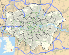
 Oakleigh Park
Oakleigh Park shown within Greater LondonOS grid reference TQ265935 London borough Barnet Ceremonial county Greater London Region London Country England Sovereign state United Kingdom Post town LONDON Postcode district N20, EN5 Dialling code 020 Police Metropolitan Fire London Ambulance London EU Parliament London UK Parliament Chipping Barnet London Assembly Barnet and Camden List of places: UK • England • London Oakleigh Park is a loosely defined area in the north of the London Borough of Barnet. It adjoins Whetstone, and is often regarded either as part of that or of East Barnet. However it has its own identity and its own railway station.
The principal road is Oakleigh Road North. Turnings off this road include Oakleigh Park North, Oakleigh Avenue and Oakleigh Park South. There is also a small shopping parade on Netherlands Road just to the north of the railway station. The name is a relatively modern invention, the station being called that when it opened in 1873.
Contents
Geography
Neighbouring areas 
High Barnet New Barnet East Barnet Whetstone 
Osidge  Oakleigh Park

North Finchley Friern Barnet Brunswick Park Transport links
Bus
Transport for London bus route 383 stops directly outside Oakleigh Park railway station, as well as operating a Hail and Ride service along Netherlands Road and Oakleigh Park North/Athenaeum Road. Buses run towards Barnet (the Spires) or towards Woodside Park tube station, every 30 minutes Mondays to Saturdays except late evenings. There is currently no service on this route on Sundays or public holidays.
Railway station
Tube station
Nearby:
Schools
Primary
- All Saints
- Sacred Heart
The Betjeman connection
In John Betjeman’s poem, ‘The Outer Suburbs’ (1932), there is a reference to Oakleigh Park as ‘Oakley Park’: ‘The weary walk from Oakley Park/Through the soft suburban dark’. This is not a spelling that occurs elsewhere, but may be personal idiosyncrasy, rather than a simple mistake, given that Betjeman was, at the time, a schoolmaster in the area. (It could possibly be childhood association. The Betjemans became acquainted with a family called Oakley during holidays in Cornwall.[1] The person universally associated with that name – the American sharp-shooter, Annie Oakley, who died in 1926 – also spelt her name thus.)
References
Categories:- Districts of London
- Districts of Barnet
- London geography stubs


Wikimedia Foundation. 2010.