- Crab Orchard National Wildlife Refuge
-
Crab Orchard National Wildlife Refuge IUCN Category IV (Habitat/Species Management Area)Map of the U.S. state of Illinois showing the location of Crab Orchard National Wildlife Refuge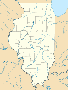

Location Williamson, Jackson, and Union counties, Illinois, USA Nearest city Marion, Illinois Coordinates 37°42′00″N 89°03′33″W / 37.7°N 89.05917°WCoordinates: 37°42′00″N 89°03′33″W / 37.7°N 89.05917°W Area 43,890 acres (177.62 km2) Established 1947 Visitors 1,000,000 Governing body U.S. Fish and Wildlife Service Crab Orchard National Wildlife Refuge is a 43,890 acre (180 km²) National Wildlife Refuge primarily in southwestern Williamson County, but with small extensions into adjacent eastern Jackson and northeastern Union counties of southern Illinois, in the United States. Its land and water contain a wide diversity of flora and fauna. It centers on Crab Orchard Lake. Major habitat types on the refuge include hardwood forest, agricultural land, grazing units, brushland, wetlands, and lakes. Other major bodies of water on the refuge are Devil's Kitchen Lake and Little Grassy Lake.
Description
The refuge provides significant resting areas for migratory birds utilizing the Mississippi Flyway. Wintering numbers of Canada Geese can peak at 200,000. A total of 700 plant species, 245 bird species, 33 mammal species, 63 fish species, and 44 reptile and amphibian species have been documented on the refuge.
The western 24,000 acres (97 km²) of the refuge provide a wide range of recreational opportunities and also include a 4,050 acre (16 km²) wilderness area. The eastern portion, 20,000 acres (81 km²), is a wildlife sanctuary, and public use is limited.
Annual visitation is approximately 1,000,000 visitors. Industrial activities on the refuge range from manufacturing and storage facilities to administrative offices. Many buildings now housing industries were used in the manufacturing of explosives during World War II, and they are still used for military ordnance production today. The concrete igloos built for munition storage are now leased to private industry for storage of many types of products.
Crab Orchard National Wildlife Refuge is managed with four broad objectives: wildlife management, agriculture, recreation, and industry. The primary wildlife management objective is to satisfy the food and resting needs of wintering Canada geese and other wildlife. This objective is coordinated with the agriculture objective through cooperative farming and permittee grazing programs.
Crab Orchard Wilderness
The Crab Orchard Wilderness, a federally listed 4,050-acre (16.4 km2) U.S. wilderness area, occupies the southernmost strip of the National Wildlife Refuge.
External links
Categories:- IUCN Category IV
- Protected areas of Jackson County, Illinois
- National Wildlife Refuges in Illinois
- Protected areas established in 1947
- Protected areas of Union County, Illinois
- Protected areas of Williamson County, Illinois
- Illinois protected area stubs

Wikimedia Foundation. 2010.