- Ard na Caithne
Infobox Irish Place
name = Ard na Caithne
crest
motto =
map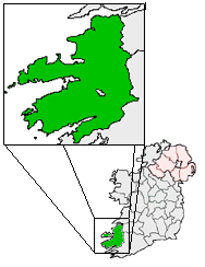
pin coords = left: 16px; top: 59px
north coord = 52.188141
west coord = 10.420532
irish grid = Q347072
area =
elevation =
province =Munster
county =County Kerry
town pop =
rural pop =
census yr =
web =
|Ard na Caithne, meaning height of the
arbutus or strawberry tree, (formerly also known as Smerwick in English, a name which lost all legal standing under the "Placenames Order (Gaeltacht Regions) 2004" ) in the heart of the Kerry Gaeltacht is one of the principal bays of Corca Dhuibhne. It is nestled at the foot ofAn Triúr Deirfiúr and Cnoc Bhréanainn, which at 952 metres is the highest mountain in the Brandon group. Bounded by the villages ofBaile an Fheirtéaraigh ,Baile na nGall and Ard na Caithne itself, the area is what has been known as the Fíor-Ghaeltacht, or trueGaeltacht , in recent decades. Ard na Caithne (old anglicised form Ardnaconnia) was also known in Irish as Iorras Tuaiscirt "north peninsula" and Gall Iorrais "peninsula of the strangers".Early Christian History
Ard na Caithne has a significant place in both the history of south-west Munster and Ireland. The early Christian
Gallarus Oratory andAn Riasc monastic site nearby are central archeological and tourist attractions.Dún an Óir
Dún an Óir, the "Fort of the Gold" is an
Iron age Promontory fort located near the harbour. It was the site of the Siege of Smerwick in 1580.iege of Smerwick
The
Siege of Smerwick , during theDesmond Rebellions , took place at Dún an Óir in1580 is one of the most infamous massacres of theSixteenth Century in Ireland.James Fitzmaurice Fitzgerald landed a smallPapal invasion force in July 1579, initiating theSecond Desmond Rebellion , but was killed only a month afterward.The landing did provoke a war that lasted for three years. In September 1580, another expeditionary force of 600 - mostly Italian -troops landed at Smerwick to aid the rebels, and were garrisoned at Dún an Óir, a fort that they constructed from earth in the new Italian style. Within days their ships had been seized by an English naval force under the command of William Winter. At the same time, crown forces under the lord deputy, Arthur, Baron Grey de Wilton, and the Earl of Ormond prevented rebel Geraldine forces from linking up with the landing force. Grey prosecuted the siege with a bombardment of heavy naval cannon, and after two days the Italian commander, Bastiano di San Giuseppi, surrendered without condition. Grey took away the troops' armour and weapons, penned them inside the fort, and "fell straight to execution. There were 600 slain".
Most of the prisoners were beheaded in a nearby field over two days, including women and children, and it appears that many of the bodies were thrown in the sea. Today that field is known in the locality as "Gort a Ghearradh" (the Field of the Cutting) while the field where the heads were buried bears the name "Gort na gCeann" (the Field of the Heads). In the early years of the
21st Century many skeletons have been revealed with the effect of coastal erosion [ [http://www.timesonline.co.uk/article/0,,2-1072220,00.html "Massacre victims from Raleigh's time return to haunt Irish shore"] ]Ard na Caithne Harbour
The harbour, where Fitzmaurice's invasion force landed, was also the landfall of the returning transatlantic expedition of
Walter Raleigh in 1587. Raleigh knew the area well and had been a member of the English forces, but military records of the time indicate that Raleigh did not participate in the massacre and was at headquarters inTipperary when it took place.Piaras Feiritéar
In the nearby
Caisleán Feiritéar lived the famous seventeenth century poet and Hiberno-Norman lord,Piaras Feiritéar . Feiritéar's life was anything but uninteresting and in both his poetry and actions he won enormous support and honour from his community. He was executed at the hands of theCromwellian s in Killarney in 1653, following theCromwellian conquest of Ireland , for his part in theIrish Rebellion of 1641 . His death brought great sorrow upon the region. He remains a folk hero in the local community today.References
ee also
* List of abbeys and priories in the Republic of Ireland (County Kerry)
External links
* [http://www.irelandscape.com/display_location.php?location_id=1036 Entry on Irelandscape Web Site]
Wikimedia Foundation. 2010.