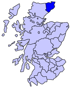
- Caithness
-
County of Caithness
until circa 1890Missing map County of Caithness
circa 1890 to 1975Missing map Caithness District
1975 to 1996
Highland council area
1996 to presentCaithness (Scots: Caitnes,[1] Scottish Gaelic: Gallaibh) is a registration county, lieutenancy area and historic local government area of Scotland. The name was used also for the earldom of Caithness and the Caithness constituency of the Parliament of the United Kingdom (1708 to 1918). Boundaries are not identical in all contexts, but the Caithness area is now entirely within the Highland council area. In 2007 the Highland Council, which is now the local government authority, created the Caithness ward management area, which has boundaries similar to those of the historic local government area.
Contents
Origins and civic history
Caithness originally formed part of the shire or sheriffdom of Inverness, but gradually gained independence: in 1455 the Earl of Caithness gained a grant of the justiciary and sheriffdom of the area from the Sheriff of Inverness. In 1503 an act of the Parliament of Scotland confirmed the separate jurisdiction, with Dornoch and Wick named as burghs in which the sheriff of Caithness was to hold courts. The area of the sheriffdom was declared to be identical to that of the Diocese of Caithness. The Sheriff of Inverness still retained power over important legal cases, however until 1641. In that year parliament declared Wick the head burgh of the shire of Caithness and the Earl of Caithness became the heritable sheriff.[2] Following the Act of Union of 1707 the term "county" began to be applied to the shire, a process that was completed with the abolition of heritable jurisdictions in 1747.[3][4] The county began to be used as a unit of local administration, and in 1890 was given an elected county council under the Local Government (Scotland) Act 1889. Although officially within the county, the burghs of Wick and Thurso retained their status as autonomous local government areas. Wick, a royal burgh and traditionally the county town, became the administrative centre for the county. County and burgh councils were later abolished, in 1975, under the Local Government (Scotland) Act 1973, and Caithness became one of eight districts, each with its own district council, within the new two-tier Highland region. In 1996, under the Local Government etc (Scotland) Act 1994, the region became a unitary local government area, and the district councils were abolished.
Boundaries, settlements and communications
As registration county, lieutenancy area and historic local government area, Caithness has a land boundary with the equally historic local government area of Sutherland. Otherwise it is bounded by sea. The land boundary follows a watershed and is crossed by two roads, the A9 and the A836, and one railway, the Far North Line. Across the Pentland Firth ferries link Caithness with Orkney, and Caithness has also an airport at Wick. The Pentland Firth island of Stroma is within Caithness.
In 2001 Caithness had a resident population of 23,866 and settlement centres include those of Berriedale, Burnside, Castletown, Dunnet, Halkirk, Haster, Reiss, John o' Groats, Latheron, Gillock, Mey, Reay, Sibster, Thurso, Watten and Wick.[5]
Toponymy
The Cait element of Caithness is Pictish or Goidelic in origin but the origin of Caithness is Norse or Norn, and may be read as meaning Horn (or Nose) of Cait. The Gaelic name, Gallaibh, means among the foreigners (the Norse). The Cait element of Caithness is represented as Cat in Cataibh, the Gaelic name for Sutherland, and as Cait in Na h-Innse Cait, the Old Irish for Shetland. The Kingdom of Cait was one of the seven Pictish kingdoms in Alba and is believed to have been in the area of Caithness and Sutherland.
Geography
Caithness extends about 30 miles (50 kilometres) north-south and about 30 miles (50 km) east-west, with an area of about 712 square miles (1844 km²). The topography is flat, in contrast to the majority of the remainder of the North of Scotland. Until the latter part of the 20th century when large areas were planted in conifers, this level profile was rendered still more striking by the almost total absence of forest.
 Caithness landscape, looking towards Halkirk from Beinn Freiceadain
The underlying geology of most of Caithness is old red sandstone to an estimated depth of over 4,000 metres. This consists of the cemented sediments of Lake Orcadie, which is believed to have stretched from Shetland to Grampian during the Devonian period, about 370 million years ago. Fossilised fish and plant remains are found between the layers of sediment. Older metamorphic (granite) rock is apparent in the Scaraben and Ord area, in the relatively high southwest area of the county. Caithness' highest point (Morven)[5] is in this area.
Because of the ease with which the sandstone splits to form large flat slabs (flagstone) it is an especially useful building material, and has been used as such since Neolithic times.
Caithness is a land of open, rolling farmland, moorland and scattered settlements. The area is fringed to the north and east by dramatic coastal scenery and is home to large, internationally important colonies of seabirds. The surrounding waters of the Pentland Firth and the North Sea hold a great diversity of marine life. Away from the coast, the landscape is dominated by open moorland and blanket bog known as the Flow Country which is the largest expanse of blanket bog in Europe, extending into Sutherland. This is divided up along the straths (river valleys) by more fertile farm and croft land.
History
The Caithness landscape is rich with the remains of pre-historic occupation. These include the Grey Cairns of Camster, the Stone Lud, the Hill O Many Stanes, a complex of sites around Loch Yarrows and over 100 brochs. A prehistoric souterrain structure at Caithness has been likened to discoveries at Midgarth and on Shapinsay.[6] Numerous coastal castles (now mostly ruins) are Norse in their foundations.[7] When the Norsemen arrived, probably in the 10th century, the county was probably Pictish[citation needed], but with its culture subject to some Goidelic influence from the Celtic Church. The name Pentland Firth can be read as meaning Pictland Fjord.
Numerous bands of Norse settlers landed in the county, and gradually established themselves around the coast. On the Latheron (south) side, they extended their settlements as far as Berriedale. Many of the names of places, and not a few of the surnames in the lowland parts of the county, are Norse in origin.[citation needed]
For a long time sovereignty over Caithness was disputed between Scotland and the Norwegian Earldom of Orkney. Circa 1196, Earl Harald Maddadsson agreed to pay a monetary tribute for Caithness to William I. Norway has recognized Caithness as fully Scottish since the Treaty of Perth in 1266.
Language
At the beginning of recorded history Caithness was inhabited by the Picts, whose language Pictish is thought to have been related to the Brythonic languages spoken by the Britons to the south. The Norn language was introduced to Caithness, Orkney and Shetland by the Norse occupation which is generally proposed to be c. AD 800.[8] Although little is known of that Norn dialect, some of this linguistic influence still exists in some parts of the county, particularly in place names. Norn continued to be spoken in Caithness until perhaps the fifteenth century[9] and lingered until the late 18th century in the Northern Isles. Gaelic speakers seem to first figure in the early stage of the Scandinavian colonisation of Caithness, gradually increasing in numerical significance from the 12th century onwards.[10] Gaelic has survived, in a limited form, in the far west of the county.[11] Scots, often referred to as English, began supplanting Norn in the early 14th century at the time of the Wars of Scottish Independence.[12] The emergent Northern Scots dialect became influenced by both Gaelic and Norn,[13] and is generally spoken in the lowlying land to the east of a line drawn from Clyth Ness to some 4 miles west of Thurso.[14] The dialect of Scots spoken the neighbourhood of John o' Groats resembles that of Orkney to some extent. Since the 17th century Standard Scottish English has increaingly been replacing both Gaelic and Scots.
It is unfortunate that, apparently, records do not exist until 1706 to show what languages were spoken but, by that time, “[I]f ye suppose a Parallel to the hypotenuse drawn from Week to Thurso, these on the Eastside of it speak most part English, and those on the Westside Irish; and the last have Ministers to preach to them in both languages.
Similarly, it is stated at that time that there were "Seven parishes [out of 10 or 11] in [the Presbytery of] Caithness where the Irish language is used."[15]
The bilingual road sign policy of Highland Region Council has led to some controversy in the region.[16]
In that context, Gaelic is sometimes erroneously claimed to have never been spoken in Caithness; the Gaelic name for the region, Gallaibh, translates as "Land of the Gall (non-Gaels)" - a name which reflects historic Norse rule - but this is a result of language shift to Scots[17][18][19][20][21][22] then towards Standard Scottish English within recent centuries.[11]
As previously indicated, the language mix or boundary changed over time, but the New Statistical Record in 1841 says,
- "On the eastern side of [the Burn of East Clyth] scarcely a word of Gaelic was either spoken or understood, and on the west side, English suffered the same fate".
Other quotes:-
"There are Seven parishes in [the Presbytery of] Caithness where the Irish language is used, viz. Thurso, Halkrig [Halkirk], Rhae [Reay], Lathrone [Latheron], Ffar [Farr], Week [Wick], Duirness [Durness]. But the people of Week understand English also." (Presbytery of Caithness, 1706)[15]
"A presbytery minute of 1727 says of 1,600 people who had 'come of age', 1500 could speak Gaelic only, and a mere five could read. Gaelic at this time was the principal language in most parishes except Bower, Canisbay, Dunnet and Olrig" (Omand, D. From the Vikings to the Forty-Five, in The Caithness book)
"Persons with a knowledge of Gaelic in the County of Caithness (in 1911) are found to number 1,685, and to constitute 6.7 per cent of the entire population of three years of age and upwards. Of these 1,248 were born in Caithness, 273 in Sutherland, 77 in Ross & Cromarty, and 87 elsewhere.... By an examination of the age distribution of the Gaelic speakers, it is found that only 22 of them are less than 20 years of age." (J. Patten MacDougall, Registrar General, 1912)
Natural heritage
The underlying geology, harsh climate and long history of human occupation have shaped this rich and distinctive natural heritage. Today we see a diverse landscape incorporating both common and rare habitats and species, and Caithness provides a stronghold for many once common breeding species that have undergone serious declines elsewhere, such as waders, water voles and flocks of over-wintering birds.
Many rare mammals, birds and fish have been sighted or caught in and around Caithness waters. Harbour porpoises, dolphins (including Risso's, bottle-nosed, common, Atlantic white-sided and white-beaked dolphins) and minke and long-finned pilot whales are regularly seen from the shore and boats. Both grey and common seals come close to the shore to feed, rest and raise their pups, and otters can be seen close to river mouths in some of the quieter locations.
Local government
See also: Politics of the Highland council areaCounty, burghs and parishes, 1890 to 1975
Caithness received an elected county council in 1890 under the Local Government (Scotland) Act 1889. At that time, two towns within the county, Wick and Thurso, were already well established as autonomous burghs with their own burgh councils. Ten parish councils, covering rural areas of the county were established in 1894.
Wick, a royal burgh, served as the county's administrative centre.
The parish councils were abolished in 1930 under the Local Government (Scotland) Act 1929. The county council and the burgh councils were abolished in 1975 under the Local Government (Scotland) Act 1973. The 1973 act also created a new two tier system, with Caithness as a district within the Highland region.
Parishes
Prior to implementation of the Local Government (Scotland) Act 1889, civil administration parishes were also parishes of the Church of Scotland, and one Caithness parish, Reay, straddled the boundary between the county of Caithness and the county of Sutherland, and another, Thurso had a separate fragment bounded by Reay and Halkirk. For civil administration purposes, implementation of the act redefined parish boundaries, transferring part of Reay to the Sutherland parish of Farr and the fragment of Thurso to the parish of Halkirk.[23]
In the cases of two of the parishes, Thurso and Wick, each includes a burgh with the same name as the parish. For civil administration purposes each of these parishes was divided between the burgh and the landward area of the parish. Landward, in this context, means rural.
Name Notes Bower Has the Stone Lud near its geographic centre Canisbay Includes the village of John O Groats Dunnet Includes the village of Dunnet and Dunnet Head Halkirk Includes the village of Halkirk Latheron Includes the village of Latheron Reay Includes the village of Reay
Was, at one time, partly in the county of SutherlandOlrig Includes the village of Castletown Thurso Landward A rural area around the burgh of Thurso Watten Includes the village of Watten Wick Landward A rural area around the burgh of Wick District, 1975 to 1996
Caithness was a district of the Highland local government region of Scotland from 1975 to 1996. When created, under the Local Government (Scotland) Act 1973, the district included the whole of the county plus Tongue and Farr areas of the neighbouring county of Sutherland. The boundary was soon changed, however, to correspond with that between the counties. Caithness was one of eight districts in the Highland region.
The region was also created in 1975, as one of nine two-tier local government regions of Scotland. Each region consisted of a number of districts and both regions and districts had their own elected councils. The creation of the Highland region and of Caithness as a district involved the abolition of the two burgh councils in Caithness, Wick and Thurso, as well as the Caithness county council.
Wick, which had been the administrative centre for the county, became the administrative centre for the district.
In 1996 local government in Scotland was again reformed, to create 32 unitary council areas. The Highland region became the Highland unitary council area, and the functions of the district councils were absorbed by the Highland Council.
Management area and area committee, 1996 to 2007
In 1996, Caithness and the other seven districts of the Highland region were merged in to the unitary Highland council area, under the Local Government etc (Scotland) Act 1994. The new Highland Council then adopted the former districts as management areas and created a system of area committees to represent the management areas.
Until 1999 the Caithness management and committee areas consisted of 8 out of the 72 Highland Council wards. Each ward elected one councillor by the first past the post system of election.
In 1999, however, ward boundaries were redrawn but management area boundaries were not. As a result area committees were named after and made decisions for areas which they did not exactly represent. The new Caithness committee area, consisting of ten out of the 80 new Highland Council wards, did not include the village of Reay, although that village was within the Caithness management area. For area committee representation the village was within the Sutherland committee area.
New wards were created for elections this year, 2007, polling on 3 May and, as the wards became effective for representational purposes, the Highland Council's management and committee structures were reorganised. The Caithness management area and the Caithness area committee were therefore abolished.
Ward management area, from 2007
In 2007 an area similar to that of the Highland Council's Caithness management area was divided between three new wards electing councillors by the single transferable vote system of election, which is designed to produce a form of proportional representation. One ward elects four councillors. Each of the other two elects three councillors. Also, the council's eight management areas were abolished, in favour of three new corporate management areas, with Caithness becoming a ward management area within the council's new Caithness, Sutherland and Easter Ross operational management area, which covers seven of the council's 22 new wards. The boundaries of the Caithness ward management area are not exactly those of the former Caithness management area, but they do include the village of Reay.
The ward management area is one of five within the corporate management area and consists of three wards, the Landward Caithness ward, the Thurso ward and the Wick ward. Each of the other ward management areas within the corporate management area consists of a single ward.
Community councils, 1975 to present (2008)
Although created under local government legislation (the Local Government (Scotland) Act 1973) community councils have no statutory powers or responsibilities and are not a tier of local government. They are however the most local tier of statutory representation.
Under the 1973 Act, district councils were obliged to implement community council schemes. A Caithness district scheme was adopted in 1975, dividing the area of the district between 12 community councils.
Statutory status for community councils was continued under the Local Government etc (Scotland) Act 1994, and a Caithness scheme is now the responsibility of the Highland Council.
The area of the former district of Caithness is now covered by 12 community council areas which are numbered and described as below in the Highland Council's Scheme for the Establishment of Community Councils in Caithness, October 1997. Current community council names and contact details are given on a Highland Council website.[24]
- 1. Royal Burgh of Wick
- 2. Sinclair's Bay (including Keiss, Reiss and part of Wick)
- 3. Dunnet and Canisbay
- 4. Bower (excluding Gelshfield area)
- 5. Watten (including part of Bower i.e. Gelshfield area)
- 6. Wick south-east, Wick south-west and part of Clyth (i.e. Bruan) (Tannach & District)
- 7. Latheron, Lybster and remainder of Clyth (including Occumster, Roster and Camster)
- 8. Berridale and Dunbeath
- 9. Thurso
- 13. Halkirk south, Halkirk north-east, Halkirk north-west (excluding Lieurary, Forsie and Westfield area)
- 14. Castletown, Olrig, Thurso east (excluding area on west side of Thurso River)
- 15. Caithness West (that part on the west side of Thurso River only), Thurso West, Reay and part of Halkirk north-west (that part comprising Lieurary, Forsie and Westfield area)
Constituency
The Caithness constituency of the House of Commons of the Parliament of Great Britain (1708 to 1801) and the Parliament of the United Kingdom (1801 to 1918) represented essentially the county from 1708 to 1918. At the same time however, the county town of Wick was represented as a component of Tain Burghs until 1832 and of Wick Burghs until 1918.
Between 1708 and 1832 the Caithness constituency was one of the Buteshire and Caithness alternating constituencies: one constituency elected a Member of Parliament (MP) to one parliament and then the other elected an MP to the next. Between 1832 and 1918 it was a separate constituency, electing an MP to every parliament.
In 1918 the Caithness constituency and Wick were merged into the then new constituency of Caithness and Sutherland. In 1997 Caithness and Sutherland was merged into Caithness, Sutherland and Easter Ross.
The Scottish Parliament constituency of Caithness, Sutherland and Easter Ross was created in 1999 and now has boundaries slightly different from those of the House of Commons constituency.
The modern constituencies may be seen as more sub-divisions of the Highland area than as representative of counties (and burghs). For its own purposes, however, the Highland Council uses more conservative sub-divisions, with names which refer back to the era of district councils and, in some cases, county councils.
In the Scottish Parliament Caithness is represented also as part of the Highlands and Islands electoral region.
See also
- Buteshire and Caithness (UK Parliament constituencies) (1708 to 1918)
- Tain Burghs (UK Parliament constituency) (1708 to 1832)
- Wick Burghs (UK Parliament constituency) (1832 to 1918)
- Caithness and Sutherland (UK Parliament constituency) (1918 to 1997)
- Caithness, Sutherland and Easter Ross (UK Parliament constituency) (1997 to present)
- Caithness, Sutherland and Easter Ross (Scottish Parliament constituency) (1999 to present)
Local media
Newspapers
The John O'Groat Journal and The Caithness Courier are weekly newspapers published by Scottish Provincial Press Limited[25] trading as North of Scotland Newspapers[26] and using offices in Union Street, Wick (but with public reception via Cliff Road.) and Olrig Street, Thurso.
News coverage tends to concentrate on the former counties of Caithness and Sutherland. The John O'Groat Journal is normally published on Fridays and The Caithness Courier is normally published on Wednesdays.
Historically, they have been independent newspapers, with the Groat as a Wick-centred paper and the Courier as a Thurso-centred paper. Even now, the Groat is archived in the public library in Wick, while the Courier is similarly archived in the library in Thurso. The Courier was printed, almost by hand, in a small shop in High Street, Thurso until the early 60's by Mr Docherty and his daughter. The Courier traditionally covers that week's sheriff court cases.
Radio
Caithness FM has been broadcasting since 1993. It also has the Orkney Commercial Radio, Superstation Orkney broadcasting from Kirkwall since 2004.[27]
Websites
Various community organisations, including Caithness Arts,[28] Castletown and District Community Council,[29] Castletown Heritage Society,[30] and Dunnet and Canisbay Community Council[31] Caitness Moto Cross Club, maintain their own websites, as do the trusts that run the Castle of Mey[32] and Castle Sinclair Girnigoe.[33]
Watsonian vice-county
Caithness, with the boundaries of the former local government county, is one of the Watsonian vice-counties, subdivisions of Britain and Ireland which are used largely for the purposes of biological recording and other scientific data-gathering.
The vice-counties were introduced by Hewett Cottrell Watson who first used them in the third volume of his Cybele Britannica published in 1852. He refined the system somewhat in later volumes, but the vice-counties remain unchanged by subsequent local government reorganisations, allowing historical and modern data to be more accurately compared. They provide a stable basis for recording using similarly-sized units, and, although grid-based reporting has grown in popularity, they remain a standard in the vast majority of ecological surveys, allowing data collected over long periods of time to be compared easily.
See also
- Counties of Scotland
- Clan Gunn
- Clan Sinclair
- List of pre-1975 counties of Scotland
- Local government in Scotland
- Local government areas of Scotland 1973 to 1996
- Subdivisions of Scotland
- Maiden Paps, Caithness
References
- ^ Scots Language Centre: Scottish Place Names in Scots
- ^ Campbell, H F (1920). Caithness & Sutherland. Cambridge County Geographies. Cambridge: Cambridge University Press. pp. 1–2.
- ^ Whetstone, Ann E.. "The Reform of the Scottish Sheriffdoms in the Eighteenth and Early Nineteenth Centuries". Albion: A Quarterly Journal Concerned with British Studies (The North American Conference on British Studies) 9 (1): 61–71. JSTOR 4048219.
- ^ Whatley, Christopher A (2000). Scottish Society 1707-1820. Manchester University Press. p. 147. ISBN 9780719045400.
- ^ a b Ordnance Survey grid references:
- Towns and villages:
- Topographical features:
- ^ C.Michael Hogan, Castle bloody, The Megalithic Portal, ed. A. Burnham, 2007
- ^ Scholarly essays in J.R. Baldwion and I.D. Whyte, eds. The Viking Age in Caithness, Orkney and the North Atlantic (Edinburgh University Press) 1993, give an overview.
- ^ The Viking age in Caithness, Orkney and the North Atlantic, Edinburgh University Press ISBN 0748604308, page 121
- ^ Jones, Charles (1997). The Edinburgh history of the Scots language. Edinburgh: Edinburgh University Press. p. 394.
- ^ The Viking age in Caithness, Orkney and the North Atlantic, Edinburgh University Press ISBN 0748604308, page 125
- ^ a b http://www.linguae-celticae.org/dateien/Gaelic_1901-2001.ppt
- ^ Mairi Robinson (editor-in-chief), The Concise Scots Dictionary, Aberdeen University Press, 1985 p.x
- ^ McColl Millar. 2007. Northern and Insular Scots. Edinburgh: University Press Ltd. p. 191
- ^ SND Introduction
- ^ a b http://www.bratach.co.uk/bratach/archive/Jun08/jun08_caithness-gaelic.html Caithness of the Gael and the Lowlander[dead link]
- ^ Ross, John (7 March 2008). "War of words over Gaelic road signs". The Scotsman (Edinburgh). http://news.scotsman.com/scotland/War-of-words-over-Gaelic.3854359.jp.
- ^ Jamieson, J.(1808) An Etymological Dictionary of the Scottish Language.
- ^ The New Statistical Account of Scotland (1845) Vol. XV
- ^ Transactions of the Hawick Archaeological Society (1863)
- ^ Murray, James A. H. (1873) The Dialect of the Southern Counties of Scotland, Transactions of the Philological Society, Part II, 1870-72. London-Berlin, Asher & Co.
- ^ Grant, William; Dixon, James Main (1921) Manual of Modern Scots. Cambridge, University Press.
- ^ The Scottish National Dictionary (1929–1976) vol. I
- ^ Boundary changes as described in Boundaries of Counties and Parishes in Scotland, Hay Shennan, 1892
- ^ Community 03 March 2008, Highland Council website, accessed 3 March 2008
- ^ Scottish Provincial Press Limited website
- ^ North of Scotland Newspapers (John O'Groat Journal in association with the Caithness Courier) website, accessed 6 March 2008
- ^ Caithness FM website
- ^ Caithness Arts website, accessed 4 March 2008
- ^ Castletown and District Community Council website
- ^ Castletown Heritage Society website, accessed 6 March 2008
- ^ ,Dunnet and Canisbay Community Council website, accessed 4 March 2008
- ^ Castle of Mey website
- ^ Castle Sinclair Girnigoe
External links
Traditional provinces and districts of Scotland Major districts (former counties, provincial lordships and rural deaneries) The Aird · Annandale · Angus · Argyll · Atholl · Boyne · Buchan · Badenoch · Breadalbane · Caithness · Carrick · Clydesdale (or Strathclyde) · Cowal · Cunningham · Desnes · Eskdale · Farines · Fife · Fothriff · Galloway · Garioch · Garmoran · The Glenkens · Gowrie · Kintyre · Knapdale · Kyle · Lauderdale · Lennox · Liddesdale · Lochaber · Lorn · Lothian · Mar · Mearns · Menteith · Merse · Moray · Nithsdale · The Rhinns · Ross (Easter and Wester) · Stormont · Strathavon · Strathbogie · Strathearn · Strathgryfe · Strathnaver · Strathspey · Sutherland · Teviotdale · Tweeddale
Minor districts Applecross · Appin · Ardgour · Ardmeanach · Ardnamurchan · Assynt · Avondale · Balquhidder · Benderloch · The Black Isle · Braemar · Coigach · Cromar · Cromdale · Douglasdale · Durness · Eddrachilles · Enzie · Ettrickdale · Ewesdale · Formartine · Gairloch · Glen Albyn · Glen Almond · Glen Cassley · Glen Clova · Glen Dochart · Glenelg · Glen Esk · Glengarry · Glen Lethnot · Glen Lyon · Glen Moriston · Glen Orchy · Glen Prosen · Glenshee · Glen Spean · Glen Urquhart · Gruinard · Howe of Fife · Howe of the Mearns · Kintail · Kintyre · Knoydart · Lochalsh · Loch Broom · Locheil · The Machars · Midmar · Moidart · Morar · Morven · Muir of Ord · Rannoch Moor · Rhinns of Kells · Strathallan · Strathardle · Strathbran · Strathbraan · Strathcarron (Forth) · Strathcarron (Oykel) · Strathconon · Strathdearn · Strathdeveron · Strathdee (Deeside) · Strathdon · Strathfarrar · Strath Gartney · Strathglass · Strathisla · Strathmore · Strath of Kildonan · Strath Oykel · Strath Tay · Strathyre · Sunart · Trossachs
Insular districts
For smaller islands, usually districts in their own right, see List of Scottish islandsBorder Areas Former local government counties of Scotland Subdivisions created by the Local Government (Scotland) Act 1889 and abolished by the Local Government (Scotland) Act 1973 Aberdeenshire · Angus · Argyll · Ayrshire · Banffshire · Berwickshire · Bute · Caithness · Clackmannanshire · Dumfriesshire · Dunbartonshire · East Lothian · Fife · Inverness-shire · Kincardineshire · Kinross-shire · Kirkcudbrightshire · Lanarkshire · Midlothian · Moray · Nairnshire · Orkney · Peeblesshire · Perthshire · Renfrewshire · Ross and Cromarty · Roxburghshire · Selkirkshire · Shetland · Stirlingshire · Sutherland · West Lothian · WigtownshireSubdivisions abolished by the Local Government (Scotland) Act 1889 Categories:


Wikimedia Foundation. 2010.