- Vysoké Tatry (town)
-
Vysoké Tatry Town  Skalnaté pleso, part of Vysoké Tatry
 Coat of arms
Country Slovakia Region Prešov District Poprad Elevation 1,010 m (3,314 ft) Coordinates 49°08′51″N 20°13′39″E / 49.1475°N 20.2275°E Area 380.216 km2 (146.802 sq mi) Population 4,718 (2005) Density 12 / km2 (31 / sq mi) Founded 1947 Timezone CET (UTC+1) - summer (DST) CEST (UTC+2) Postal code 062 01 (Starý Smokovec), 059 60 (Tatranská Lomnica), 059 85 (Štrbské Pleso) Area code +421-52 Car plate PP 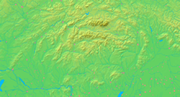

 Location in Slovakia
 Location in the Prešov Region
Wikimedia Commons: Vysoké Tatry (town) Statistics: MOŠ/MIS Website: http://www.vysoketatry.sk Vysoké Tatry (literally, High Tatras), informally Mesto Vysoké Tatry (literally, The Town of High Tatras), is a town at the feet of the Slovak part of High Tatras in Slovakia including all the major resorts in that region. It was created in 1990, and its official name from 1990 to 1999 was Starý Smokovec, which is the name of one of its major settlements.
Contents
Features and statistics
The town of Vysoké Tatry is special in many respects. It is not a true town, but a conglomerate of separate and different settlements (originally separate villages), whose only common feature is that they are the main tourist resorts in the Slovak High Tatras, while being connected through a common railway network (the Tatra Railway). After the country's capital, the town is Slovakia's major tourist destination. On December 31, 2004, it had 4953 inhabitants, excluding tourists. It is located at an altitude of 1,010 m (3,313.65 ft) above sea level. Covering 380,216 km2 (146,802.22 sq mi), it is Slovakia's largest urban area.
The local authority, cultural centre, and main shops are located in the settlement of Starý Smokovec.
Administrative division
 A map of the three originally separate municipalities in this area making up the present-day town
The town consists of three cadastral areas, which consist of 14 settlements:
- Štrbské Pleso (the settlement itself was transferred to the village of Štrba, according to the ruling of the Supreme Court)[1]
- Vyšné Hágy (f. in 1890, 1125 m)
- Podbanské (f. in 1871, 940 m, partly in the village of Pribylina now)
- Starý Smokovec
- Horný Smokovec (950 m)
- Dolný Smokovec (890 m)
- Nový Smokovec (1 000 m)
- Starý Smokovec (founded in 1793, 1 010 m)
- Tatranská Polianka (f. in 1885, 1 005 m)
- Tatranské Zruby (f. in 1923, 995 m)
- Nová Polianka (f. in 1946, 1 060 m)
- Tatranská Lomnica
- Tatranská Lomnica (f. in 1893, 850 m)
- Tatranská Kotlina (f. in 1881, 760 m)
- Tatranská Lesná (f. in 1927, 915 m)
- Kežmarské Žľaby (920 m)
- Tatranské Matliare (f. in the mid-19th century, 885 m)
History
The present-day town was created in 1990 and has a complicated administrative history.
The municipality (that is, not a town) of Vysoké Tatry was created as early as 1947 on the territory of the following formerly distinct municipalities: Batizovce, Huncovce, Folvarky, Gerlachov, Kežmarok, Liptovská Kokava, Mlynica, Nová Lesná, Malý Slavkov, Mengusovce,výbor Vysoké Tatry" - literally, "The United National Committee of High Tatras", 'national committee' being the term then used to designate local authorities in Czechoslovakia).
In 1954, parts of the municipalities Pribylina (the majority of which was returned in 2004), Východná, and Liptovská Kokava were added to Vysoké Tatry. Starý Smokovec was made the seat of the Vysoké Tatry municipality.
In 1960, the Vysoké Tatry municipality ceased to exist and was divided into the following separate municipalities: Starý Smokovec (enhanced with town status), Štrbské Pleso, Tatranská Lomnica, Ždiar, and Štôla. However, since 1964 these municipalities had again a common local authority, although they remained distinct municipalities.
In 1990, three of the above municipalities - Starý Smokovec, Štrbské pleso and Tatranská Lomnica - were merged to create the town of 'Starý Smokovec'(named after the settlement serving as the seat of the authorities). The remaining municipalities - Ždiar and Štôla - are still independent municipalities.
In 1999, the town of 'Starý Smokovec' was renamed 'Vysoké Tatry'.
Demographics
On 31 December 2006, Vysoké Tatry had a population of 4,718. According to the 2001 census, 92.95% of inhabitants were Slovaks, 2.22% Czechs, 0.57% Hungarians, 0.26% Germans, and 0.17% Rusyns.[2] The religious make-up was as follows: 61.96% Roman Catholics, 18.96% people with no religious affiliation, 7.64% Lutherans, and 3.62% Greek Catholics.[2]
Sport
In 1935 and 1970 the area hosted the FIS Nordic World Ski Championships. The area was scheduled to host the 17th Winter Deaflympics, but the event was cancelled because of the lack of readiness by the Slovakian Deaflympic Organizing Committee to host the games.
Notable people
- Ludwig Greiner, identified Gerlachovský Peak as the summit of the Tatras, Carpathians
International relations
See also: List of twin towns and sister cities in SlovakiaTwin towns — Sister cities
Vysoké Tatry is twinned with:
 Košice, Slovakia (since 2006) [3]
 Pardubice, Czech Republic
References
- Notes
- ^ Štrbské Pleso patrí mestu Štrba – newspaper Pravda, 3 May 2007 (in Slovak)
- ^ a b "Municipal Statistics". Statistical Office of the Slovak republic. Archived from the original on 2008-02-08. http://web.archive.org/web/20080208225314/http://www.statistics.sk/mosmis/eng/run.html. Retrieved 2008-02-17.
- ^ "Partnership towns of the City of Košice" (in Slovak). © 2007-2009 City of Košice Magistrát mesta Košice, Tr. SNP 48/A, 040 11 Košice. http://www.kosice.sk/clanok.asp?file=gov_s_c-00.html. Retrieved 2009-07-12.
External links
Poprad · Svit · Vysoké Tatry
Batizovce · Gánovce · Gerlachov · Hozelec · Hôrka · Hranovnica · Jánovce · Kravany · Liptovská Teplička · Lučivná · Mengusovce · Mlynica · Nová Lesná · Spišská Teplica · Spišské Bystré · Spišský Štiavnik · Štôla · Štrba · Šuňava · Švábovce · Tatranská Javorina · Veľký Slavkov · Vernár · Vikartovce · Vydrník · Ždiar Categories:
- Villages and municipalities in Poprad District
- Cities and towns in Slovakia
- Spiš
- High Tatras
- Štrbské Pleso (the settlement itself was transferred to the village of Štrba, according to the ruling of the Supreme Court)[1]


Wikimedia Foundation. 2010.