- Clydebank
-
Coordinates: 55°53′59″N 4°24′02″W / 55.8997°N 4.4006°W
Clydebank Scottish Gaelic: Bruach Chluaidh [1] 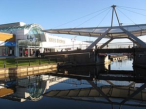
The Clyde Shopping Centre incorporates a bridge over the Forth and Clyde Canal.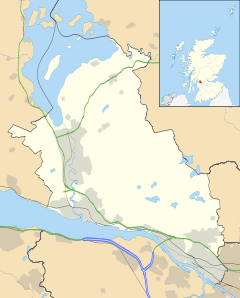
 Clydebank
Clydebank shown within West DunbartonshirePopulation Total Clydebank (sum of 4 localities) Town: 45,210; Locality of Clydebank: 29,858[2] OS grid reference NS500700 Council area West Dunbartonshire Lieutenancy area Dunbartonshire Country Scotland Sovereign state United Kingdom Post town CLYDEBANK Postcode district G81 & G60 Dialling code 0141 & 01389 Police Strathclyde Fire Strathclyde Ambulance Scottish EU Parliament Scotland UK Parliament West Dunbartonshire Scottish Parliament Clydebank and Milngavie West of Scotland List of places: UK • Scotland •  Street scene in Clydebank
Clydebank is a town in West Dunbartonshire, in the Central Lowlands of Scotland. Situated on the north bank of the River Clyde, Clydebank borders Dumbarton, the town with which it was combined to form West Dunbartonshire, as well as the town of Milngavie in East Dunbartonshire, and the Yoker and Drumchapel districts of the adjacent City of Glasgow. Clydebank is part of the registration county of Dumbarton, the Dunbartonshire Crown lieutenancy area, and, for Office of National Statistics purposes, part of the urban area designated as Greater Glasgow.[3] Clydebank was founded as a police burgh on 18 November 1886.
Contents
History
Clydebank is located within the historical boundaries of the ancient Kingdom of Strathclyde, the Mormaerdom of Lennox, and the parish of Old Kilpatrick (12th century), on the north bank of the River Clyde. A long-standing local legend is that the village of Old Kilpatrick derived its name from being the birthplace of Saint Patrick, the patron saint of Ireland.[4] There do not appear to be any historical sources which support this, however.
The town encompasses part of the Antonine Wall, including, at Hardgate/Duntocher, the site of one of the forts built at regular intervals along the wall. In 2008, the Antonine Wall was designated as a World Heritage Site, as part of a multinational Heritage Site encompassing the borders of the Roman Empire.[5]
Before 1870, the area which later became Clydebank was largely rural, and agricultural. It consisted of some villages (Hardgate, Faifley, Duntocher, Dalmuir, Old Kilpatrick), farms and estates, with some small scale mining operations (coal, limestone and whinstone), several cotton mills and some small shipbuilding yards.[4][6]
At the start of the 1870s, however, the growing trade and industry in Glasgow resulted in the Clyde Navigation Trustees needing additional space for shipping quays in Glasgow. They used their statutory powers to compulsorily purchase the area occupied by the Clyde Bank Iron Shipyard in Govan, which belonged to J & G Thomson. Forced to find another site for their shipyard, J & G Thomson looked at various sites further down the River Clyde, and eventually purchased, from the estates of Miss Hamilton of Cochno, some suitably flat land on the "West Barns o'Clyde" on the north bank of the river, opposite the point where the River Cart flows into the River Clyde. The land was situated close to the Forth and Clyde Canal and to the main road running west out Glasgow, and so was conveniently positioned for transporting materials and workers to and from the shipyard. The position opposite the mouth of the River Cart was to also to prove important as the shipyard grew, since it enabled the company to build much bigger, heavier ships than would otherwise have been possible that far up the Clyde. Construction of the new shipyard started on 1 May 1871.[7]
Initially, the company transported workers to and from the shipyard by paddle steamer (passenger steamers were commonly used by people to travel up and down the Clyde well into the second half of the 20th century). However it was not ideal, having to ship workers to and fro all the time, so the company also started building blocks of tenement flats to house the workers. These first blocks of housing became known unofficially as "Tamson's (Thomson's) Buildings", after the name of the company.[7]
Gradually, as the shipyard grew, so did the cluster of buildings grow nearby. More houses, a school, a large shed which served as canteen, community hall and church (known as the "Tarry Kirk"), then finally two proper churches in 1876 and 1877. As the resident population grew, so did the needs and problems associated with a growing population. Other manufacturers and employers moved into the area, and by 1880 approximately 2,000 men were living and working there.[7]
In 1882 a railway line was built running from Glasgow out to the new shipyard (the Glasgow, Yoker and Clydebank Railway). Then, between 1882 and 1884, the Singer Manufacturing Company built a massive sewing machine factory in Kilbowie, less than half a mile north of the Clyde Bank shipyard. More people moved into the area, and finally, in 1886, the local populace petitioned for the creation of a police burgh, on the basis that the area now qualified as a "populous place". The petition was granted, and the new town was named after the shipyard which had given birth to it - Clydebank.[7]
On 13 and 14 March 1941, Luftwaffe bombers attacked various targets in and around Clydebank. In what became known as the Clydebank Blitz, the town itself was seriously damaged as were the local shipyards and armaments factories such as the Dalnottar tank farm and the Singer's Sewing Machine factory.[8] Over the two days 528 civilians were killed and over 617 people were seriously injured.[9]
Geography
Dalmuir, Drumry, Duntocher, Faifley, Hardgate, Kilbowie, Linnvale, Mountblow, Old Kilpatrick, Parkhall, Radnor Park, Town Centre, Whitecrook and a small part of the Yoker district of Glasgow City (sometimes termed Clydebank East).
Duntocher, Hardgate and Faifley are part of Clydebank, however as each was annexed to the town during the existence of the former burgh and district councils, these three areas continue to have fairly strong local identities separate from that of the town. The town exists in the local zeitgeist as comprising the above listed areas, however the former Clydebank District also included the settlement of Bowling, while for statistical purposes the town is divided into several localities; namely Faifley, Duntocher & Hardgate, Old Kilpatrick, and a rump Clydebank.
Politics
In the early 20th century the town was synonymous with the Scottish socialist movements led by the shipyard workers along the river Clyde, giving rise to the title of Red Clydeside.
The 11,000 workers at the largest factory of Singer sewing machines went on strike in March–April 1911, ceasing to work in solidarity of 12 female colleagues protesting against work process reorganization. Following the end of the strike, Singer fired 400 workers, including all strike leaders and purported members of the IWGB, among whom Arthur McManus, who later went on to become the first chairman of the Communist Party of Great Britain between 1920 and 1922.[10]
Labour unrest, in particular by women and unskilled labour, greatly increased between 1910-1914 in Clydeside, with four times more days on strike than between 1900 and 1910. During these four years preceding World War I, membership of those affiliated to the Scottish Trades Union Congress rose from 129,000 in 1909 to 230,000 in 1914.[10]
It is the generally held belief of residents that Clydebank has far more common interests with other urban towns and districts of the Glasgow Settlement or Greater Glasgow city-region than they do with detached northern rural areas of West Dunbartonshire, although this should not be assumed to have ended the town's identifying itself as part of the historical county of Dunbartonshire, which many residents feel is important in maintaining Clydebank's independent identity from the adjacent City of Glasgow. As stated previously the town borders but is not part of the local authority area called the City of Glasgow, although as the boundary falls between neighbouring houses its existence is largely irrelevant in terms of people's use of commercial and leisure facilities, housing, employment and transport. The town is part of a single urban area (officially the Glasgow City Metropolitan Area) with the terms Glasgow and Greater Glasgow often used interchangeably, with context being important to establish meaning as for some Clydebank residents the claiming of the town as part of the City of Glasgow could be a sensitive issue. This Glasgow City Metropolitan Area includes places falling within the limits of the following local authorities: West Dunbartonshire (Clydebank), all of East Dunbartonshire, North Lanarkshire, South Lanarkshire, Renfrewshire, all of East Renfrewshire and all of the City of Glasgow. These areas form a single health service area, NHS Greater Glasgow and Clyde. Like these areas, most of Clydebank uses the Glasgow telephone area code "0141", however the northern & western portions of the Clydebank area use "01389". The G81 postcode is the most widely used in the area, but the Bowling and Old Kilpatrick areas of the town use G60.
Sport
Clydebank has two semi-professional football teams, Clydebank F.C. and Yoker Athletic F.C.. Both are members of the Scottish Junior Football Association, Clydebank playing in the West of Scotland Superleague First Division, one tier higher than Yoker AFC, who play in the Central District League Division One. Clydebank FC formerly held status as a senior league club but, while in administration in 2002, the club was purchased by a consortium and moved to Airdrie and renamed Airdrie United F.C.. A new Clydebank F.C. were formed in 2003 and entered the Central district of Scottish Junior football. Clydebank also encompass a variety of amateur football teams Drumchapel Utd, Drumchapel Amateurs and most recently the rise of Clydebank Rovers
Clydebank's Rugby Football Club is based in Whitecrook. The club was founded on 29 May 1969. Their first game was played at Whitecrook on Monday 1 September 1969 against a Presidents XV captained by Richard Alan of Hutchesons and Scotland. The club play in red and black and regularly field two XVs.
Other sport clubs based in Clydebank are: the Clydesdale Harriers, founded in 1885 as Scotland's first amateur open athletics club; and the Lomond Roads Cycling Club.
The Antonine Sports Centre is located in Duntocher and was established in October 1980, it is a not-for-profit, charitable organisation which is run by a voluntary Board of Directors. It was founded by Mr. David Ward, a local resident who remained on the Board of Directors for 25 years.
Films
Clydebank has been the subject of several documentary films over the years,[11] including (more recently) Iain McGuinness' Post-Blitz Clydebank and Clydebank Through A Lens.
Employment
Although the town currently has a fairly moderate official unemployment rate, at around 6%, however, 20% of the population are described by Scottish National Statistics as "employment deprived".[12]
A major employer in the town was John Brown & Company shipyard, which built several well-known ships, including the RMS Lusitania, Hood, Queen Mary, Queen Elizabeth, and Queen Elizabeth 2. Later it became part of Upper Clyde Shipbuilders, which was the scene of a famous "work-in" in the 1970s. The yard and associated engineering works continued to operate under a succession of owners until 2000.
Singer Corporation was also a major industry in Clydebank, giving thousands of jobs to the townsfolk but closed in 1980, with Clydebank Business Park where its famous building used to stand (next to where Singer railway station is now).
The town is home to the independent Clydebank Co-operative Society which has a number of outlets in the town.
Coat of arms

The Burgh of Clydebank adopted an unofficial coat of arms in 1892, when it was required to obtain a common seal by the Burgh Police (Scotland) Act 1892. The design was described disparagingly by Arthur Charles Fox-Davies as a fine healthy specimen of home-made heraldry.[13]
The design comprised a shield surmounted by a mural crown, above which was a helm bearing a wreath and crest. In the centrepiece of the shield was a Lennox Cross representative of the ancient Earls of Lennox. In chief position was a sewing machine representing the Singer Corporation and in base position "on the waves of the sea" was a representation of the battleship HMS Ramillies built at J & G Thomson's Clydebank Shipyard in 1892. In the dexter fess position was a stag's head taken from the coat of arms of shipbuilder James Rodger Thomson, the first Provost of the Burgh. In sinister fess position there was a lion rampant taken from the coat of arms of local landowner, Alexander Dunn Pattison of Dalmuir.
The crest was a garb or wheatsheaf representing the agricultural interests of the area.
The Latin motto below the shield was Labore et Scientia or by work and by knowledge.
In 1929 there was a concerted campaign by the office of Lord Lyon King of Arms to ensure that all burghs using unmatriculated arms regularised their position, and more than fifty burghs registered arms between 1929 and 1931. This led to Clydebank's arms being matriculated on 6 February 1930. The 1930 grant was almost identical to the 1892 device.[14]
In 1975 the burgh was abolished, becoming part of larger Clydebank District, and the burgh arms went out of use. Clydebank District Council was granted new arms on 3 September 1975. This consisted of a red saltire on a white field for the ancient province of Lennox and for the town's more recent historic links to Ireland which previously used the same flag. The cog-wheel symbolised all the local industries and the demi-figure of Saint Patrick referred to Old Kilpatrick, a burgh of barony from 1672, and where the saint is reputed to have been born. A representation of part of the Roman Antonine Wall was included as the Wall and Roman forts at Old Kilpatrick and Greenhill were features common to the burgh and to the villages in the District. The lymphad (galley ship) was for Clyde shipbuilding. The burgh motto was retained.[15] At the request of the district council, the arms were rematriculated on 19 April 1985 with the addition of a dove of peace in the centre of the saltire. The coat of arms went out of use in 1996 with the abolition of the District Council. In 1998 the successor West Dunbartonshire Council was granted very similar arms.[16]
Local Transport
 Bridge linking the two parts of the Clyde Shopping Centre.
The town is served by scotsrail from Clydebank railway station, Drumry railway station, Dalmuir railway station, Yoker railway station, Kilpatrick railway station and Singer railway station. Bus connections to Glasgow, Dumbarton and the surrounding areas of Clydebank use the bus terminus at the southern end of the Clyde Shopping Centre.
References
- ^ Ainmean-Àite na h-Alba ~ Gaelic Place-names of Scotland
- ^ Scrol.co.uk (2001). "Comparative Population: Clydebank Locality". http://www.scrol.gov.uk/scrol/browser/profile.jsp?profile=Population&mainLevel=Locality&mainText=Clydebank&mainTextExplicitMatch=false&compLevel=CountryProfile&compText=&compTextExplicitMatch=null. Retrieved 2008-12-18.
- ^ "Table KS01: Usual resident population (by locality)" (PDF). 2001 Census: Key Statistics for Settlements and Localities Scotland. General Register Office for Scotland. http://www.gro-scotland.gov.uk/files1/the-census/setloc-ks01.pdf. Retrieved 6 February 2010.
- ^ a b Davidson, The Rev. Mr. John (1973-83) [First published 1799]. "Number XV. Old Kilpatrick (County of Dumbarton.)". In Sinclair, Sir John. The Statistical Account of Scotland 1791-1799. Volume 5. Wakefield: E. P. Publishing. pp. 229–240.
- ^ "(Press release) Antonine Wall Gains World Heritage Site Status". Antonine Wall. 7 July 2008. http://www.antoninewall.org/index.php.
- ^ Barclay, The Rev. Matthew (1845). "Parish of Old Kilpatrick (Presbytery of Dumbarton, Synod of Glasgow and Ayr)". The New Statistical Account of Scotland 1834-1845. Volume 8. Edinburgh: William Blackwood & Sons. pp. 15–35.
- ^ a b c d Hood, John (1988). The History of Clydebank. The Parthenon Publishing Group Ltd. pp. 3–5. ISBN 1850701474.
- ^ "Clydebank", Blitz on Clideside. Retrieved 9 June 2011.
- ^ "Clydebank Blitz", Scotland's History. Retrieved 9 June 2011.
- ^ a b The Singer strike 1911, Glasgow Digital Library
- ^ "Search for 'Clydebank' at BFI". http://ftvdb.bfi.org.uk/search.php?needle=Clydebank&category=Titles. Retrieved 13 October 2009.
- ^ http://www.sns.gov.uk/Reports/Report.aspx?ReportId=1&PostCode=G81%201BF
- ^ A.C. Fox-Davies, The Book of Public Arms, 2nd edition, London, 1915
- ^ R. M. Urquhart, Scottish Burgh and County Heraldry, London, 1973
- ^ R.M. Urquhart, Scottish Civic Heraldry, London, 1979
- ^ R.M. Urquhart, Scottish Civic Heraldry 2, Hamilton, 2001
Further reading
- I.M.M. MacPhail, The Clydebank Blitz (1974, ISBN 0-85279-061-9)
- Clydebank Restoration Trust
- The Clydebank Story
- West Dunbartonshire CVS
- Clydebank College AFC
External links
- Post-Blitz Clydebank — a documentary about Clydebank, Scotland from 1947 to 1952
- Clydebank Through A Lens — a documentary about Clydebank from the 1960s to '80s
- Clyde Waterfront Heritage — Clydebank
- oldchs.co.uk — a site dedicated to preserving the memories of Clydebank High School pupils, teachers, and other staff
- West Dunbartonshire Council Website
Categories:- Large burghs
- Shipbuilding / shipbreaking localities of Scotland
- Towns in West Dunbartonshire


Wikimedia Foundation. 2010.