- Copythorne
-
Coordinates: 50°55′48″N 1°33′50″W / 50.930°N 1.564°W
Copythorne 
St. Mary's church, Copythorne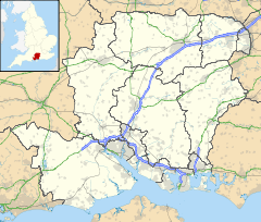
 Copythorne
Copythorne shown within HampshireOS grid reference SU308147 Parish Copythorne District New Forest Shire county Hampshire Region South East Country England Sovereign state United Kingdom Post town SOUTHAMPTON Postcode district SO40 Dialling code 023 Police Hampshire Fire Hampshire Ambulance South Central EU Parliament South East England UK Parliament New Forest East List of places: UK • England • Hampshire Copythorne is a village and civil parish situated in Hampshire, England, within the boundaries of the New Forest National Park.
Contents
Overview
Copythorne is in the north-eastern part of the New Forest, in Hampshire, England. The village is on the A31 Romsey Road, just south of the M27 motorway which splits the parish in two halves.[1] There is an Anglican parish church dedicated to Saint Mary, an Infants School, and a hall.
The parish contains the villages of Cadnam, Bartley, Winsor, Newbridge, and Ower.[1] To the north of the village is Copythorne Common; parts of Cadnam Common and Furzley Common are also in the parish, as well as Shelly Common in the far north of the parish.[2] There is woodland in the south and north of the parish, and Paultons Park – an old estate with a modern theme park – is also in the parish.
History
Copythorne is first recorded as Coppethorne in the 14th century.[3] The name means "Cropped (haw)thorn",[3] which relates to the practice of pollarding trees to provide feed for animals.[4]
There are several Bronze Age barrows in the parish, locally called "Money Hills".[4] At approximately the site of the present church, the Roman road from Nursling suddenly turned south towards Cadnam roundabout.[4]
In the middle ages much of the land in the area was part of the monastic estates of Amesbury, Netley, and Glastonbury.[2] After the Dissolution many of these lands become part of the Paultons estate.[2]
Saint Mary's Church in Copythorne is a red brick structure built in 1834, with alterations made around 1891-2.[5] The civil parish of Copythorne was one of those created out of the ancient parish of Eling in 1894.[2]
Notes
External links
Towns, villages and hamlets in the New Forest District of Hampshire, England 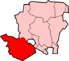
Allum Green | Applemore | Ashlett | Ashley | Ashurst | Bartley | Barton on Sea | Bashley | Beaulieu | Bisterne | Blashford | Blissford | Bolderwood | Boldre | Bramshaw | Bransgore | Breamore | Brockenhurst | Brook | Brookheath | Bucklers Hard | Burgate | Burley | Bull Hill | Cadnam | Calshot | Colbury | Copythorne | Crow | Damerham | Denny Lodge | Dibden | Dibden Purlieu | Downton | East Boldre | East End | East Hill | East Martin | East Mills | Emery Down | Ellingham | Everton | Exbury | Fawley | Fordingbridge | Fritham | Frogham | Furze Hill | Godshill | Gorley Lynch | Hale | Hale Park | Hale Purlieu | Hangersley | Harbridge | Hightown | Highwood | Hordle | Hungerford | Hyde | Hythe | Ibsley | Keyhaven | Lepe | Linbrook | Linford | Linwood | Lopshill | Lower Daggons | Lymington | Lyndhurst | Marchwood | Martin | Milford on Sea | Minstead | Mockbeggar | Netley Marsh | New Milton | Norley Wood | North Gorley | Ossemsley | Pennington | Picket Hill | Picket Post | Pilley | Portmore | Poulner | Ringwood | Rockbourne | Rockford | Sandford | Sandleheath | Shobley | Sopley | South Baddesley | South Gorley | Stuckton | Sway | Tinkers Cross | Tiptoe | Totton and Eling | Walhampton | Whitsbury | Whitsbury Common | Whitsbury Cross | Woodgreen | Woodlands
Categories:- New Forest
- Villages in Hampshire


Wikimedia Foundation. 2010.