- OR Tambo District Municipality
-
OR Tambo District Municipality — District municipality — Location in the Eastern Cape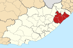
Coordinates: 31°34′S 28°46′E / 31.567°S 28.767°ECoordinates: 31°34′S 28°46′E / 31.567°S 28.767°E Country South Africa Province Eastern Cape Seat Mthatha Local municipalities List- King Sabata Dalindyebo
- Mbizana
- Mhlontlo
- Ntabankulu
- Nyandeni
- Port St Johns
- Qaukeni
Government – Mayor Zoleka Capa (ANC) Area[1] – Total 15,535 km2 (5,998.1 sq mi) Population [1] – Total 1,676,480 – Density 107.9/km2 (279.5/sq mi) Racial makeup – Black African 99.5% – White 0.1% – Coloured 0.3% – Asian 0.2 Languages (in order of size) – isiXhosa 98% – English 1% – isiZulu >1% – Afrikaans >1% Time zone South African Standard Time (UTC+2) Municipal code DC15 Website www.ortambodm.org.za OR Tambo is one of the 7 districts of Eastern Cape province of South Africa. The seat of OR Tambo is Mthatha (formerley spelt Umtata). The vast majority of its 1 676 463 people speak Xhosa (2001 Census). The district is named after Oliver Tambo. The district code is DC15.
The district is within Wild Coast Region.
Contents
Geography
Neighbours
OR Tambo is surrounded by:
- Alfred Nzo (DC44) to the north
- Sisonke (DC43) to the north
- Ugu (DC21) to the north-east
- the Indian Ocean to the south-east
- Amatole (DC12) to the south-west
- Chris Hani (DC13) to the west
- Ukhahlamba (DC14) to the north-west
Local municipalities
The district contains the following local municipalities:
Local municipality Population % King Sabata Dalindyebo 415 227 24.77% Nyandeni 281 252 16.78% Ngquza Hill 255 371 15.23% Mbizana 245 420 14.64% Mhlontlo 196 675 11.73% Port St Johns 146 134 8.72% Ntabankulu 136 391 8.14% After the 2011 municipal election, OR Tambo District will shrink, with Mbizana and Ntabankulu local municipalities being transferred to Alfred Nzo District Municipality.[2]
Demographics
The following statistics are from the 2001 census.
Language Population % Xhosa 1 650 359 98.44% English 10 651 0.64% Zulu 4 418 0.26% Afrikaans 2 814 0.17% Sotho 2 691 0.16% Other 1 867 0.11% Swati 1 516 0.09% Ndebele 975 0.06% Northern Sotho 625 0.04% Tswana 226 0.01% Venda 179 0.01% Tsonga 149 0.01% Gender
Gender Population % Female 918 483 54.79% Male 757 980 45.21% Ethnic group
Ethnic group Population % Black African 1 668 152 99.50% Coloured 5 398 0.32% White 2 009 0.12% Indian/Asian 904 0.05% Age
Age Population % 000 - 004 215 814 12.87% 005 - 009 267 090 15.93% 010 - 014 268 632 16.02% 015 - 019 223 484 13.33% 020 - 024 135 214 8.07% 025 - 029 93 877 5.60% 030 - 034 74 041 4.42% 035 - 039 70 360 4.20% 040 - 044 65 698 3.92% 045 - 049 50 357 3.00% 050 - 054 41 828 2.50% 055 - 059 32 556 1.94% 060 - 064 43 877 2.62% 065 - 069 35 462 2.12% 070 - 074 30 004 1.79% 075 - 079 13 399 0.80% 080 - 084 10 224 0.61% 085 - 089 2 714 0.16% 090 - 094 1 219 0.07% 095 - 099 479 0.03% 100 plus 134 0.01% Politics
Election results
Election results for OR Tambo in the South African general election, 2004.
- Population 18 and over: 782 012 (46.65% of total population)
- Total votes: 496 206 (29.60% of total population)
- Voting % estimate: 63.45% votes as a % of population 18 and over
Party Votes % African National Congress 392 740 79.15% United Democratic Movement 91 722 18.48% African Christian Democratic Party 2 763 0.56% Pan African Congress 2 733 0.55% Democratic Alliance 1 141 0.23% SOPA 675 0.14% United Christian Democratic Party 583 0.12% Inkhata Freedom Party 535 0.11% Azanian People's Organisation 508 0.10% EMSA 425 0.09% New National Party 381 0.08% PJC 353 0.07% Freedom Front Plus 314 0.06% UF 282 0.06% Independent Democrats 259 0.05% TOP 211 0.04% NA 158 0.03% CDP 145 0.03% NLP 100 0.02% KISS 90 0.02% Minority Front 88 0.02% Total 496 206 100.00% References
- ^ a b "OR Tambo District Municipality". South Africa Cooperative Development and Traditional Affairs. http://web.ndmc.gov.za/Profiles/Provincial_Profiles/EC_OR_Tambo.htm. Retrieved 02 December 2009.
- ^ "MFMA Circular No. 54: Municipal Budget Circular for the 2011/12 MTREF". National Treasury. 10 December 2010. p. 5. http://mfma.treasury.gov.za/MFMA/Circulars/MFMA%20Circular%20No%2054%20-%20MFMA%20Circular%202011_12%20MTREF_FINAL.pdf. Retrieved 23 March 2011.
- Independent Electoral Commission 2004 election results
- Municipal Demarcation Board
- Stats SA Census 2001 page
Province of Eastern Cape, South Africa Provincial Capital: BhishoMetropolitan
MunicipalitiesBuffalo City · Nelson Mandela BayDistrict
and Local
MunicipalitiesCamdeboo · Blue Crane Route · Ikwezi · Makana · Ndlambe · Sunday's River Valley · Baviaans · Kouga · Kou-KammaInxuba Yethemba · Tsolwana · Inkwanca · Lukhanji · Intsika · Emalahleni · Engcobo · SakhisizweElundini · Senqu · Maletswai · GariepO.R. TamboCategories:- District Municipalities of the Eastern Cape

Wikimedia Foundation. 2010.