- Benjamín Rivera Noriega Airport
-
Benjamín Rivera Noriega Airport 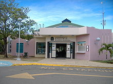
IATA: CPX – ICAO: TJCP – FAA LID: CPX Summary Airport type Public Owner Puerto Rico Ports Authority Operator Puerto Rico Ports Authority Serves Culebra, Puerto Rico Elevation AMSL 49 ft / 15 m Coordinates 18°18′48″N 065°18′16″W / 18.31333°N 65.30444°WCoordinates: 18°18′48″N 065°18′16″W / 18.31333°N 65.30444°W Map Location in Puerto Rico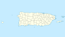
 TJCP
TJCPRunways Direction Length Surface ft m 13/31 2,600 792 Asphalt Statistics (1998) Aircraft operations 36,322 Passenger Movement 75,964 (2,008) Source: Federal Aviation Administration[1]
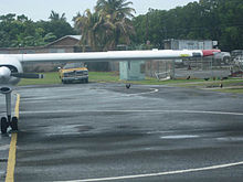
2008 passengers from airport[2] The airport has one paved runway.
Benjamín Rivera Noriega Airport (IATA: CPX, ICAO: TJCP, FAA LID: CPX) is a public airport located on the island of Culebra in Puerto Rico. It is owned by the Puerto Rico Ports Authority.[1]
Contents
History
The airport of Culebra was originally built as a military airport by the United States Marine Corps, opening in 1957. In 1965, the government of Puerto Rico started flying civilians from San Juan to the island with a Legislative compensation.
After the Navy-Culebra protests, the Puerto Rico Ports Authority started administering the civilian flight operations in Culebra, inaugurating the first passenger terminal in October 24, 1976. The airport and its 80 acres were officially transferred to the Ports Authority in 1980.
A new passenger terminal was inaugurated in 1994, and its name was changed to Benjamín Rivera Noriega, in honor of a pilot from Ciales. He became a community leader recognized by his service to the residents of Culebra.[3]
Facilities and aircraft
Benjamín Rivera Noriega Airport covers an area of 15 acres (6.1 ha) at an elevation of 49 feet (15 m) above mean sea level. It has one asphalt paved runway designated 13/31 which measures 2,600 by 50 feet (792 x 15 m). For the 12-month period ending March 16, 1998, the airport had 36,322 aircraft operations, an average of 99 per day: 93% air taxi and 7% general aviation.[1]
The airport is noted for the mountain at the approach end of the runway to the North. This obstacle, as well as the short length of the runway, keep jet aircraft and airlines from using this airport. Commercial operations are currently limited to air taxi service using propeller aircraft with 10 seats or less. The approach to this airport is considered good practice for pilots before flying to Saint Barthélemy Airport.
Airlines and destinations
Airlines Destinations Air Culebra San Juan [4] Air Flamenco Ceiba, San Juan Isla Nena Air Ceiba, Vieques, San Juan [5] Vieques Air Link San Juan, Vieques Incidents and accidents
On July 1, 2011, a Cessna 185 that took off from Benjamin Rivera Noriega airport with a family of five on board, registration number N8438Q, crashed while on its way to Mercedita Airport in Ponce. One body was found in Humacao. The other four passengers are presumed dead.[6]
See also
References
- ^ a b c FAA Airport Master Record for CPX (Form 5010 PDF), effective 2009-05-07.
- ^ Benjamín Rivera Noriega Airport - Passenger Traffic 2008
- ^ Aeropuerto Benjamín Rivera Noriega at Autoridad de Puertos de Puerto Rico
- ^ Air Culebra
- ^ Isla Nena Air Services, Inc.
- ^ [1]
External links
- Resources for this airport:
- AirNav airport information for TJCP
- ASN accident history for CPX
- FlightAware airport information and live flight tracker for TJCP
- NOAA/NWS latest weather observations for TJCP
- SkyVector aeronautical chart for CPX
Airports in Puerto Rico International Luis Muñoz Marín International Airport (SJU) · Mercedita Airport (PSE) · Rafael Hernández Airport (BQN)
Regional Antonio (Nery) Juarbe Pol Airport (ABO) · Antonio Rivera Rodríguez Airport (VQS) · Benjamín Rivera Noriega Airport (CPX) · Eugenio María de Hostos Airport (MAZ) · Fernando Luis Ribas Dominicci Airport (SIG) · José Aponte de la Torre Airport (RVR)
Closed Diego Jiménez Torres Airport (X95) · Dorado Airport · Humacao Airport (X63)
Categories:- Airports in Puerto Rico
- Culebra, Puerto Rico


Wikimedia Foundation. 2010.