- Douglas Island
-
This article is about the island in Alaska. For other islands, see Douglas Island (disambiguation).
 Douglas Harbor in, Douglas, Alaska The island in the midground, right, houses a US Coast Guard station. Mount Juneau lies in the background behind the Coast Guard island
Douglas Island is a tidal island in the U.S. state of Alaska, just west of downtown Juneau and east of Admiralty Island. It is separated from mainland Juneau by the Gastineau Channel. The Juneau-Douglas Bridge, connecting the island with Juneau, provides a two lane road to and from the island and accommodates both vehicular and pedestrian traffic.[1] Recently, there have been plans to build a new bridge from North Douglas to the Mendenhall Valley. Admiralty Island lies to the west and south, across the Stephens Passage. Douglas Island was named for John Douglas, Bishop of Salisbury by Captain George Vancouver. Joseph Whidbey, master of the Discovery during Vancouver's expedition, was the first to sight it in 1794.[1]
 Resting place of several members of the Taku Indians' Raven Clan
Interesting features of the island include remnants of the Treadwell gold mine, Sandy Beach, the only sand beach in the Juneau area (made from mine tailings), Eaglecrest Ski Area, Perseverance Theatre, and the Douglas Public Library. A tidal island, Douglas is connected to the mainland at its north end when the Gastineau Channel is at low tide. During low tide, Douglas Island is connected with Juneau's Twin Lakes area, the Juneau International Airport as well as other sites.
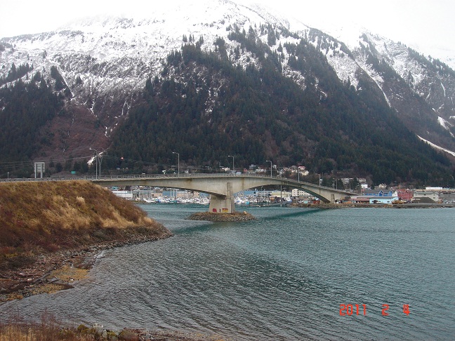
 Juneau-Douglas Bridge The bridge crossing Gastineau Channel, connecting Juneau with Douglas Island. The original bridge was built in 1935. The bridge shown here, which replaced the original, was completed in the early 1980s.
Douglas is usually thought of as two areas: downtown Douglas 58°16′32″N 134°23′33″W / 58.27556°N 134.3925°W (including West Juneau 58°17′42″N 134°25′46″W / 58.295°N 134.42944°W), containing Douglas Harbor, Sandy Beach, the mines, the library, Gastineau Elementary, the theatre, the gas station, the few bars and restaurants, and the bridge to Juneau; and North Douglas Island, containing a tank farm, Eaglecrest Ski Area and a heliport.
The island has a land area of 199.243 square kilometres (76.928 sq mi) and a population of 5,297 at the 2000 census. It is part of the City and Borough of Juneau.
References
- Douglas Island: Blocks 1004 thru 1039, Block Group 1; Block Group 2; Block Group 3; Census Tract 6, Juneau City and Borough, Alaska United States Census Bureau
- ^ "Structures / Juneau-Douglas Bridge / Images". Structurae. http://en.structurae.de/structures/data/index.cfm?id=s0026999. Retrieved 2011-02-18.
External links
Coordinates: 58°16′14″N 134°30′21″W / 58.27056°N 134.50583°W
Categories:- Tidal islands
- Islands of the Alexander Archipelago
- Landforms of Juneau City and Borough, Alaska


Wikimedia Foundation. 2010.