- Poinciana, Florida
-
Poinciana, Florida — CDP — 
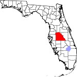
LogoLocation in Osceola County in the state of Florida
Coordinates: 28°9′21″N 81°28′35″W / 28.15583°N 81.47639°WCoordinates: 28°9′21″N 81°28′35″W / 28.15583°N 81.47639°W Country  United States
State  Florida
County Polk/Osceola Area – Total 35.3 sq mi (91.5 km2) – Land 35.1 sq mi (90.9 km2) – Water 0.2 sq mi (0.6 km2) Elevation 66 ft (20 m) Population (2010) – Total 53,193 – Density 1,505.7/sq mi (581.3/km2) Time zone Eastern (EST) (UTC-5) – Summer (DST) EDT (UTC-4) ZIP code 34758, 34759 Area code(s) 407, 321, 863 FIPS code 12-57900[1] GNIS feature ID 1853279[2] Poinciana is a census-designated place (CDP) in Osceola and Polk counties in the U.S. state of Florida. It lies southwest of Kissimmee and about 14 miles (23 km) east of Haines City. As of the 2010 United States Census, it had a population of 53,193.[3]
As of June 2011 the population was reported as 69,746, according to "Box Score", a demographic breakdown of each of the 10 Villages which make up the Association of Poiciana Villages (APV). The difference from the Census figure is due to "Box Score" counting neighboring census tracts that are included within the original Poinciana PUD boundary defined by the State of Florida but not included in either the "Poinciana Pioneer" or CDP population count. According to the latest census reports these adjoining tracts represent an additional 29,914 persons. Depending on the definition, the greater Poinciana Area represents a population of between 53,193 and 83,107.
This puts Poinciana as one of the fastest growth areas for Central Florida over the past decade.
Located on approximately 47,000 acres (190 km²), Poinciana APV is a deed-restricted community, which means that it is governed by a homeowners' association (HOA). The HOA is the Association of Poinciana Villages (APV). In 2011, the APV HOA fee stood at $264 per year, which the APV allows to be paid on a monthly basis. Other local fees may apply to communities within Poinciana, such as CDD's fees for residents of a community named Solivita (Village 10) which is a senior citizen only gated community. Neighbor subdivisions such as Crescent Lakes, Trafalgar, Doral, Isles of Bellalago, Cypress Cove, Wilderness, Bellalago, etc are included in the non CDP Census adjacent tracts referred to above. Many of these subdivisions were defined in the original Poinciana boundary PUD but were developed as separate HOAs, having their own taxing districts, fees etc.
Contents
Transportation
US Highway 17/92 (here part of the Orange Blossom Trail) runs through the north of Poinciana.
Local bus service is provided to Kissimmee by the Lynx network. Poinciana is planned to be the southern terminus of the proposed SunRail system.
Geography
Poinciana is located at 28°9′21″N 81°28′35″W / 28.15583°N 81.47639°W (28.155768, -81.476502)[4].
According to the United States Census Bureau, the CDP has a total area of 35.3 square miles (91 km2), of which 35.1 square miles (91 km2) is land and 0.2 square miles (0.52 km2), or 0.68%, is water.
Demographics
Historical populations Census Pop. %± 2000 13,647 — 2010 53,193 289.8% source:[5] As of the census[1] of 2010 there were 53,193 residing in the CDP. The racial makeup of the CDP was 56.44% White, 24.47% African American, 0.73% Native American, 1.8% Asian, 0.20% Pacific Islander, 11.38% from other races, and 4.98% from two or more races. Hispanic or Latino of any race were 51.2% of the population.
In addition there were 29,914 residing in the non-CDP neighborhoods. Hispanic or Latino of any race were 43.7% of the population.
For census 2000 there were 4,153 households out of which 50.3% had children under the age of 18 living with them, 65.5% were married couples living together, 15.4% had a female householder with no husband present, and 14.2% were non-families. 10.5% of all households were made up of individuals and 3.7% had someone living alone who was 65 years of age or older. The average household size was 3.29 and the average family size was 3.49. This information will be updated for census 2010 when it becomes available.
In the 2010 Census CDP the population was spread out with 29.27% under the age of 18, and 70.73% age 18 and over. The non CDP population was 27.4% under age of 18 and 72.6% over.
In 2000 the median income for a household in the CDP was $37,172, and the median income for a family was $37,688. Males had a median income of $26,860 versus $20,934 for females. The per capita income for the CDP was $12,590. About 12.0% of families and 12.8% of the population were below the poverty line, including 17.9% of those under age 18 and 12.3% of those age 65 or over. Likewise, 2010 income information will be updated when it become available.
Education
- Osceola County
- Pre-Kindergarten Schools
- Poinciana 247 Pre-K & V.P.K. (Private School)
- Elementary Schools
- Bellalago Academy
- Poinciana Academy Of Fine Arts (PAFA)
- Koa Elementary
- Chestnut Elementary (CES)
- Deerwood Elementary (DWE)
- Middle Schools
- Horizon Middle (HMS)
- Discovery Intermediate (DIS)
- High Schools
- Poinciana High (PHS)
- New Dimensions (NDHS) (public charter high school)
- Liberty High (LHS): New High School Opened on August 2007
- Pre-Kindergarten Schools
- Polk County
- Elementary Schools
- Lake Marion Creek Elementary
- Palmetto Elementary
- Laurel Elementary
- Elementary Schools
Libraries
- School District of Osceola County
- Poinciana Branch Library - Osceola library system
See also
References
- ^ a b "American FactFinder". United States Census Bureau. http://factfinder.census.gov. Retrieved 2008-01-31.
- ^ "US Board on Geographic Names". United States Geological Survey. 2007-10-25. http://geonames.usgs.gov. Retrieved 2008-01-31.
- ^ "Race, Hispanic or Latino, Age, and Housing Occupancy: 2010 Census Redistricting Data (Public Law 94-171) Summary File (QT-PL), Poinciana CDP, Florida". U.S. Census Bureau, American FactFinder 2. http://factfinder2.census.gov. Retrieved August 5, 2011.
- ^ "US Gazetteer files: 2010, 2000, and 1990". United States Census Bureau. 2011-02-12. http://www.census.gov/geo/www/gazetteer/gazette.html. Retrieved 2011-04-23.
- ^ "CENSUS OF POPULATION AND HOUSING (1790-2010)". U.S. Census Bureau. http://www.census.gov/prod/www/abs/decennial/index.html. Retrieved 2010-07-17.
Municipalities and communities of Osceola County, Florida Cities 
CDPs Buenaventura Lakes | Campbell | Celebration | Citrus Ridge‡ | Poinciana‡ | Yeehaw Junction
Unincorporated
communitiesAshton | Bull Creek | Deer Park | Harmony | Holopaw | Intercession City | Kenansville | Lake Marian Highlands | Narcoosee | Reedy Creek Improvement District‡
Footnotes ‡This populated place also has portions in an adjacent county or counties
Municipalities and communities of Polk County, Florida Cities Auburndale | Bartow | Davenport | Eagle Lake | Fort Meade | Frostproof | Haines City | Lake Alfred | Lakeland | Lake Wales | Mulberry | Polk City | Winter Haven
Towns Village CDPs Babson Park | Combee Settlement | Citrus Ridge‡ | Crooked Lake Park | Crystal Lake | Cypress Gardens | Fussels Corner | Highland City | Inwood | Jan Phyl Village | Kathleen | Lakeland Highlands | Loughman | Medulla | Poinciana‡ | Wahneta | Waverly | Willow Oak
Unincorporated
communitiesFootnotes ‡This populated place also has portions in an adjacent county or counties
Categories:- Census-designated places in Osceola County, Florida
- Census-designated places in Polk County, Florida
- Populated places in Florida with Hispanic majority populations
- Greater Orlando
- Osceola County


Wikimedia Foundation. 2010.