- Halesowen
-
Coordinates: 52°27′01″N 2°03′03″W / 52.450164°N 2.050935°W
Halesowen 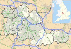
 Halesowen
Halesowen shown within the West MidlandsPopulation 55,273 OS grid reference SO9583 Metropolitan borough Dudley Metropolitan county West Midlands Region West Midlands Country England Sovereign state United Kingdom Post town HALESOWEN Postcode district B62, B63 Dialling code 0121 or 01384 (Parts of Cradley) Police West Midlands Fire West Midlands Ambulance West Midlands EU Parliament West Midlands UK Parliament Halesowen & Rowley Regis List of places: UK • England • West Midlands Halesowen (
 /heɪlzˈoʊ.ɨn/) is a town in the Metropolitan Borough of Dudley, in the West Midlands, England.
The population, as measured by the United Kingdom Census 2001, was 55,273.[1] Halesowen is included in the Halesowen and Rowley Regis constituency currently held by the Conservative James Morris.
Contents
Geography and administration
Halesowen was traditionally an isolated and separate part of the County of Shropshire but was incorporated into Worcestershire in 1844 by an Act of Parliament. Since the local government reorganisation of 1974 it has formed a part of the West Midlands Metropolitan County and Conurbation, in the Dudley Metropolitan Borough. Halesowen is located approximately ten miles south-west of Birmingham at the edge of the industrial Midlands.
Although predominantly urban or suburban in character, Halesowen borders on green belt land with excellent access to the countryside, for example the Clent Hills. It has extensive road links including Junction 3 of the M5 motorway, which allow easy commuting to Birmingham, other areas of the Black County or nationwide. The centre of Birmingham is approximately 30 minutes away by car and reachable with the number 9 bus.
The centre of Halesowen is home to a Norman church, a football ground (where non-league Halesowen Town F.C. play) and College of Further Education which was founded in 1939.
Most of the housing stock in Halesowen is privately owned and was built in the 30 years which followed the end of World War II, although some parts of the town are still made up of Victorian and Edwardian terraced houses. The town centre was almost completely rebuilt during the 1930s.
Suburbs
In 1974, Dudley Metropolitan Borough Council identified six historical suburbs, within Halesowen, which they signed accordingly with a series of gateway signs. In addition to the Town Centre, these are listed below. A separate sign for Illey was added many years later.
Neighbourhoods
Each of the suburbs above contain various neighbourhoods within them. Here are some:
- Abbeyfields
- Haden Hill
- Hurst Green
- Illey
- Manor Abbey
- Olive Hill
- Shenstone Valley
- Squirrels Estate
- Tanhouse
- Colley Gate
Climate
As with the rest of the British Isles and West Midlands, Halesowen experiences a maritime climate with cool summers and mild winters. A Met Office weather station provide's local climate data for the period 1971-2000, although it ceased observation's in 2004. Temperature extremes at Halesowen have ranged from −14.5 °C (5.9 °F) during December 1981[2] up to 34.7 °C (94.5 °F) during August 1990.[3]
Climate data for Haleswowen 153m asl, 1971-2000, Extremes 1959-2004 Month Jan Feb Mar Apr May Jun Jul Aug Sep Oct Nov Dec Year Record high °C (°F) 14.2
(57.6)16.8
(62.2)21.7
(71.1)25.4
(77.7)27.5
(81.5)31.6
(88.9)32.6
(90.7)34.7
(94.5)27.2
(81.0)24.4
(75.9)17.1
(62.8)15.3
(59.5)34.7
(94.5)Average high °C (°F) 6.6
(43.9)7.1
(44.8)9.7
(49.5)12.5
(54.5)16.3
(61.3)18.9
(66.0)21.6
(70.9)21.1
(70.0)17.8
(64.0)13.7
(56.7)9.5
(49.1)7.3
(45.1)13.5 Average low °C (°F) 1.1
(34.0)0.8
(33.4)2.4
(36.3)3.6
(38.5)6.4
(43.5)9.3
(48.7)11.5
(52.7)11.2
(52.2)9.1
(48.4)6.4
(43.5)3.4
(38.1)2.0
(35.6)5.6 Record low °C (°F) −13.9
(7.0)−11.6
(11.1)−11.1
(12.0)−5.4
(22.3)−3.9
(25.0)−1.1
(30.0)2.2
(36.0)2.8
(37.0)−0.2
(31.6)−5
(23.0)−6.2
(20.8)−14.5
(5.9)−14.5
(5.9)Precipitation mm (inches) 67.5
(2.657)49.8
(1.961)55.2
(2.173)58.0
(2.283)59.0
(2.323)60.4
(2.378)60.9
(2.398)70.6
(2.78)67.0
(2.638)70.9
(2.791)70.1
(2.76)73.2
(2.882)762.6
(30.024)Source: Royal Dutch Meteorological Institute/KNMI[4] History
See also: Worcestershire's evolving county boundariesHalesowen was recorded in the Domesday Book of 1086 as being larger than Birmingham. The manor and town was known as Hala (from the Anglo-Saxon word "halh", meaning nook or remote valley), until it was gifted by King Henry II to Welsh Prince David Owen and became known as Halas Owen. The parish of Halesowen, which incorporated other townships later to become independent parishes, was an exclave of the county of Shropshire, but grew to become a town and was transferred to the jurisdiction of Worcestershire by the Counties (Detached Parts) Act 1844. Included in the boundaries was the ancient village of Brettle.
In the 1220s, Halesowen had a market and fair and, by 1270, it had been granted a charter of liberties by its lord, the Premonstratensian Abbey of Halesowen. By 1300, it is estimated that the population was around 600. The court rolls for Halesowen survive to 1272 and show that the majority of migrants to Halesowen in the 14th century were women at 75%. Little was done to remove them and many went on to become small retailers in the area.[5]
The village is well known by medieval historians for the conflict that took place around this time. In 1279, as the Abbot attempted to increase labour services for his tenants (which had been fixed in 1244), the peasants attempted to plead their case in the King's Court, a privilege forbidden to unfree villeins. The Abbot thus fined them £10 which was a large sum at the time, and resistance, led by Roger Ketel, heightened. The conflict was snuffed out in 1282 as Ketel and Alice Edrich (the pregnant wife of another prominent rebel) were murdered by thugs hired by the abbey.
During the 18th century Halesowen developed rapidly as a result of the Industrial Revolution. The manufacture of nails was the staple trade in the town and many mills were used for slitting and iron production.[6] Coal mining had been done in the area from at least as early as the reign of Edward I.[6] Dating to 1893, Coombes Wood was the largest colliery in the town; at its peak in 1919 Halesowen had 130 working mines.[7]
Halesowen became the centre of a poor law union in the 19th century, which later became established as a rural sanitary district and later the Halesowen Rural District in 1894. Oldbury was included into the area of Halesowen under an Act of 1829.[8] With increasing urbanisation of the area, in the early 20th century, it became the Halesowen Urban District in 1925, and obtained a grant of charter to become a municipal borough in 1936.[7] In 1974, under the Local Government Act 1972, Halesowen was incorporated into the new Dudley Metropolitan Borough, in the metropolitan county of the West Midlands.
Halesowen was once served by a railway line - in reality two lines which met at an end-on junction at the station. The first was a branch of the Great Western Railway from Old Hill to Halesowen, opened in 1878, followed in 1883 by a section jointly owned by the Great Western and the Midland Railway (though worked mostly by the latter), linking the town with Northfield on the Midland Railway's Birmingham to Bristol main line, with intermediate stations at Rubery, Hunnington, and a workmen's halt at Longbridge serving the car factories (not to be confused with the present Longbridge station). Being largely rural in character, the line failed to attract much traffic and regular passenger services ended between Halesowen and Northfield as far back as 1919, and between Old Hill and Halesowen in 1927, though the workmen's trains continued to serve Longbridge until 1960. The line is now lifted, but the track-bed can be seen close to the town, although there is no sign of the station. The goods shed remained until recently, serving as an industrial unit though it has now been demolished.
In the 1960s, the town centre underwent vast redevelopment which saw most of the older buildings demolished. The high street was pedestrianised and a shopping precinct (called "The Precinct") was developed, housing many new retail units as well as a new public library. The centre was refurbished in the late 1980s and placed undercover, being renamed The Cornbow Centre at this time.
Trade in the town centre declined between 1985 and 1990 as the Merry Hill Shopping Centre some five miles away at Brierley Hill was developed, although not as severely as it declined in Stourbridge and in particular Dudley. The only high profile casualty was the J Sainsbury supermarket, which closed in 1992 due to the popularity of the store which had opened at Merry Hill three years earlier to succeed the Dudley store - combined with the onset of the recession at the start of the 1990s.
A further upgrading of the town centre took place in 2007 and 2008, with part of the Cornbow Centre (including a petrol station and several smaller retail units) being demolished to make way for a new Asda superstore which opened on 24 November 2008. The bus station was also rebuilt. This 18 month £30 million project was completed in December 2008 and the town received a commendation for the work by the Retail Property Organisation.[9]
Landmarks
In the eastern part of Halesowen is Leasowes Park, which is considered to be one of the first natural landscape gardens in England. The 18th century poet William Shenstone designed the garden, beginning works in 1743 and continuing until his death in 1763, transforming existing farmland he had inherited after his parents' death. Today, the parkland is Grade One Listed, as it is of national importance. The local theatre and a Wetherspoon's public house are both named after William Shenstone as are at least two roads in the locality.
The Parish Church of St. John the Baptist was founded by Roger de Montgomery and stands on the site of an even earlier Anglo-Saxon church. Several extensions have been made including the outer south aisle which was added in 1883 by John Oldrid Scott[10] although there is still much evidence of the original Norman work. A Medieval cross stands in the churchyard, having previously stood in Great Cornbow until it was blown down by a gale in 1908. [1]
Nearby are the ruins of Halesowen Abbey, founded in 1215 by Peter des Roches, Bishop of Winchester. The Dissolution of the Monasteries saw the Abbey pass into private hands in 1538. The Abbey was the subject of an archaeological evaluation[11] by Birmingham Archaeology and is now owned and managed by English Heritage.
Most of the town centre was rebuilt in the 1960s to create a modern shopping area that incorporated a new library as well as many supermarkets and shops centred around the Cornbow Centre. This was refurbished in the late 1980s to create a covered shopping area.
Halesowen has recently undergone a £30 million regeneration of its town centre, which has included the construction of a new Asda supermarket located in the Cornbow Centre, together with a new multi-storey car park, a new state-of-the-art bus station and improvements to the road layout.[12]
Economy
The principal industry of Halesowen was traditionally nail making, an industry that was performed on a small scale individually in the backyards of a large number of nail makers. Halesowen also had, along with most other areas of the Black Country, a large number of above and underground coal mines. In more recent years, the arrival of a junction of the motorway network allowed Halesowen to attract a number of large organisations to the town.
Sandvik's UK headquarters are based here as well as Somers Forge, SomersTotalKare and the Mucklow Group.[citation needed]
JCDecaux UK has its Birmingham area office in Halesowen.[13]
Transport
Halesowen, as mentioned above, is no longer served by a railway station. It is however served by a fairly comprehensive bus network, and is on the Hagley Road Bus Corridor from Birmingham to Stourbridge (route 9) and the Merry Hill Shopping Centre (route 222). Halesowen Bus Station is located on Queensway, next to the new ASDA supermarket and the Job Centre Plus.
Education
There are currently 14 primary schools, 3 secondary schools and a further education college situated within the district of Halesowen.
Newfield Park Primary School primary school located in Halesowen, was built during the 1960s to serve the expanding local area of Hawne.
In 1972, when still a Borough in its own right, Halesowen Council abolished the traditional infant and junior schools and replaced them with first schools for ages 5 to 9 and middle schools for the 9 to 13 age group, but this system was abolished in 1982 and reverted to the previous infant schools for 5 to 7 year olds and junior schools for ages 7 to 11. It was one of the first instances of three-tier education being abolished in favour of a return to traditional age ranges, though most areas which adopted the system have since reverted to the traditional age ranges.
The rest of the Dudley Metropolitan Borough consisted of 5-8 first and 8-12 middle schools (barring Stourbridge and Kingswinford, which had both retained the traditional 5-7 infant and 7-11 junior schools) until following the suit of Halesowen and reverting to the traditional ranges in 1990.
Primary schools
- Caslon Primary School
- Colley Lane Primary School
- Halesowen Church of England Primary School
- Hasbury Church of England Primary School
- Howley Grange Primary School
- Huntingtree Primary School
- Hurst Green Primary School
- Lapal Primary School
- Lutley Primary School
- Manor Way Primary School
- Newfield Park Primary School
- Olive Hill Primary School
- Our Lady and St. Kenelm Roman Catholic Primary School
- Tenterfields Primary School
Special Needs Schools
- Halesbury Special School
Secondary schools
- Windsor High School
- Leasowes High School & Community College
- Earls High School
Further education
- Halesowen College
- Windsor High School Sixth Form
Media
Halesowen is served by local editions of two regional evening papers, the Birmingham based Evening Mail and the Wolverhampton based Express & Star. There are two local weekly newspapers, delivered free to every household in Halesowen, The Halesowen News and The Halesowen Chronicle.
The Halesowen area is served by commercial and BBC radio stations broadcasting from Wolverhampton and Birmingham as well as from within Worcestershire, Staffordshire and Shropshire. Radio stations serving the area are 102.5 The Bridge, Kerrang! 105.2, Galaxy, 96.4 BRMB, Beacon Radio and Heart FM.
Halesowen's only own licensed radio station currently is HCR International (Halesowen College Radio) 1386AM and 106.0 - 106.8 FM within the Whittingham Campus which also streams live online from its website.[14]
Leisure
Halesowen has a football team, non-league Halesowen Town F.C., as well as cricket (including Halesowen Cricket Club), hockey (Old Halesonians Hockey Club) and golf clubs. Halesowen is home to two Campaign for Real Ale (CAMRA) Good Beer Guide listed pubs, the 'Hawne Tavern' and the 'Waggon and Horses,' both of which have won the local CAMRA branch Pub of the Year accolade in 2005 and 2006 respectively. The 'Waggon and Horses' has also won the West Midlands County Pub of the Year Award for 2006, beating pubs from the Black Country, Birmingham, Solihull and Coventry. The Somers Sports and Social Club has won CAMRA's national Club of the Year award three times, in 2000, 2001 and 2002,[15] and Coombes Wood Sports and Social Club has won branch and regional awards. Both clubs are also listed in CAMRA's Good Beer Guide.
Sports
Hockey
Halesowen is also the base for Old Halesonians Hockey Club; who run 5 Men's League teams, a Ladies team and a Badgers team. They also have a Summer League team and Veterans team. Old Halesonians Hockey Club (OHHC) which was established in 1963, also have a thriving Junior Section, which benefits from close links with local schools and Metropolitan Borough of Dudley Council, and provides coaching for Boys and Girls from age seven upwards. Old Halesonians Hockey Club play their home games at Great Park in nearby Rubery, Windsor High School (Halesowen), or at Four Dwellings High School in Quinton. The Old Halesonians Clubhouse is at Wassell Grove in Hagley.
Cycling
The Cycling Section at Halesowen Athletic and Cycling club ranks in British Cycling's top 30. It has a very strong Youth programme with several current National Champions. They also have a tennis club adjacent to the cycling track. These encompass part of the trackbed of the disused railway line.
Hobbies/SkillsHalesowen is the base for two Amateur Dramatic Societies - Startime Variety (pantomimes in January and Summer Variety shows around July, both at the Cornbow Hall Theatre) and Mayhem Theatre Company (comedies and dramas, normally two shows per year at the Leasowes Theatre).
Halesowen Jazz Club holds fortnightly concerts on Sundays (except in Summer) at Halesowen Cricket Club (licensed premises), usually featuring Trad and New Orleans Jazz.
Halesowen Boardgamers' Club play adult-orientated board and card games (German and American games such as Settlers of Catan, Acquire and Carcassonne) each Wednesday evening at Halesowen Townsend Social Club (a licensed premises, formerly known as Halesowen Conservative & Unionist Club).
The Halesowen Scout Band is based in the town and rehearses and performs there regularly.
Public Houses
- The Forge Inn (Halesowen Road)
- Black Horse Inn (Illey Lane)
- The Black Horse (Manor Way)
- The Hunting Tree (Alexandra Road)
- Chainmaker (130 Colley Gate)
- Clock Inn (Nimmings Road)
- The Cobham Arms (Howley Grange Road)
- Fairfield (Fairfield Road)
- Foxhunt (Hagley Road)
- The Full Moon (Hurst Green Road)
- The Gate Inn (110 Colley Gate)
- Hare & Hounds (252 Hagley Road)
- The Hasbury Inn (Hagley Road)
- The Hawne Tavern (76 Attwood Street)
- King Edward VII (88 Stourbridge Road)
- The Lighthouse (153 Coombs Road)
- The Little Chop House (Windmill Hill)
- The Loyal Lodge (15 Furnace Hill)
- Lutley Oak (327 Stourbridge Road)
- The Maypole Inn (93 Bassnage Road)
- The Old Crown Inn (Carters Lane)
- Olde Queens Head (Birmingham Street)
- Park Lane Tavern (Park Lane)
- Picks (91 High Street)
- The Rose & Crown (Hagley Road)
- The Rose and Crown (95 Colley Lane)
- The Round Of Beef (33 Windmill Hill)
- The Royal Oak (Manor Lane)
- Stag & Three Horseshoes (Halesowen Road)
- The Swan Inn (Long Lane)
- The Victoria Inn (Malt Mill Lane)
- The Vine Inn (51 Lyde Green)
- Waggon & Horses (Stourbridge Road)
- Wagon & Horses (166 Long Lane)
- The Whitley (Stourbridge Road)
- The Why Not Inn (Whynot Street)
- The Widders (Barrack Lane)
- William Shenstone (JD Wetherspoon), The (1-5 Queensway)
- The Woodman (Bromsgrove Road)
Notable residents
- Alexander of Hales, English scholastic theologican and writer.
- Thomas Attwood, British economist and campaigner for electoral reform, was born at Hawne House, Halesowen on 6 October 1783
- Leslie Bridgewater, film score and light music composer[16]
- Chris Crudelli, television presenter, lived here from the age of 9 and studied at Halesowen College.
- James Grove, Horn button manufacturer.
- Bill Oddie, television actor and presenter, attended the former Halesowen Grammar School which is now Earls High School.
- Robert Plant, of Led Zeppelin, was born in West Bromwich but brought up in Halesowen and attended both Halesowen Grammar School and King Edward VI Grammar School, Stourbridge (now Earls High and King Edward VI College respectively).
- Lee Sharpe, Manchester United and England footballer
- William Shenstone, poet and landscape gardener.
- Frank Skinner, comedian and television presenter, lived in nearby Oldbury and taught at Halesowen College.
- Julian Smith, Sax ophonist, who became known after appearing on the third series of 'Britain's Got Talent' in 2009.
- Walter Somers, Ironmaster.
- Glenn Tipton, guitarist with Judas Priest, attended Olive Hill Primary school and worked at Coombs Wood for British Steel.[17]
- Jordanne Whiley, International Women's Wheelchair Tennis Champion.
- Rex Williams, former World Billiards Champion.
- Francis Brett Young, novelist and poet.
- Paul William Self, former Manager of local Bearwood band The Twang who had a debut Top 3 album and 2 Top 15 singles.
References
- ^ Office for National Statistics : Census 2001 : Urban Areas : Table KS01 : Usual Resident Population Retrieved 2009-08-26
- ^ "1981 temperature". KNMI. http://eca.knmi.nl/utils/monitordetail.php?seasonid=18&year=1981&indexid=TNn&stationid=1856.
- ^ "1990 temperature". KNMI. http://eca.knmi.nl/utils/monitordetail.php?seasonid=14&year=1990&indexid=TXx&stationid=1856.
- ^ "Halesowen Climate". KNMI. http://eca.knmi.nl/utils/mapserver/anomaly.php?indexcat=**&indexid=TNn&year=1981&seasonid=18&create_image=true&minx=-1111428.5714287&miny=-4687142.8571429&maxx=621904.76190476&maxy=-3387142.8571428&MapSize=560%2C420&imagewidth=560&imageheight=420&mainmap.x=300&mainmap.y=307&CMD=QUERY_POINT&CMD=QUERY_POINT#bottom. Retrieved 10 Nov 2011.
- ^ Palliser, David Michael; Peter Clark, Martin J. Daunton (2000). The Cambridge Urban History of Britain. Cambridge University Press. pp. 97–9. ISBN 0521417074.
- ^ a b John Hemmingway (2001). "A Brief History of Halesowen". Dudley Metropolitan Borough Council. http://www.dudley.gov.uk/community-and-living/town-centre-management/halesowen-town-centre/a-brief-history-of-halesowen. Retrieved 2008-04-01.
- ^ a b "Hales Owen History". Halesowen Roots. http://www.halesowenroots.com/halesowen_history.htm. Retrieved 2008-04-01.
- ^ 'Halesowen: Introduction, borough and manors', A History of the County of Worcester: volume 3 (1913), pp. 136-146. URL: Date accessed: 01 April 2008.
- ^ Council, Dudley. "Building a better Halesowen". Dudley Metropolitan Bourough Council. http://www.dudley.gov.uk/community-and-living/town-centre-management/halesowen-town-centre/halesowen-regeneration/building-a-better-halesowen. Retrieved 2 April 2011.
- ^ The Buildings of England: Worcestershire, Nikolaus Pevsner, 1968 Penguin. p180
- ^ "Halesowen Abbey". Birmingham Archaeology. http://www.arch-ant.bham.ac.uk/bufau/projects/Halesowen%20Abbey/Halesowen%20Abbey.htm. Retrieved 2008-12-03.
- ^ "Halesowen Regeneration". Dudley Metropolitan Borough Council. 2007-11-01. http://www.dudley.gov.uk/index.asp?pgid=29468. Retrieved 2008-04-01.
- ^ "Contact." JCDecaux UK. Retrieved on 28 September 2011. "JCDecaux - Birmingham 209-215 Long Lane Halesowen, West Midlands Birmingham, B62 9JT"
- ^ : HCR International Official website
- ^ CAMRA web site
- ^ Leslie Bridgewater, IMDB and More legends of Light Music, Robert Farnon Society
- ^ http://www.glenntipton.co.uk/early-life.asp
External links
- Halesowen Abbey
- Halesowen College of Further Education
- Halesowen News Local Halesowen weekly newspaper
- River Stour
Ceremonial county of West Midlands Metropolitan districts Major settlements - Aldridge
- Bilston
- Birmingham
- Blackheath
- Bloxwich
- Brierley Hill
- Brownhills
- Coseley
- Coventry
- Cradley Heath
- Darlaston
- Dudley
- Fordbridge
- Halesowen
- Oldbury
- Rowley Regis
- Smethwick
- Solihull
- Stourbridge
- Sutton Coldfield
- Tipton
- Walsall
- Wednesbury
- Wednesfield
- West Bromwich
- Willenhall
- Wolverhampton
See also: West Midlands
Rivers Canals Topics - Black Country
- Centro
- Conservation areas
- Coventry/Bedworth Urban Area
- History of West Midlands County
- Museums
- West Midlands conurbation
Categories:- Towns in the West Midlands (county)
- Areas of Dudley

Wikimedia Foundation. 2010.