- Colorado State Highway 13
-
State Highway 13

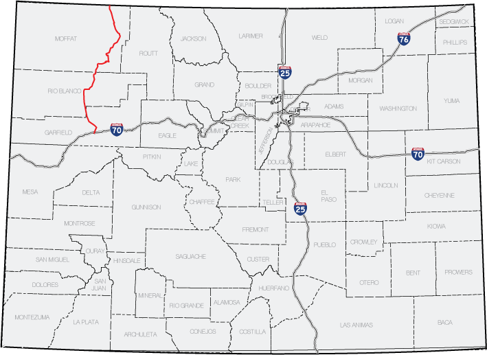
Route information Maintained by CDOT Length: 128.00 mi[1] (206.00 km) Major junctions South end:  I-70 in Rifle
North end:  WYO 789 near Baggs
Location Counties: Moffat, Rio Blanco, Garfield Highway system ←  SH 12
SH 12SH 14  →
→State Highway 13 in the U.S. state of Colorado is a mountain route that travels from the Wyoming border near Baggs, Wyoming down through the Rocky Mountains to Rifle.
Contents
Route description
The route begins at a diamond interchange with Interstate 70 south of Rifle. It then crosses the Colorado River and intersects U.S. Route 6 at the south side of Rifle. Along the north side of town the road turns slightly northeastward as it passes through the northern Rifle and into grassland,[2] where it intersects State Highway 325. As the road turns back northward and then slightly northwestward, the surrounding terrain turns into a more barren land dotted with occasional shrubs and grass.[2] As the road continues northwestward, the shrubs and trees become more dense along hillsides. SH 13 then crosses into Rio Blanco County, when the direction becomes straight north. SH 13 then interchanges with State Highway 64, which meets its east end here, and turns abruptly eastward. SH 13 then becomes Market Street as it cuts through the south side of Meeker, paralleling the White River. Following an intersection with a local road leading to Meeker Airport, the road again turns northward back into rural Rio Grande County.
Following several miles of barren land north of Meeker, SH 13 exits the White River Valley and enters mountainous terrain. The road then follows the Good Springs Creek valley to the Moffat county line. SH 13 continues through rural Moffat County and gradually turns eastward and again northward after a several miles. Near Hamilton, the route's next destination, the road meets State Highway 317 and turns slightly northwestward. After a distance winding through barren land, the road reaches Craig, where it meets U.S. Route 40 and begins a short concurrency through the city. Following the overlap SH 13 again moves northward, out of town and along the Fortification Creek valley. Here fields, are located along the road, moving northwestward.[2] Eventually, after moving along several miles of road through farmland, the road reaches the Wyoming state line. The road continues as Wyoming Highway 789 to Baggs.
History
The route was established in the 1920s and was paved by 1947. Minor changes corrected the route to its current routing today by 1985.[3]
Major intersections
County Location Mile Destination Notes Garfield Rifle 0.000 I-70South end of route 0.545  US 6E
US 6E4.114  SH 325
Rio Blanco 39.010  SH 64
SH 64Moffat Hamilton 75.793  SH 317
Craig 88.635  US 40
US 40Begin concurrency 89.608 US 40End concurrency 127.999 WYO 789 at the Wyoming borderNorth end of route References
- ^ "Segment list for SH 13". http://www.dot.state.co.us/app_DTD_DataAccess/Highways/index.cfm?fuseaction=Description&route=013&begRefPt=0&endRefPt=500&Printable=true. Retrieved 2007-05-12.
- ^ a b c Microsoft. Map of Route Overview of SH 13 – Bing Maps (Map). NavTEQ, Inc. http://www.bing.com/maps/#JmNwPTQwLjI4MzgzNTAwODc0MDQzfi0xMDcuNzE3NDA0MDY3NTE2MzMmbHZsPTgmc3R5PXImcnRwPXBvcy4zOS41MzMwMDAyMTU4ODgwMl8tMTA3Ljc4MzMwNDYwMTkwNzczX1JpZmxlJTJDJTIwQ09fX19lX35wb3MuNDEuMDM0NjY5ODAxNTkyODNfLTEwNy42NTc4OTkyNjA1MjA5NF9CYWdncyUyQyUyMFdZX19fZV8mbW9kZT1EJnJ0b3A9MH4wfjB+. Retrieved 2010-06-02.
- ^ Salek, Matthew E. (01-03-2010). "Colorado Routes 1-19". http://www.mesalek.com/colo/r1-19.html#13. Retrieved 2010-04-04.
Categories:

Wikimedia Foundation. 2010.