- Cropley (VTA)
-
Cropley
VTA light rail stationStation statistics Address Capitol Avenue and Cropley Avenue
San Jose, CaliforniaCoordinates 37°24′12″N 121°52′55″W / 37.403370°N 121.882070°WCoordinates: 37°24′12″N 121°52′55″W / 37.403370°N 121.882070°W Lines Alum Rock–Santa TeresaOther information Opened 2004 Accessible 
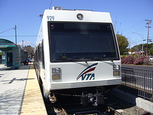
Owned by VTA Services Preceding station VTA Light Rail Following station toward Alum RockAlum Rock–Santa Teresa toward Santa TeresaCropley is a light rail station operated by Santa Clara Valley Transportation Authority (VTA). This station is served by VTA's Alum Rock–Santa Teresa line.
The station was opened in 2004 as part of the second phase of VTA's Tasman East light rail extension.[1]
Contents
Location
Cropley station is located in the median of North Capitol Avenue near Cropley Avenue in San Jose, California.
Station amenities
- Payphone
- Wheelchair accessible
Connecting transit
There are currently no bus connections.
VTA Bus Route 59, which previously served this station, was discontinued on January 14, 2008 as a result of updates to VTA bus service.
See also
References
- ^ "Tasman East/Capitol Project Description". Completed projects. Santa Clara Valley Transportation Authority. 2008-05-12. http://www.vta.org/projects/te_cap/project/. Retrieved 2008-11-16.
VTA Light Rail Stations Almaden • Alum Rock • Bascom • Baypointe • Bayshore/NASA • Berryessa • Blossom Hill • Bonaventura • Borregas • Branham • Capitol • Champion • Children's Discovery Museum • Cisco Way • Civic Center • Component • Convention Center • Cottle • Cropley • Crossman • Curtner • Downtown Campbell • Downtown Mountain View • Evelyn • Fair Oaks • Fruitdale • Gish • Great America • Great Mall/Main • Hamilton • Hostetter • I-880/Milpitas • Japantown/Ayer • Karina • Lick Mill • Lockheed Martin • McKee • Metro/Airport • Middlefield • Moffett Park • Montague • Oakridge • Ohlone/Chynoweth • Old Ironsides • Orchard • Paseo de San Antonio • Penitencia Creek • Race • Reamwood • River Oaks • Saint James • San Jose Diridon • San Fernando • Santa Clara • Santa Teresa • Snell • Tamien • Tasman • Vienna • Virginia • Whisman • WinchesterConnecting services Other Categories:- Santa Clara Valley Transportation Authority light rail stations
- Railway stations in San Jose, California
- Tram stubs
- California railway station stubs

Wikimedia Foundation. 2010.