- Tank District
Infobox Pakistan district
district = Tank District
area =
population =
pop_year = 1998
density =
caption = Area Map for the province ofNWFP andFATA showing Tank District alongside other districts
region =North-West Frontier Province
established =
nazim =
naib_nazim =
seats =
tehsils =
languages =
website =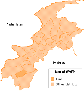
Tank, is a district in the
North-West Frontier Province ofPakistan , the city of Tank is the capital of the district. Tank was formerly part ofDera Ismail Khan District . Tank is bounded by the districts of Lakki Marwat to the northeast, Dera Ismail Khan to the east and southeast, andSouth Waziristan to the southwest, west, and northwest. The climate in Tank reaches 110-120 °F, however in the cold, harsh winters of the mountains, people come to Tank to enjoy a pleasant stay and then resort back during the summer.Administration
The district contains one
tehsil (subdivision), also called Tank [ [http://www.statpak.gov.pk/depts/pco/statistics/admin_unit/admin_list_tehsil.html LIST OF TEHSILS/TALUKAS WITH RESPECT TO THEIR DISTRICTS - Government of Pakistan] ] . And is represented in the Provincial Assembly by one elected MPA, Gulistan Bittani, who represents the following constituency: [ [http://www.panwfp.gov.pk/index.php/members/bydistrict/en/9/52 Constituencies and MPAs - Website of the Provincial Assembly of the NWFP] ]* PF-69 (Tank-1)
History
Prelude
The northern territory between the Indus river and the mountains of
Afghanistan was deemed impossible to tread in the days before the creation of Pakistan. Many a kings and great warriors tried to conquer the land by might but the fierce natives would flee them away. With successive by empires from the north likeAlexander the Great , the great andGenghis Khan andMongols from the east and the south, the natives were centred into a limited and desolate land, yet not defeated completely.The Macedonians flee
At the
Battle of the Hydaspes (now theBeas River ), fought betweenAlexander the Great 's army and the Indian kingPurushotthama (better known as Porus), theMacedon ian army refused to go any further. It is said that Alexander's army's was at risk of being trapped, or was faced by an enemy army too big to defeat, and had to retreat southwards through theMakran Desert.The Sikh and British Invasions
Finally, the Sikhs from the south over-ran the local tribes. They annexed the land in 1838. Somewhere in the midst of this turmoil, the British were assembling against the Afghans and the
First British-Afghan War commenced. Soon the British they took over in 1848; . The British regiments weren't able to occupy the entire territory and remained in camps at the foothills of the mountains. The harsh and dangerous upland terrain remained unexplored.: "...even the shadows of the hills were hazardous." [Taken from the book "Tank: Crossroad to the Frontier Tribes"]The British Colonial Rule
The eastern border of the Kingdom of
Kabul (Afghanistan ) was undefined until 1893 when the Durand Line was demarcated. Done in haste, theDurand Line demarcation is still rallied against (see Intersting References section for more on that). At that moment, the line was used to intentionally separate the fierce Pushtun tribes from the tame. Under the same agreement, the tribes ofWaziristan were clearly designated as being under the British rule.Tank seen as a centre for negotiation
The British negotiated with the tribes through their agents in the border towns and Tank was a centre of negotiation with the Mahsud tribe - the Nawab of Tank having married a Mahsud wife. For the Britishers the Mahsud tribe was the most difficult to control, and in 1860 when the Mahsuds attacked the British with a 3000 strong
Lashkar the British were forced to penetrate into the territory of Tank to control them.The birth of a province
In January 1899,
Lord Curzon was appointedViceroy of India . Reaching India shortly after the suppression of the frontier risings of 1897-98, he paid special attention to the independent tribes of the north-west frontier and inaugurated a new province called theNorth-West Frontier Province , and pursued a policy of forceful control mingled with conciliation. The only major armed outbreak on this frontier during the period of his administration was theMahsud Waziri campaign of 1901.Culture and Society
The people
" The native villagers "are mainly the farmers and field workers, who depend upon the flood waters to water their lands. Their water rights are stolen by the tribes people living upstream. Most all of the village people are
Pushtu speakers but there are many villages where people speak saraiki like chadhrar." The northern settlers "are Pushtu speaking people who make their livelihood by farming, land ownership, gun running, smuggling, falcon catching, migration for employment to the Persian Gulf, or by ownership of shops and businesses in Tank.
" Jirga "by definition means "Council". These are the religious circles and a group of people that decide the fate of the dwellers and rule the people by their sets of laws and principles.
People in the region speak native languages like
Pushtu and other non-Pushtu languages such as:
*Saraiki The tribes
The natives are ruled and distributed into various
Pukhtun tribes including the Katti Khel who were the ruler and chiefs (Nawab) of Tank,Bhittani s,Kundi ,Mianis (they live in the Gomal valley of Tank), Wazir's and theMahsud s. Both these tribes are at constant quarrel with each other over the territory of Tank as being theirs.The actual Nawabs of Tank are Katti Khel who came as invaders from Afghanistan with Ibrahim Lodhi. One of generals of his army was appointed as the chief and nawab of Tank, who belonged to province of Katawaz in Afghanistan. The later descendents of him are known as Katti Khel who reside in Tank and Dera Ismail Khan. The chiefs of Katti Khel family were Nawab Shah Nawaz Khan, Nawab Sarwar Khan, Qatal Khan, Nawab Ghulam Qasim Khan, Nawab Quttubudin Khan,whose descendents are Nawab Haibat Khan (Deceased 1993), Nawabzadas Azmat, Rehmat, Sadat, Niamet, Nusrat and Hashmat (deceased 1999)Khans. Other members of the family are those who live in Gomal and are descendants of the exiled brother of Nawab Quttubudin Khan who gave them lands for their maintenance and upkeep. These at times do lay claim to the title but have remained of no consequence other than occasionally participating in minor political activity.ee also
*
Federally Administered Tribal Areas
*Indus River
*Beas River
*Pashtun people
*Lord Curzon
*Alexander the Great References
* [http://www.dailytimes.com.pk/default.asp?page=story_27-10-2003_pg7_10 Durand Line re-demarcation]
Wikimedia Foundation. 2010.