Brown Covered Bridge

Brown Covered Bridge

Infobox_nrhp | name =Brown Covered Bridge
nrhp_type =


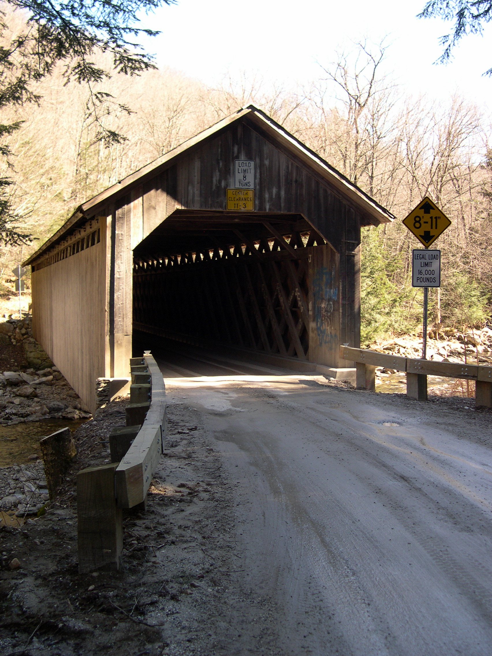
caption =The West approach to the Brown bridge
nearest_city= North Clarendon, Vermont
lat_degrees = 43 | lat_minutes = 33 | lat_seconds = 58.24 | lat_direction = N
long_degrees = 72 | long_minutes = 55 | long_seconds = 10.18 | long_direction = W
area =
built =1880
architect= Powers,Nicholas M.
architecture= Other
added = January 21, 1974
governing_body = Local
refnum=74000250 cite web|url=http://www.nr.nps.gov/|title=National Register Information System|date=2007-01-23|work=National Register of Historic Places|publisher=National Park Service]
The Brown Covered Bridge is a covered bridge in Clarendon, Vermont. Built in 1880 by Nicholas Powers, the bridge is a town lattice style with a 100 foot span across the Cold River. The bridge is listed on the National Register of Historic Places

It is located on North Cold River Road, a seasonal dirt road a few miles from U.S. Route 7 near Rutland, Vermont.

References

External links


Wikimedia Foundation. 2010.

Игры ⚽ Поможем написать реферат

Look at other dictionaries:

  • Covered bridge — The Cogan House Covered Bridge over Larrys Creek, Cogan House Township, Pennsylvania, U.S. Ancestor Truss bridge, others …   Wikipedia

  • Fallasburg Covered Bridge — 42.980263888889 85.327055555556 Koordinaten: 42° 58′ 49″ N, 85° 19′ 37,4″ W f1 …   Deutsch Wikipedia

  • Ada Covered Bridge — Infobox Bridge bridge name=Ada Covered Bridge caption=Upstream view from observation deck in park. carries=Fase/Bronson St. (footpath) crosses=Thornapple River locale=Ada, Michigan maint=Kent County Road Commission design=Brown truss Covered… …   Wikipedia

  • Sonestown Covered Bridge — Coordinates: 41°20′47″N 76°33′18″W / 41.34639°N 76.555°W / 41.34639; 76.555 …   Wikipedia

  • Forksville Covered Bridge — Geobox|Bridge name = Forksville Covered Bridge native name = category = National Register of Historic Places image size = 300 image caption = The Forksville Covered Bridge over Loyalsock Creek official name = Forksville Covered Bridge other name …   Wikipedia

  • Hillsgrove Covered Bridge — Geobox|Bridge name = Hillsgrove Covered Bridge native name = category = National Register of Historic Places image size = 300 image caption = The Hillsgrove Covered Bridge over Loyalsock Creek official name = Hillsgrove Covered Bridge other name …   Wikipedia

  • Gudgeonville Covered Bridge — Geobox|Bridge name = Gudgeonville Covered Bridge official name = Gudgeonville Covered Bridge other name = Gudgeonville Road category = U.S. National Register of Historic Places image size = 300 caption = country = United States country state =… …   Wikipedia

  • Gudgeonville Covered Bridge — 41.979855555556 80.266088888889 Koordinaten: 41° 58′ 47,5″ N, 80° 15′ 57,9″ W f1 …   Deutsch Wikipedia

  • Mill Creek Covered Bridge — Mill Creek Bridge U.S. National Register of Historic Places …   Wikipedia

  • Cogan House Covered Bridge — Coordinates: 41°23′54″N 77°12′03″W / 41.39833°N 77.20083°W / 41.39833; 77.20083 …   Wikipedia

Share the article and excerpts

Direct link
Do a right-click on the link above
and select “Copy Link”