- Clenze
-
Clenze 

 ClenzeLocation of Clenze within Lüchow-Dannenberg district
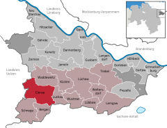

Coordinates 52°56′9″N 10°57′21″E / 52.93583°N 10.95583°ECoordinates: 52°56′9″N 10°57′21″E / 52.93583°N 10.95583°E Administration Country Germany State Lower Saxony District Lüchow-Dannenberg Municipal assoc. Lüchow (Wendland) Local subdivisions 28 Ortsteile Mayor Herbert Höbermann Basic statistics Area 71.77 km2 (27.71 sq mi) Elevation 25 m (82 ft) Population 2,254 (31 December 2010)[1] - Density 31 /km2 (81 /sq mi) Other information Time zone CET/CEST (UTC+1/+2) Licence plate DAN Postal code 29459 Area code 05844 Clenze is a municipality in the district Lüchow-Dannenberg, in Lower Saxony, Germany. It is situated approx. 20 km northwest of Salzwedel, and 25 km east of Uelzen.
The Polabian name of Clenze is Klǫcka (spelled Cloontzka in older German reference material).
Up until November 1, 2006 Clenze was the seat of the Samtgemeinde ("collective municipality") Clenze. It is now part of the Samtgemeinde Lüchow (Wendland).
References
- ^ "Bevölkerungsfortschreibung" (in German). Landesbetrieb für Statistik und Kommunikationstechnologie Niedersachsen. 31 December 2009. http://www1.nls.niedersachsen.de/statistik/html/parametereingabe.asp?DT=K1000014&CM=Bev%F6lkerungsfortschreibung.
Bergen an der Dumme | Clenze | Damnatz | Dannenberg | Gartow | Göhrde | Gorleben | Gusborn | Hitzacker | Höhbeck | Jameln | Karwitz | Küsten | Langendorf | Lemgow | Lübbow | Lüchow | Luckau | Neu Darchau | Prezelle | Schnackenburg | Schnega | Trebel | Waddeweitz | Woltersdorf | Wustrow | Zernien Categories:
- Municipalities in Lower Saxony
- Lüneburg region geography stubs


Wikimedia Foundation. 2010.