- New York State Route 441
-
NYS Route 441
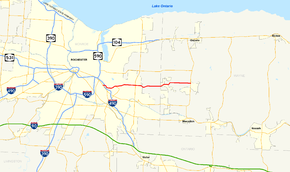
Map of the Rochester area with NY 441 highlighted in redRoute information Maintained by NYSDOT Length: 12.55 mi[3] (20.20 km) Existed: late 1940s[1][2] – present Major junctions West end:  NY 96 in Brighton
 I-490 in Brighton
 NY 250 in Penfield
East end:  NY 350 in Walworth
Location Counties: Monroe, Wayne Highway system Numbered highways in New York
Interstate • U.S. • N.Y. (former) • Reference • County←  NY 440
NY 442  →
→New York State Route 441 (NY 441) is an east–west state highway in the eastern suburbs of Rochester, New York, United States. Its western terminus is at NY 96 in Brighton, and its eastern terminus is at NY 350 in Walworth. The portion of NY 441 in Brighton and western Penfield is a divided highway. The highway gradually narrows to a two-lane road as it heads away from the city of Rochester. It connects to Interstate 490 (I-490) in Brighton and intersects NY 250 in Penfield.
NY 441 was originally routed on Penfield Road between Brighton and Penfield when it was assigned in the late 1940s. It remained on Penfield Road through Penfield and into Wayne County to its current eastern terminus in Walworth. The entirety of this routing had previously been part of NY 33, which extended east to Marion during the 1930s and 1940s. The divided highway that now carries NY 441 through Brighton and western Penfield was constructed during the late 1960s and opened as a realignment of NY 441 by 1971.
Contents
Route description
West of Penfield
NY 441 begins at an intersection with NY 96 (East Avenue) in the Monroe County town of Brighton. This portion of NY 441 is named Linden Avenue; the road continues west of Route 96 as Elmwood Avenue. Just east of Route 96, Route 441 meets I-490 at exit 23. Past the interchange, NY 441 turns southeastward and becomes a divided highway.[4] The portion of NY 441 from East Avenue to the Wayne County line is designated as the "Korean War Memorial Highway" by the state of New York.[5]
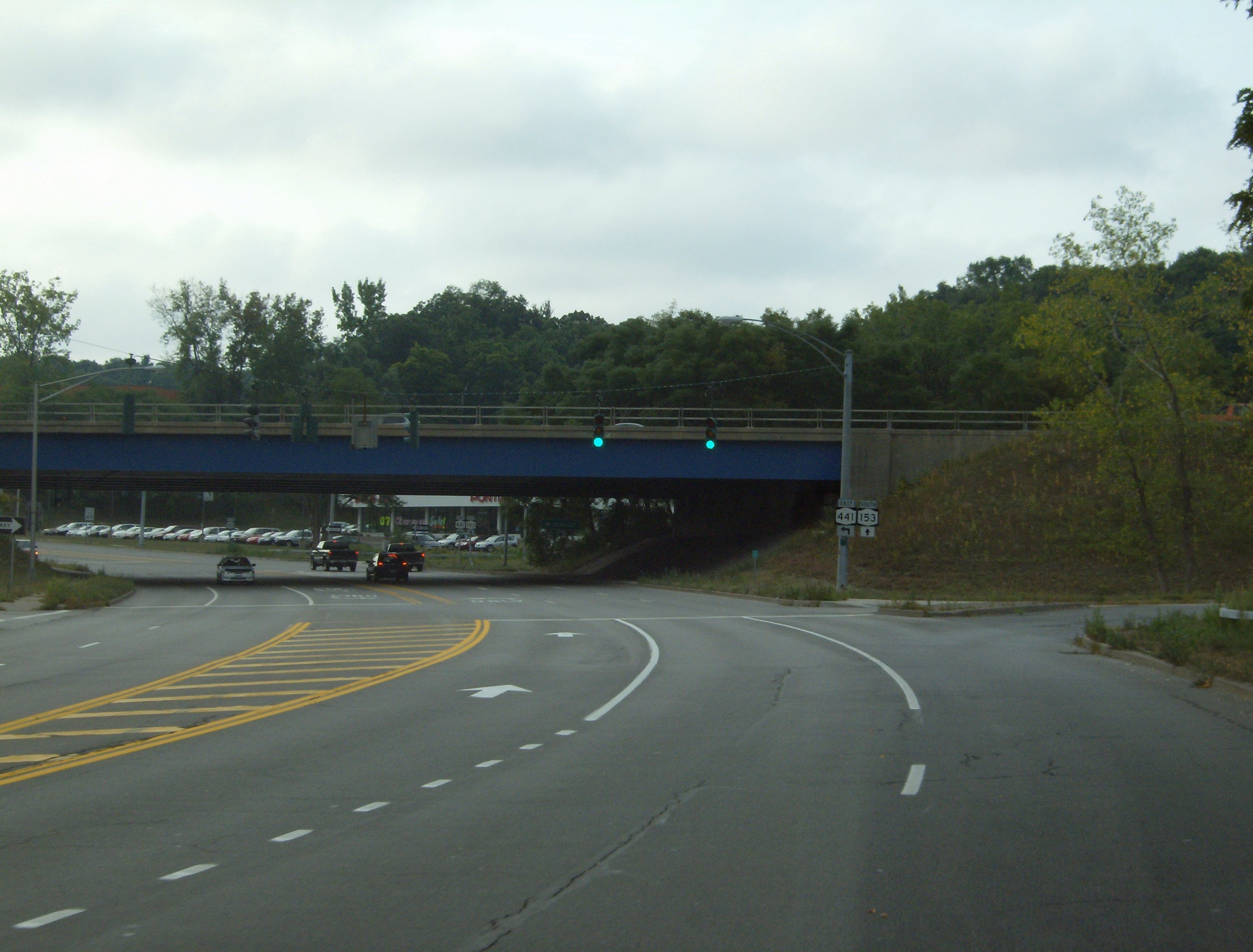
 Interchange between NY 153 and NY 441 as seen from Panorama Trail southbound
Linden Avenue separates from NY 441 roughly 0.4 miles (0.6 km) from I-490 and follows a routing parallel to NY 441 on the opposite side of the nearby Rochester Subdivision, a double-tracked rail line owned by CSX Transportation. Continuing onward, Route 441 curves eastward and crosses over the CSX railroad line ahead of another intersection with Linden Avenue in the town of Pittsford. Linden Avenue crosses NY 441 and heads southeastward toward East Rochester; however, NY 441 curves northeastward to enter the town of Penfield.[4]
Although this portion of NY 441 is surrounded by woodlands, it is actually located in a largely developed area of Penfield known locally as Panorama. The woods cease as NY 441 approaches an interchange with Panorama Trail (NY 153), the lone limited-access junction along the divided highway. East of NY 153, NY 441 crosses over Irondequoit Creek and downgrades to a four-lane undivided highway at a junction with Penfield Road. Here, Route 441 becomes Penfield Road and enters the densely populated hamlet of Penfield.[4]
Penfield and Wayne County
In Penfield, Route 441 passes through the commercial town center and intersects Five Mile Line Road at the Four Corners of Penfield. As it heads east through the town of Penfield, the businesses are largely replaced by residences. The one exception to this is in the immediate vicinity of Lloyd's Corners—the intersection of NY 441 and NY 250—where three of the four corners of the junction are occupied by large strip malls. The level of development along NY 441 begins to decline 0.75 miles (1.21 km) east of NY 250, where the road narrows to two lanes. The surroundings become largely undeveloped by the point where NY 441 enters Wayne County.[4]
Now in the town of Walworth, NY 441 becomes Walworth–Penfield Road. Just east of the county line, NY 441 shifts slightly northward by way of an S-curve that serves as a connector between the segmented West Walworth Road, which NY 441 intersects at both ends of the curve. This is the last curve along NY 441 as it follows a linear east–west routing over several small hills to a junction with NY 350 west of the hamlet of Walworth, where NY 441 terminates.[4] The roadway, however, continues east to Marion as Walworth–Penfield Road, Walworth–Marion Road, and Buffalo Street, a continuous highway maintained by Wayne County as County Route 205 (CR 205) west of Hall Center Road and Maple Avenue and as CR 207 east of those roads.[6]
History
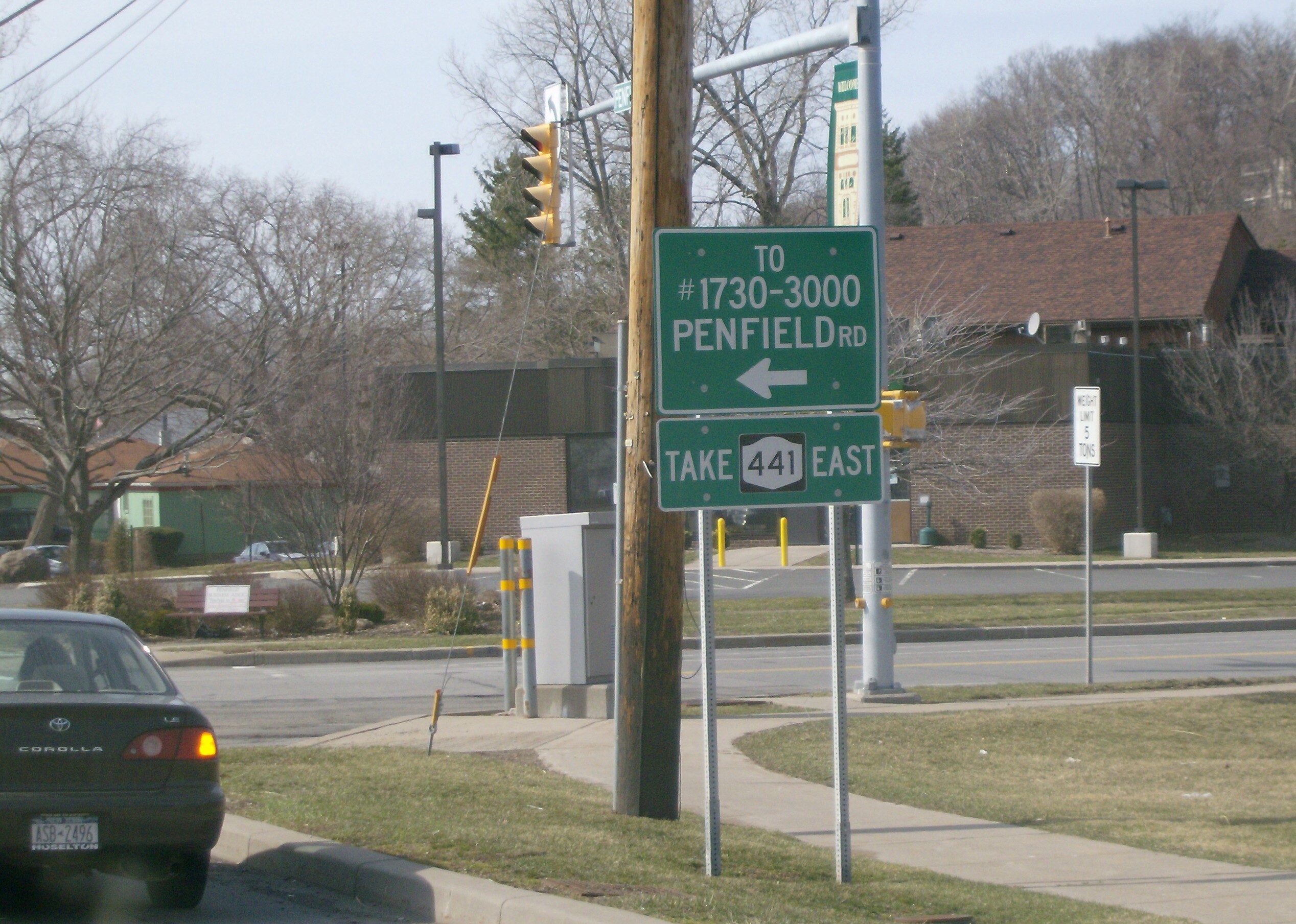
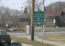 Sign on Penfield Road (former NY 441) in Panorama directing traffic bound for eastern Penfield Road (NY 441) onto Panorama Trail
The portion of NY 441 from where Penfield Road leaves NY 441 in Penfield to Walworth was originally designated as part of NY 33 in the 1930 renumbering of state highways in New York. West of the Four Corners of Penfield, NY 33 remained on Penfield Road through Penfield and Brighton to the modern intersection of Penfield Road and NY 96 (East Avenue). The route turned west to follow East Avenue into Rochester. On its eastern end, NY 33 continued on to Marion, where it ended at NY 21.[7] NY 33 was truncated to its current eastern terminus at NY 31 in downtown Rochester in the late 1940s. The portion of former NY 33 between NY 96 and NY 350 was redesignated as NY 441.[1][2]
Construction on a new divided highway through the towns of Brighton and Penfield began in the late 1960s and was completed by 1971, at which time it became a realignment of NY 441. At the western end, NY 441 was routed onto the pre-existing Linden Avenue to connect to NY 96 southeast of its former terminus.[8][9] This portion of Linden Avenue—from NY 96 to I-490—was originally maintained by Monroe County as CR 15.[10] In 2007, ownership and maintenance of the CR 15 segment of NY 441 was transferred from Monroe County to the state of New York as part of a highway maintenance swap between the two levels of government. A bill (S4856, 2007) to enact the swap was introduced in the New York State Senate on April 23 and passed by both the Senate and the New York State Assembly on June 20. The act was signed into law by Governor Eliot Spitzer on August 28. Under the terms of the act, it took effect 90 days after it was signed into law; thus, the maintenance swap officially took place on November 26, 2007.[11] The entirety of NY 441 is now maintained by the New York State Department of Transportation.[12]
Major intersections
County Location Mile[3] Destinations Notes Monroe Brighton 0.00 NY 96 (East Avenue)0.20 I-490Exit 23 (I-490) Penfield 2.01  NY 153 (Panorama Trail)
Diamond interchange; northern terminus of NY 153 2.96 Five Mile Line Road Four Corners; former northern terminus of NY 253 4.74 NY 250 (Fairport – Nine Mile Point Road)Lloyd's Corners Wayne Walworth 12.55 NY 3501.000 mi = 1.609 km; 1.000 km = 0.621 mi References
- ^ a b State of New York Department of Public Works. Official Highway Map of New York State (Map). Cartography by General Drafting (1947–48 ed.).
- ^ a b Esso (1949). New York (Map). Cartography by General Drafting (1950 ed.).
- ^ a b "2008 Traffic Data Report for New York State" (PDF). New York State Department of Transportation. June 16, 2009. p. 315. https://www.nysdot.gov/divisions/engineering/technical-services/hds-respository/NYSDOT_Traffic_Data_Report_2008.pdf. Retrieved December 9, 2009.
- ^ a b c d e Google, Inc. Google Maps – overview of NY 441 (Map). Cartography by Google, Inc. http://maps.google.com/maps?f=d&source=s_d&saddr=Linden+Ave%2FNY-441&daddr=43.139191,-77.292638&hl=en&geocode=FVoWkgIdxgBh-w%3B&mra=dme&mrcr=0&mrsp=1&sz=17&sll=43.139348,-77.293453&sspn=0.005519,0.013926&ie=UTF8&t=h&ll=43.134815,-77.410698&spn=0.176629,0.445633&z=12. Retrieved April 28, 2009.
- ^ New York State Department of Transportation (January 2009) (PDF). Official Description of Highway Touring Routes, Bicycling Touring Routes, Scenic Byways, & Commemorative/Memorial Designations in New York State. https://www.nysdot.gov/divisions/operating/oom/transportation-systems/repository/2009%20tour-bk.pdf. Retrieved April 28, 2009.
- ^ Yahoo! Inc. Yahoo! Maps – Walworth and Marion, New York (Map). Cartography by NAVTEQ. http://maps.yahoo.com/#mvt=m&lat=43.145818&lon=-77.245262&zoom=15. Retrieved April 28, 2009.
- ^ Automobile Legal Association (ALA) Automobile Green Book, 1930/31 and 1931/32 editions, (Scarborough Motor Guide Co., Boston, 1930 and 1931). The 1930/31 edition shows New York state routes prior to the 1930 renumbering
- ^ Esso (1968). New York (Map). Cartography by General Drafting (1969–70 ed.).
- ^ United States Geological Survey (1978). Rochester East Quadrangle – New York – Monroe Co. (Map). 1:24,000. 7.5 Minute Series (Topographic). http://www.nysgis.state.ny.us/gisdata/quads/drg24/usgspreview/index.cfm?code=o43077b5. Retrieved April 27, 2009.
- ^ New York State Department of Transportation (1997). Rochester East Digital Raster Quadrangle (Map). 1:24,000. http://www.nysgis.state.ny.us/gisdata/quads/drg24/dotpreview/index.cfm?code=o18. Retrieved April 28, 2009.
- ^ New York State Legislature. "Bills of New York State – bill number-based search". http://public.leginfo.state.ny.us/menugetf.cgi. Retrieved February 5, 2010.
- ^ New York State Department of Transportation (March 2, 2009). "Region 4 Inventory Listing". https://www.nysdot.gov/divisions/engineering/technical-services/highway-data-services/inventory-listing. Retrieved April 28, 2009.
External links
Categories:- State highways in New York
- Transportation in Monroe County, New York
- Transportation in Wayne County, New York

Wikimedia Foundation. 2010.