- Lake Peipus
-
Lake Peipus-Pihkva
Peipsi-Pihkva järv
Чудско-Псковское озеро
Landsat satellite photo Location Estonia, Russia Coordinates 58°41′N 27°29′E / 58.683°N 27.483°ECoordinates: 58°41′N 27°29′E / 58.683°N 27.483°E Primary inflows Emajõgi, Velikaya Primary outflows Narva Catchment area 47,800 km2 (18,500 sq mi) Basin countries Estonia, Russia, Latvia, Belarus Surface area 3,555 km2 (1,373 sq mi) Average depth 7.1 m (23 ft) Max. depth 15.3 m (50 ft) Water volume 25 km3 (6.0 cu mi) Shore length1 520 km (320 mi) Surface elevation 30 m (98 ft) Islands Piirissaar, Kolpina, Kamenka Settlements Mustvee, Kallaste 1 Shore length is not a well-defined measure. Lake Peipus,[1] (Estonian: Peipsi järv, Pihkva järv; Russian: Чудско-Псковское озеро (Chudsko-Pskovskoe ozero), German: Peipussee) is the biggest transboundary lake in Europe on the border between Estonia (part of European Union) and Russia.
The lake is the fifth largest in Europe after Lake Ladoga and Lake Onega in Russia north of St. Petersburg, Lake Vänern in Sweden, and Lake Saimaa in Finland.[2]
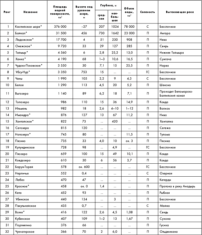
Lake Peipus-Pihkva is a remnant of a bigger body of water which existed in this area during an Ice Age. It covers 3,555 km2, and has an average depth of 7.1 m, the deepest point being 15 m.[3][4] The lake has several islands and consists of 3 parts:
- Lake Peipsi/Chudskoe (Estonian: Peipsi järv, Russian: Чудское озеро) is the northern part of the lake with the area of 2611 km2 (73%).
- Lake Pihkva/Pskovskoe (Estonian: Pihkva järv, Russian: Псковское озеро) is the southern part of the lake (area 708 km2 or 20%).
- Lake Lämmijärv/Teploe (Estonian: Lämmijärv, Russian: Тёплое озеро) is the sound connecting both parts of the lake (area 236 km2 or 7%).
The lake is used for fishing and recreation, but suffered from some environmental degradation from Soviet era agriculture. Some 30 rivers and streams discharge into Lake Peipus. The largest rivers are Emajõgi and Velikaya River. The lake is drained by the Narva River.
In 1242, the lake was the site of the Battle on the Ice (Estonian: Jäälahing) between the Teutonic Knights and Novgorodians under Alexander Nevsky.
Contents
Formation
The lake is a remnant of a larger body of water which existed in this area during an Ice Age.[5][citation needed] In the Paleozoic Era, 300–400 million years ago, the entire territory of the modern Gulf of Finland was covered by a sea. Its modern relief was formed as a result of glacier activities, the last of which, the Weichselian glaciation, ended about 12,000 years ago.
Topography and hydrography
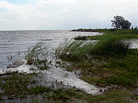
The banks of Lake Peipus have smooth contours and form only one large bay – Raskopelsky Bay. The low shores of the lake mostly consist of peat and are bordered by vast lowland and marshes which are flooded in the Spring with the flooding area reaching up to 1000 km2.[6] The west bank of the Pihkva Lake is high and steep; the west bank of Peipus Lake is low and boggy, and the east bank is more sublime. There are sand dunes and hills, covered with pine forests. Along the sandy shores there is a 200–300 m wide stretch of shallow waters.[7]
Water balance of Lake Peipus-Pihkva[6] Water balance Volume Inflow Precipitation 560 mm (1.9 km3) Surface and groundwater 3150 mm (11.2 km3) Outflow Streamflow 3390 mm (12 km3) Evaporation 320 mm (1.1 km3) The relief of the bottom is uniform and flat, gradually rising near the shores and covered with silt, and in some places with sand.[8] The deepest point of 15.3 m is located in the Teploe Lake, 300 m from the coast.[9]
The lake is well-flowing, with the annual inflow of water equal to about half of the total water volume.[6]
The lake water is fresh, with a low transparency of about 2.5 m due to plankton and suspended sediments caused by the river flow.[6] Water currents are weak (5–9 cm/s); they are induced by the wind and stop when it ceases. However, during the spring flood, there is a constant surface current from south to north.[8]
Because of the shallow depth, the lake quickly warms up and cools down. Water temperature reaches 25–26 °C in July.[9] The lakes freeze in late November – early December and thaws in late April – early May, first lakes Teploe and Pihkva and then lake Peipus.[6]
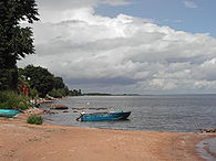
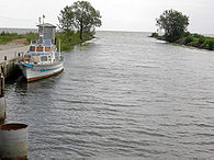
Kallaste Mustvee harbor Ranna Shoreline at Mustvee  Map of pools of Narva and Lake Peipsi
Basin and islands
About 30 rivers flow into the lake.[10] The largest are Velikaya and Emajõgi, smaller rivers include Zadubka, Cherma, Gdovka, Kuna, Torohovka, Remda, Rovya, Chernaya, Lipenka, Startseva, Borovka, Abija, Obdeh, Piusa, Võhandu, Kodza, Kargaya, Omedu, Tagajõgi and Alajõgi. The lake is drained by only one river, the Narva into the Baltic Sea.[3]
The lake contains 29 islands with a total area of 25.8 km2, with 40 more islands located within the delta of the Velikaya River.[9] The islands are low wetlands, elevated above the lake surface on average by only 1–2 m (maximum 4.5 m) and therefore suffer from floods. The largest islands are Piirissaar (area 7.39 km2, located in the southern part of Lake Peipus), Kolpino (area 11 km2, in the Pihkva Lake) and Kamenka (area 6 km2). In the center of Pihkva Lake there is a group of Talabski Islands (Belova, Zalita and Talavenets).[6]
Flora and fauna
The lake hosts 54 species of coastal aquatic flora, including cane, calamus, bulrush, grass rush, Lesser Bulrush and water parsnip. Floating plants are rare and are of only three types: arrowhead, yellow water-lily and water knotweed.[11] The wetlands of the coastal strip of the lake are important resting and feeding grounds for swans, geese and ducks migrating between the White Sea and Baltic Sea.[8][12] The lake is home to perch, pike-perch, bream, roaches, whitefishes, smelt and other fish species.[3]
Ecology
The ecological condition of the lake basin is, in general, satisfactory – water is mostly of grades I and II (clean), and is of grade III in some rivers due to the high content of phosphorus. The water condition of the rivers has improved since 2001–2007, but there is an increase in population of blue-green algae. The main problem of Lake Peipus is its eutrophication.[13]
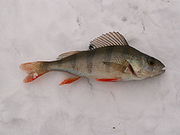
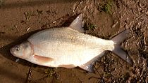
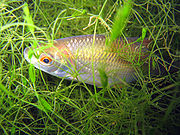
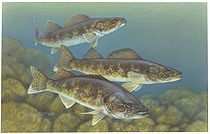
European perch Carp bream roach Pike-perch Economy
The towns standing on the banks are relatively small and include Mustvee (population 1,610), Kallaste (population 1,260) and Gdov (population 4,400). The largest city, Pskov (population 202,000) stands on the Velikaya River, 10 km from the lake.[7] Ship navigation is well developed and serves fishery, transport of goods and passengers and tourist tours.[12][14][15] The picturesque shores of the lake are a popular destination for tourism and recreation at several tourist camps and sanatoriums.[16][17][18]
History
In 1242, the southern part of Lake Peipus hosted a major historical battle where Teutonic Knights were defeated by the Russian troops from Novgorod led by Alexander Nevsky. The battle is remarkable in that it was mostly fought on the frozen surface of the lake and is therefore called the Battle on the Ice.[19][20]
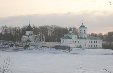
The largest city on the lake, Pskov, is also one of the oldest cities in Russia, known from at least 903 AD from a record in the Primary Chronicle of the Laurentian Codex.[21][22] Several historical buildings remain in the city, including Mirozhsky Monastery (1156, which contains famous frescoes of 14–17th centuries), Pskov Kremlin (14–17th centuries) with the five-domed Trinity Cathedral (1682–1699), churches of Ivanovo (until 1243), Snetogorsky monastery (13th century), Church of Basil (1413), Church of Cosmas and Damian (1462), Church of St. George (1494) and others.[23]
Gdov was founded in 1431 as a fortress and became a city in 1780;[24] the only remains of the historical Gdov Kremlin are three fortress walls.[25] Kallaste was founded in the 18th century by the Old Believers who had fled from the Novgorod area,[26][27] and there is still a functional Russian Orthodox Old-Rite Church in the town. Near Kallaste, there is one of the largest surfacings of Devonian sandstone with a length of 930 m and a maximum height of 8 m, as well as several caves and one of the largest in Estonia colonies of swallows.[28]
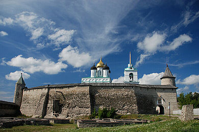
Mirozhsky Monastery Pskov Kremlin References
- ^ http://www.britannica.com/EBchecked/topic/448876/Lake-Peipus
- ^ Kapanen, Galya; Jaan–Mati Punning, Irina Blinova, and Külli Kangur (2008). "The Roles of Natural and Anthropogenic Factors of Ecological State in the Lake Peipus". International Journal of Applied Science, Engineering and Technology. http://www.waset.org/journals/waset/v28/v28-25.pdf. Retrieved 2008-10-15.
- ^ a b c "Chudsko-Pskovskoe ozero". Great Soviet Encyclopedia. http://slovari.yandex.ru/dict/bse/article/00089/94700.htm.
- ^ Russia Lakes area of more than 350 km2
- ^ Encyclopedic Dictionary of Geography: Geographical names - Moscow: Soviet Encyclopedia. 1983, p. 488.
- ^ a b c d e f Sokolov AA Hydrography of the USSR L.: Gidrometeoizdat, 1952
- ^ a b Tourist Encyclopedia. Peipsi-Pskov Lake
- ^ a b c study the situation of the ports on the Narva River
- ^ a b c lakes and rivers south of Estonia, the islands
- ^ By Peipus pond
- ^ Fish and Lake Pskov region. Lakes
- ^ a b Tourist portal svali.ru
- ^ Minutes of the eleventh meeting of the Joint Russian-Estonian commission for the protection and rational use of transboundary waters
- ^ TrevelTurs. Peipsi-Pskov lake system
- ^ Transport of Pskov Oblast
- ^ Pskov region. Peipsi and Lake Pskov
- ^ More and more foreigners resting on Lake Peipus
- ^ Tourist Encyclopedia
- ^ Tony Jaques (2007). Dictionary of Battles and Sieges: F-O. Greenwood Publishing Group. p. 564. ISBN 0313335389. http://books.google.com/?id=Dh6jydKXikoC&pg=PA564.
- ^ Toivo Miljan (2004). Historical dictionary of Estonia. Scarecrow Press. p. 299. ISBN 0810849046. http://books.google.com/?id=XKWRct15XfkC&pg=PA299.
- ^ "Pskov". Great Soviet Encyclopedia. http://slovari.yandex.ru/dict/bse/article/00063/74100.htm.
- ^ Wladyslaw Duczko (2004). Viking Rus: studies on the presence of Scandinavians in Eastern Europe. BRILL. p. 114. ISBN 9004138749. http://books.google.com/?id=hEawXSP4AVwC&pg=PA114.
- ^ ancient city of Pskov
- ^ "Gdov". Great Soviet Encyclopedia. http://slovari.yandex.ru/dict/bse/article/00017/09000.htm.
- ^ My Gdov
- ^ Kallaste. A bit of history
- ^ Old Believer community Kallaste
- ^ Russian site about the city Kallaste
External links
- Peipsi Infokeskus Estonian tourist information website
Categories:- Lakes of Estonia
- Lakes of Russia
- Estonia–Russia border
- International lakes of Europe
- Narva River basin


Wikimedia Foundation. 2010.