- Pyhä-Häkki National Park
Geobox|Protected Area
name = Pyhä-Häkki National Park
native_name = Pyhä-Häkin kansallispuisto
other_name =
other_name1 =
category_local = National Park of Finland
category_iucn = II
image_size =
image_caption =
country = Finland
country_
state =
state_type =
state_
region = Western Finland
region_type = Province
location =
lat_d = 62
lat_m = 50
lat_s = 44
lat_NS = N
long_d = 25
long_m = 28
long_s = 21
long_EW = E
elevation =
biome =
biome_share =
biome1 =
biome1_share =
geology =
geology1 =
plant =
plant1 =
animal =
animal1 =
area = 13
area1 =
area1_type =
length =
length_orientation =
width =
width_orientation =
highest =
highest location =
highest_lat_d =
highest_lat_m =
highest_lat_s =
highest_lat_NS =
highest_long_d =
highest_long_m =
highest_long_s =
highest_long_EW =
highest_elevation =
lowest =
lowest_location =
lowest_lat_d =
lowest_lat_m =
lowest_lat_s =
lowest_lat_NS =
lowest_long_d =
lowest_long_m =
lowest_long_s =
lowest_long_EW =
lowest_elevation =
established_type = Established
established = 1956
established1_type =
established1 =
management_body =Metsähallitus
management_location =
management_lat_d =
management_lat_m =
management_lat_s =
management_lat_NS =
management_long_d =
management_long_m =
management_long_s =
management_long_EW =
management_elevation =
visitation = 9000
visitation_date = 2005
free_type =
free =
free1_type =
free1 =
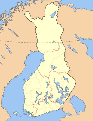
map_locator_x = 45.1
map_locator_y = 88.8
map_size =
map_caption =
map_first =
website = http://www.outdoors.fi/pyha-hakkinpPyhä-Häkki National Park ("Pyhä-Häkin kansallispuisto") is a
national park inWestern Finland . It was established in 1956 (extended in 1982 when Kotaneva was joined to it) and covers convert|13|km2|sqmi|0. Its foundation was planned already in the late 1930s, but the war interrupted these plans.The national park protects old
Scots pine andNorway spruce copses, which started growing when Finland was still under Swedish rule, andswamp s, which comprise half of the national park. The national park is the largest remaining area ofvirgin forest in the southern half ofFinland . In addition to the pine and the spruce, "Betula pendula ", "Betula pubescens ", "Populus tremula ", and "Alnus glutinosa " (the latter along some creeks) are the tallertree species encountered in the national park.See also
*
List of national parks of Finland
*Protected areas of Finland External links
* [http://www.outdoors.fi/pyha-hakkinp Outdoors.fi – Pyhä-Häkki National Park]
* [http://www.pyha-hakki.k-netti.nu/ Pyhä-Häkki files] – Photos and writings about Pyhä-Häkki
* [http://puisto.info/ The park's unofficial webpage]

Wikimedia Foundation. 2010.