- Torkham
Infobox Settlement
official_name =Torkham
other_name =
native_name =
nickname =
settlement_type =
motto =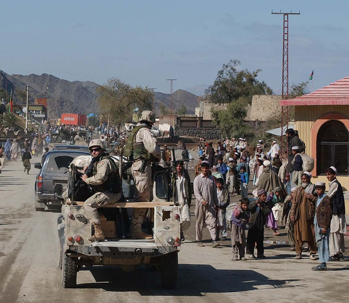
imagesize = 300px
image_caption = Torkham's main street
flag_size =
image_
seal_size =
image_shield =
shield_size =
image_blank_emblem =
blank_emblem_type =
blank_emblem_size =
mapsize =
map_caption =
mapsize1 =
map_caption1 =
image_dot_
dot_mapsize =
dot_map_caption =
dot_x = |dot_y =
pushpin_
pushpin_label_position =bottom
pushpin_map_caption =Location in Afghanistan
pushpin_mapsize =300
subdivision_type = Country
subdivision_name = flag|Afghanistan
subdivision_type1 = Province
subdivision_name1 =Nangarhar Province
subdivision_type2 = District
subdivision_name2 =
subdivision_type3 =
subdivision_name3 =
subdivision_type4 =
subdivision_name4 =
government_footnotes =
government_type =
leader_title =
leader_name =
leader_title1 =
leader_name1 =
leader_title2 =
leader_name2 =
leader_title3 =
leader_name3 =
leader_title4 =
leader_name4 =
established_title =
established_date =
established_title2 =
established_date2 =
established_title3 =
established_date3 =
area_magnitude =
unit_pref =Imperial
area_footnotes =
area_total_km2 =
area_land_km2 =
area_water_km2 =
area_total_sq_mi =
area_land_sq_mi =
area_water_sq_mi =
area_water_percent =
area_urban_km2 =
area_urban_sq_mi =
area_metro_km2 =
area_metro_sq_mi =
area_blank1_title =
area_blank1_km2 =
area_blank1_sq_mi =
population_as_of =
population_footnotes =
population_note =
population_total =population_density_km2 =
population_density_sq_mi =
population_metro =
population_density_metro_km2 =
population_density_metro_sq_mi =
population_urban =
population_density_urban_km2 =
population_density_urban_sq_mi =
population_blank1_title =Ethnicities
population_blank1 =
population_blank2_title =Religions
population_blank2 =
population_density_blank1_km2 =
population_density_blank1_sq_mi =
timezone =
utc_offset =
timezone_DST =
utc_offset_DST =
latd=34|latm=6 |lats=53|latNS=N
longd=71|longm=5 |longs=5|longEW=E
elevation_footnotes =
elevation_m = 1066
elevation_ft =
postal_code_type =
postal_code =
area_code =
blank_name =
blank_info =
blank1_name =
blank1_info =
website =
footnotes =Torkham is a border crossing town in the
Nangarhar province ofAfghanistan and theKhyber Agency of Pakistan'sFederally Administered Tribal Areas , right on theDurand Line border.cite web
url=http://www.usaid.gov/locations/asia_near_east/documents/countries/afghanistan/033104_report.pdf
title=Rebuilding Afghanistan: Strengthening the Government
publisher=USAID
date=March 24 2004
accessdate=2008-01-22] cite news
url=http://query.nytimes.com/gst/fullpage.html?res=9503E4D6143BF935A25752C1A9679C8B63&sec=&spon=&pagewanted=all
title= A NATION CHALLENGED: AFGHANISTAN REDUX; Warlord Rule Is Re-emerging In Some Towns
publisher=New York Times
author=David Rohde
date=Friday,November 16 ,2001
accessdate=2008-02-19
quote=] cite news
url=http://www.ddrafg.com/images/ANP/DASH-A%2004-01%20ANP%20Towr%20Kham%20border.pdf
title=ANP secure Towr Kham border
page=
pages=
publisher=Defense and Security, Afghanistan
author=
date=April 4 2006
accessdate=2008-02-19
quote=] It is linked by a highway withJalalabad to the west,Peshawar to the east, and is linked theN-5 National Highway toKarachi - the town is only five kilometres west of the summit of theKhyber Pass . Torkham is the busiestport of entry between Afghanistan and Pakistan. It is also a major transporting, shipping, and receiving site between the two neighboring countries.cite web
url=http://www.zharov.com/dupree/chapter10.html
title=An Historical Guide To Afghanistan - From The East - Chapter 10 - Torkham to Kabul
page=
pages=
publisher=
author=Nancy Hatch Dupree
date=]In November 2001 the "
New York Times " reported that Towr Kham was the home ofHazrati Ali , an anti-Taliban militia leader who seized power after the Taliban retreated.The "New York Times" reported that Hazrati Ali had joined forces with two other militia leaders,Mawlawi Yunis Khalis , andEzatullah , to set up a regional provisional government.In April 2006 the
Afghan Border Police announced that they would start requiring travelers crossing the border at Towr Kham to possess valid travel documents.cite news
url=http://www.defenselink.mil/news/newsarticle.aspx?id=15504
title=Afghan Police Secure Towr Kham Border
publisher=American Forces Press Service
date=April 10 2006
accessdate=2008-02-18
quote=]Highway 1 connects Towr Kham to
Kabul .cite news
url=http://www.defenselink.mil/transcripts/transcript.aspx?transcriptid=4025
title=DoD News Briefing with Lt. Col. Phillips from Afghanistan
publisher=United States Department of Defense
author=Lt. ColGordon Phillips and State Department RepresentativeShawn Waddoups
date=August 22 ,2007
accessdate=2008-02-10
quote=As far as the second question about roads to connect to the Ring Road, we have recently received approval to build -- or to make asphalt roads that connect four of the important district centers here in Nangarhar to Highway 1, which is the main road that runs from Towr Kham gate, the border crossing point with -- between Afghanistan and Pakistan and runs into Kabul and connects with the Ring Road. ]American forces staff the nearby
Towr Kham Fire Base .cite news
url=http://www.defendamerica.mil/articles/may2006/a052606ms2.html
title='Fighting Deuce' MPs Patrol Afghan Mountains
publisher=Defend America
author=Sgt.Matt Summers
date=May 26 ,2006
accessdate=2008-02-18
quote=] cite news
url=http://www.defendamerica.mil/articles/may2006/a052406ms3.html
title=Afghan Border Police, Villagers Secure Border
page=
pages=
publisher=Defend America
author=
date=May 24 ,2006
accessdate=2008-02-18
quote=]Torkham lies on the most important supply route for Western Forces in Afghanistan. Pakistan has used blocking supplies as a bargaining chip, for example as a reaction to Western Forces attacking targets in Pakistan [ [http://english.aljazeera.net/news/asia/2008/09/2008967658362588.html Pakistan blocks fuel to US forces, SEPTEMBER 06, 2008] ]
See also
*
Durand Line
*Spin Boldak References
External links
* [http://www.zharov.com/dupree/chapter10.html Historical Guide To Afghanistan - From The East (Torkham to Kabul)]
* [http://www.flickr.com/photos/sohrab_kabuli/129360605/ Images of Torham border crossing]
* [http://www.jamestown.org/news.php Torkham]The Jamestown Foundation April 3 2008

Wikimedia Foundation. 2010.