- National Register of Historic Places listings in Lancaster County, Pennsylvania
-
 Location of Lancaster County in Pennsylvania
This is a list of the National Register of Historic Places listings in Lancaster County, Pennsylvania.
This is intended to be a complete list of the properties and districts on the National Register of Historic Places in Lancaster County, Pennsylvania, United States. The locations of National Register properties and districts for which the latitude and longitude coordinates are included below, may be seen in a Google map.[1]
There are 203 properties and districts listed on the National Register in the county. The city of Lancaster is the location of 59 of these properties and districts; they are listed separately, while the 144 properties and districts in the other parts of the county are listed here. Three sites are further designated as National Historic Landmarks. Another property was once listed but has been removed.
-
- This National Park Service list is complete through NPS recent listings posted November 10, 2011.[2]
Current listings
Lancaster
Exclusive of Lancaster
[3] Landmark name[4] Image Date listed Location Municipality Summary 1 Abbeville December 14, 1978 1140 Columbia Avenue
40°2′16″N 76°20′7″W / 40.03778°N 76.33528°WLancaster Township 2 Andrews Bridge Historic District December 22, 1988 Junction of Pennsylvania Route 896 and Sproul and Creek Roads
39°52′15″N 76°0′20″W / 39.87083°N 76.00556°WColerain Township 3 Ashley and Bailey Silk Mill June 27, 1980 East Walnut and Pine Streets
40°3′33″N 76°32′51″W / 40.05917°N 76.5475°WMarietta 4 Bachman and Forry Tobacco Warehouse 
March 29, 1979 125 Bank Alley
40°1′46″N 76°30′13″W / 40.02944°N 76.50361°WColumbia 5 Bangor Episcopal Church April 30, 1987 Northwestern corner of Main and Water Streets, Blue Ball
40°8′1″N 75°57′42″W / 40.13361°N 75.96167°WEast Earl Township 6 Baumgardner's Mill Covered Bridge 
December 11, 1980 Southwest of Willow Street on Township 425
39°55′50″N 76°17′44″W / 39.93056°N 76.29556°WMartic and Pequea Townships 7 Bausman Farmstead August 30, 1994 1630 and 1631 Pennsylvania Route 999 (Millersville Pike)
40°1′17.7″N 76°20′0″W / 40.021583°N 76.333333°WLancaster Township 8 Big and Little Indian Rock Petroglyphs April 3, 1978 In the Susquehanna River, south of Safe Harbor
39°55′15″N 76°23′5″W / 39.92083°N 76.38472°W[5]Conestoga Township 9 Bird-in-Hand Hotel July 24, 1992 2695 Old Philadelphia Pike (Pennsylvania Route 340), Bird-in-Hand
40°2′19″N 76°10′48″W / 40.03861°N 76.18°WEast Lampeter Township 10 Bitzer's Mill Covered Bridge 
December 11, 1980 Southeast of Ephrata on Legislative Route 36122
40°8′25″N 76°9′8″W / 40.14028°N 76.15222°WWest Earl Township 11 Bowmansville Roller Mill January 19, 1990 Junction of Pennsylvania Route 625 and Von Nieda Street, Bowmansville
40°11′24″N 76°0′43″W / 40.19°N 76.01194°WBrecknock Township 12 Bridge in West Earl Township 
June 22, 1988 Legislative Route 36032 over Conestoga Creek, Brownstown
40°7′42″N 76°12′1″W / 40.12833°N 76.20028°WWest Earl Township 13 George Brown's Sons Cotton and Woolen Mill July 21, 1995 324–360 East Main Street
40°6′32″N 76°29′47″W / 40.10889°N 76.49639°WMount Joy 14 Bucher Thal Historic District December 31, 1987 Weaver Road
40°13′33″N 76°7′57″W / 40.22583°N 76.1325°WDenver 15 James Buchanan House 
October 15, 1966 1120 Marietta Avenue
40°2′36″N 76°19′49″W / 40.04333°N 76.33028°WLancaster Township 16 Joseph Bucher House September 7, 1979 104 East Front St
40°3′19″N 76°33′17″W / 40.05528°N 76.55472°WMarietta 17 Buck Hill Farm Covered Bridge 
December 10, 1980 South of Lititz, east of Pennsylvania Route 501, Warwick Township
40°7′55″N 76°18′3″W / 40.13194°N 76.30083°WLititz 18 Butcher's Mill Covered Bridge 
December 11, 1980 South of Denver on Township 955, East Cocalico Township
40°12′28″N 76°8′5″W / 40.20778°N 76.13472°WDenver 19 Byers-Muma House February 22, 2002 1402 Trout Run Road
40°5′12″N 76°33′4″W / 40.08667°N 76.55111°WEast Donegal Township 20 Cameron Estate 
November 3, 1975 2 miles (3.2 km) west of Mount Joy on Donegal Springs Road
40°6′10″N 76°34′0″W / 40.10278°N 76.566667°WEast Donegal Township 21 Central Hotel June 4, 1973 102 North Market Street
40°6′41″N 76°30′12″W / 40.11139°N 76.50333°WMount Joy 22 Chickies Historic District December 28, 2005 Roughly bounded by the Susquehanna River, Chickies Creek, Bank Street and Long Lane
40°3′27″N 76°31′35″W / 40.0575°N 76.52639°WMarietta 23 Colemanville Covered Bridge 
December 11, 1980 Northeast of Pequea on Township 408
39°53′55″N 76°20′32″W / 39.89861°N 76.34222°WConestoga and Martic Townships 24 Columbia Historic District 
May 6, 1983 Roughly bounded by the Susquehanna River, Union, Cedar, 4th, and 5th Streets, Chestnut to 9th Street
40°2′2″N 76°30′12″W / 40.03389°N 76.50333°WColumbia 25 Columbia Wagon Works February 2, 2001 920 Plane Street
40°1′39″N 76°29′23″W / 40.0275°N 76.48972°WColumbia 26 Combination Baggage and Mail Car No. 5403 December 17, 1979 Railroad Museum of Pennsylvania
39°58′56″N 76°9′40″W / 39.98222°N 76.16111°WStrasburg Township 27 Conestoga Town June 18, 1973 Junction of Safe Harbor and Indian Marker Roads
39°57′35.424″N 76°24′1.44″W / 39.95984°N 76.4004°W[6]Manor Township 28 Congregational Store January 6, 1983 120–122 East Main Street
40°9′23″N 76°18′14″W / 40.15639°N 76.30389°WLititz 29 Connell Mansion 
January 19, 1979 249 West Main Street
40°10′51″N 76°10′53″W / 40.18083°N 76.18139°WEphrata 30 Consolidation Freight Locomotive No. 1187 
December 17, 1979 Railroad Museum of Pennsylvania
39°58′56″N 76°9′40″W / 39.98222°N 76.16111°WStrasburg Township 31 Consolidation Freight Locomotive No. 2846 
December 17, 1979 Railroad Museum of Pennsylvania
39°58′56″N 76°9′40″W / 39.98222°N 76.16111°WStrasburg Township 32 Consolidation Freight Locomotive No. 7688 
December 17, 1979 Railroad Museum of Pennsylvania
39°58′56″N 76°9′40″W / 39.98222°N 76.16111°WStrasburg Township 33 Cumberland Valley Car 
December 17, 1979 Railroad Museum of Pennsylvania
39°58′56″N 76°9′40″W / 39.98222°N 76.16111°WStrasburg Township 34 Edward Davies House September 6, 1991 West of Water Street on the southern side of Pennsylvania Route 23, Churchtown
40°8′1″N 75°57′38″W / 40.13361°N 75.96056°WCaernarvon Township 35 David Davis Farm August 30, 1994 737 Spruce Road
40°7′23″N 76°4′46″W / 40.12306°N 76.07944°WEarl Township 36 DDI Electric Locomotive No. 36 
December 17, 1979 Railroad Museum of Pennsylvania
39°58′56″N 76°9′40″W / 39.98222°N 76.16111°WStrasburg Township 37 Michael Dohner Farmhouse June 27, 1980 South of U.S. Route 30, east of the intersection with Pennsylvania Route 896
40°1′39″N 76°13′49″W / 40.0275°N 76.23028°WEast Lampeter Township 38 Donegal Mills Plantation January 20, 1978 Southwest of Mount Joy on Trout Run Road
40°5′6″N 76°32′26″W / 40.085°N 76.54056°WEast Donegal Township 39 Donegal Presbyterian Church Complex July 2, 1985 Donegal Springs Road
40°6′4″N 76°34′0″W / 40.10111°N 76.566667°WEast Donegal Township 40 John Douglass House September 5, 1990 Sproul Road, south of Pennsylvania Route 896, Kirkwood
39°51′55″N 76°0′30″W / 39.86528°N 76.00833°WColerain Township 41 Duncan Island (36LA60,61) May 10, 1984 In the Susquehanna River
39°51′41″N 76°21′49″W / 39.86139°N 76.36361°W[7]Martic Township 42 Eby Shoe Corporation 
August 18, 1989 136 North State Street
40°10′50″N 76°10′29″W / 40.18056°N 76.17472°WEphrata 43 Ephrata Cloister 
December 24, 1967 Junction of U.S. Routes 222 and 322
40°10′59″N 76°11′21″W / 40.18306°N 76.18917°WEphrata 44 Ephrata Commercial Historic District 
November 8, 2006 Portions of West Main, East Main, North State, South State Streets, and Washington Avenue
40°10′41″N 76°10′39″W / 40.17806°N 76.1775°WEphrata 45 Erb's Covered Bridge 
December 10, 1980 North of Rothsville on Township 634
40°10′3″N 76°14′39″W / 40.1675°N 76.24417°WEphrata and Warwick Township 46 Ann Cunningham Evans House May 9, 2002 6132 Twenty-eighth Division Highway
40°6′44″N 75°59′0″W / 40.11222°N 75.983333°WCaernarvon Township 47 Flat Car No. 473567 December 17, 1979 Railroad Museum of Pennsylvania
39°58′56″N 76°9′40″W / 39.98222°N 76.16111°WStrasburg Township 48 Forry's Mill Covered Bridge 
December 11, 1980 Northeast of Columbia on Township 362, Rapho/West Hempfield Townships
40°3′59″N 76°28′42″W / 40.06639°N 76.47833°WRapho and West Hempfield Townships 49 Freight Locomotive No. 5741 
December 17, 1979 Railroad Museum of Pennsylvania
39°58′56″N 76°9′40″W / 39.98222°N 76.16111°WStrasburg Township 50 Frey-Haverstick Site (36LA6) January 15, 1986 Eastern side of the Susquehanna River, north of Staman's Run
39°59′42″N 76°28′13.8″W / 39.995°N 76.4705°W[8]Washington Boro 51 Robert Fulton Birthplace 
October 15, 1966 8 miles (13 km) south of Quarryville on U.S. Route 222
39°48′17″N 76°9′37″W / 39.80472°N 76.16028°WFulton Township 52 Furnace Hills Tenant House May 20, 2005 Unpaved road approximately 500 feet (150 m) east of Project Drive
40°15′55″N 76°12′21″W / 40.26528°N 76.20583°WWest Cocalico Township 53 John B. Good House February 8, 1980 Pennsylvania Route 625 in Bowmansville
40°11′48″N 76°1′3″W / 40.19667°N 76.0175°WBrecknock Township 54 Grove Mansion April 21, 1983 133 River Road, Maytown
40°4′21″N 76°34′49″W / 40.0725°N 76.58028°WEast Donegal Township 55 Christian Habeck Farm August 30, 1994 2301 Spring Valley Road
40°3′41″N 76°21′52″W / 40.06139°N 76.36444°WEast Hempfield Township 56 Hammer Creek Bridge June 22, 1988 Legislative Route 36011 over Hammer Creek
40°11′48″N 76°16′45″W / 40.19667°N 76.27917°WElizabeth and Warwick Townships 57 Johannes Harnish Farmstead March 12, 1999 202 Woodfield Crossing
40°0′5″N 76°17′11″W / 40.00139°N 76.28639°WWest Lampeter Township 58 Christian and Emma Herr Farm August 30, 1994 2131 and 2133 South View Road
39°58′16″N 76°14′20″W / 39.97111°N 76.23889°WWest Lampeter Township 59 Hans Herr House May 3, 1971 1851 Hans Herr Drive
39°58′48.3″N 76°15′43″W / 39.980083°N 76.26194°WWest Lampeter Township 60 Herr's Mill Covered Bridge 
December 10, 1980 Southwest of Soundersburg on Township 696
40°0′35″N 76°9′44″W / 40.00972°N 76.16222°WEast Lampeter and Paradise Townships 61 Hibshman Farm June 27, 1980 Springville Road
40°12′18″N 76°10′33″W / 40.205°N 76.17583°WEphrata 62 Kagerise Store and House November 3, 1988 84–86 West Main Street
40°14′33″N 76°3′30″W / 40.2425°N 76.05833°WAdamstown 63 Kauffman's Distillery Covered Bridge 
December 11, 1980 Southwest of Manheim on Township 889
40°8′53″N 76°24′37″W / 40.14806°N 76.41028°WPenn and Rapho Townships 64 Keller's Covered Bridge 
December 10, 1980 Middle Creek Road (TR 660) over Cocalico Creek
40°9′51″N 76°13′57″W / 40.16417°N 76.2325°WEphrata Township 65 Jacob Keller Farm July 17, 1986 900 Rettew Mill Road
40°10′13″N 76°12′21″W / 40.17028°N 76.20583°WEphrata 66 Kirks Mills Historic District July 17, 1978 West of Nottingham, Chester County off Pennsylvania Route 272
39°45′11″N 76°6′27″W / 39.75306°N 76.1075°WLittle Britain Township 67 Kreider Shoe Manufacturing Company 
June 27, 1980 155 South Poplar Street
40°8′55.7″N 76°36′21″W / 40.148806°N 76.60583°WElizabethtown 68 Lancaster County House of Employment April 17, 1980 900 East King Street
40°2′17″N 76°17′8″W / 40.03806°N 76.28556°WLancaster Township 69 Landis Mill Covered Bridge 
December 10, 1980 Shreiner Station Road near the Park City Center
40°4′7″N 76°20′42″W / 40.06861°N 76.345°WEast Hempfield and Manheim Townships 70 Landis Valley Museum January 3, 2000 2451 Kissel Hill Road
40°5′36″N 76°16′48″W / 40.09333°N 76.28°WManheim Township 71 Leaman Place Covered Bridge 
December 11, 1980 South of Intercourse on Township 684
40°0′44″N 76°6′30″W / 40.01222°N 76.10833°WLeacock and Paradise Townships 72 Lime Valley Covered Bridge 
December 10, 1980 North of Refton on Township 498
39°57′38″N 76°14′6″W / 39.96056°N 76.235°WStrasburg and West Lampeter Townships 73 Linden House January 6, 1983 606 East Market Street
40°3′35″N 76°32′30″W / 40.05972°N 76.54167°WMarietta 74 Lititz Moravian Historic District 
May 9, 1986 Roughly bounded by East Main, Willow and Locust, Marion and Orange, and South Cedar and South and North Broad Streets
40°9′17″N 76°18′6″W / 40.15472°N 76.30167°WLititz 75 Locomotive No. 6755 
December 17, 1979 Railroad Museum of Pennsylvania
39°58′56″N 76°9′40″W / 39.98222°N 76.16111°WStrasburg Township 76 Locust Grove August 3, 1977 South of Bainbridge off Pennsylvania Route 441
40°4′44″N 76°39′38″W / 40.07889°N 76.66056°WConoy Township 77 Manheim Borough Historic District February 4, 2000 Roughly bounded by Colebrook, Laurel, Fuller Dr., And Fulton Streets
40°9′45″N 76°23′45″W / 40.1625°N 76.39583°WManheim 78 Manor Street Elementary School April 2, 1987 Tenth and Manor Streets
40°1′39″N 76°29′23″W / 40.0275°N 76.48972°WColumbia 79 Marietta Historic District July 18, 1978 Roughly bounded by Market, Front, Biddle, and Waterford Streets
40°3′22″N 76°33′28″W / 40.05611°N 76.55778°WMarietta 80 Mascot Roller Mills September 29, 1983 Newport and Stumptown Roads, Mascot
40°3′46″N 76°9′26″W / 40.06278°N 76.15722°WUpper Leacock Township 81 Mentzer Building 
March 7, 1985 3 West Main Street
40°10′47″N 76°10′44″W / 40.17972°N 76.17889°WEphrata 82 Mercer's Mill Covered Bridge 
December 11, 1980 South of Christiana
39°55′53″N 75°58′54″W / 39.93139°N 75.98167°WSadsbury Township Extends into Chester County 83 Mikado Freight Locomotive No. 520 
December 17, 1979 Railroad Museum of Pennsylvania
39°58′56″N 76°9′40″W / 39.98222°N 76.16111°WStrasburg Township 84 Mount Hope Estate 
December 1, 1980 Northwest of Manheim on Pennsylvania Route 72; also roughly along Shearer's Creek, east of Mansion House Road and north of the Pennsylvania Turnpike
40°13′37″N 76°25′47″W / 40.22694°N 76.42972°WPenn and Rapho Townships Second set of boundaries represents a boundary increase of September 6, 1991 85 Mountain Springs Hotel 
March 2, 1982 320 East Main Street
40°10′31″N 76°10′21″W / 40.17528°N 76.1725°WEphrata 86 Samuel N. Mumma Tobacco Warehouse May 30, 1997 Elizabeth Street junction with Barbara Avenue
40°5′46″N 76°25′8″W / 40.09611°N 76.41889°WEast Hempfield Township 87 Murry Site December 10, 1980 2 miles (3.2 km) south of Washington Boro
39°58′44.4″N 76°27′10.8″W / 39.979°N 76.453°W[9]Manor Township 88 Neff's Mill Covered Bridge 
December 11, 1980 West of Strasburg on Township 559
39°58′43″N 76°13′33″W / 39.97861°N 76.22583°WStrasburg and West Lampeter Townships 89 New Holland Machine Company 
August 9, 2000 146 East Franklin Street
40°6′3″N 76°5′19″W / 40.10083°N 76.08861°WNew Holland 90 Nissly Swiss Chocolate Company June 28, 1996 951 Wood Street
40°6′48″N 76°31′38″W / 40.11333°N 76.52722°WMount Joy 91 Northeast Lancaster Township Historic District March 20, 1986 Roughly bounded by Marietta, Race, and Wheatland Avenues and Wilson Drive
40°2′32″N 76°19′56″W / 40.04222°N 76.33222°WLancaster Township 92 Old Columbia-Wrightsville Bridge 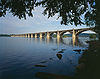
June 22, 1988 Legislative Route 128 over the Susquehanna River and a railroad
40°1′50″N 76°30′41″W / 40.03056°N 76.51139°WColumbia Extends into York County 93 Oregon Mill Complex June 27, 1985 1415 Oregon Road
40°6′48″N 76°15′0″W / 40.11333°N 76.25°WManheim Township 94 Passenger and Baggage Car No. 4639 
December 17, 1979 Railroad Museum of Pennsylvania
39°58′56″N 76°9′40″W / 39.98222°N 76.16111°WStrasburg Township 95 Passenger Coach No. 3556 
December 17, 1979 Railroad Museum of Pennsylvania
39°58′56″N 76°9′40″W / 39.98222°N 76.16111°WStrasburg Township 96 Passenger Day Coach No. 8177 December 17, 1979 Railroad Museum of Pennsylvania
39°58′56″N 76°9′40″W / 39.98222°N 76.16111°WStrasburg Township 97 Passenger Locomotive No. 1223 
December 17, 1979 Railroad Museum of Pennsylvania
39°58′56″N 76°9′40″W / 39.98222°N 76.16111°WStrasburg Township 98 Passenger Locomotive No. 1737 
December 17, 1979 Railroad Museum of Pennsylvania
39°58′56″N 76°9′40″W / 39.98222°N 76.16111°WStrasburg Township 99 Passenger Locomotive No. 460 
December 17, 1979 Railroad Museum of Pennsylvania
39°58′56″N 76°9′40″W / 39.98222°N 76.16111°WStrasburg Township 100 Passenger Locomotive No. 7002 
December 17, 1979 Railroad Museum of Pennsylvania
39°58′56″N 76°9′40″W / 39.98222°N 76.16111°WStrasburg Township 101 Pine Grove Covered Bridge 
December 11, 1980 Southeast of Kirkwood on Legislative Route 36018
39°47′37″N 76°2′41″W / 39.79361°N 76.04472°WLittle Britain Township Extends into Chester County 102 Pinetown Covered Bridge 
December 11, 1980 East of Lancaster on Township 620
40°6′20″N 76°14′55″W / 40.10556°N 76.24861°WUpper Leacock and Manheim Townships 103 Pool Forge Covered Bridge 
December 11, 1980 Northwest of Churchtown on Township 773
40°8′27″N 76°0′0″W / 40.14083°N 76°WCaernarvon Township 104 Poole Forge April 29, 1993 1936, 1938, 1940 and 1942 Main Street, Narvon
40°7′50″N 75°58′35″W / 40.13056°N 75.97639°WCaernarvon Township 105 Red Run Covered Bridge 
December 11, 1980 Northwest of Terre Hill west of Township 816
40°10′32″N 76°4′55″W / 40.17556°N 76.08194°WBrecknock Township 106 Reinholds Station Trinity Chapel September 5, 1990 114 East Main Street
40°15′57″N 76°6′45″W / 40.26583°N 76.1125°WReinholds 107 Peter and Catherine Reyer Farmhouse November 7, 1996 Trout Run Road, west of junction with Pennsylvania Route 272
40°11′39″N 76°10′45″W / 40.19417°N 76.17917°WEphrata 108 Roberts Farm Site (36LA1) April 3, 1986 On a knoll above the Conestoga River, just before its confluence with the Susquehanna River
39°56′42.36″N 76°22′26.861″W / 39.9451°N 76.37412806°W[10]Conestoga Township 109 Siegrist's Mill Covered Bridge 
December 10, 1980 Northeast of Columbia on Township 360
40°4′33″N 76°28′17″W / 40.07583°N 76.47139°WRapho and West Hempfield Townships Washed away by Tropical Storm Lee in 2011 110 Shearer's Covered Bridge 
December 10, 1980 High School Memorial Park
40°10′19″N 76°23′25″W / 40.17194°N 76.39028°WManheim 111 Shenk's Mill Covered Bridge 
December 10, 1980 South of Manheim on Township 372, East Hempfield/Rapho Townships
40°6′56″N 76°25′32″W / 40.11556°N 76.42556°WEast Hempfield and Rapho Townships 112 Shenks Ferry Site (36LA2) March 3, 1982 Along Grubbs Creek, ¾ mile above the Susquehanna River
39°54′18″N 76°21′36.72″W / 39.905°N 76.3602°W[11]Conestoga Township 113 Shreiner Farm August 30, 1994 Oregon Pike north side, .3 miles (0.48 km) east of Suncrest Road
40°6′3″N 76°15′59″W / 40.10083°N 76.26639°WManheim Township 114 Shultz-Funk Site (36LA7 and 36LA9) March 3, 1982 Above the Susquehanna River near Washington Boro, immediately south of Witmer's Run
39°58′6.355″N 76°27′17.87″W / 39.96843194°N 76.4549639°W[12]Manor Township 115 Speedwell Forge Mansion May 24, 2006 465 Speedwell Forge Road
40°13′07″N 76°19′51″W / 40.21855°N 76.3309°WElizabeth Township 116 Spring Grove Forge Mansion July 11, 1984 Spring Grove Road
40°8′41″N 76°1′17″W / 40.14472°N 76.02139°WEast Earl Township 117 Christian Stauffer House October 16, 1986 Millcross Road
40°3′36″N 76°15′17″W / 40.06°N 76.25472°WLancaster 118 Steel Hopper Car No. 33164 
December 17, 1979 Railroad Museum of Pennsylvania
39°58′56″N 76°9′40″W / 39.98222°N 76.16111°WStrasburg Township 119 Steel Passenger Coach No. 1650 December 17, 1979 Railroad Museum of Pennsylvania
39°58′56″N 76°9′40″W / 39.98222°N 76.16111°WStrasburg Township 120 Steel Passenger Coach No. 1651 December 17, 1979 Railroad Museum of Pennsylvania
39°58′56″N 76°9′40″W / 39.98222°N 76.16111°WStrasburg Township 121 Stiegel-Coleman House 
November 13, 1966 Pennsylvania Route 501 and U.S. Route 322, Brickerville
40°14′16″N 76°17′44″W / 40.23778°N 76.29556°WElizabeth Township 122 John Casper Stoever Log House January 6, 1987 200 West Main Street
40°6′4″N 76°5′33″W / 40.10111°N 76.0925°WNew Holland 123 Strasburg Historic District 
March 3, 1983 East and West Main, West Miller, South Decatur Streets
39°58′51″N 76°11′15″W / 39.98083°N 76.1875°WStrasburg 124 Strickler Site June 18, 1973 ¾ mile north of Creswell Station, and 1 mile south of Washington Boro
39°58′48″N 76°27′40″W / 39.98°N 76.46111°W[13][14]Manor Township 125 Julius Sturgis Pretzel House December 16, 1974 219–221 East Main Street
40°9′23″N 76°18′2″W / 40.15639°N 76.30056°WLititz 126 Johann Agust Sutter House April 20, 1982 17–19 East Main Street
40°9′26″N 76°18′24″W / 40.15722°N 76.30667°WLititz 127 Switcher No. 1670 
December 17, 1979 Railroad Museum of Pennsylvania
39°58′56″N 76°9′40″W / 39.98222°N 76.16111°WStrasburg Township 128 Switcher No. 94 
December 17, 1979 Railroad Museum of Pennsylvania
39°58′56″N 76°9′40″W / 39.98222°N 76.16111°WStrasburg Township 129 Totten House February 3, 1989 1049 East King Street
40°2′22″N 76°16′56″W / 40.03944°N 76.28222°WLancaster Township 130 Henry Walter House July 26, 1984 Greenville Road
40°16′14″N 76°9′17″W / 40.27056°N 76.15472°WWest Cocalico Township 131 Weaver's Mill Covered Bridge 
December 11, 1980 Southwest of Churchtown on Township 773
40°7′47″N 75°58′35″W / 40.12972°N 75.97639°WCaernarvon Township 132 Henry Weaver Farmstead December 15, 1978 South of Terre Hill off U.S. Route 322
40°8′4″N 76°3′38″W / 40.13444°N 76.06056°WEast Earl Township 133 Weber-Weaver Farm May 27, 1999 1835 Pioneer Road
40°0′14″N 76°13′59″W / 40.00389°N 76.23306°WWest Lampeter Township 134 William Werner House May 10, 1984 66 East Main Street
40°9′24″N 76°18′19″W / 40.15667°N 76.30528°WLititz 135 White Chimneys 
April 1, 1975 1 mile (1.6 km) northwest of Gap on U.S. Route 30
39°59′43″N 76°2′24″W / 39.99528°N 76.04°WSalisbury Township 136 White Rock Forge Covered Bridge 
December 10, 1980 South of Kirkwood on Township 337
39°49′29″N 76°5′25″W / 39.82472°N 76.09028°WColerain and Little Britain Townships 137 Windom Mill Farm August 30, 1994 3407 Blue Rock Road
40°0′38″N 76°23′55″W / 40.01056°N 76.39861°WManor Township 138 Windsor Forge Mansion January 4, 1990 Windsor Road south of Bootjack Road
40°7′40″N 75°57′35″W / 40.12778°N 75.95972°WCaernarvon Township 139 Witmer's Tavern December 1, 1978 2014 Old Philadelphia Pike
40°2′24.5″N 76°14′30″W / 40.040139°N 76.24167°WEast Lampeter Township 140 Wooden Baggage Express No. 6 
December 17, 1979 Railroad Museum of Pennsylvania
39°58′56″N 76°9′40″W / 39.98222°N 76.16111°WStrasburg Township 141 Wooden Express Baggage No. 6076 December 17, 1979 Railroad Museum of Pennsylvania
39°58′56″N 76°9′40″W / 39.98222°N 76.16111°WStrasburg Township 142 Wooden Hopper Gondola No. 1818 
December 17, 1979 Railroad Museum of Pennsylvania
39°58′56″N 76°9′40″W / 39.98222°N 76.16111°WStrasburg Township 143 Wright's Ferry Mansion 
November 20, 1979 38 South 2nd Street
40°1′46″N 76°30′12″W / 40.02944°N 76.50333°WColumbia 144 Zook's Mill Covered Bridge 
December 11, 1980 West of Brownstown on Township 797
40°7′50″N 76°13′54″W / 40.13056°N 76.23167°WWarwick and West Earl Townships Former listing
[3] Landmark name[4] Image Date delisted Location City or Town Summary 1 Jackson's Mill Covered Bridge 
June 27, 1986 North of Kirkwood Kirkwood Listed on December 11, 1980 See also
- List of National Historic Landmarks in Pennsylvania
- National Register of Historic Places listings in Pennsylvania
- List of Pennsylvania state historical markers in Lancaster
References
- ^ The latitude and longitude information provided in this table was derived originally from the National Register Information System, which has been found to be fairly accurate for about 99% of listings. For about 1% of NRIS original coordinates, experience has shown that one or both coordinates are typos or otherwise extremely far off; some corrections may have been made. A more subtle problem causes many locations to be off by up to 150 yards, depending on location in the country: most NRIS coordinates were derived from tracing out latitude and longitudes off of USGS topographical quadrant maps created under the North American Datum of 1927, which differs from the current, highly accurate WGS84 GPS system used by Google maps. Chicago is about right, but NRIS longitudes in Washington are higher by about 4.5 seconds, and are lower by about 2.0 seconds in Maine. Latitudes differ by about 1.0 second in Florida. Some locations in this table may have been corrected to current GPS standards.
- ^ "National Register of Historic Places: Weekly List Actions". National Park Service, United States Department of the Interior. Retrieved on November 10, 2011.
- ^ a b Numbers represent an ordering by significant words. Various colorings, defined here, differentiate National Historic Landmark sites and National Register of Historic Places Districts from other NRHP buildings, structures, sites or objects.
- ^ a b "NPS Focus". National Register of Historic Places. National Park Service. http://nrhp.focus.nps.gov. Retrieved November 20, 2009.
- ^ Location derived from the GNIS feature record for Indian Rock Island; the NRIS lists the site as "Address Restricted"
- ^ Location derived from the historical marker pictured at this webpage; the NRIS lists the site as "Address Restricted"
- ^ Location derived from its GNIS feature record; the NRIS lists the site as "Address Restricted"
- ^ Location derived from its NRHP nomination form; the NRIS lists the site as "Address Restricted"
- ^ Location derived from its NRHP nomination form; the NRIS lists the site as "Address Restricted"
- ^ Location derived from its NRHP form; the NRIS lists the site as "Address Restricted"
- ^ Location derived from its NRHP nomination form; the NRIS lists the site as "Address Restricted"
- ^ Cadzow, Donald A. Archaeological Studies of the Susquehannock Indians of Pennsylvania, Safe Harbor Report 2, 156. Accessed 2009-10-20. The NRIS lists the site as "Address Restricted".
- ^ Cadzow, Donald A. Archaeological Studies of the Susquehannock Indians of Pennsylvania, Safe Harbor Report 2, 63. Accessed 2009-10-20.
- ^ Magoon, Dane T. "'Chesapeake' Pipes and Uncritical Assumptions: A View from Northeastern North Carolina". North Carolina Archaeology 48 (1999), 118. Accessed 2009-12-26. The NRIS lists the site as "Address Restricted".
Municipalities and communities of Lancaster County, Pennsylvania City 
Boroughs Adamstown‡ | Akron | Christiana | Columbia | Denver | East Petersburg | Elizabethtown | Ephrata | Lititz | Manheim | Marietta | Millersville | Mount Joy | Mountville | New Holland | Quarryville | Strasburg | Terre Hill
Townships Bart | Brecknock | Caernarvon | Clay | Colerain | Conestoga | Conoy | Drumore | Earl | East Cocalico | East Donegal | East Drumore | East Earl | East Hempfield | East Lampeter | Eden | Elizabeth | Ephrata | Fulton | Lancaster | Leacock | Little Britain | Manheim | Manor | Martic | Mount Joy | Paradise | Penn | Pequea | Providence | Rapho | Sadsbury | Salisbury | Strasburg | Upper Leacock | Warwick | West Cocalico | West Donegal | West Earl | West Hempfield | West Lampeter
CDPs Unincorporated
communitiesBainbridge | Bausman | Bird-in-Hand | Brownstown | Blainsport | Blue Ball | Bowmansville | Buck | Central Manor | Churchtown | Cocalico | Conestoga | Conewago | Creswell | Dillerville | Elm | Falmouth | Farmersville | Fivepointville | Georgetown | Goodville | Gordonville | Hempfield | Hinkletown | Holtwood | Hopeland | Intercourse | Kinzers | Kirkwood | Kissel Hill | Lampeter | Leaman Place | Lyndon | Martindale | Mastersonville | Mechanics Grove | New Danville | Neffsville | Nickel Mines | Penryn | Pequea | Rawlinsville | Refton | Reinholds | Ronks | Safe Harbor | Schoeneck | Silver Spring | Smoketown | Stevens | Talmage | Wakefield | Washington Boro | White Horse
Footnotes ‡This populated place also has portions in an adjacent county or counties
Categories:- National Register of Historic Places in Pennsylvania by county
- Lancaster County, Pennsylvania
-


Wikimedia Foundation. 2010.