- Interstate 80 in California
Infobox road
state=CA
type=I
route=80
section=380
maint=Caltrans
alternate_name=Bayshore Freeway ,Eastshore Freeway 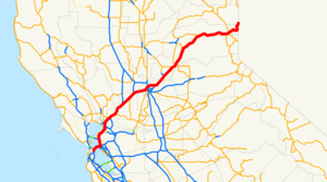
length_mi=207.554
length_round=3
length_ref=
established=August 7 ,1947 by FHWA [http://cahighways.org/itypes.html California Highways: Interstate Highway Types and the History of California's Interstates] ]July 1 ,1964 by Caltrans [http://cahighways.org/073-080.html#080 California Highways: Interstate 80] ]
direction_a=West
terminus_a=jct|state=CA|US|101 in San Francisco
junction=jct|state=CA|I|580|I|880 in Oakland jct|state=CA|I|505 in Vacaville jct|state=CA|I|5 in Sacramento jct|state=CA|SR|49 in Auburn jct|state=CA|SR|89 in Truckee
direction_b=East
terminus_b=jct|state=NV|I|80 atNevada state line
previous_type=SR
previous_route=79
next_type=SR
next_route=82
commons=categoryIn theU.S. state ofCalifornia ,Interstate 80 , a major east-west route of theInterstate Highway System , has its western terminus inSan Francisco, California ,United States . From San Francisco it heads east across the Bay Bridge to Oakland, where it turns north and crosses theCarquinez Bridge before turning back northeast and east throughSacramento Valley . I-80 then goes over Sierra Nevada mountain range and crosses intoNevada state.Route description
West end in San Francisco
According to signage, I-80 begins at its intersection with U.S. Route 101 in San Francisco. However, the San Francisco Skyway is not part of the
Interstate Highway System ; the Interstate actually begins at the west end of the Bay Bridge, at the ramps formerly connecting to theEmbarcadero Freeway . Thus the first 1.20 miles (1.93 km) of the signed Interstate are not an actual Interstate. [Federal Highway Administration , [http://www.fhwa.dot.gov/HEP10/nhs/maps/ca/sanfrancisco_ca.pdf National Highway System: San Francisco--Oakland CA] , April 2004] [California Department of Transportation , [http://www.dot.ca.gov/hq/tsip/hseb/crs_maps/ California Road System (CRS) Maps] , accessed November 2007]When I-80 was first approved, it was to head north on the
Central Freeway (US 101) and west on the never-built Panhandle Freeway, ending at planned I-280 (State Route 1) inGolden Gate Park . A January1968 amendment moved I-280 to its present alignment, removed Interstate 480, and truncated I-80 to the Embarcadero Freeway (then I-280, formerly I-480). These changes were made on the state level later that year, but Route 80 was only truncated to US 101. (The Central Freeway remained part of US 101, and the Panhandle Freeway became "State Route 241". The Panhandle Freeway was later cancelled in the wake of the Freeway Revolts, and the State Route 241 designation has since been reassigned to an unrelated stretch of highway in Orange County) The San Francisco Skyway, which had already been signed as part of I-80, has remained a de facto section of Interstate 80 to the present day and remains listed as part of Route 80 in California.The Eastshore Freeway is a segment of Interstate Highways 80 and 580 which runs along the northeast shoreline of
San Francisco Bay in northernCalifornia . It begins at theCarquinez Bridge and ends at theMacArthur Maze interchange just east of the western end of theSan Francisco – Oakland Bay Bridge . Interstate 580 joins the Eastshore Freeway at an interchange in Albany.acramento portion
Legislative Route 242 was defined in 1957, connecting pre-1964 Legislative Route 6 west of Sacramento to pre-1964 Legislative Route 3 northeast of Sacramento. [ [http://cahighways.org/241-248.html#LR242 California Highways: Legislative Route 242] ] Interstate 880, a bypass of I-80, was approved along Legislative Route 242 by the
American Association of State Highway Officials onNovember 10 ,1958 . [ [http://cahighways.org/itypes.html California Highways: Interstate Highway Types and the History of California's Interstates] ] The Route 880 designation was adopted by the state in the 1964 renumbering; the bypass was completed in 1972.Interstate 80 has run north of
Sacramento on the Beltline Freeway which was originally Interstate 880, a bypassfreeway . The I-80 routing alignment was moved from a route through Sacramento, now Interstate 80 Business, after the proposed Interstate 80 replacement of the North Sacramento Freeway was cancelled. The Beltline Freeway runs northeast from the junction of I-80 and I-80 Business (U.S. Route 50 there) inWest Sacramento across Interstate 5 to its junction northeast of Sacramento with I-80 Business (which is State Route 51). State Route 244 heads east as a short freeway spur) from that interchange.ierra Nevada portion
Crossing the Sierra Nevada, I-80 regularly gets snow at higher elevations from fall to spring. Caltrans sometimes requires vehicles to use
snow tires ,snow chains or other traction devices in the mountains during and aftersnowstorm s.cite web |url=http://www.dot.ca.gov/hq/roadinfo/chcontrl.htm |title=Chain Controls |date=2007 |accessdate=2008-01-04 |author=Caltrans]Checkpoint s are often utilized to enforce chain restrictions prior to entering icy or snowy portions of the interstate.I-80 crosses the Sierra Nevada crest at the
Donner Summit also known as Euer Saddle at the elevation convert|7239|ft|m westbound and convert|7227|ft|m eastbound. [ [http://www.dot.ca.gov/hq/tsip/tsidoc/summit.xls Elevation and Location of Summits and Passes in California] ] The summit is located in Nevada County (California state). The pass is generally open year-round; it isplow ed in winter, but may temporarily close during the worst snowstorms. The older route overDonner Pass is about two miles (3 km) south. Albeit Donner Pass is lower, Euer Saddle was chosen for the interstate because of more gradual approaches. Portions of I-80 through the Sierra-Nevada mountain range are really rough, and the road is badly cracked.fact|date=October 2008|(02 October)Other names
Interstate 80 has the following names, as designated by various state laws: [cite book | url=http://www.dot.ca.gov/hq/tsip/hseb/products/2006_Named_Freeways.pdf | title=2006 Named Freeways, Highways, Structures and Other Appurtenances in California | publisher=
Caltrans | pages=116 | accessdate=2007-10-13]*Alan S. Hart Freeway: from the Sacramento/Placer County line to the Nevada state line.
*Dutch Flat and Donner Lake Wagon Road : from Emigrant Gap to Donner Lake.
*Lincoln Highway : from Sacramento to Reno.
*Kent D. Pursel Memorial Freeway: from the Bay Bridge to the Alameda/Contra Costa County line.
*Linus F. Claeys Freeway: from SR 4 to the Carquinez Bridge.
*Dwight D. Eisenhower Highway: for its entire length.
*East-WestBlue Star Memorial Highway : for its entire length.Exit list
:"Note: Except where prefixed with a letter,
postmile s were measured in 1964, based on the alignment as it existed at that time, and do not necessarily reflect current mileage. The numbers reset at some county lines; the start and end postmiles in each county are given in the county column."References
External links
* [http://www.dot.ca.gov/dist4/route80r.htm Caltrans District 4: Current major projects on Route 80]

Wikimedia Foundation. 2010.